- JL
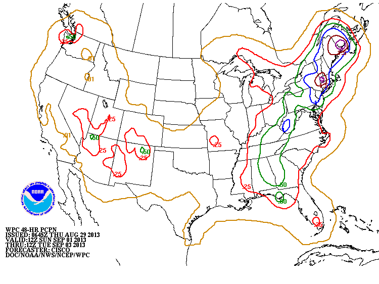
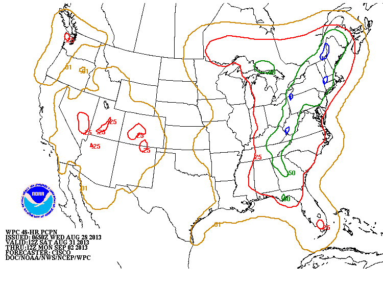
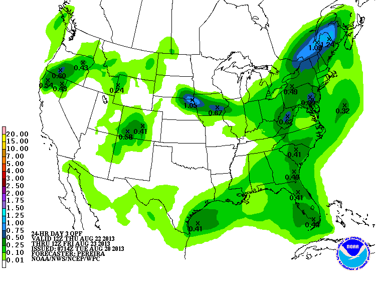
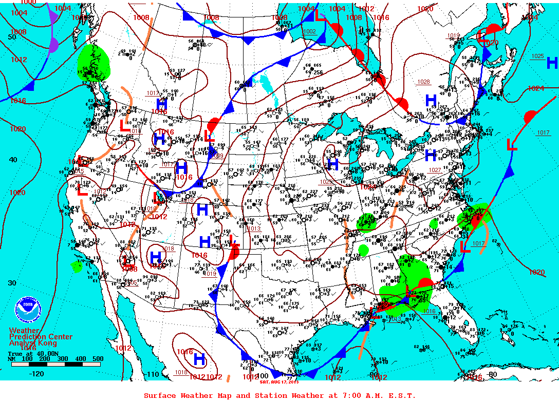
A stretch of weak cold fronts mixed in with a deep trough of low pressure will bring an abundance of moisture to the eastern US throughout the holiday weekend. The main focus however is on Monday when rainfall is most probable at a much wider range. 
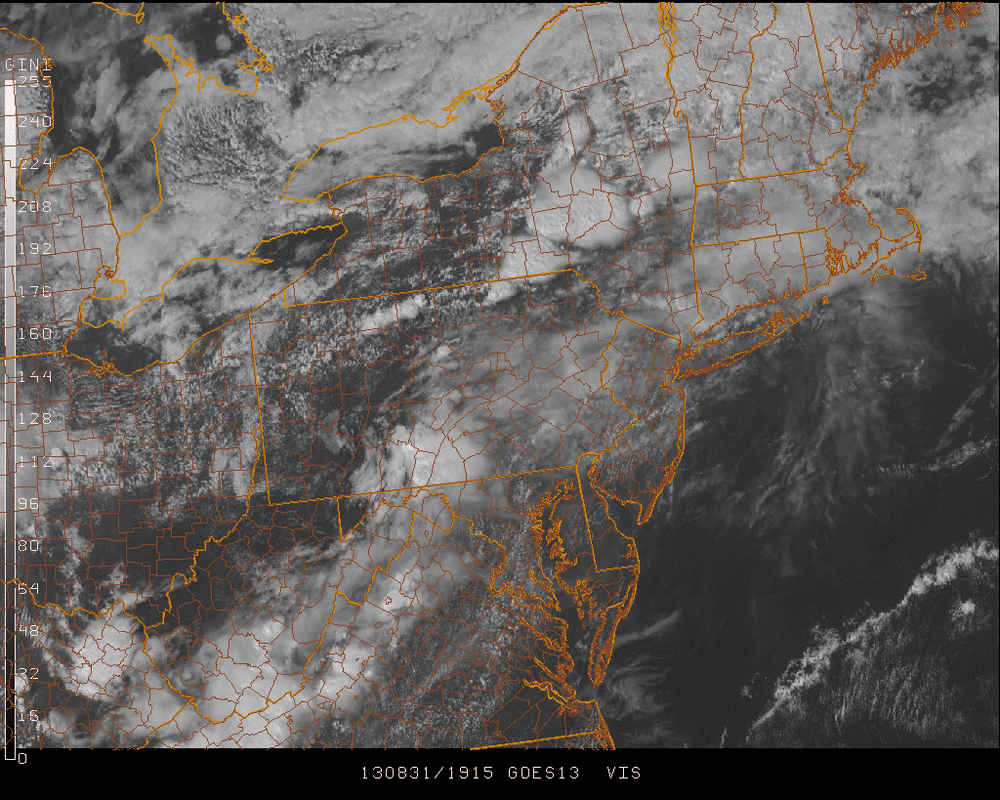
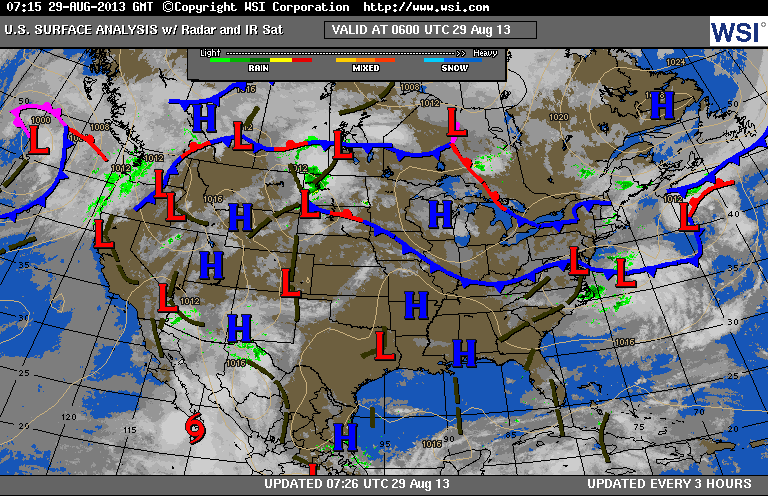
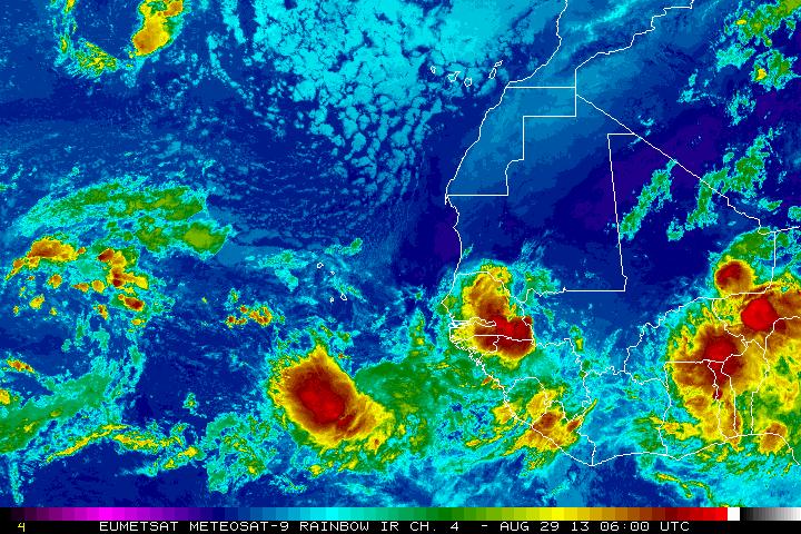
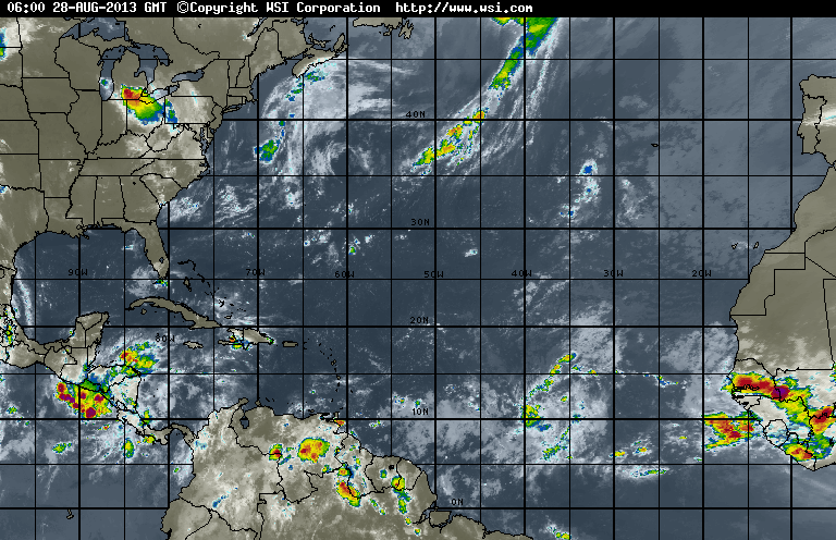
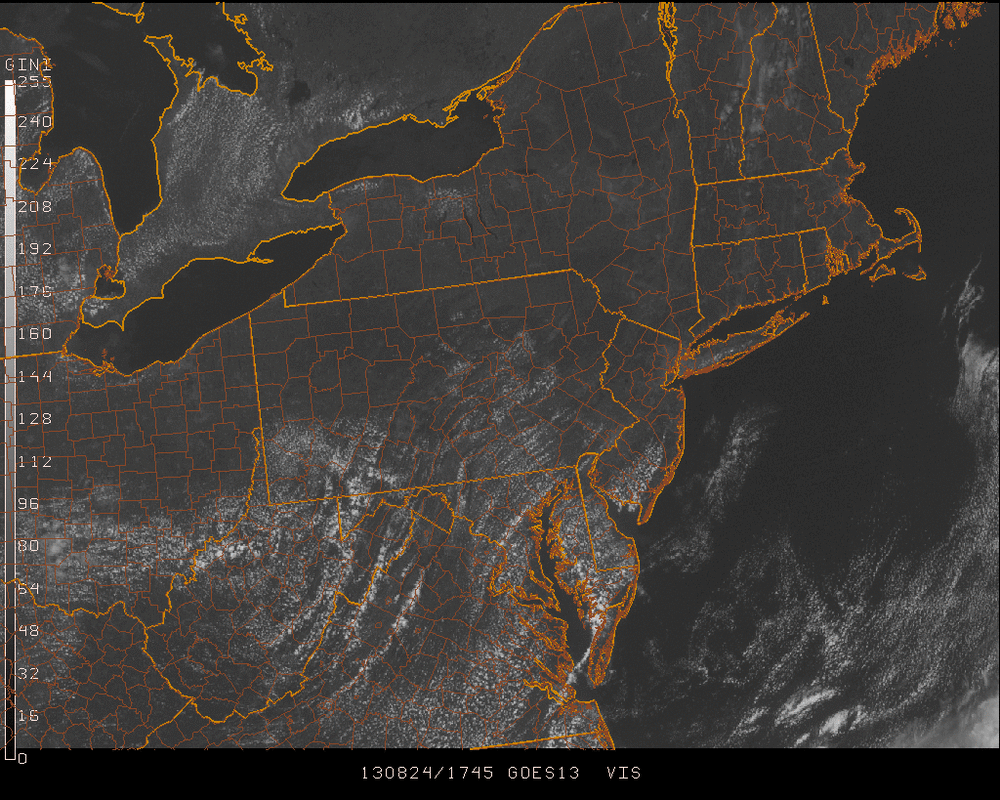
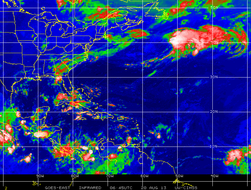
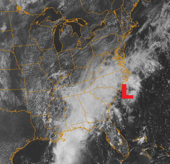
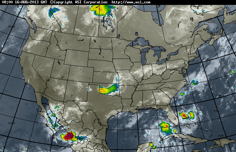
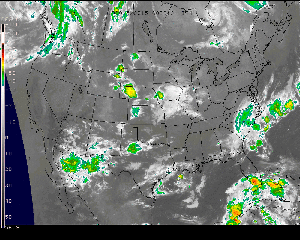
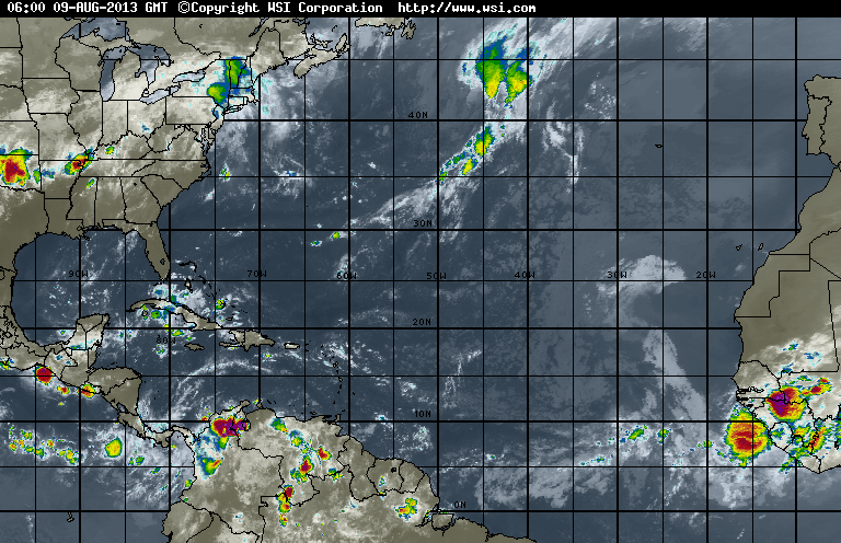
The sun has been able to reach through the clouds in many areas as depicted by the visible satellite imagery of the northeast for this afternoon... Rain showers & thunderstorms for this Saturday have been secluded to the inland regions of the northeast as well as the Appalachians. These can be seen on the same visible satellite shown below by viewing the whitest clouds (for example, east of the Finger Lakes in New York). 
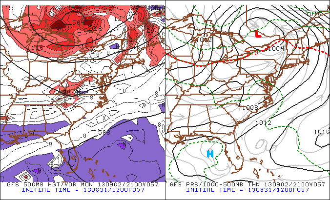
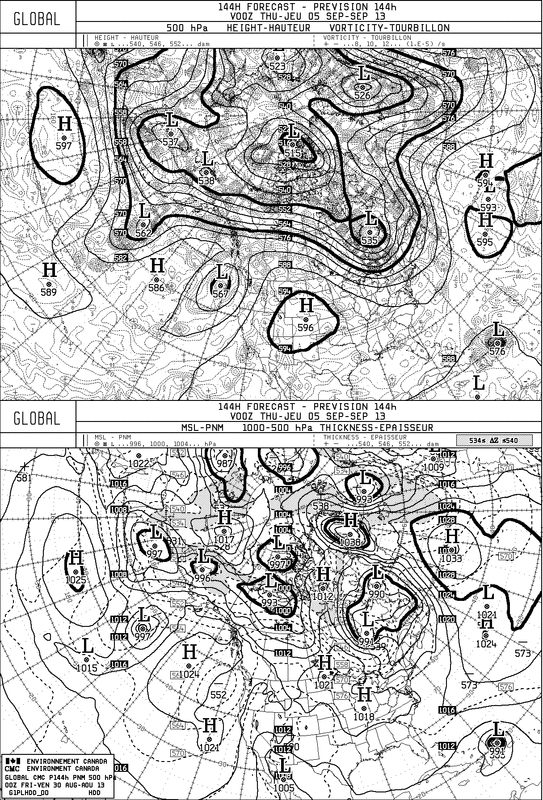
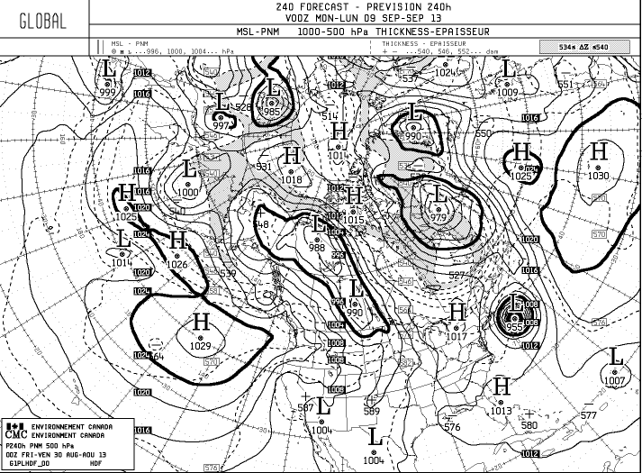
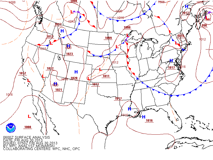
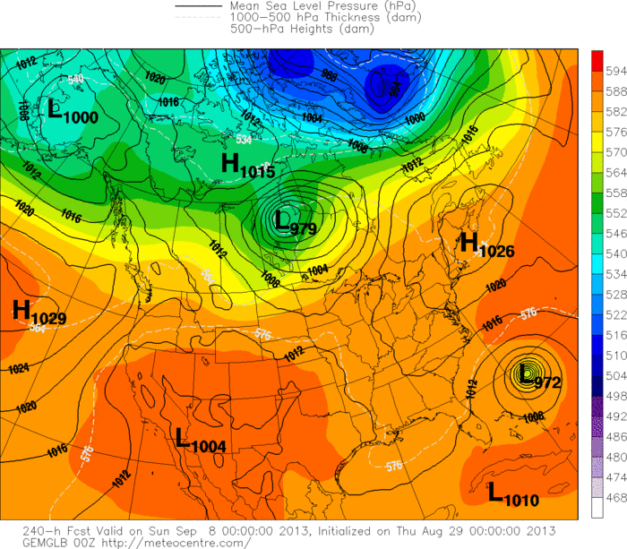
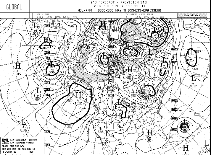
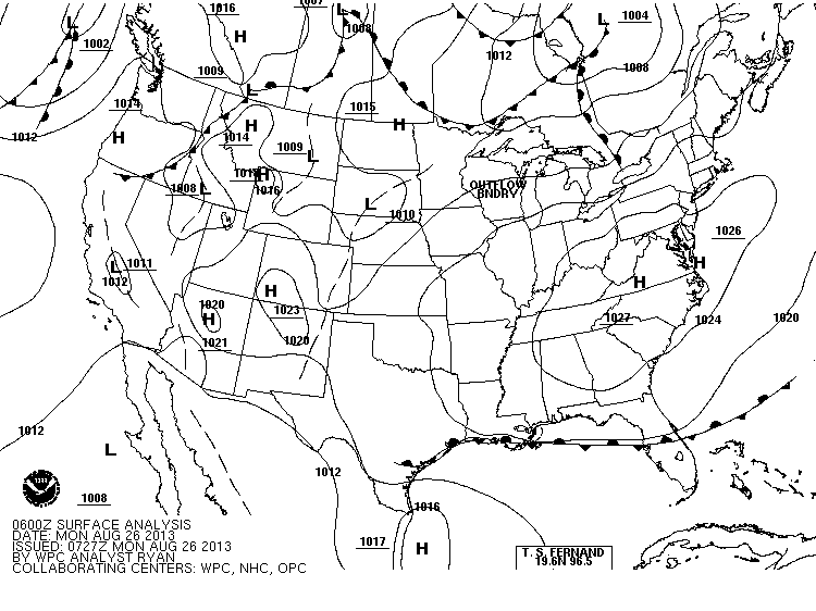
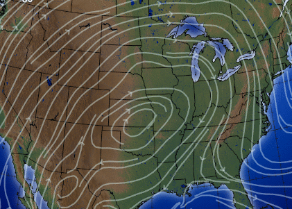
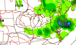
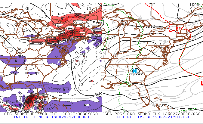
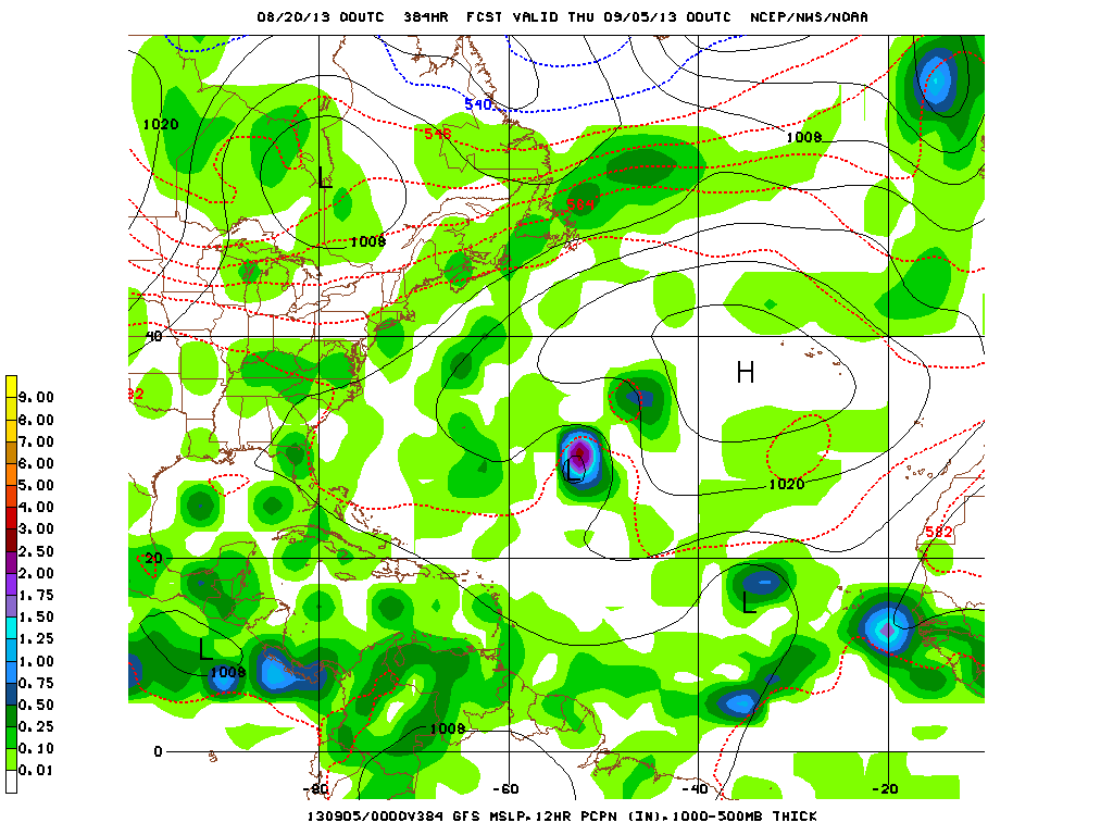
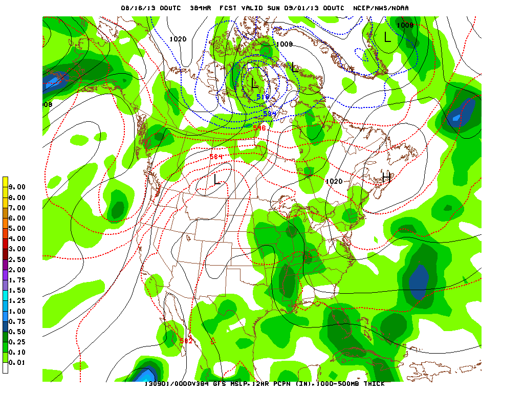
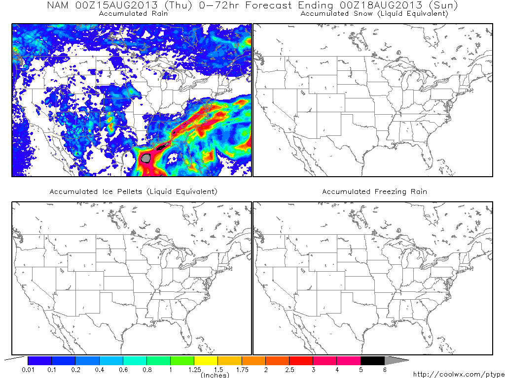
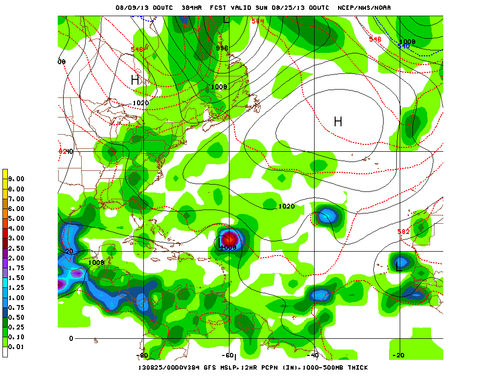
On Monday, low pressure system associated with a deep trough will move northeast. As seen in the image below ( 12Z GFS depicting Monday afternoon), model placement of the system has it extending south through the Carolinas. While the day is not expected to be an entire washout, Monday poses the greatest threat for rain & thunderstorms over the next 3 days. This system moves out early Tuesday & will be replaced with high pressure and an extended period of sunshine. Enjoy the holiday weekend as best as you can.
- JL
0 Comments
Just along The African coast...a pretty good formation that is more than likely going to become tropical storm Gabrielle. This post is prior to 5am ...so have not seen any data from hurricane center...but would not be surprised if they name it now. Next picture is a close up. The Canadian Model for next Wednesday...shows Gabrielle approaching The Bahamas. This is the system they have been picking up all week. In the next map...you will see where they put her for next Sunday......dangerously close up The East Coast. A look at this a.m. weather map continues to show the "noisy" condition. All of the fronts will consolidate to one strong front plowing thru The East Coast by Tuesday. Prior to that...hazy - humid - chance of thunderstorms. Have a nice and safe holiday weekend.
As you can see...map still noisy. It's the front across Southern Canada that will be responsible for a thunderstorms thru the holiday weekend. The front over Ohio Valley will only help to add to that. Chances for storms will be best away from the coast thru Sunday. Monday- Mon.nite..stronger storms are possible...before cooler air comes in Tues. This map shows rainfall amounts from Sunday into Tuesday. Most of the Northeast 1"....with 2"+ Maine...Berkshires/Ct. Most of this will be squeezed out Monday and Monday nite. Even though THE Hurricane Center is not mentioning these tropical waves....satellite pictures from off Africa show the pattern beginning to explode and I'm sure The Canadian Models are picking up on this. Next map will show you a formidable storm headed toward The Lower 48...within 10 days. Aside from that...tomorrow we will have a detailed holiday weather outlook for you.
You don't need to be a meteorologist to look at the above map and be able to tell that very unsettled weather prevails. There are more fronts on the map than the Pope has cardinals. Looks like mid-Atlantic is today's target. After that it will focus on the East coast this holiday weekend. Cold front in Montana will head to the Gt.Lakes and Northeast Monday...when the best chance of thunderstorms will be likely. The above map shows how much rain could fall this weekend. The small circles of blue indicate 1" of rain. How they can pin point The Berkshires...Erie Pa., etc....is beyond me. i.e. yesterday 1/2" amounts were the max for New England and Ct. thru Cape Cod got 2". Atlantic satellite shows a good tropical wave in the south - central Atlantic....Canadian model is either picking this up or one near Africa and bringing toward US Mainland again early Sept. Hard to see...but see the unsettled weather in Southern most Fla., that has a circulation and should be watched. This is the Canadian Model - 10 days out- Sept. 7th....see the tropical
system approaching Bahamas. If that were right...it should have a direct path toward the Atlantic coast.....but that's 10 days out. Later. Our national radar this morning shows one batch of rain moving off New England and another diving through the Gt.Lks and into the Ohio Valley. Aside from that....you will notice on radar and satellite that much of our Nation is quiet. We will have a front hauting the east this weekend....but a strong cold front will drop out of Canada and stir things up on Labor Day before The Northeast gets cooler again. Tropics are quiet....but you can see tropical waves all across the Atlantic. Satellite pix off Africa shows 2 healthy disturbances and either one of these will become more organized this week and we may be looking at Gabrielle. Later.
The national weather pattern is such that moisture from Baja Ca. heads north to southern Canada and then turns east across the Upper Midwest...to Great Lakes and then southeast across New England. This pattern is called "Ring of Fire". It is a difficult pattern for computers to grab as to timing....so this week will be a nightmare...forecast-wise. We expect a ball of energy to spawn and low for The Northeast mid week with heavy rain. Labor Day weekend hard to call now...certainly will not be sunny from start to finish. Below...you can see the moisture stream on our water vapor satellite. Black is dry- sinking air. Corresponding to our "ring" here is our lightning detection map...along with this a.m. weather map....which shows fronts lines up across the Northern-tier of the Country. The forecast for rainfall for midweek spots The Northeast with some of the heaviest rain. Following that...water vapor satellite picture of Africa. Notice the dry air just along the coast...(black).....one of the reasons we have not seen much development thus far. That's it for now..later.
As we predicted last week, another front will move through over the next few days, bringing chances of precip starting Monday late afternoon into Wednesday overnight. Now usually when fronts move through, the rain's limited to one day, so why are there so many days with rain in the forecast? The current surface map shows a very large area of high pressure over the tristate area, which is why we're having so much sunshine. Just to the NW of the great lakes we see a low pressure system along with a front stretching all the way to California. Where they move is the answer to our question. Below is the jet stream: This is the upper level air where winds move much faster than on the surface and can tell us on a larger scale where systems may move. We can see the very large area of high pressure in the center of the nation, and the winds curving along the great lakes and dipping down along the eastern seaboard (which is one of the reasons why it's cooler today as we're getting the cooler Canadian air). But, the entire jet will be moving east over the next few days, meaning that the very strong easterly winds that you can currently see over the great lakes will force that low pressure system in the first picture to also move east. Along with the southwesterly winds, this means the front will elongate and remain almost vertical as it moves across the nation. This is Wednesday evening, and you can see how the low finally drops down south into New England, with the front stretching very far west. So, while the low pressure system will remain above the Canadian-US border, the front will stretch across the US and bring us chances of rain for a few days as it keeps the air around us unstable. But remember, even though it's a cold front passing by, those south to south-westerly winds will move into the area and increase temperatures by 4-7° once again reaching into the mid-upper 80's as it was last week. So enjoy the sunny, cooler, and much less humid weather, and worry about all the stuff I said above another day. -Mike Merin Saturday has been all about the comfortable conditions for much of the Eastern USA. High Pressure is bringing a steady flow of air from the north & east. However, into next week, a series of disturbances will pass through the Northeast from the Great Lakes Region. The first of which will impact the region on Monday... The GFS places the trough in the NY area by the time the evening arrives on Monday. Isolated showers or thunderstorms could be seen as this shortwave passes by. As the week progresses, the trough will continue to deepen as another Low presses by Wednesday into Thursday keeping the threat for wet weather until the end of the week. The outlook towards next weekend though shows High pressure from Canada taking control as Saturday arrives, drying the air out, & providing us with another beautiful weekend.
Take care & be well. A cool front pushing thru the East will bring less humid weather and nice weather to The East. Things heat up again across the Plains....and some of that weather could make it to the East Coast next week. Weather map for today shows a more normal pattern. A tropical depression off Baja Ca., will work north and may bring unusual wetness to the SW...in addition to their monsoon season. The track and satellite picture of the depression follows. Satellite picture shows a disturbed area of weather in the Gulf. Hurricane center only giving that a 20% of developing. Meanwhile..you can see the cold front in the East followed by friendly skies. Have a safe and enjoyable weekend...see ya Monday.
Don't see much of a change in the national pattern. Trofs on each coast..ridge in middle. One cold front after another will move across The Northern US...about every 4-5days. Front moving by mid next week may actually result in a good sized storm off New England....that could do well for Labor Day Weekend for The Northeast. Here is today's weather map...showing the next cold front headed for the Northeast. Satellite pictures show some moisture with cold front...but not impressed. Tropics remain very quiet. Long range model for early Sept. shows nothing of interest in the tropical Atlantic. Map below is a heat index chart for this Sunday. You can see where the heat is...and for the most part that's where it has been and pretty much will stay there for rest of the month. Be safe...Later.
Weather map shows cold front pushing thru the upper Midwest...and it will uplift warm and humid air only to be followed by another mass of comfortable weather spreading east by Friday. Weekend looks good in The East...but sizzling again in Plains. Satellite picture clearly shows showers and thunderstorms with the cold front from Minnesota into The Plains. Aside from that...much of the Nation...quiet. African satellite this morning shows things could be getting more active. We have seen intense areas like this last week...but when they reach the Atlantic...they fall apart...so we will watch it. The GFS model today...does not show the "busy" Atlantic that it did yesterday for early
Sept. Odds favor increased tropical activity by Sept. 7-8th. For now..go slow..later. Very warm and more humid for Eastern half of the Nation next few. Cold front pushes thru Midwest Wednesday...then thru the East Friday. By weekend...cooler and drier air for a good portion of the East. Satellite picture indicates just how quiet it is. Only significant precip. comes Thursday into Friday with cold front. Map shows where the rain will have fallen by Thursday.....most of which is less than .50". A very quiet Atlantic satellite picture this a.m. Take a look at the long range GFS model for Sept. 4-5-2013. Several tropical systems...one of which is headed toward the Bahamas. Do we believe that ? Believe that it will be summerlike for rest of the week. Later.
A return to warm and humid weather this week for much of the Nation. Our satellite show the old front stalled along the East Coast...it will slowly dissipate. Next front in upper Midwest not reaching East until end of week. Our a.m. weather map looks very active but when all is said and done....not much to worry about except for some thunderstorm activity in the usual places. A look at our upper air pattern still shows a trof in the East....but the jet stream will head north and that will allow for warmer weather East...while cooling down West. Finally...Erin has dissipated. There's some action along the African coast....but hurricane center only giving that a 10% chance of growing. I beginning to wonder about this season. Too early to say...and don't want to jinx anything...but it may not be as active as many thought. Here's a pix of African coast....what's your take ? Later.
Conditions have been generally quite beautiful for the Northeast. Continued sunshine and low humidity levels have the 2nd half of summer feel really comfortable. Low pressure moving up the eastern seaboard on this Saturday and into Sunday has the possibility to briefly change the dry spell. This moisture will continue a North-Northeasterly track along the coast until it curves out east into the Atlantic as it passes the Chesapeake Bay. This brings the chance for light rain showers to clip the New York Metro Area along with Long Island & the southern coastline of New England. With winds pushing in from the Northeast as this low treks past the region, expect a cooler breeze on Sunday resulting in temperatures throughout NYC and Long Island to be in the 70's, with some areas not making it to 75.
This speed bump is a small one as High pressure will move right back in place over the Northeast well into next week, with temperatures returning into the 80's. Take care & be well. - JL Looks like the stalled front will give residents from Delaware and MAryland on south to Florida and Gulf Coast some very wet weather this weekend. New England on west....will be just fine. Satellite pix this a.m. verifies all of that and more. Long range models for Labor Day Weekend...indicate heat out West - Rockies and Plains...while more tepid weather continues in NE. Maps below show 1 - expected systems in Atlantic by this evening. Erin with 40 mph winds may juice up a bit...but Hurricane Center expects it to weaken as it gets into Central Atlantic. 2- Sat. pix of Africa shows a vigorous wave ready to hit the coast...and that may need some serious watching if it holds together. For now...that's closes out another week.
Have a nice weekend...be safe...later. Sometimes looking at computer models is not enough. Past experience is often a vital tool in forecasting. Two weeks ago...residents in the Northeast woke up to rain on the weekend...totally unexpected. Why ? An small offshore low. Same situation haunts the East Coast this weekend. Hard to say how far north the rain will go...but The Southeast thru DelMarva Area will get soaked. As to NJ on north....debatable. New England could stay dry. Here is a satellite pix from this a.m. showing the problem area along the coast. Now you can look at the map that tells us how much rain can fall ...valid for this Saturday......followed by a map that predicts accumulated precip....again for this weekend. It's a close call from beaches from NJ to Cape Cod. We now have a tropical depression off Africa....and another one about to form and move thru Yuchatan and into Gulf of Mexico. If you thought it was cool in The East.....this map shows lows that have either tied the record or broke the record for this time of year. You gotta love it.
In the wake of a cold front along the east coast.....drier and much cooler air working in. Most places east of The Mississippi will feel this..with the exception of the deep south. Wind will be especially gusty over the Northeast today...adding to that feeling. Satellite picture shows most of the Nation's wet weather - Northern Rockies and Dakotas...otherwise...quiet rules. A look at the steering flow - some 18,000 ft. shows the trof over the East...keeping temps. cooler. The map following that map shows what this flow will look like some 8-10 days out....which brings us thru late next week. You can see the northwest flow still in the East...with the warmest weather central Nation. I made a bold prediction on the radio yesterday that the Northeast would not see another 90 degree temp. this summer. (That doesn't mean it can't happen after Sept. 21...LOL ). By the way - before we look at the tropics. .....still don't trust this front
stalled in the south. Something tropical is bound to form in Gulf...and this front could dampen late weekend for Mid Atlantic. Back to tropics...there are waves across So. Atlantic. Hurricane center giving a 30-40% chance of development near Haiti...and off Africa. Don't see strong indications on satellite...but the season is moving into high gear. Later. Interesting to note that since the July Heatwave....the weather has been much more tepid and don't see that changing. Days of 90+ normally begin to shrink now anyhow....but latest pattern does not indicate anything different. Satellite picture shows cold front sweeping east across Appalachians...so showers and storms East today...then back to pleasant weather for rest of week. This front stalls in the southeast...and it's moisture will try coming back over weekend. Models say no to any rain....but not so sure about that. Tropics are still quiet. Hurricane center watching something near Haiti..possible...not probable. Here is the latest tropical atlantic analysis. Almost back to school....so time for a lesson. NAO! North Atlantic Oscillation. This is the pattern that is used to predict long range weather for winter and summer. The below diagram will answer any and all questions you may ever have had concerning NAO. After you study the charts...throw some of the info at your spouse or friends..they will be impressed...and even more...they won't question you unless they are a meteorologist. Later.
A cold front will fly across the Midwest today and then The East on Tuesday. That front may bring some gusty thunderstorms from New England to Mid Atlantic Tuesday....otherwise quiet weather will prevail. The map above .....highlights areas of thunderstorms in green....yellow indicates slight risk of severe weather. Below...jump to the tropics...where you will see a satellite picture that is quiet. The map following that...shows the sea surface temps. across the globe. Notice how there is blue showing up off Africa....that indicates cool water, perhaps one of the reasons why there is little development there. You will also notice not much orange & red across the South Atlantic....all could play and interesting role for this season. We do expect the Gulf of Mexico to become active this week...so watch that area. Be safe..later.
Aside from high cirrus clouds passing eastward, skies for the weekend are considerably dry once more. High pressure will move in from the Midwest while a weak Low will stay to the south of the Northeast. Rather uneventful whether will transpire into the week with the exception of a cold front moving through Tuesday, after which more high pressure will settle in to the week's end. Aside from scattered showers & thunderstorms on Tuesday, dry air and air that's not too warm will be overall pattern for the week, perfect for outdoor activities.
Take care & be well - JL All is on schedule as a cold front heads across the East today into tonite. Large area of wet weather will accompany this front...some places getting heavy rains.... gusty thunderstorms...and perhaps a tornado. Drier - but not necessarily cooler air for weekend. Mid Atlantic to Carolinas...not as lucky. Below...rainfall amounts through tonight. NOAA issued their update for Hurricane Season yesterday...and continue to forecast a very busy season. Hurricane computer models from N.Carolina predicting 2 major hurricanes...1 along East Coast and 1 Gulf Coast. Atlantic satellite picture shows development off Africa...and analysis shows a train to tropical waves. GFS Model for Aug.25....last frame......shows an active Atlantic Basin.
For now...take it slow today...then relax and enjoy the weekend and be safe. Later. Very warm and humid weather moves back across the East...only to be accompanied by showers and thunderstorms into Friday evening. Humidity comes down this weekend....and it cools off by Sunday...but from Mid Atlantic south...sticky and unsettled. So how many of us will have a bad-hair day ? Map below...courtesy of WSI will let you know. National satellite shows same areas getting the heavy rain...mid section of Country. Satellite from the Atlantic continues amazingly quiet. Canadian model for next Wednesday shows the same pattern which has prevailed for much of the summer...with the exception of the big July Heatwave. Trof in East....Ridge in West. Be safe - Later.
The cool dry air over the Ne moving out...replaced by more humid weather and times of showers and thunderstorms especially end of week. Pattern gets difficult this weekend. Front stalls...waiting for a 2nd front to help it out...but in the meantime...waves will form on front and may continue to cause unsettled weather thru weekend in Mid Atlantic. A look at the satellite picture - doesn't look any different from yesterday. Convection in mid section will move east thru end of week. The following map is a prediction of rainfall by Friday. Global satellite view shows a very weak ITCZ zone off Africa....and dust and dry weather is probably keeping things quiet there....for now. Lastly...outlook for temperatures into Aug. 20th....shows the Eastern half of the Nation still below normal. It's ok to see that now...but you don't want to see that in February. Later.
Our upper air pattern continues to dictate unsettled weather...but not for everyone. As our upper air storm in south central Canada moves east.....it will drag a cold front with it...and that will be the focus of showers and thunderstorms especially end of week for The East. Once that front moves by...the humid unsettled weather drops south. Our satellite picture shows that swirling low - north of Minnesota.....and notice how active the tropical Pacific is ! Atlantic...quiet...and The Hurricane Center will be updating this year's prediction on Thursday...a conference in which I will attend and bring you the latest. Our current surface map looks "noisy".....but the next map is a projection for 48 hours out. That simplifies the entire pattern as you can see a strong cold front headed east with a nice dry air mass following. Finally, interesting to see what the models are depicting for late August. Once again trofiness in The East...Ridge out west....so that would indicate the hottest weather with the ridge...out west....and cooler weather East. Don't have a problem with that. Looks like
90 is possible early this weekend along the East Coast before that cold front moves by. Later. An unseasonable upper air pattern prevails....where we can see the polar low displaced far south over Central Canada. This will keep a good portion of the U.S. below normal in temperature. The westerly flow will have many imbedded shortwaves...all of which will serve to keep us unsettled. Timing will be a big problem right into the weekend. Below you will see a map depicting the upper air pattern....followed by a map showing temp. anomalies over the next 8-14 days. The blue indicates below normal. Our a.m. satellite picture is quiet...with several areas of wetness thru the Nation. Next map shows expected amounts of rain for late week into the weekend. Much of the country unsettled. Tropical Atlantic quiet. LATER.
|
We'll have daily weather discussions, talking about major systems on the horizon along with anything noteworthy that pops up on our radar.
Pat Pagano,
|