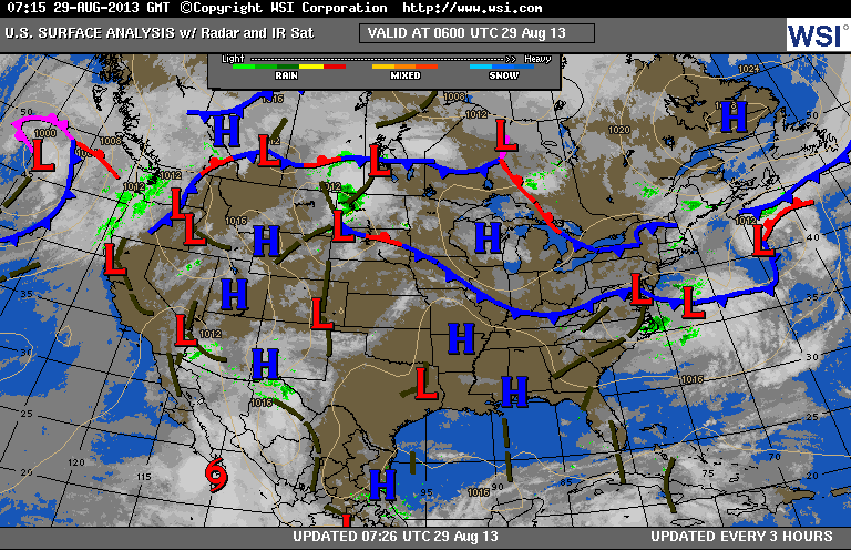
As you can see...map still noisy. It's the front across Southern Canada that will be responsible for a thunderstorms thru the holiday weekend.
The front over Ohio Valley will only help to add to that. Chances for storms will be best away from the coast thru Sunday. Monday- Mon.nite..stronger storms are possible...before cooler air comes in Tues.
The front over Ohio Valley will only help to add to that. Chances for storms will be best away from the coast thru Sunday. Monday- Mon.nite..stronger storms are possible...before cooler air comes in Tues.
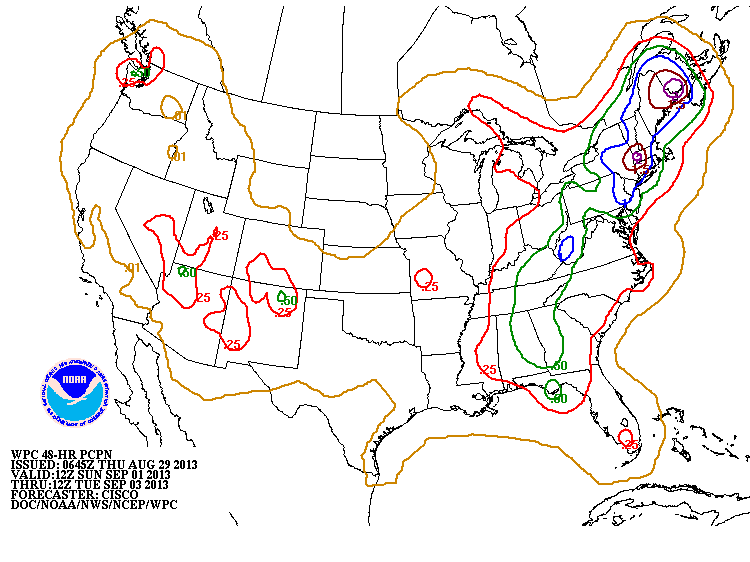
This map shows rainfall amounts from Sunday into Tuesday. Most of the Northeast 1"....with 2"+ Maine...Berkshires/Ct. Most of this will be squeezed out Monday and Monday nite.
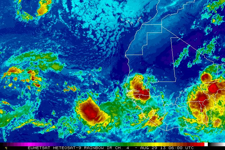
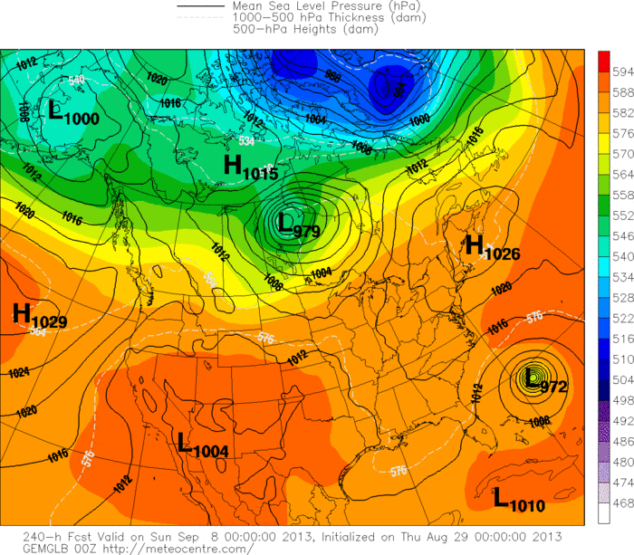
Even though THE Hurricane Center is not mentioning these tropical waves....satellite pictures from off Africa show the pattern beginning to explode and I'm sure The Canadian Models are picking up on this. Next map will show you a formidable storm headed toward The Lower 48...within 10 days. Aside from that...tomorrow we will have a detailed holiday weather outlook for you.

 RSS Feed
