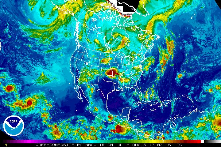
Our upper air pattern continues to dictate unsettled weather...but not for everyone. As our upper air storm in south central Canada moves east.....it will drag a cold front with it...and that will be the focus of showers and thunderstorms especially end of week for The East. Once that front moves by...the humid unsettled weather drops south. Our satellite picture shows that swirling low - north of Minnesota.....and notice how active the tropical Pacific is ! Atlantic...quiet...and The Hurricane Center will be updating this year's prediction on Thursday...a conference in which I will attend and bring you the latest.
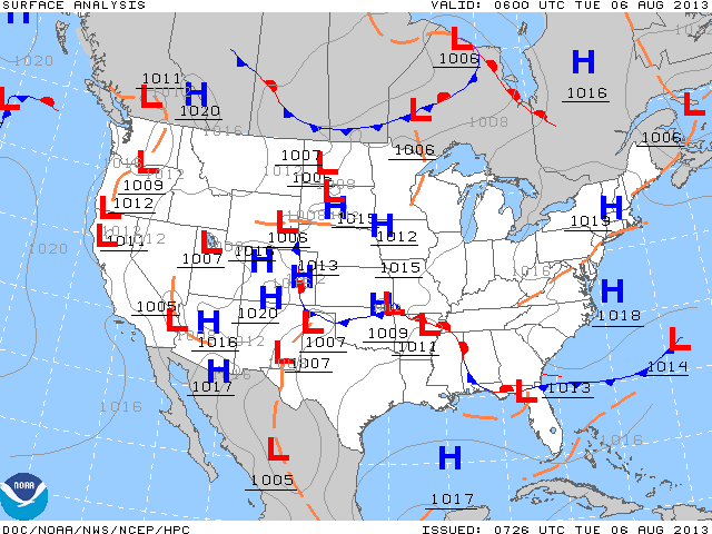
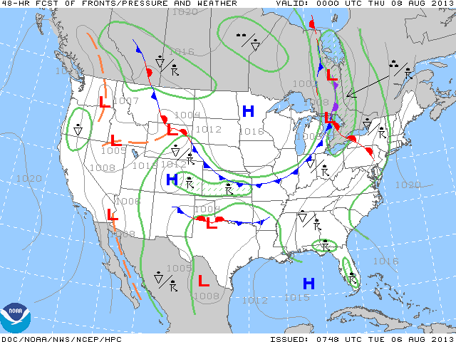
Our current surface map looks "noisy".....but the next map is a projection for 48 hours out. That simplifies the entire pattern as you can see a strong cold front headed east with a nice dry air mass following.
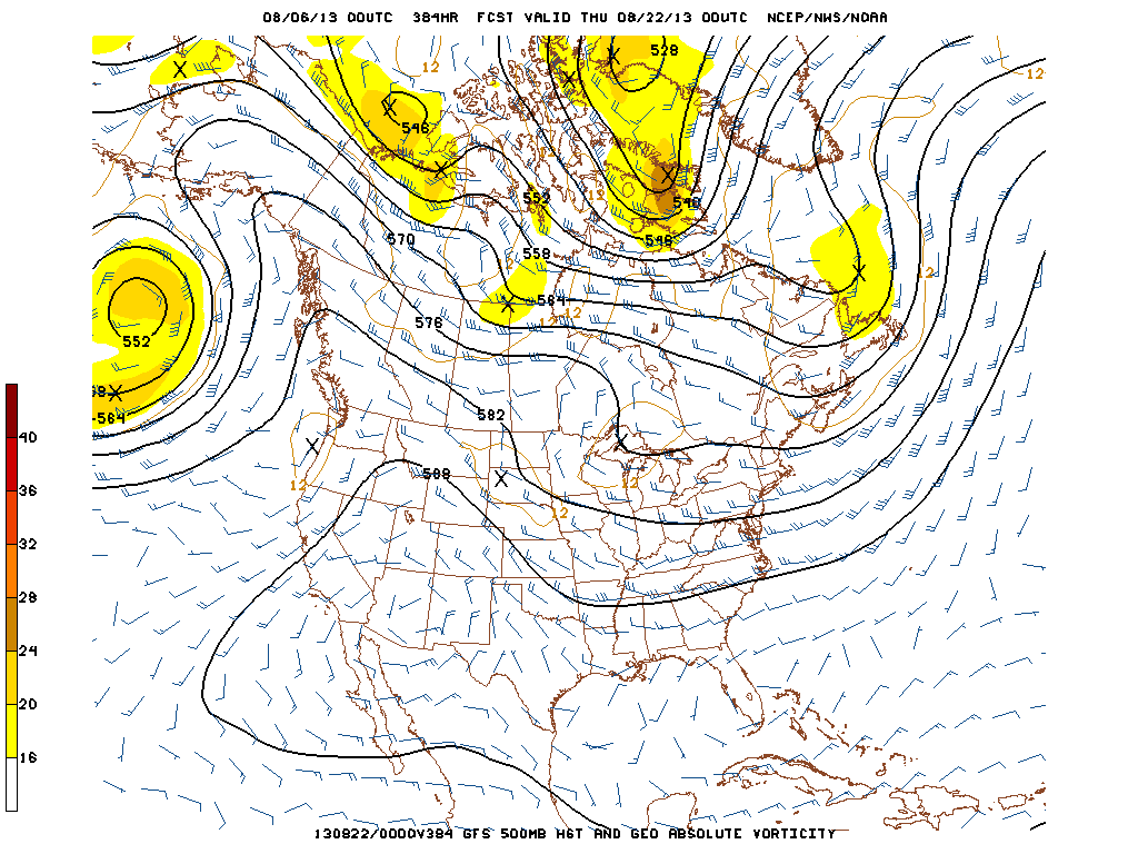
Finally, interesting to see what the models are depicting for late August. Once again trofiness in The East...Ridge out west....so that would indicate the hottest weather with the ridge...out west....and cooler weather East. Don't have a problem with that. Looks like
90 is possible early this weekend along the East Coast before that cold front moves by. Later.
90 is possible early this weekend along the East Coast before that cold front moves by. Later.


 RSS Feed
