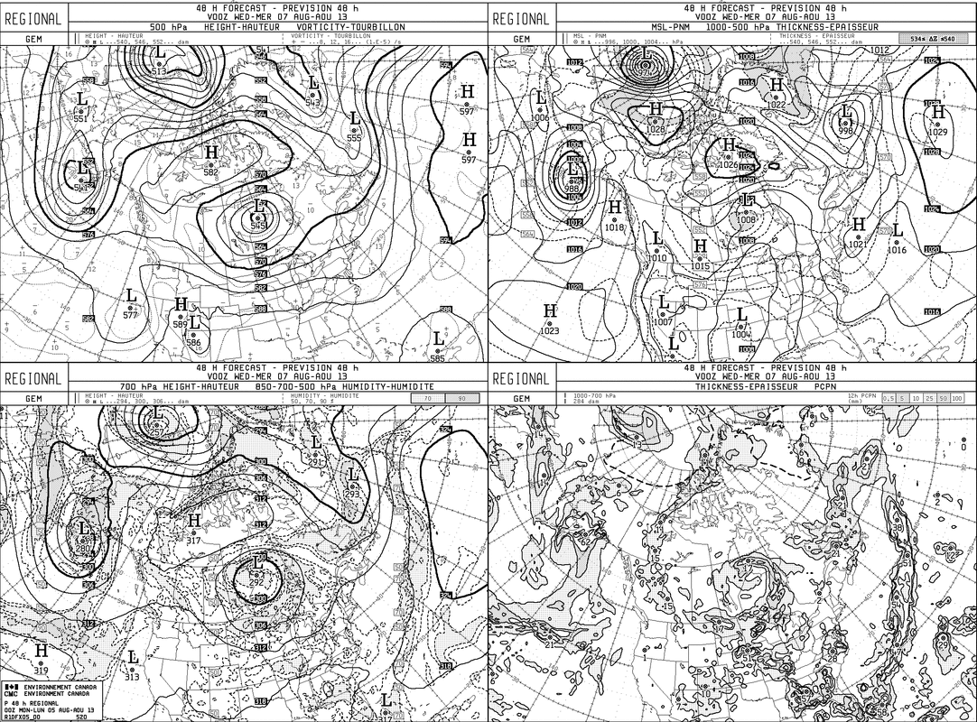
An unseasonable upper air pattern prevails....where we can see
the polar low displaced far south over Central Canada. This will keep
a good portion of the U.S. below normal in temperature. The westerly flow will have many imbedded shortwaves...all of which will serve to keep us unsettled. Timing will be a big problem right into the weekend.
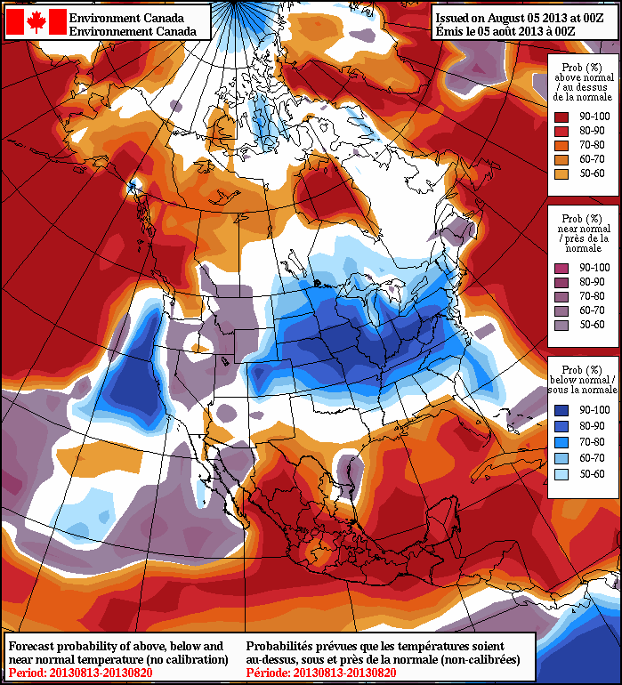
Below you will see a map depicting the upper air pattern....followed by a map showing temp. anomalies over the next 8-14 days. The blue indicates below normal.
the polar low displaced far south over Central Canada. This will keep
a good portion of the U.S. below normal in temperature. The westerly flow will have many imbedded shortwaves...all of which will serve to keep us unsettled. Timing will be a big problem right into the weekend.
Below you will see a map depicting the upper air pattern....followed by a map showing temp. anomalies over the next 8-14 days. The blue indicates below normal.
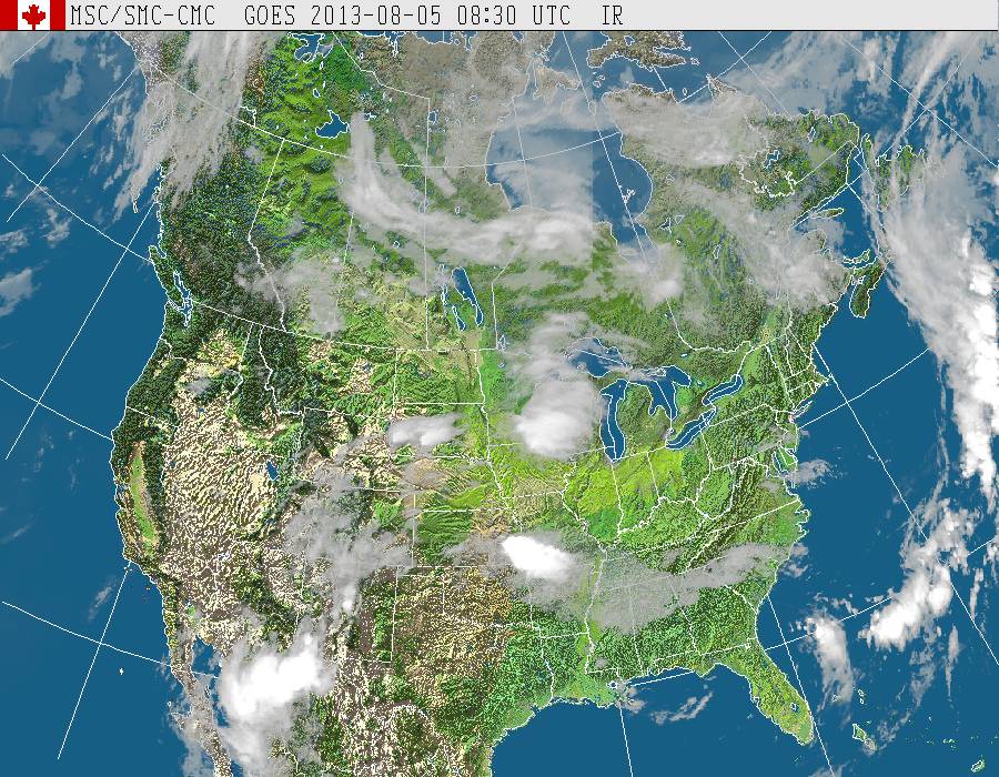
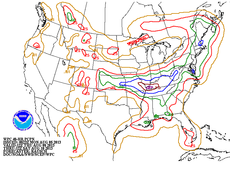
Our a.m. satellite picture is quiet...with several areas of wetness thru the Nation. Next map shows expected amounts of rain for late week into the weekend. Much of the country unsettled. Tropical Atlantic quiet. LATER.

 RSS Feed
