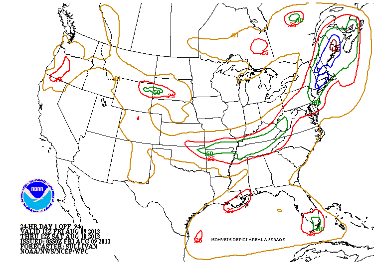
All is on schedule as a cold front heads across the East today into tonite. Large area of wet weather will accompany this front...some places getting heavy rains.... gusty thunderstorms...and perhaps a tornado. Drier - but not necessarily cooler air for weekend. Mid Atlantic to Carolinas...not as lucky. Below...rainfall amounts through tonight.
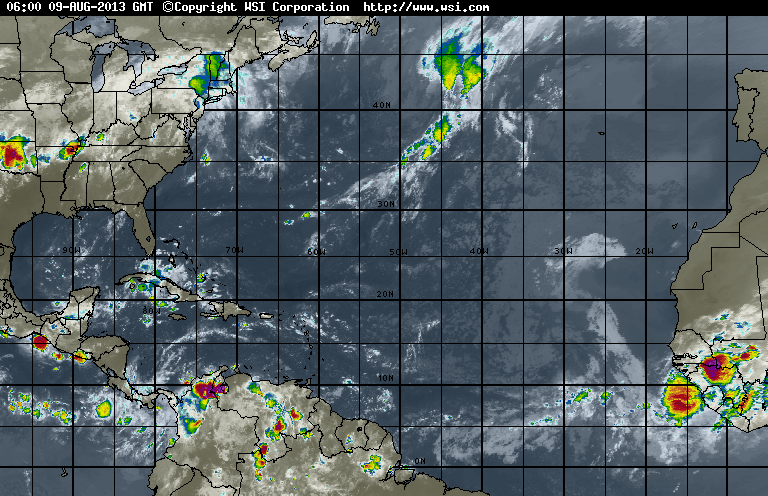
NOAA issued their update for Hurricane Season yesterday...and continue to forecast a very busy season. Hurricane computer models from N.Carolina predicting 2 major hurricanes...1 along East Coast and 1 Gulf Coast. Atlantic satellite picture shows development off Africa...and analysis shows a train to tropical waves.
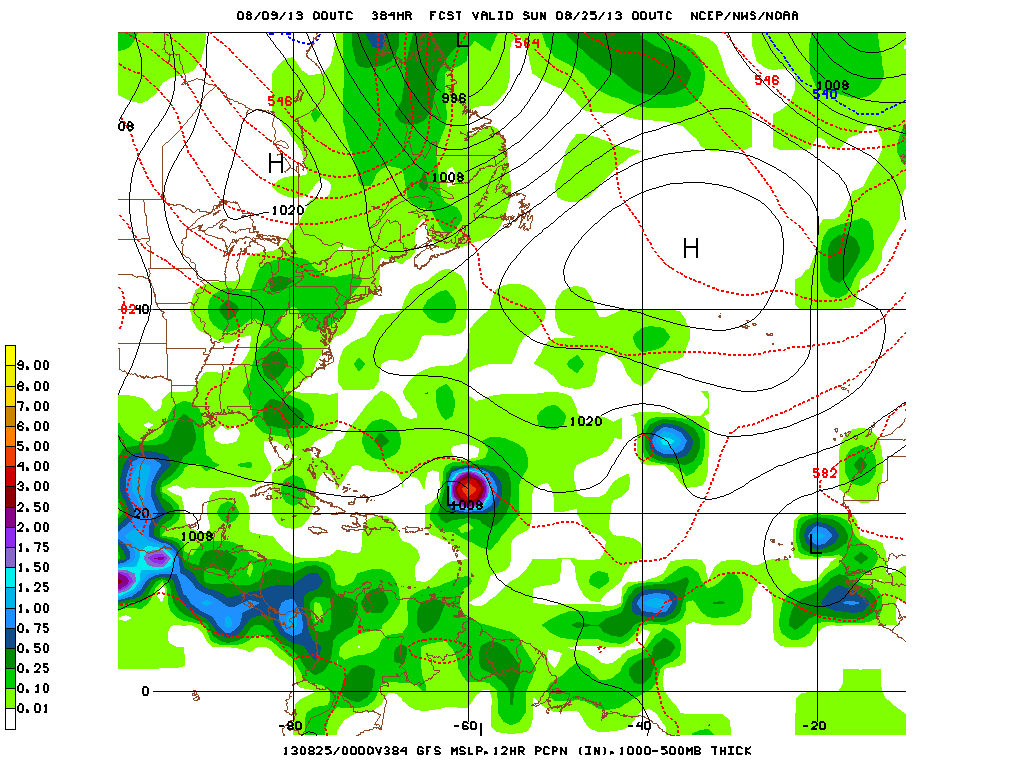
GFS Model for Aug.25....last frame......shows an active Atlantic Basin.
For now...take it slow today...then relax and enjoy the weekend and be safe. Later.
For now...take it slow today...then relax and enjoy the weekend and be safe. Later.

 RSS Feed
