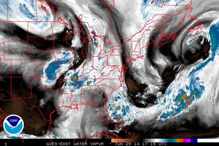
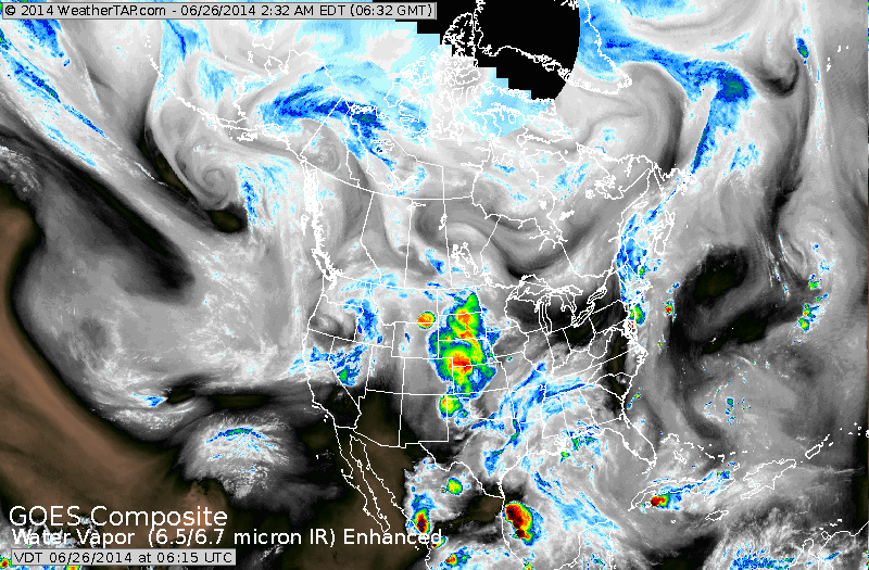
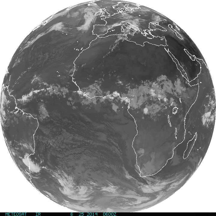
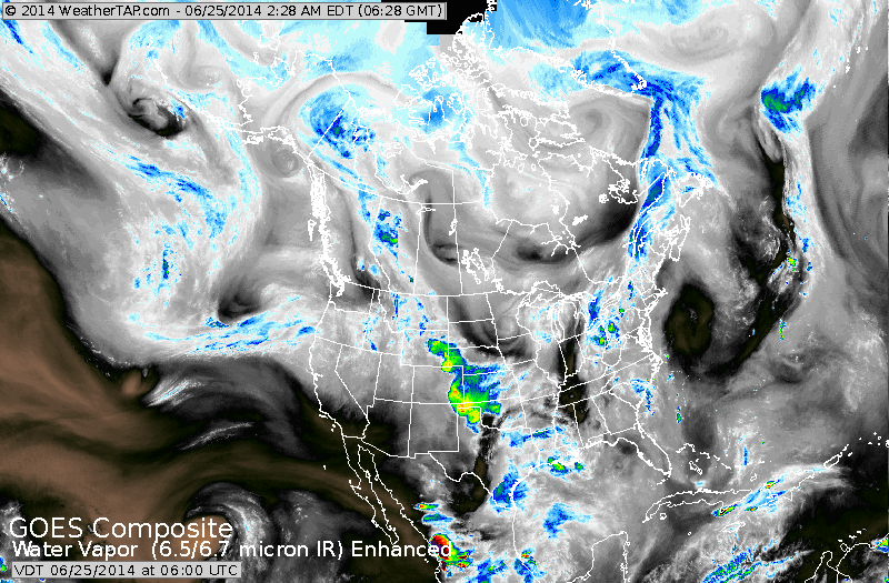
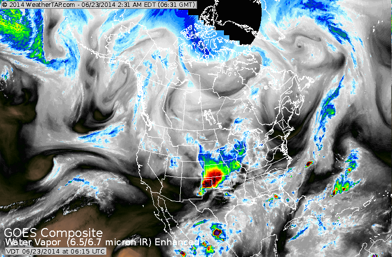
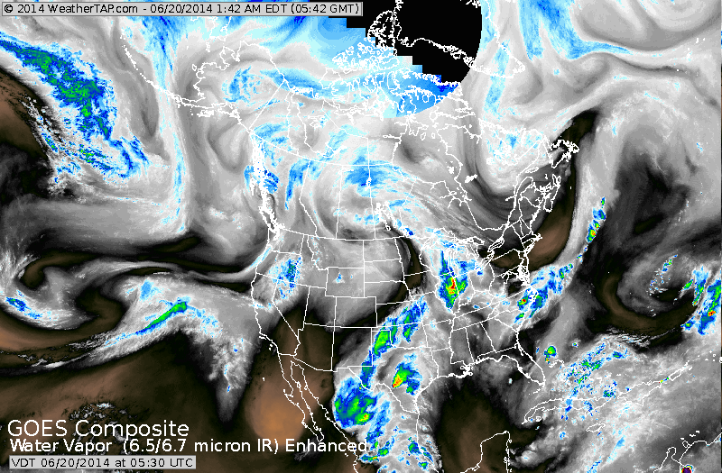
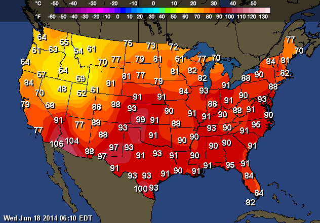
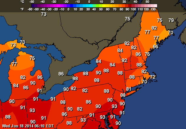
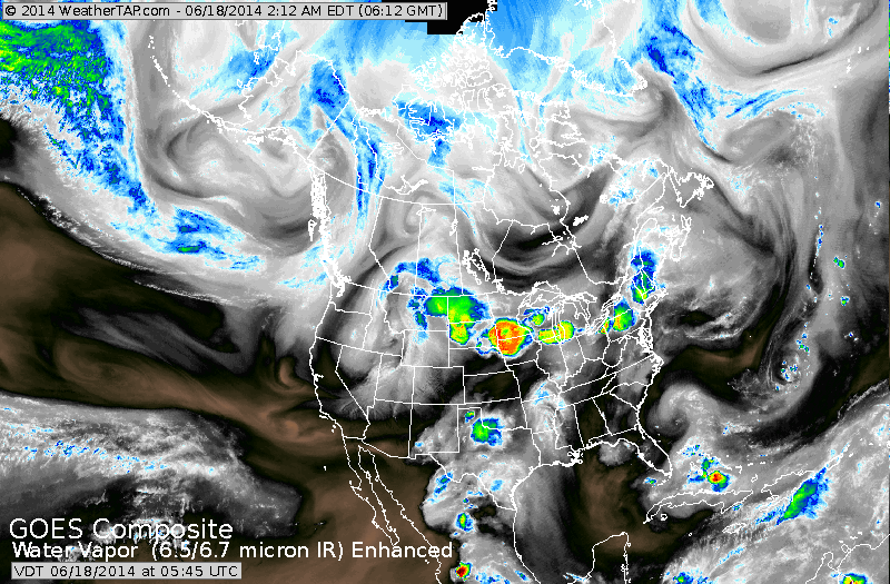
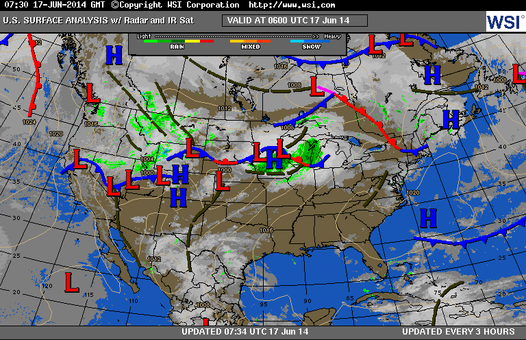
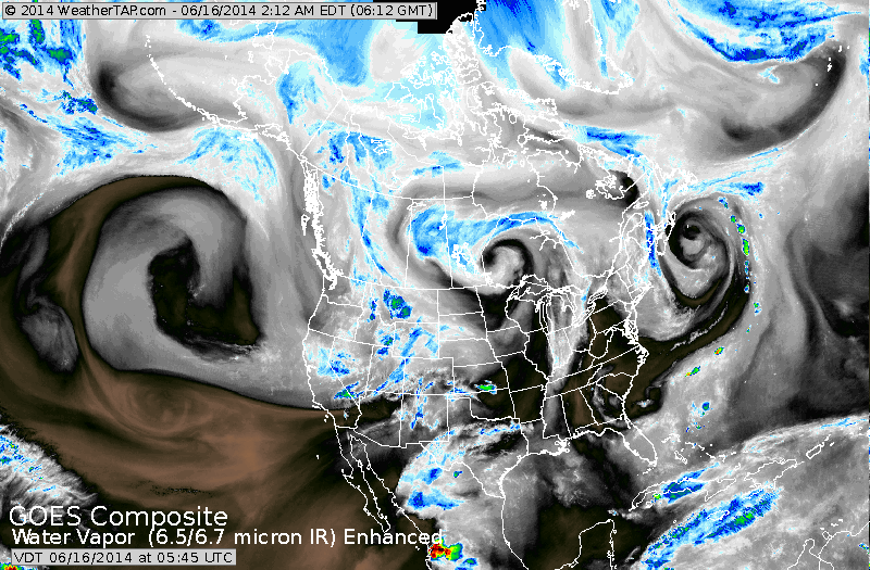
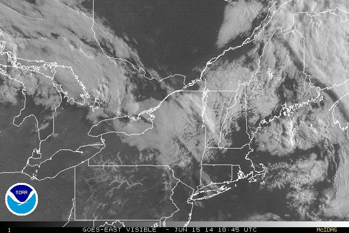
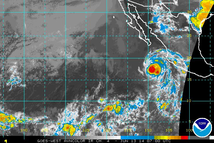
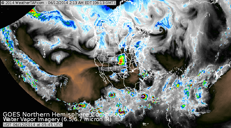
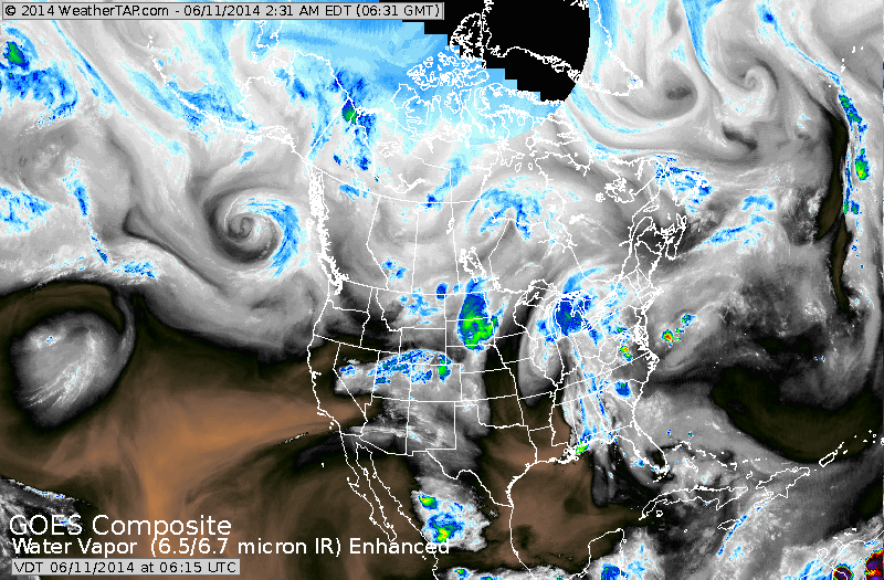
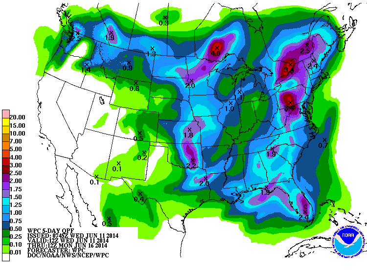
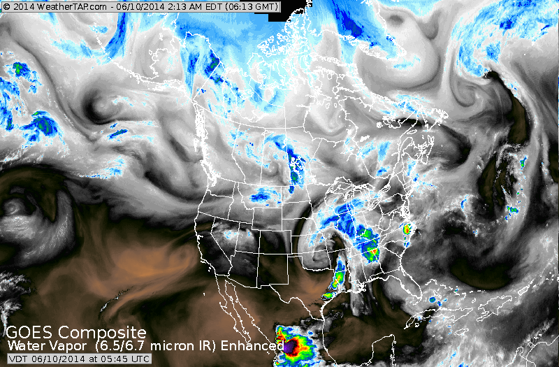
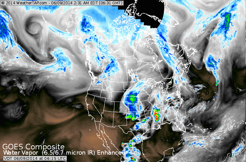
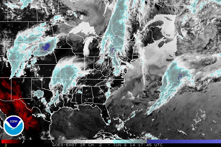
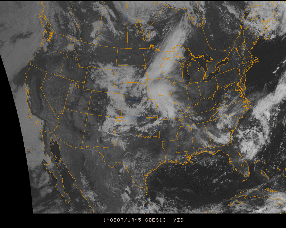
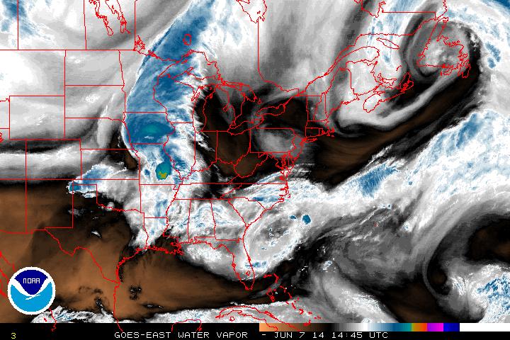
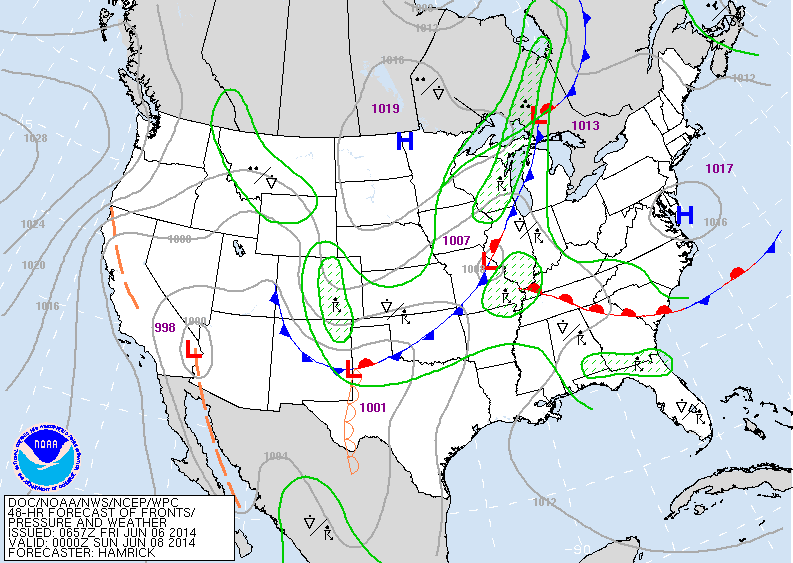
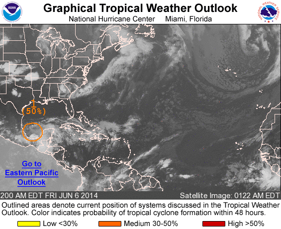
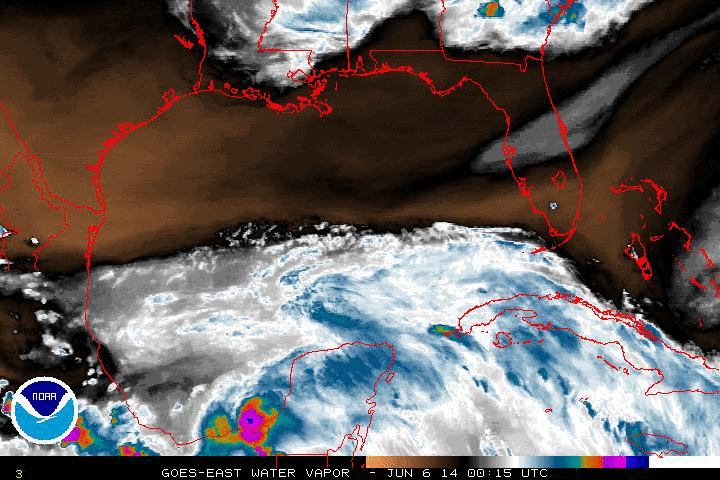
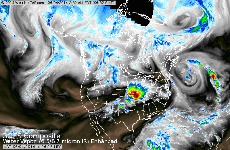
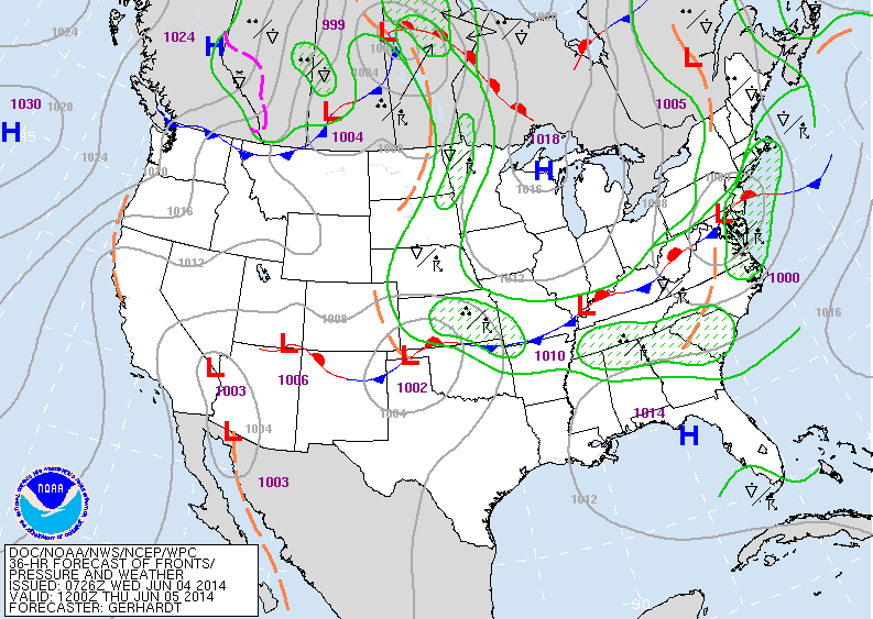
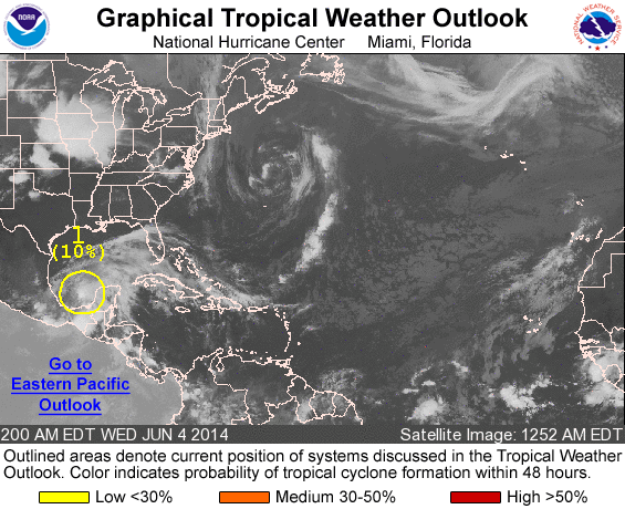
Satellite above shows large burst of showers and storms moving into Gt. Lakes. That area will head east to affect The East Coast by Wednesday. Swirl of colors over Florida could give birth to tropical depression that could affect East Coast later this week. 
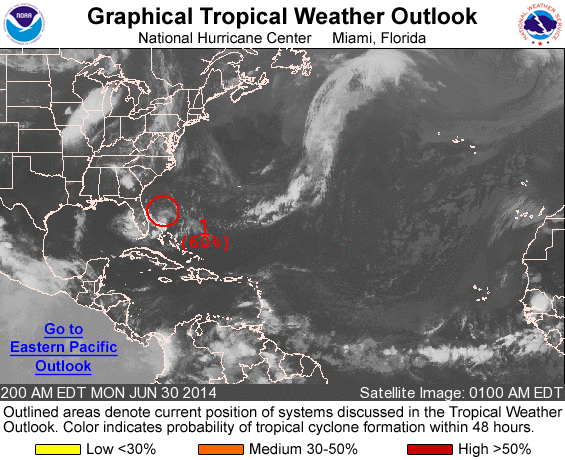
Above...Hurricane center gives the area in red a 60-80% chance of forming into a tropical system. A plane will investigate the area today. If it forms into a tropical depression/ storm it would be given the name Arthur and could affect parts of The East Coast Thursday and Friday...4th of July. 
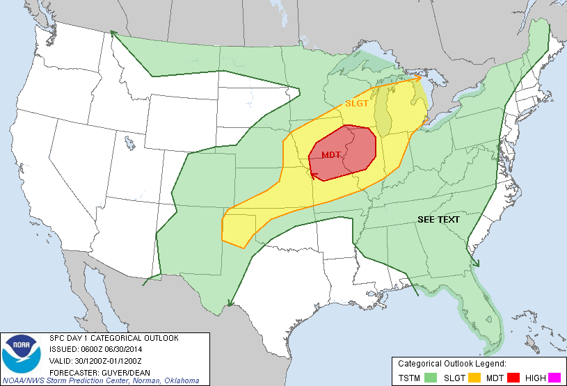
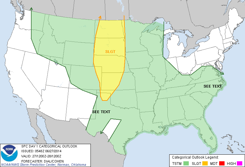
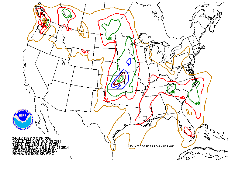
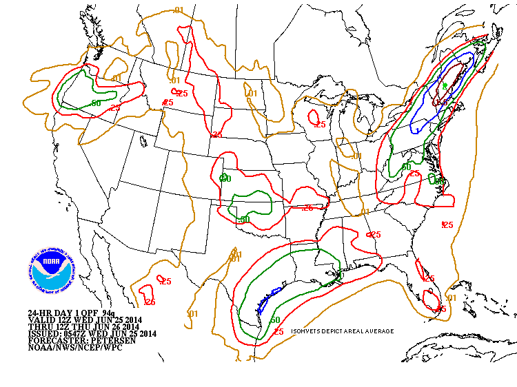
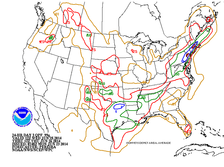
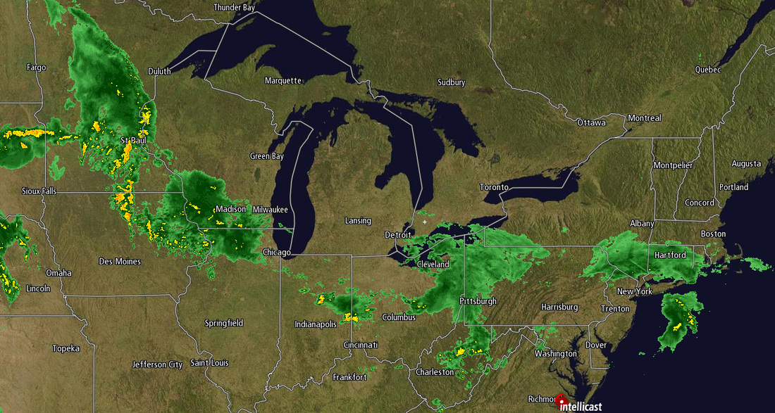
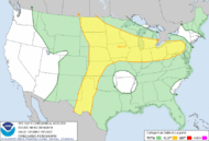
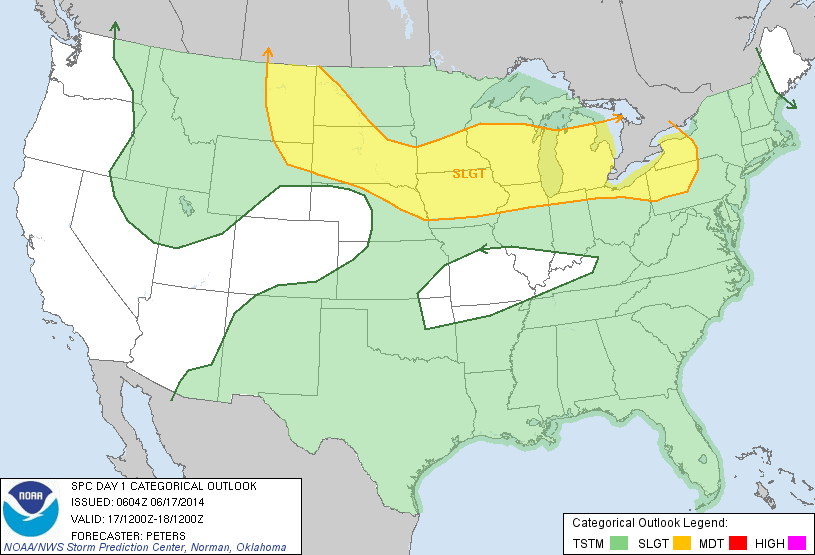
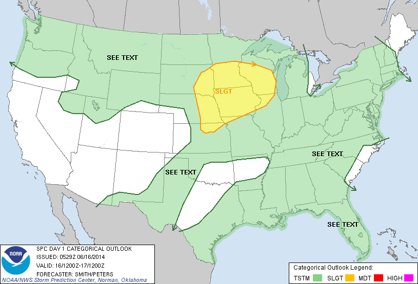
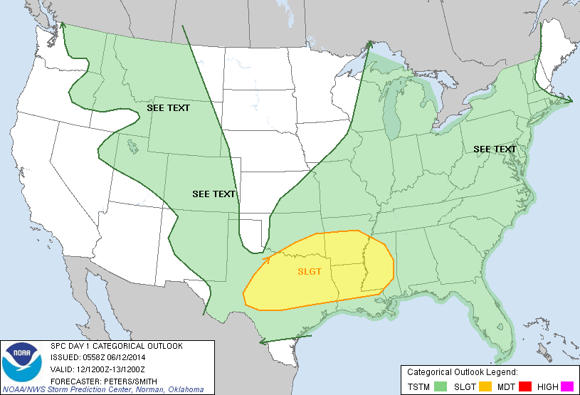
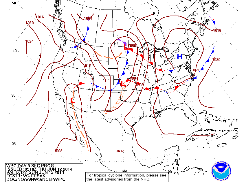
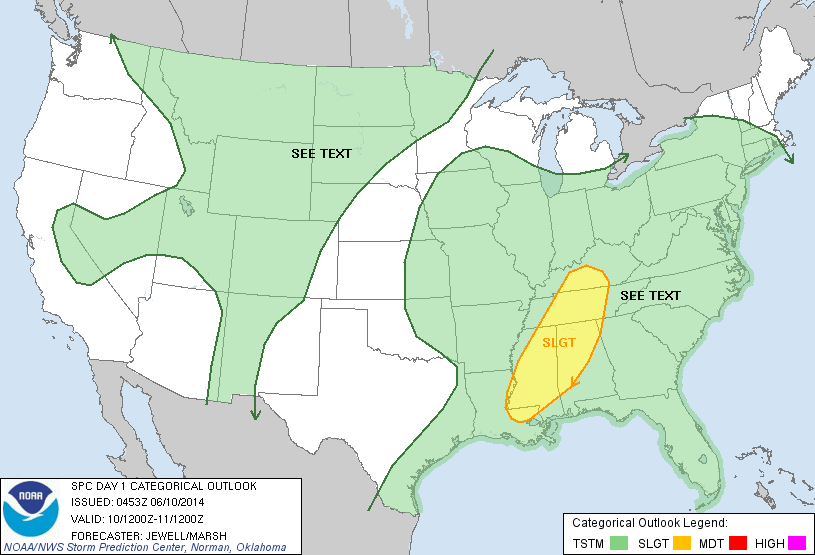
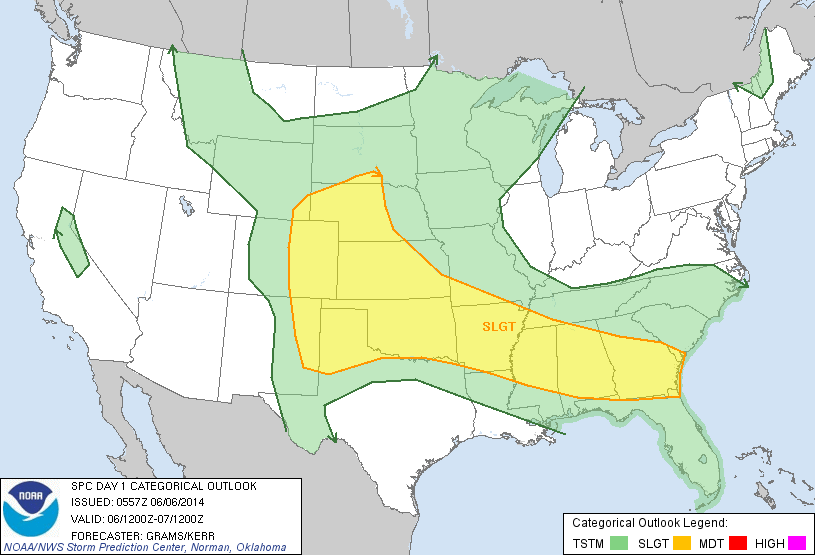
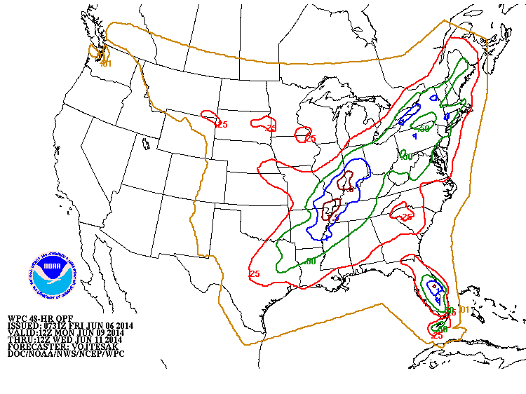
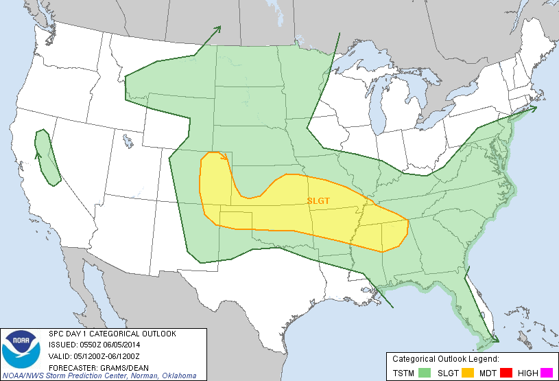
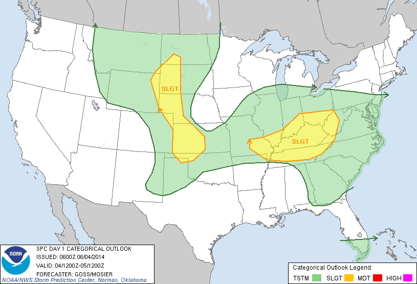
Above....area of yellow is a slight risk of severe storms today. Red is a moderate risk....indication a good chance. 
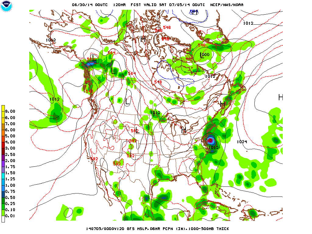
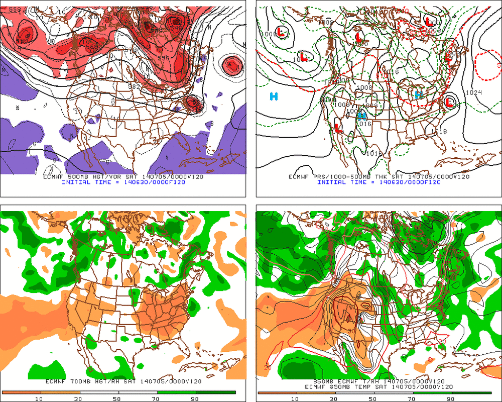
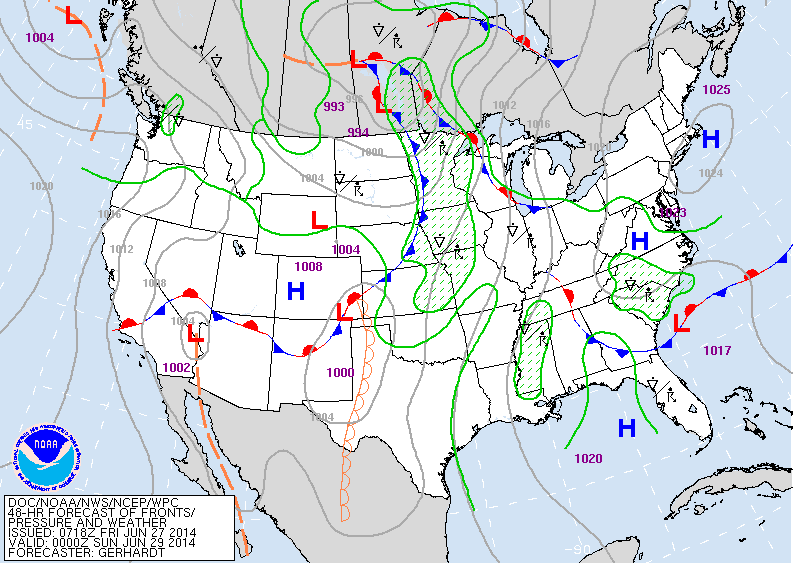
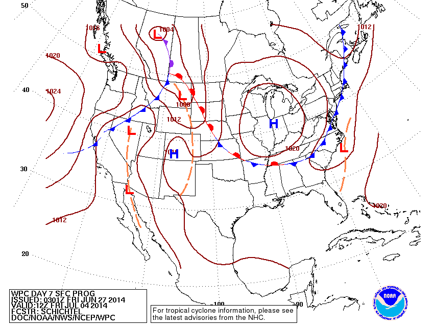
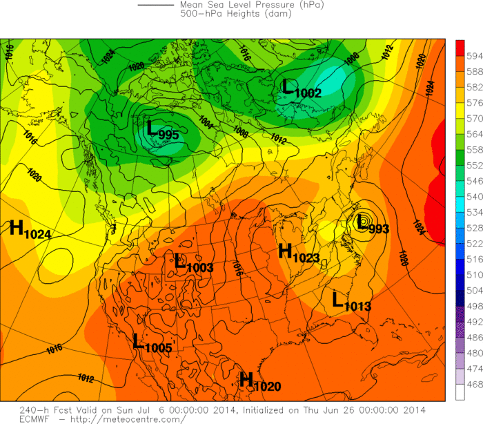
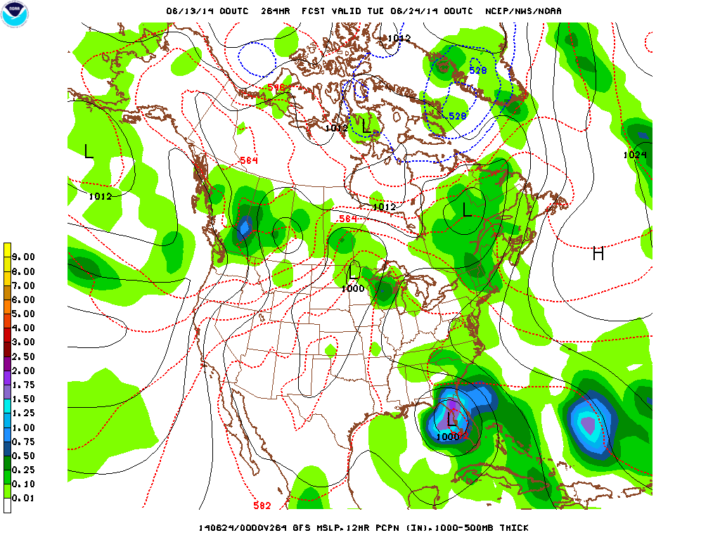
Above...The GFS....then The Euro for Friday 4th of July. Both models show a tropical low along the mid Atlantic coast which would not be good for Firework celebrations or for any outdoor activities especially from Mid Atlantic - north. Time will tell...will keep you posted. Later.
0 Comments
Low pressure that was centralized in the northern plains continues to move north into Canada while the cold front is dragging south into the Midwest, with another low pressure center building in Kansas. Find weather along the East coast today as high pressure remains in control. The scattered rain showers and thunderstorms will continue east and affect the Northeast into the midweek and perhaps leave just in time for Fourth of July weekend. But the intriguing story to end June is possibly the first tropical system in the Atlantic for 2014. The low pressure system located just offshore of Florida is continuing to show signs of development, though at a slow pace... Water vapor imagery above shows the cluster off the southeast shore. It hasn't had much movement lately and shown progressive signs of organization. The dry air shooting down from the north however is impeding rapid development. It is looking like though by the mid-week, this system could become a tropical depression. It's too early to discuss what kind of path a tropical system that has yet to form is going to take, but for right now, the expectations are that it meanders right where it is into the week.
- JL The trough located in the Central US is resulting in warm and moist air flowing up form the Gulf of Mexico. There is plenty of lift resulting in pop-up thunderstorms scattered throughout the Mississippi and Ohio Valley regions and further southeast. Towards the Northeast, conditions are beautiful with sun and dry air. The Northeast will gain humidity into the start of next week along with the threat for scattered showers & t-storms... The above visible satellite image shows just how scattered the clouds and thunderstorms are. Counter-clockwise rotation can be seen up in the Dakotas, where low pressure is centered. The associated fronts that traverse down through the Mississippi River into Missouri and into Oklahoma are where the main threats for strong thunderstorms are later today and into tonight.
This system will spend a couple of days moving east.... One more note of interest are the clouds just off the Carolina coast, showing some signs of organization to become the first Atlantic tropical system of 2014 (Arthur). It will continue to be looked at in the coming days... - JL Satellite above shows large area of stormy - convective weather over The Plains. This area will work slowly east to haunt the Northern and Central Plains with severe weather from today thru Sunday. Severe thunderstorms and tornadoes are possible. The milky white in south..hazy - hot - humid -with some thunderstorms. The black in Northeast...dry - Canadian air. Above...yellow shows the area most likely to see severe weather today. Map above shows how we think it will look this Saturday nite. The cold front in the Plains will be the big troublemaker. Nice in Northeast and Mid Atlantic..and West Coast. Unsettled south. This cold front is expected to move offshore of The East Coast by 4th of July. Above - map for 4th of July. If this proves accurate then a chunk of the Country from Great Lakes to East Coast will have great weather. Hot humid weather continues south. Showers and storms in Northern Rockies. Above....high temperatures expected for July 4th. Yellow would indicate pleasant.....orange and red...Hot. Have a nice safe weekend....folks in Plains...be vigilant....
Satellite above shows drier air from Great Lakes to Northeast.....(black) while colors light up The Plains where all of the moisture will be from now into the weekend. Today's map above shows cold front moving off East Coast paving the way for nice weather over much of the eastern half of our Nation...except the southeast. Wet weather...as indicated above...plagues the central states. Above...amounts of rain this weekend. Central and Southeast and Pacific Northwest need umbrellas. Above...map predicting systems for Thursday, July 3rd. If this map is accurate...(ummmm?) nice weather for much of the eastern 2/3 of the Nation. Take a look below...at The infamous Euro model which wants to hit the east coast with some sort of a storm around 4th of July. Will keep an eye on it....but much too far out to bank on anything like that. Be safe.
Above...disc shot of our satellite from Africa to Caribbean. Very quiet. Weather map for late today showing cold front in the east. Once that front pushes offshore...modified Canadian air will cover much of The Northeast...Mid Atlantic...while the rest of the Nation stays stick and unsettled into the weekend. Satellite above shows cold front from Northeast to Ohio Valley. The enhanced colors over the Rockies and Plains will continue over The Southern U.S. Above...amount of rainfall over the next 24 hours.....clearly indicating heavy rain to northern half of New England....along the Texas coast. Stay safe, later.
Above...satellite picture shows lots of clouds and moisture. Remember...dark areas...clear and dry...... colors mean moisture. Above...map shows rainfall totals for the next 7 days which includes the weekend. Clearly...the purple indicates heavy rains of 2" or more....as you can see...no shortage of rain. Above...map shows high temperatures for next Tuesday. You can see that heat is advancing northward over the entire Nation. This leads to what I think will be a sizzling
4th of July...and with that will come fireworks from Mom Nature. For now...relax..be safe. Satellite above shows large moisture swath Southern Plains extending to Great Lakes. This system will affect the Eastern Half of The Nation into Thursday with warm- humid weather and showers and storms. The front in mid section of The Nation causing most of the adverse weather this week. Meanwhile Canadian air is trying to press south...let's see if it makes it by the weekend. Amounts of rainfall (above) expected mid week this week. Notice the blue and brown over New England....that's 1-2" of rain. Map above....shows high temperatures for NEXT Monday. Will that set the stage for The Big 4th of July Weekend ? I'm willing to bet that in man y places it will be too hot by then..and with heat comes storms. For now...be safe.
Great weather all around today, so let's switch to something we can talk about and keep in mind for the upcoming months. If you didn't know already, the Hurricane season has already started! The hurricane season officially started for the Atlantic on June 1st three weeks ago (5/15 for the Pacific) and will last until November 30th. For the Atlantic though there hasn't really been much to remind us of that as there hasn't been a single storm that formed thus far. Three in the Pacific however and they were record breaking: May 22nd-29th there was a category 4 hurricane named Amanda with , 155 MPH winds, the strongest May tropical storm in the Pacific. June 2nd-4th there was Tropical Storm Boris, no big deal and didn't stick around for long. And finally June 6-June 15 there was yet another category 4 hurricane, this one named Christina and had 150 MPH winds making it the earliest second major hurricane on record. Currently though everything is calm, with nothing brewing in the Atlantic and only one small area of disturbance in the Pacific, and even that has only a 10% chance of forming in to a hurricane. For the Pacific we're already 3 storms in with two of them being major, and all signals point towards it being an above normal season. On average there's 15 named storms a year, 8 hurricanes and 4 major hurricanes.
For the Atlantic though, El Nino should be lowering the amount of storms forming for the Atlantic. On average we have 12 named storms a year, with 6 of them hurricanes and 3 of them major hurricanes, and it seems like there will be slightly below average for this time of year. These are storms that form, not make landfall. we'll just have to wait and see how this season pans out. -Mike Merin Notice the dry air over The Northeast: that trof will keep that area dry and pleasant all weekend. The Front over Great Lakes - Plains and Texas will basically keep those areas unsettled. Another band of showers in Pacific Northwest will do likely. Summer arrives at 6:51 Eastern Time Saturday.....enjoy. Map above is valid for this Saturday...but will probably be a good average of the entire weekend. The front in The Dakotas keeping The Plains unsettled. The front in Ohio/Tenn. Valleys keep them unsettled. Best areas:
West...Northeast...Southern Plains. So - short but sweet for most. Have a safe weekend. Yesterday marked record temperatures for many counties across the US as well as the Northeast. As you can see in the map below, much of the region was baking in the 80's with no shortage of sunshine to make the temps feel even hotter. There were plenty of 90's as well as you go into NJ and southbound. The reason though why it felt much worse though was because of the high humidity as well as the fact that lows were still in the 70's for the NY metro area or the upper 60's for New England, meaning that there was no break from the hot weather. For those without central air or a good AC system, this also meant that your houses were unable to take a break and take in some of the cooler air to prepare for the hot day. Enough about yesterday though, onto today: It will be anywhere from 7-13° cooler today than it was yesterday across the Northeast, with clouds and showers during the day tapering off in the afternoon and leading into sunny skies. Those showers on the radar currently located in western PA will hit the NY metro area in the afternoon, but everything farther to the west will miss us completely.
The same can't be said unfortunately for places like Minnesota. As you can see they have a very large area of heavy showers and thunderstorms drenching the state, and the chance for showers/storms will continue for them over the next 5 days. Back to the Northeast though, once we get rid of the showers today, Friday Saturday Sunday even into Monday looks like we'll have plenty of sunshine, and more manageable temperatures in the mid-upper 70's. Looking forward to it. -Mike Merin Satellite above shows flare up of rain and storms upper Midwest and Great Lakes. System in Northern Rockies brought some snow to higher elevations yesterday. Notice the swirl off the Carolinas. Upper low...but needs to be watched. Above...click to enlarge...yellow showing best area for severe storms today. Above...today's map....active indeed. Northern Rockies to Ohio Valley. Above.....rainfall amounts for the next 5 days. West is dry and much of The Northeast. Above...departure from normal for daytime highs for the next 5 days. Red is above...blue is below...purple is normal.
Be safe. Satellite above.....large burst of colors in Great Lakes is a large area of thunderstorms...called an MCC....mesoscale convective cluster. Some of this will weaken while the rest continues east. The swirl in The Pacific Northwest will creat more storms later this week..and that too moving east which could mess things up in East this weekend. Surface map above for today shows that front and low with all the wetness in The Great Lakes. The system in The Rockies will only continue to spread unsettled weather east. Very untypical for June. Above...today's areas for potential severe weather - yellow. Above - 2 maps: 1 through June 26th....just above through June 30. They represent how high temperatures will average right through the end of the month. East and West
warmer...Central - cooler..... elsewhere - near normal. Be safe. You can see the major storms on this satellite: off The Canadian Maritimes....reason for wind in Northeast this weekend, another south central Canada...and another in The Pacific. These systems will cause fronts to move across the county but also result in warmer and more humid weather overall. When it gets warm and humid..thunderstorms are possible..and any storm could be heavy or even severe. Above...today's threat for severe weather - upper Midwest in yellow. Green indicates - simple chance for thunderstorms...which covers almost the entire Nation. A weak trof of low pressure will bring showers and storms to Northeast today and tonight. Front in Plains will bring
a better threat for storms today. Elsewhere...typical afternoon and evening thunderstorms with humid conditions. Be safe. On this Father's Day most regions are waking up to sunshine. The exception this morning is for the Midwest and southern plains where a low pressure system is dumping copious amounts of rain. The morning water vapor image below shows just how much moisture there is in the air. The blackened areas represent the parts where the air is barren of moisture. But even the Northeast is still seeing sunny skies generally as the visible imagery shows below. A ridge is moving into place that will clear the skies into today and tomorrow. Taking a look at the radar this morning for the Midwest... Thunderstorms associated with this frontal system could bring heavy gusts and isolated hail events, but the severe threat is not large at this time... As this tries to move east, the strong ridge along the Appalachian Mountains will limit this system's progress and eventually weaken it as it moves towards the east coast by Tuesday & Wednesday this week, dropping the threat down to scattered rain showers and thunderstorms for the metropolis areas of Washington DC, NYC and areas further northeast.
Enjoy your Father's Day and have a great week! - JL Satellite shows much of the heavy rain in Northeast staying inland and across New England. Heavy storms move out of Texas.....storms gaining in Dakotas and then east. Above - early morning temperatures this morning....fyi. Above...satellite shot of Hurricane Cristina off Mexico and staying offshore with 100-120 mph winds. Early morning radar above. Today's map...wet front in East moving offshore in time for the weekend. Frontal system in Rockies brings wet weather to Upper Midwest and Plains this weekend. Map above shows how daytime temps. will average thru June 22nd. Red...way above.....Blue...way below...in fact do not be surprised in if snows next week in The Northern Rockies. Finally...for what it is worth...The GFS Model insisting that a tropical storm or hurricane will threaten Gulf Coast...especially Florida the last week in June. (Below). Have a nice weekend.
Below...satellite picture showing moisture from Appalachians east...and large area of rain and storms iin Southern Plains moving east. All will head off East Coast by weekend. Spiral off Vancouver will help promote warming in East next week. Above...hemispheric shot showing Hurricane Cristina off Mexico and moving away. Another system over Central America will head into Pacific and become the next tropical storm there. Above...today's map....showing the pair of fronts producing unsettled weather from Great Lakes to Texas and over to East Coast. System in Pacific Northwest will produce wet weather on FAther's Day in Midwest. Below...the yellow indicates today's threat for severe weather. Above...map for Sunday: high pressure over Northeast...fair and very warm. Front over Plains will produce wet weather there....elsewhere...fair and very warm. Below...map showing high temperatures expected on this Sunday, Father's Day. Once again...think temperatures in The Northeast will be warmer than depicted. Be safe.
Above...(you can enlarge by clicking on photo). Notice the flare up of color in the far lower right corner....that will be the next tropical system to watch next week. The blues...indicate wetness.....black/ brown...dry as a bone. Notice the vigorous storm off the Canadian West Coast. That will be a player next week..when hot weather could shift to The East. Above...today's map: sluggish moving system in the East. A faster moving front in Plains...will catch up to the eastern system and knock it off the coast this weekend. Above...High temperatures expected for this Sunday, Father's Day. Think they are underplayed in Northeast....where especially New England could see temps headed for 90. Above...map for Sunday: high pressure over Northeast...should provide for very warm to hot weather. Best chance for rain...Upper Midwest. Map above shows total rainfall from today through next Monday. Remember...the darker - the heavier....so if you are clear to green....you don't have much rain to worry about. Be safe !.
Map above - see the "L" in southern Illinois...it was over Kansas yesterday. It will head east off the East Coast Saturday...when finally a break to drier weather will follow. Above...satellite shows large area of wet weather is middle of the country. That system as pointed out above will not exit the country until Saturday....so soggy weather for The East...but dry and hot West. Above...yellow indicates threat for severe weather today. Green....general area for thunderstorms. Above...amounts of rain through this Sunday. The purple is the heaviest...green the lightest. How temperatures will average daytime - through June 19th....for a change...above in the East....but so will rainfall.
Below...how high temps will average thru June 23rd...again...above in The East ...and again rainfall the same. Satellite shows dry weather (black) out west, Clusters of showers and storms from Plains to East Coast...likely to stay that way all week. Today's map above: low in southern Plain heads east and keeps things very unsettled and summerlike for Eastern half of Nation for several days. Above...rainfall totals expected this week. The darker the color...the more rainfall......which covers more than 2/3 of The Nation. Above.....how high temperatures will average this week. Blue is below the average....Red - above - and purple below.
Be safe...later. The weekend was beautiful for many and wet for some... Into this next week, the moist & unstable air will spread across the Eastern US. Below shows the Infrared imagery of the eastern half of the US on this Sunday afternoon... Three centers of low pressure are visible here... One entering Pennsylvania, one in Oklahoma, and the last one beginning to show signs of life towards Wyoming, South Dakota, and Nebraska. All of these are connected by a long frontal boundary. These regions (Deep south, southeast, Mid-Atlantic, Northeast) are experiencing temperatures around 80 degrees or warmer today, with some areas seeing rain showers and thunderstorms. While areas closer to the Great Lakes in the Midwest are seeing substantial amounts of sunshine and temperatures just reaching 70 degrees for a much more beautiful Sunday! Into this next week though... The low in the northeast currently will move out early. The low currently entering in the Southeast will continue to produce scattered thunderstorms as it moves east to both the Southeast and the Northeast regions. The system passing by the Rockies however will try to be the bigger story by the end of this week for the east coast which Pat will go into as this wet week progresses.
- JL A look at the visible imagery big picture of the country shows a dry west whereas from the Central US and eastward, clouds are much more plentiful. Hazy & humid air is prevalent along a stationary front in the Southeast which could kick up thunderstorm activity in the region through the weekend. Even though the clouds are not thick in the visible, in the water vapor image below, you can see there is plenty of moisture in the Southeast today. In the Midwest, low pressure is building in Missouri today along the bottom of a cold front extending up through the Great Lakes into Canada. This low will move ENE and could develop into a MCC (Mesoscale Convective Complex) through Sunday.
As a result of the current synoptic situation... Conditions across the Midwest will be comfortable as the current systems pass on, whereas into the east, conditions will only get stickier and warmer as the weekend progresses (For the Northeast, look for this by Monday). - JL Above...satellite shows heavy storms Texas to Missouri...that will be today's problem areas. Elsewhere ...mainly fair. Above...yellow area indicates threat of severe weather for today. Above...map for Saturday: showers & storms fron Great Lakes to southern Rockies....Tenn. Valley and Southeast. Rainfall amounts from Monday thru Wednesday next week. Most places seeing better than 1/2" to 2" of rain. Average high temperatures expected for late next week. Above...Tropical outlook: Hurricane center has now brought the probability up to 50% of a tropical system forming in the Yucatan. Below...a close up satellite of this system. A plane will be headed into the area this afternoon to investigate.
Have a safe - nice weekend. Above...today's map by early afternoon. Wet weather moving out across New England. Showers and storms Tennessee Valley to Carolinas....and upper Midwest. West is fair and warm. Satellite picture below...corresponds nicely with this map. Above...risk of severe weather today - yellow - which pretty much will be the case Friday and Saturday. Above...high temps for this Sunday....which...overall...will be the warmest day nation-wide of the next 7. Above...amounts of rainfall for next Tuesday thru Thursday,....indicating alot of wetness for the Nation. Below...Hurricane center watching area near Yucatan....should be slow to develop...but will bring dangerous flooding to that area. Be safe....later.
Satellite above shows strong disturbance moving into Ohio Valley. This system heads for Mid Atlantic Thursday and will include part of The Northeast. Once it moves offshore..typical summer weather most places for the weekend. Today's threat of severe weather highlighted in yellow. Above - map for Thursday. Low near Washington DC will be the big weather maker...extending rain into New England. Pleasant weather over Great Lakes should move in for the weekend. Above...high temperatures expected for this Sunday. Brown, orange,reds...warmest readings.....green...coolest. Hurricane center is back to highlighting Yucatan for possible development. One of our models take this system
up the coast next week. Much too soon to worry about that. Be safe. Later. |
We'll have daily weather discussions, talking about major systems on the horizon along with anything noteworthy that pops up on our radar.
Pat Pagano,
|