The weekend was beautiful for many and wet for some... Into this next week, the moist & unstable air will spread across the Eastern US. Below shows the Infrared imagery of the eastern half of the US on this Sunday afternoon...
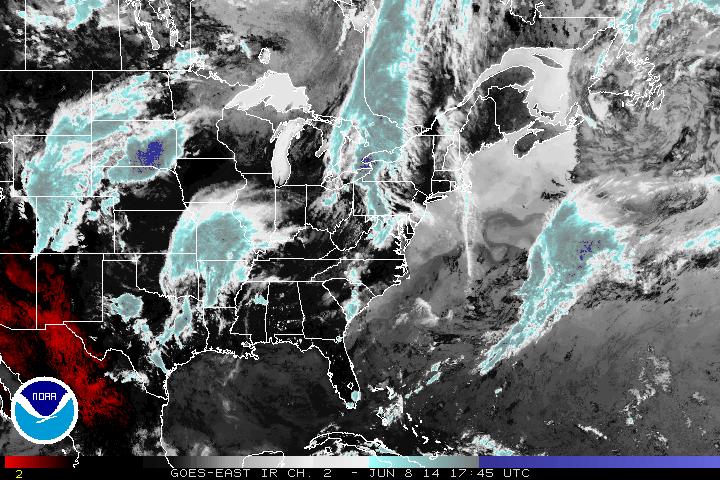
Three centers of low pressure are visible here... One entering Pennsylvania, one in Oklahoma, and the last one beginning to show signs of life towards Wyoming, South Dakota, and Nebraska. All of these are connected by a long frontal boundary. These regions (Deep south, southeast, Mid-Atlantic, Northeast) are experiencing temperatures around 80 degrees or warmer today, with some areas seeing rain showers and thunderstorms. While areas closer to the Great Lakes in the Midwest are seeing substantial amounts of sunshine and temperatures just reaching 70 degrees for a much more beautiful Sunday!
Into this next week though... The low in the northeast currently will move out early. The low currently entering in the Southeast will continue to produce scattered thunderstorms as it moves east to both the Southeast and the Northeast regions. The system passing by the Rockies however will try to be the bigger story by the end of this week for the east coast which Pat will go into as this wet week progresses.
- JL
- JL

 RSS Feed
