
Satellite above shows large area of stormy - convective weather over The Plains. This area will work slowly east to haunt the Northern and Central Plains with severe weather from today thru Sunday. Severe thunderstorms and tornadoes are possible. The milky white in south..hazy - hot - humid -with some thunderstorms. The black in Northeast...dry - Canadian air.
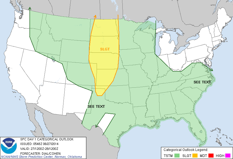
Above...yellow shows the area most likely to see severe weather today.
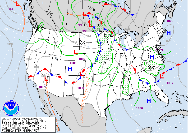
Map above shows how we think it will look this Saturday nite. The cold front in the Plains will be the big troublemaker. Nice in Northeast and Mid Atlantic..and West Coast. Unsettled south. This cold front is expected to move
offshore of The East Coast by 4th of July.
offshore of The East Coast by 4th of July.
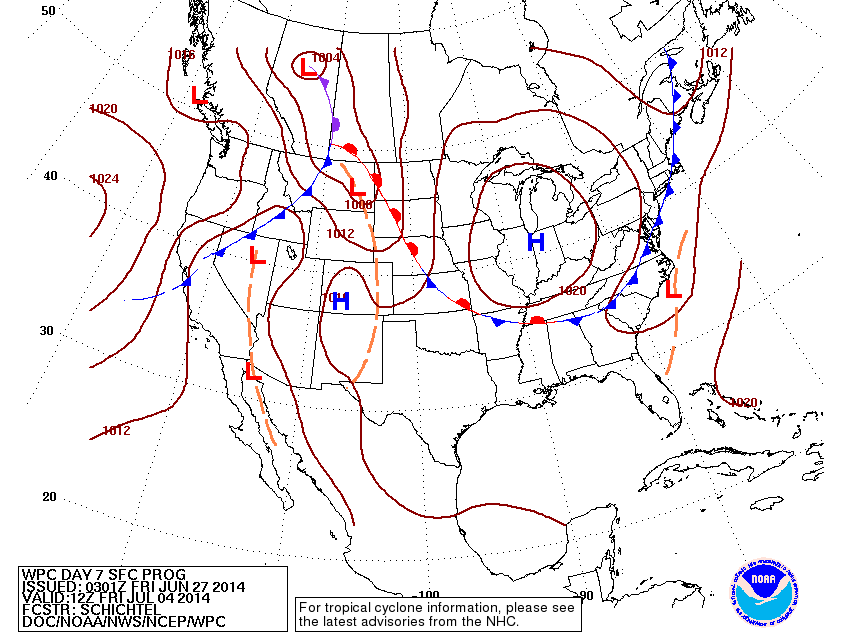
Above - map for 4th of July. If this proves accurate then a chunk of the
Country from Great Lakes to East Coast will have great weather. Hot humid weather continues south. Showers and storms in Northern Rockies.
Country from Great Lakes to East Coast will have great weather. Hot humid weather continues south. Showers and storms in Northern Rockies.
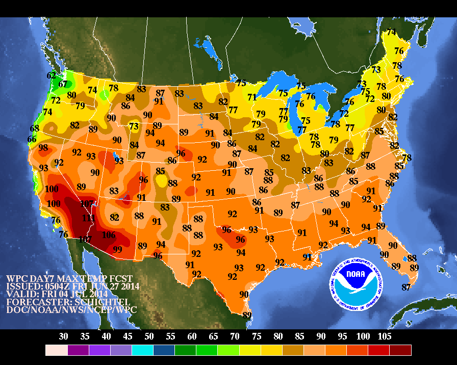
Above....high temperatures expected for July 4th. Yellow would indicate pleasant.....orange and red...Hot. Have a nice safe weekend....folks in Plains...be vigilant....

 RSS Feed
