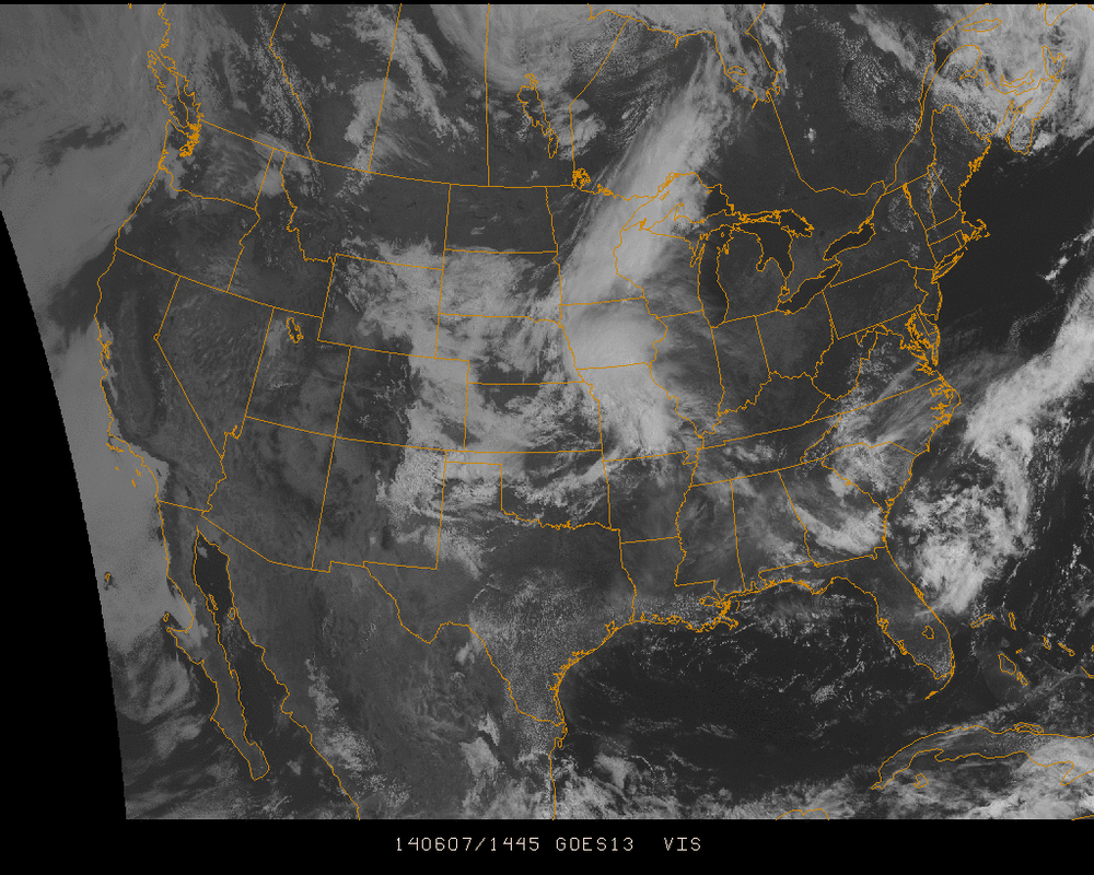
A look at the visible imagery big picture of the country shows a dry west whereas from the Central US and eastward, clouds are much more plentiful.
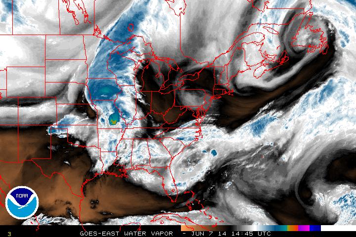
Hazy & humid air is prevalent along a stationary front in the Southeast which could kick up thunderstorm activity in the region through the weekend. Even though the clouds are not thick in the visible, in the water vapor image below, you can see there is plenty of moisture in the Southeast today.
In the Midwest, low pressure is building in Missouri today along the bottom of a cold front extending up through the Great Lakes into Canada. This low will move ENE and could develop into a MCC (Mesoscale Convective Complex) through Sunday.
As a result of the current synoptic situation... Conditions across the Midwest will be comfortable as the current systems pass on, whereas into the east, conditions will only get stickier and warmer as the weekend progresses (For the Northeast, look for this by Monday).
- JL
As a result of the current synoptic situation... Conditions across the Midwest will be comfortable as the current systems pass on, whereas into the east, conditions will only get stickier and warmer as the weekend progresses (For the Northeast, look for this by Monday).
- JL

 RSS Feed
