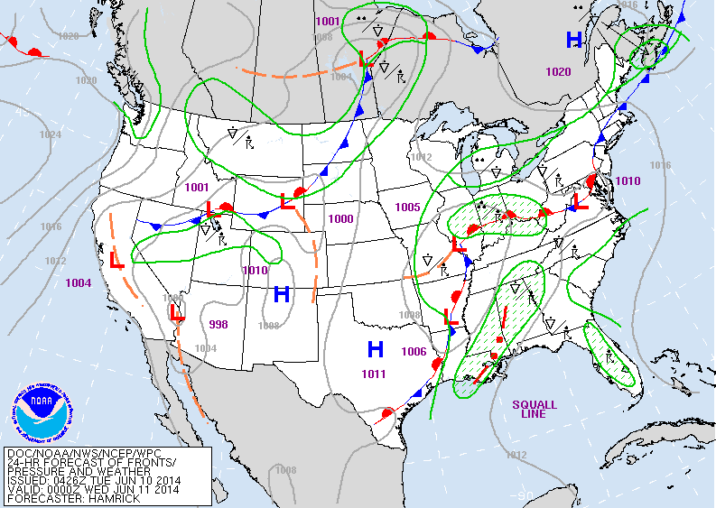
Map above - see the "L" in southern Illinois...it was over
Kansas yesterday. It will head east off the East Coast
Saturday...when finally a break to drier weather will follow.
Kansas yesterday. It will head east off the East Coast
Saturday...when finally a break to drier weather will follow.
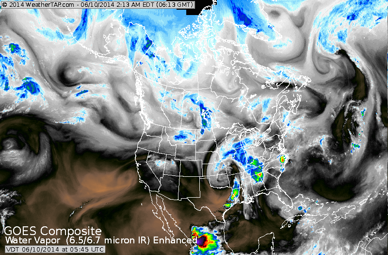
Above...satellite shows large area of wet weather is middle of the country. That system as pointed out above will not
exit the country until Saturday....so soggy weather for The East...but dry and hot West.
exit the country until Saturday....so soggy weather for The East...but dry and hot West.
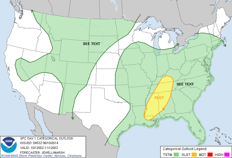
Above...yellow indicates threat for severe weather today.
Green....general area for thunderstorms.
Green....general area for thunderstorms.
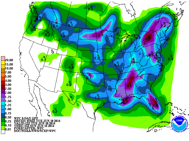
Above...amounts of rain through this Sunday. The purple is the heaviest...green the lightest.
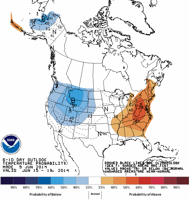
How temperatures will average daytime - through June 19th....for a change...above in the East....but so will rainfall.
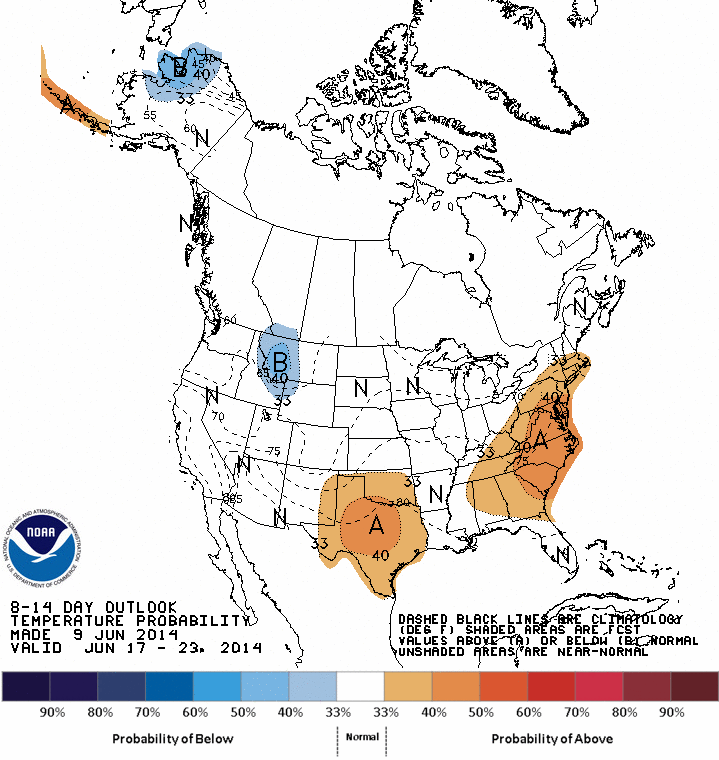
Below...how high temps will average thru June 23rd...again...above in The East ...and again rainfall the same.
Below...how high temps will average thru June 23rd...again...above in The East ...and again rainfall the same.

 RSS Feed
