Metro Weather Inc. Services
Like us, follow us, link to us, contact us!
  • Home
    • Daily Weather Discussion
  • Weather Prepared for You
    • Film and TV Production
    • Radio & Television
    • Government and Industry
    • Forensic Services >
      • Weather Record Request Form
    • Metro Morning Monitor
  • About Metro Weather
    • Senior Staff
  • Your Weather Images
  • Contact Us

Turning nice East....Not so good South....

6/5/2014

0 Comments

 
Picture
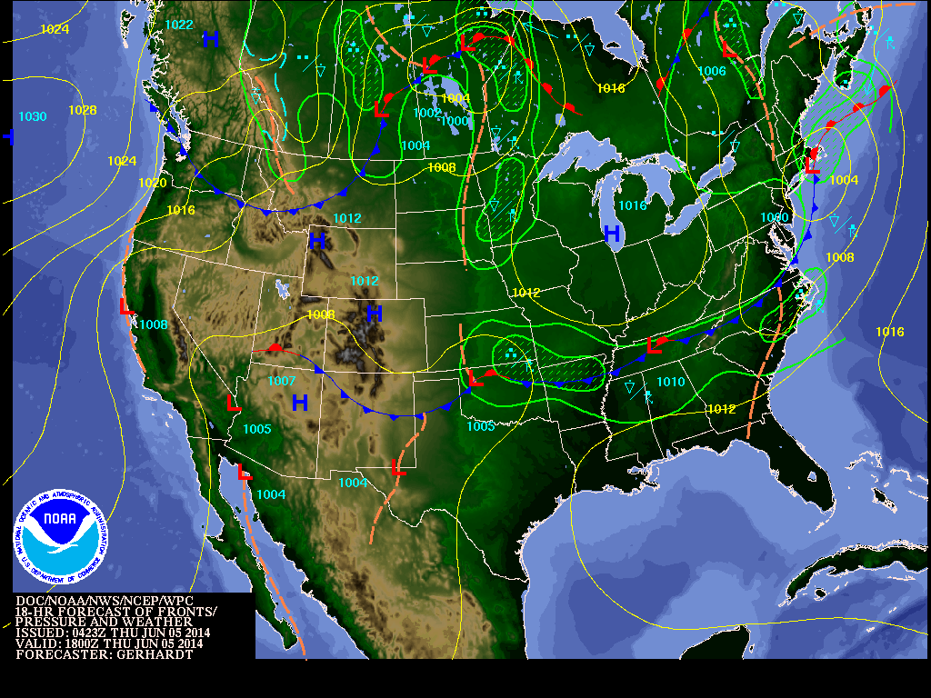
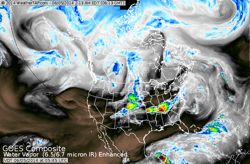
Above...today's map by early afternoon. Wet weather moving out across New England. Showers and storms Tennessee Valley to Carolinas....and upper Midwest. West is fair and warm.  Satellite picture below...corresponds  nicely with this map.
Picture
Picture
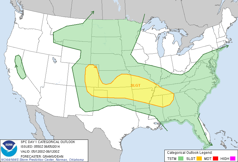
Above...risk of severe weather today - yellow - which pretty much will be the case Friday and Saturday.
Picture
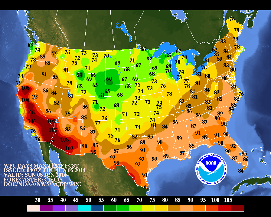
Above...high temps for this Sunday....which...overall...will be the warmest day nation-wide of the next 7.
Picture
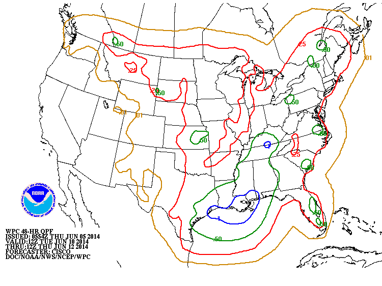
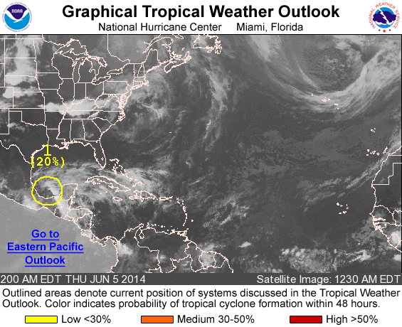
Above...amounts of rainfall for next Tuesday thru Thursday,....indicating alot of wetness for the Nation. Below...Hurricane center watching area near Yucatan....should be slow to develop...but will bring dangerous flooding to that area.   Be safe....later.
Picture
0 Comments


Leave a Reply.

    Genesis of a Tornado
    We'll have daily weather discussions, talking about major systems on the horizon along with anything noteworthy that pops up on our radar.

    Pat Pagano,
    Mike Merin

    Follow us on Twitter and like us on Facebook to get updates whenever we post a new entry!

    RSS Feed

Powered by Create your own unique website with customizable templates.