Metro Weather Inc. Services
Like us, follow us, link to us, contact us!
  • Home
    • Daily Weather Discussion
  • Weather Prepared for You
    • Film and TV Production
    • Radio & Television
    • Government and Industry
    • Forensic Services >
      • Weather Record Request Form
    • Metro Morning Monitor
  • About Metro Weather
    • Senior Staff
  • Your Weather Images
  • Contact Us

Weekend ...Clearing East.....Wet.....Central

6/13/2014

0 Comments

 
Picture
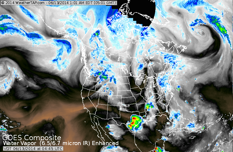
Satellite shows much of the heavy rain in Northeast staying inland and across New England. Heavy storms move out of Texas.....storms gaining in Dakotas and then east.
Picture
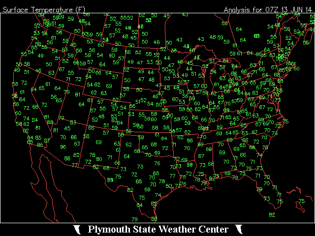
Above - early morning temperatures this morning....fyi.
Picture
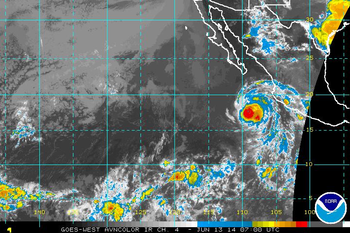
Above...satellite shot of Hurricane Cristina off Mexico and staying offshore with 100-120 mph winds.
Picture
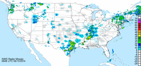
Early morning radar above.
Picture
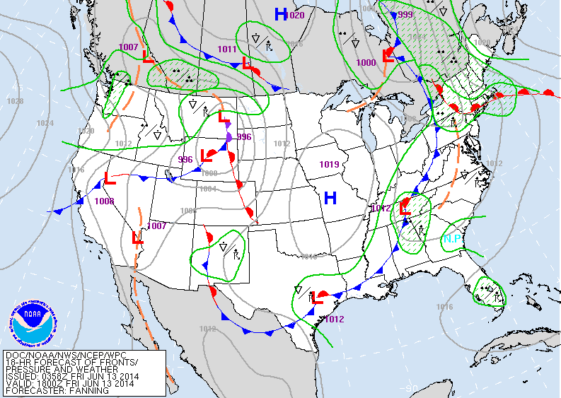
Today's map...wet front in East moving offshore in time for the weekend. Frontal system in Rockies brings wet weather to Upper Midwest and Plains this weekend.
Picture
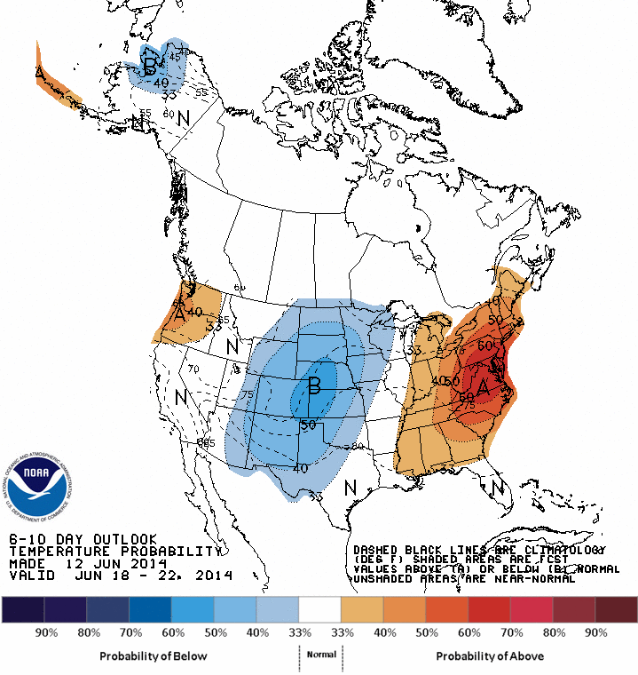
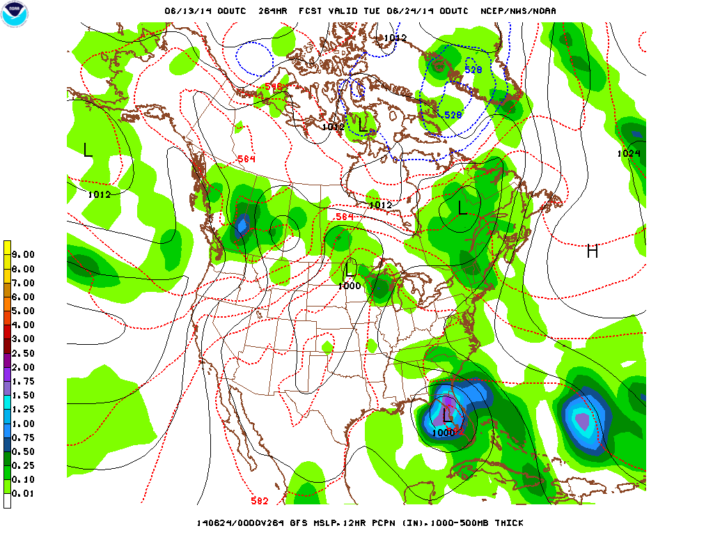
Map above shows how daytime temps. will average thru June 22nd.  Red...way above.....Blue...way below...in fact do not be surprised in if snows next week in The Northern Rockies. Finally...for what it is worth...The GFS Model insisting that a tropical storm or hurricane will threaten Gulf Coast...especially Florida the last week in June. (Below). Have a nice weekend.
Picture
0 Comments


Leave a Reply.

    Genesis of a Tornado
    We'll have daily weather discussions, talking about major systems on the horizon along with anything noteworthy that pops up on our radar.

    Pat Pagano,
    Mike Merin

    Follow us on Twitter and like us on Facebook to get updates whenever we post a new entry!

    RSS Feed

Powered by Create your own unique website with customizable templates.