The trough located in the Central US is resulting in warm and moist air flowing up form the Gulf of Mexico. There is plenty of lift resulting in pop-up thunderstorms scattered throughout the Mississippi and Ohio Valley regions and further southeast. Towards the Northeast, conditions are beautiful with sun and dry air. The Northeast will gain humidity into the start of next week along with the threat for scattered showers & t-storms...
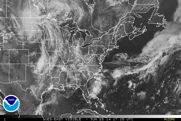
The above visible satellite image shows just how scattered the clouds and thunderstorms are. Counter-clockwise rotation can be seen up in the Dakotas, where low pressure is centered. The associated fronts that traverse down through the Mississippi River into Missouri and into Oklahoma are where the main threats for strong thunderstorms are later today and into tonight.
This system will spend a couple of days moving east....
One more note of interest are the clouds just off the Carolina coast, showing some signs of organization to become the first Atlantic tropical system of 2014 (Arthur). It will continue to be looked at in the coming days...
- JL
This system will spend a couple of days moving east....
One more note of interest are the clouds just off the Carolina coast, showing some signs of organization to become the first Atlantic tropical system of 2014 (Arthur). It will continue to be looked at in the coming days...
- JL

 RSS Feed
