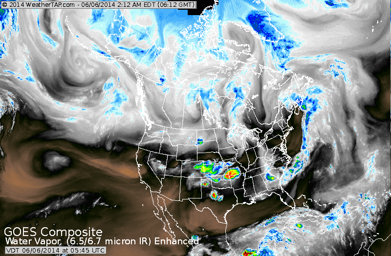
Above...satellite shows heavy storms Texas to Missouri...that will be today's problem areas. Elsewhere ...mainly fair.
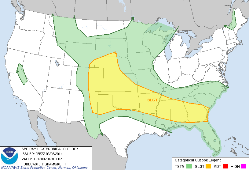
Above...yellow area indicates threat of severe weather for today.
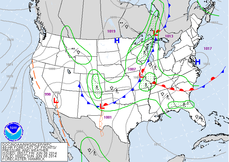
Above...map for Saturday: showers & storms fron Great Lakes to southern Rockies....Tenn. Valley and Southeast.
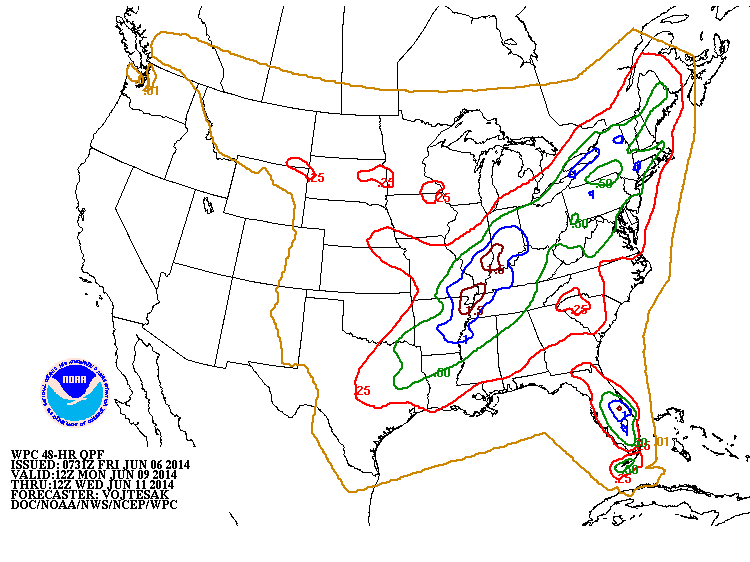
Rainfall amounts from Monday thru Wednesday next week.
Most places seeing better than 1/2" to 2" of rain.
Most places seeing better than 1/2" to 2" of rain.
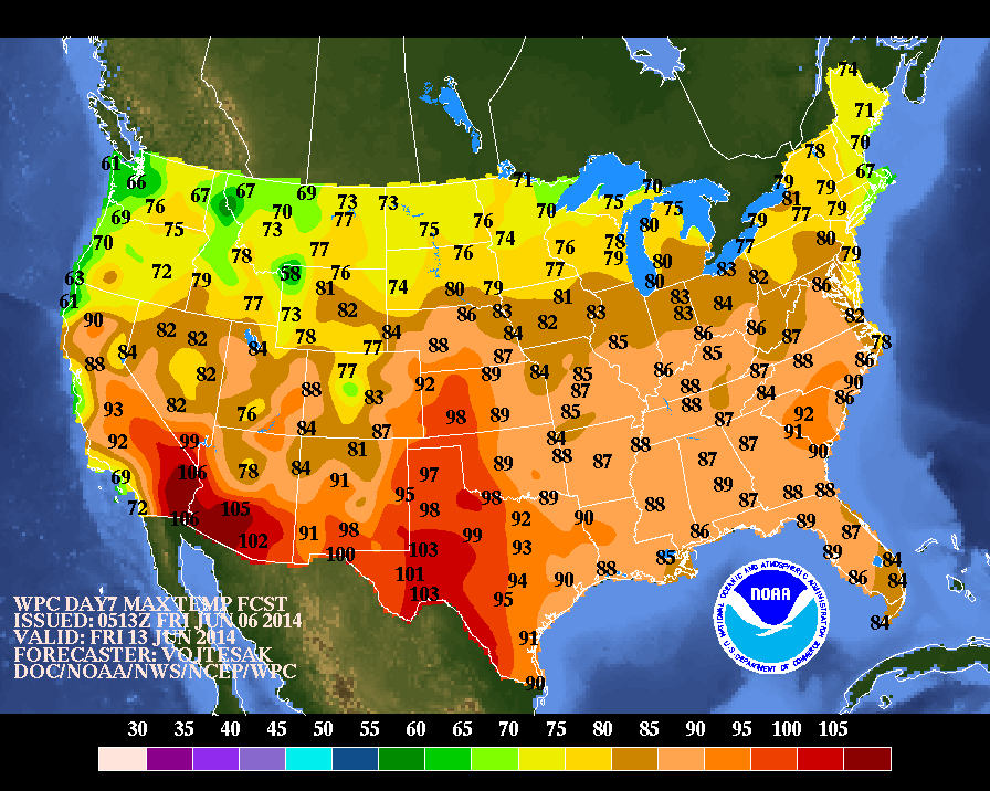
Average high temperatures expected for late next week.
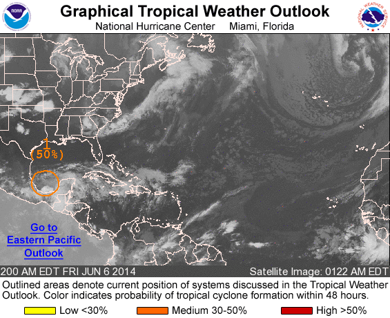
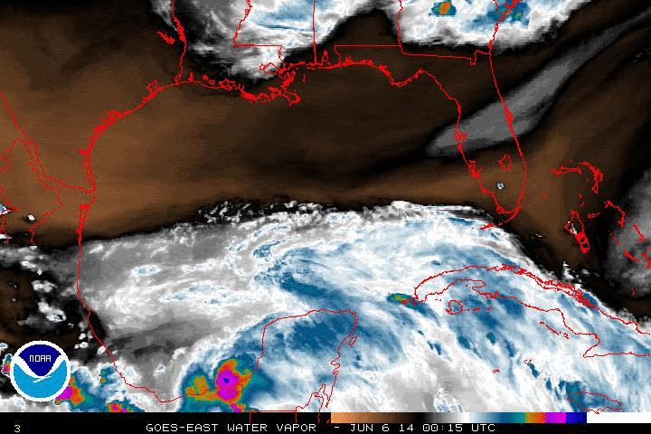
Above...Tropical outlook: Hurricane center has now brought the probability up to 50% of a tropical system forming in the Yucatan. Below...a close up satellite of this system. A plane will be headed into the area this afternoon to investigate.
Have a safe - nice weekend.
Have a safe - nice weekend.

 RSS Feed
