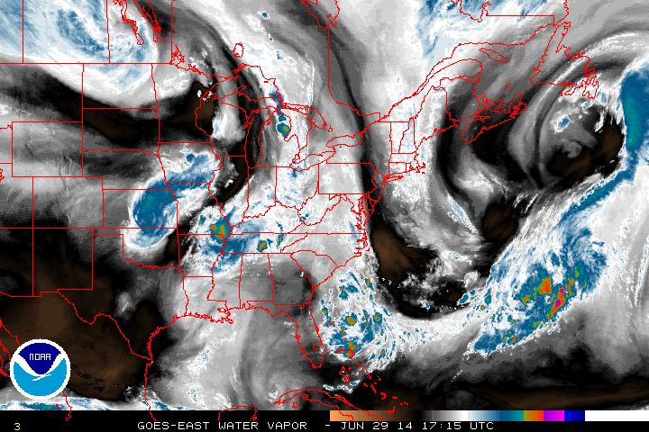
Low pressure that was centralized in the northern plains continues to move north into Canada while the cold front is dragging south into the Midwest, with another low pressure center building in Kansas. Find weather along the East coast today as high pressure remains in control. The scattered rain showers and thunderstorms will continue east and affect the Northeast into the midweek and perhaps leave just in time for Fourth of July weekend.
But the intriguing story to end June is possibly the first tropical system in the Atlantic for 2014.
The low pressure system located just offshore of Florida is continuing to show signs of development, though at a slow pace...
But the intriguing story to end June is possibly the first tropical system in the Atlantic for 2014.
The low pressure system located just offshore of Florida is continuing to show signs of development, though at a slow pace...
Water vapor imagery above shows the cluster off the southeast shore. It hasn't had much movement lately and shown progressive signs of organization. The dry air shooting down from the north however is impeding rapid development. It is looking like though by the mid-week, this system could become a tropical depression. It's too early to discuss what kind of path a tropical system that has yet to form is going to take, but for right now, the expectations are that it meanders right where it is into the week.
- JL
- JL


 RSS Feed
