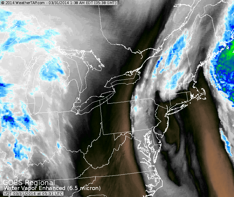
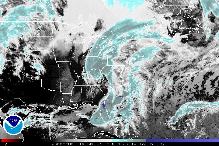
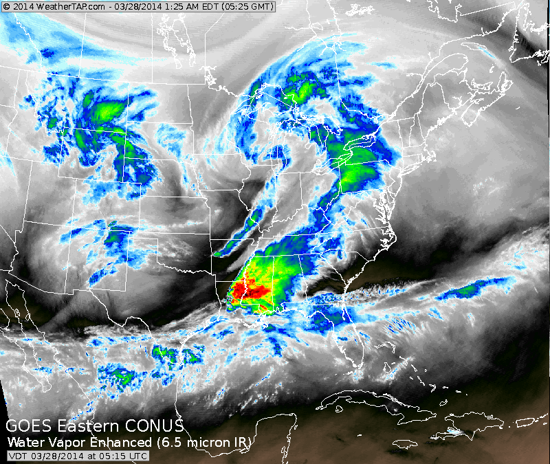
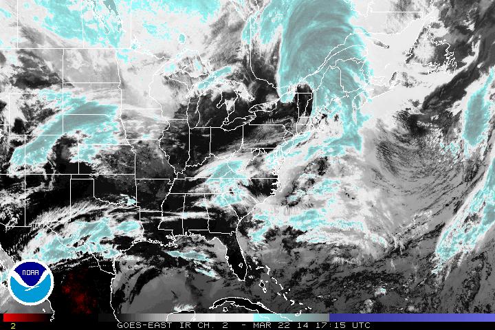
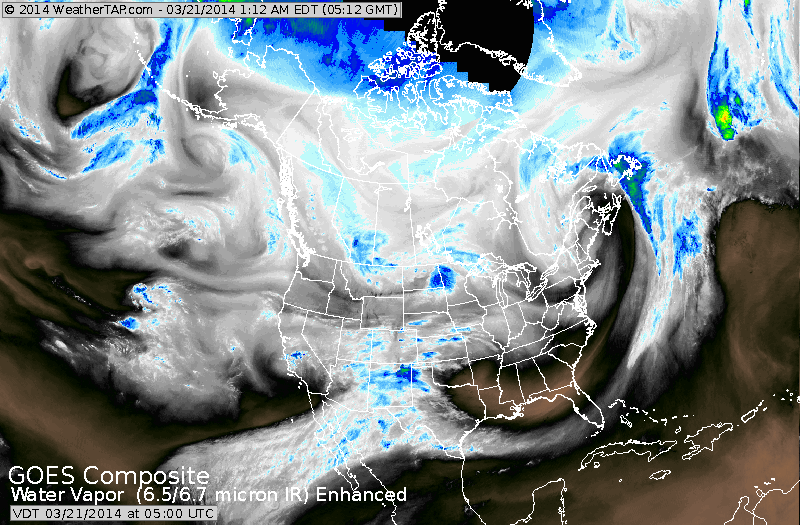
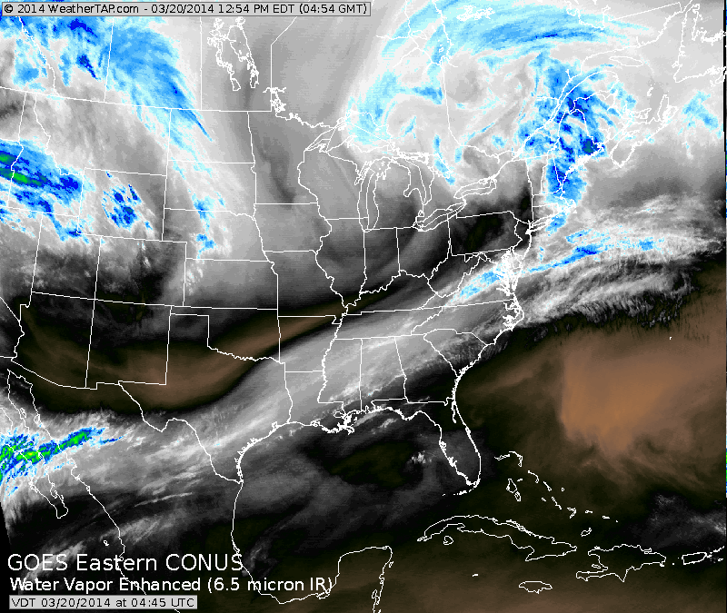
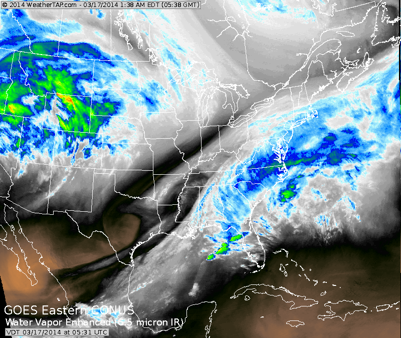
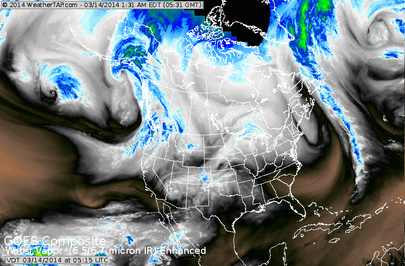
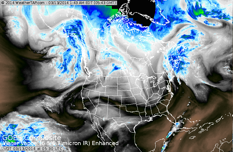
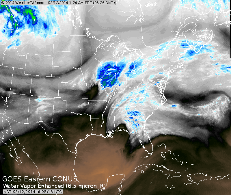
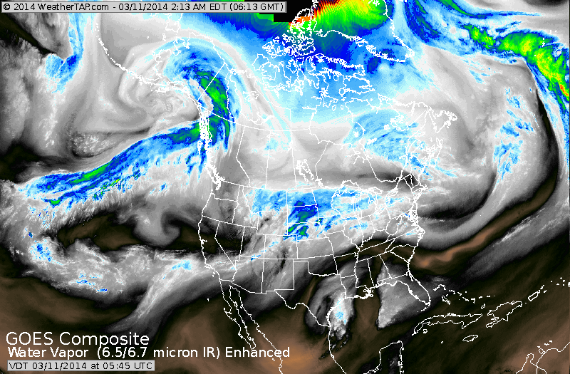
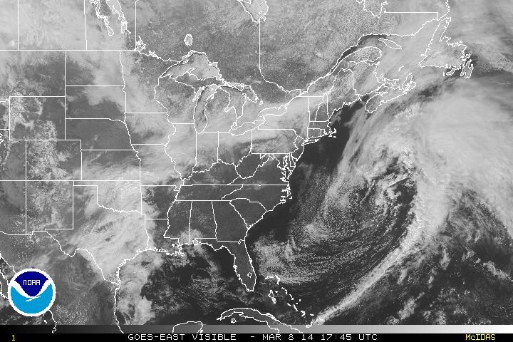
Close up satellite shows an upper storm off New Jersey.....with moisture still moving around it in The Northeast. Black and orange indicates dry air and clear skies...hopefully moving into The Northeast later on. 
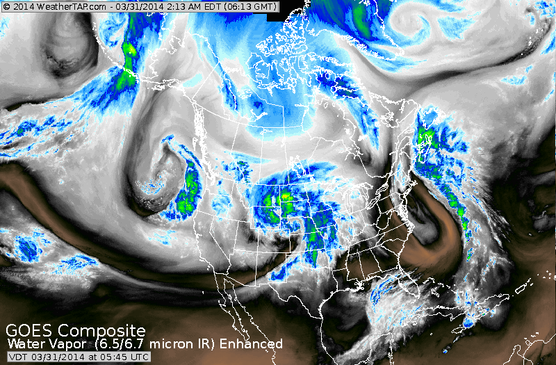
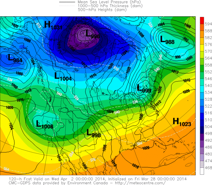
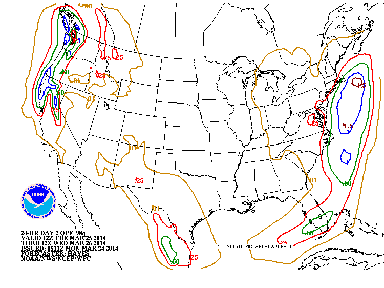
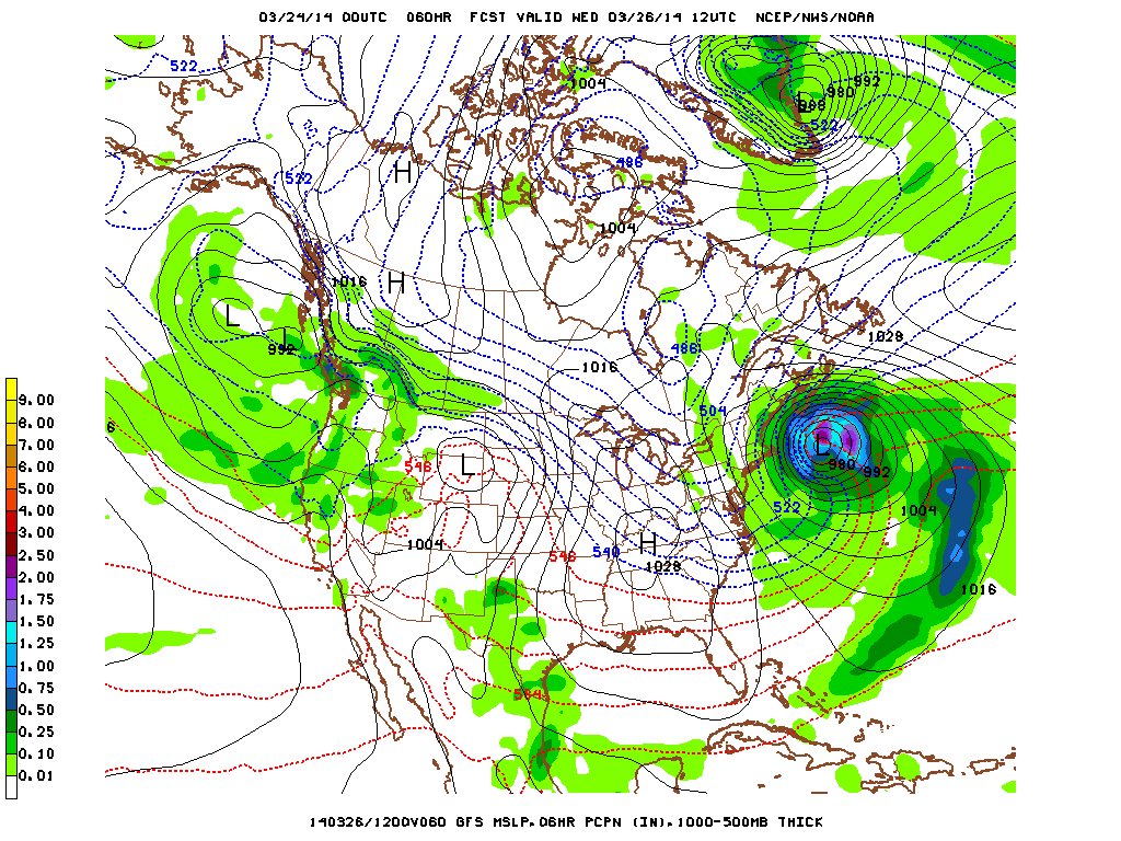
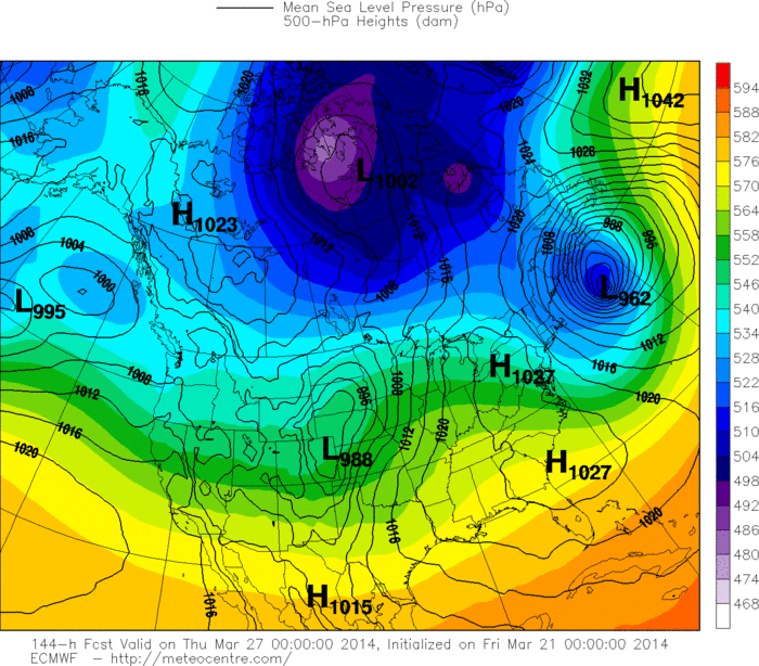
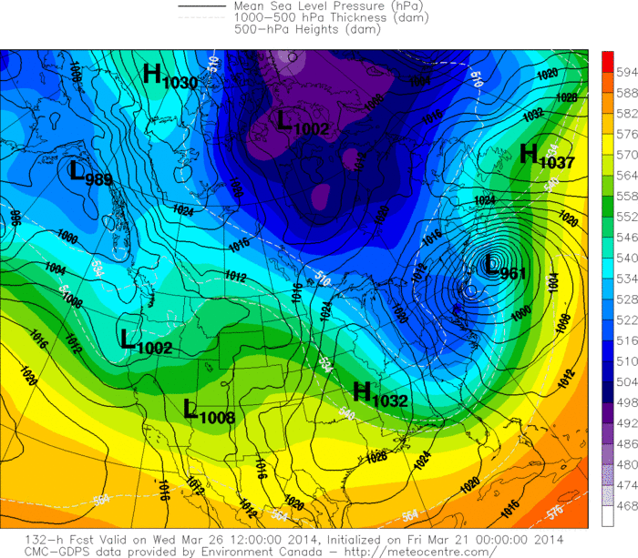
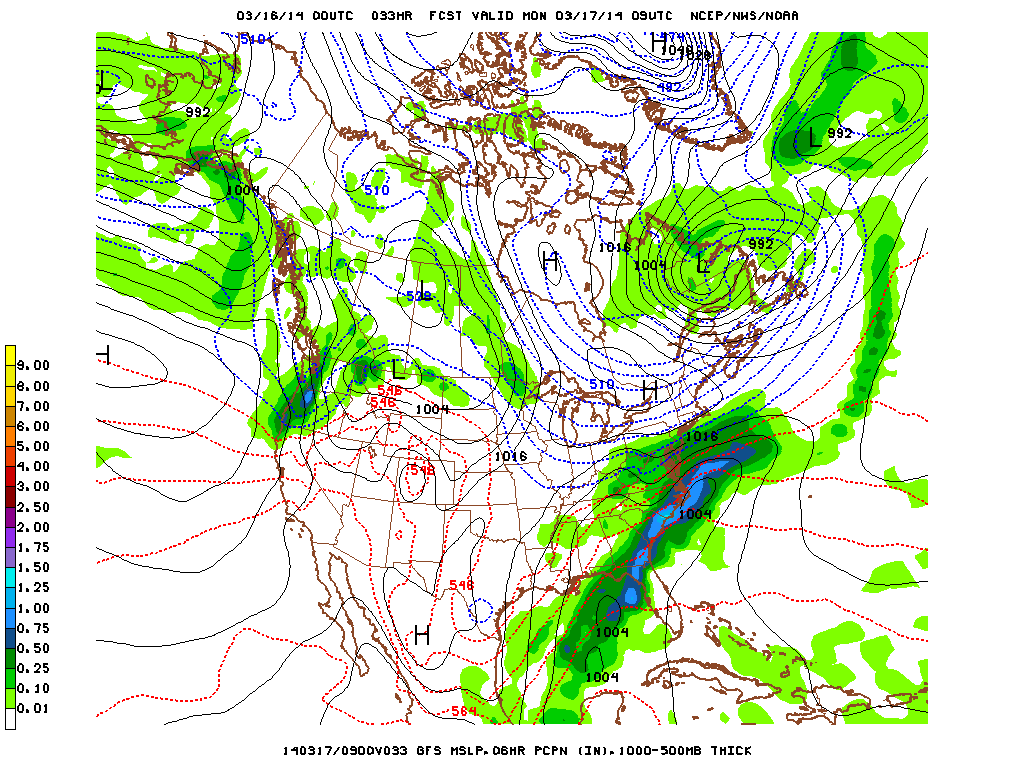
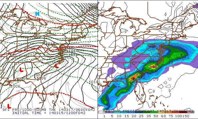
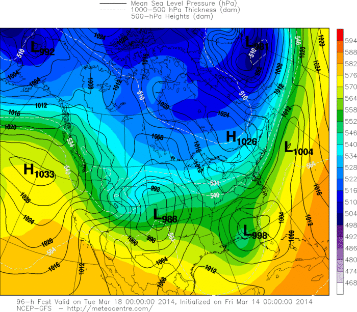
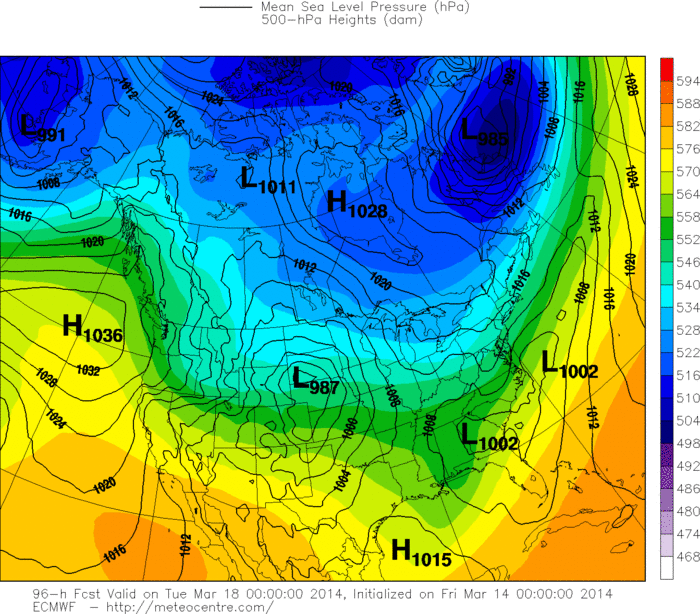
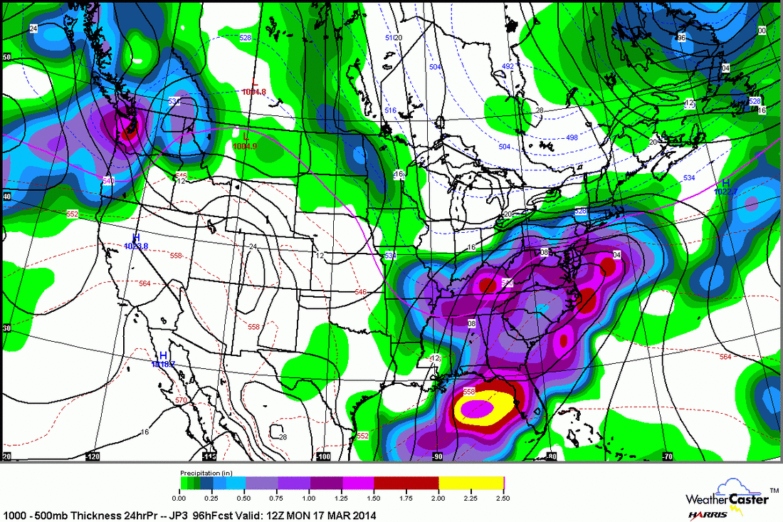
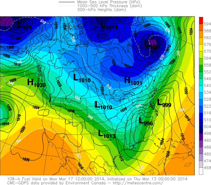
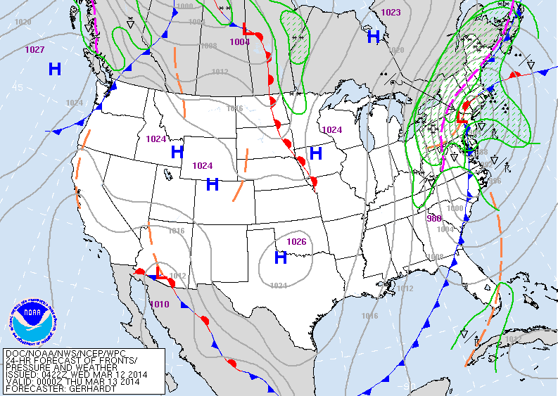
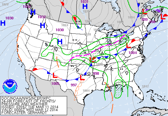
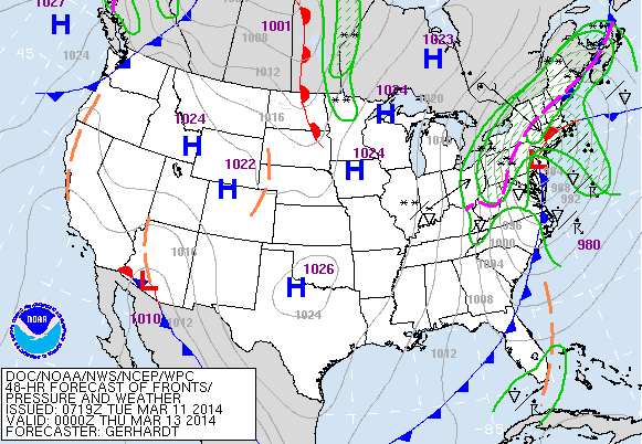
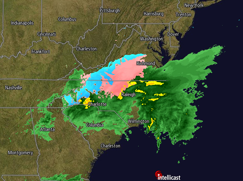
Above...large area of blue and green in mid section is a winter storm that will bring heavy snow to upper Midwest...possible severe storms in Southern storms. By the time it reaches the east...(midweek) it will be greatly diminished. 
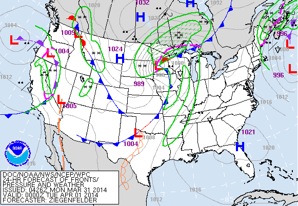
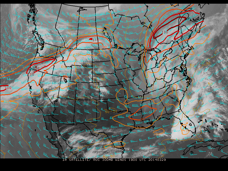
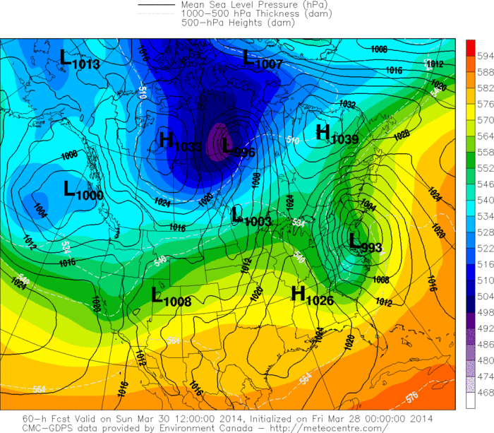
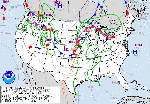
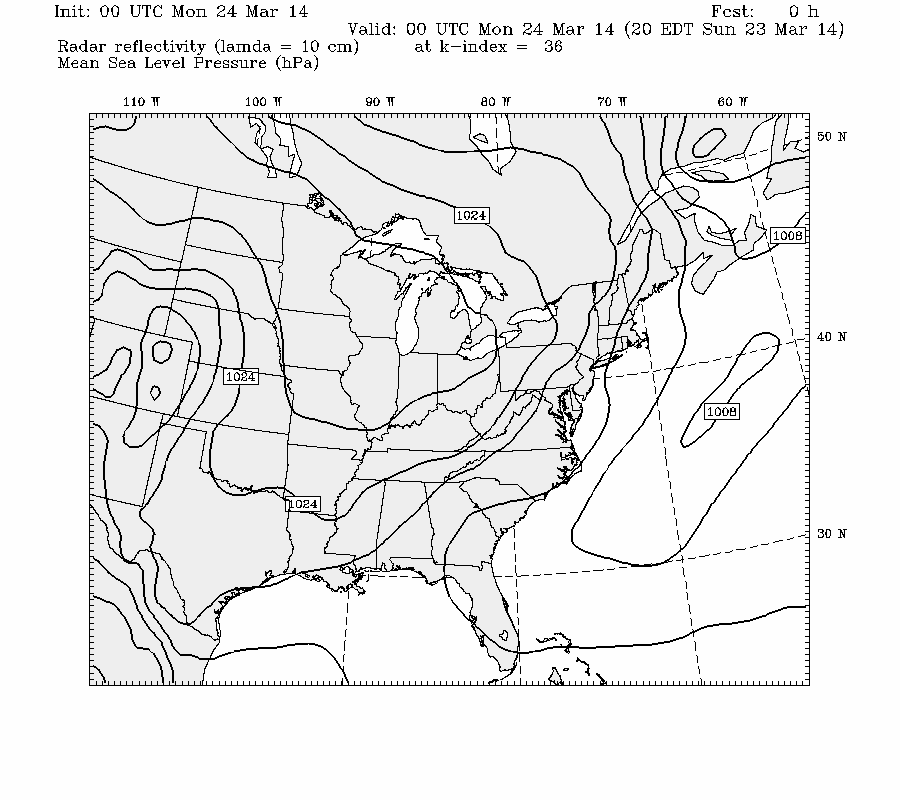
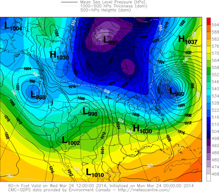
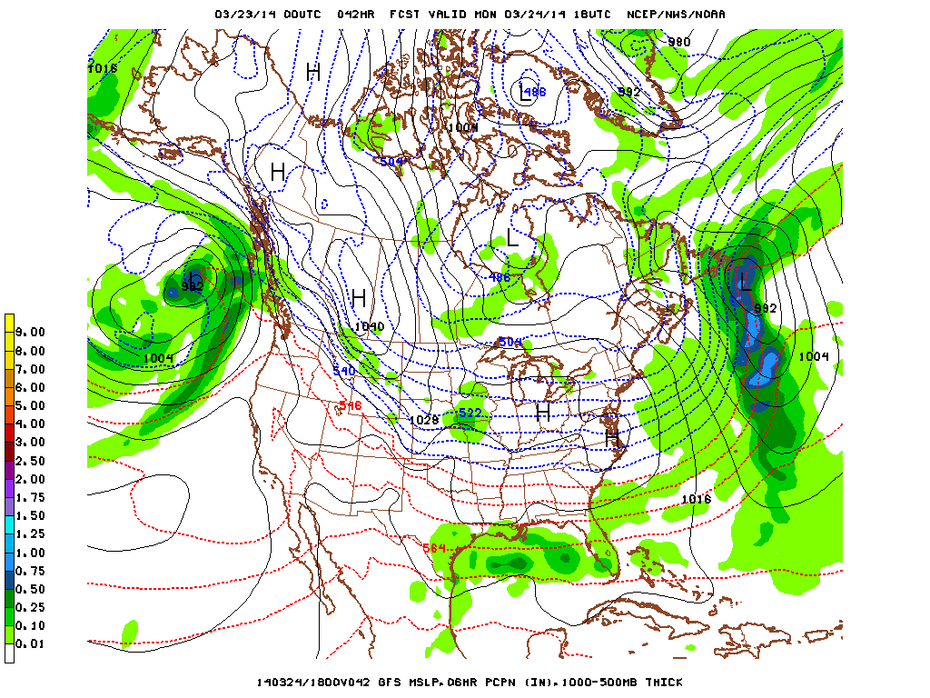
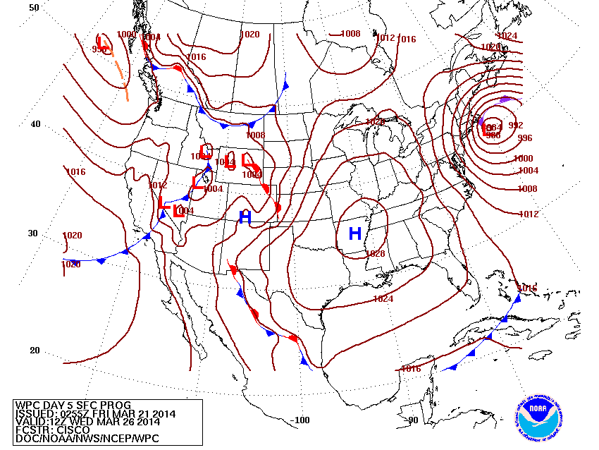
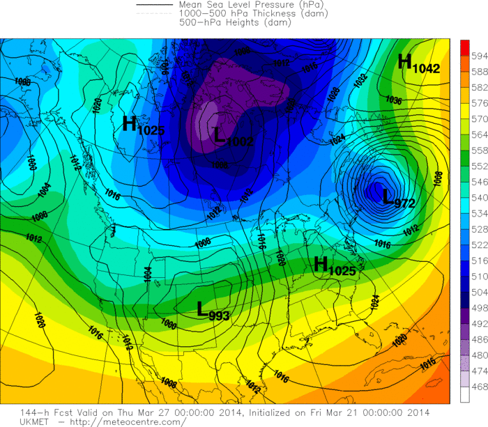
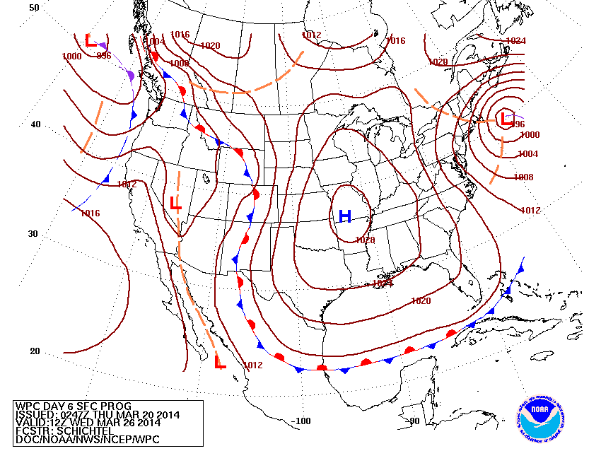
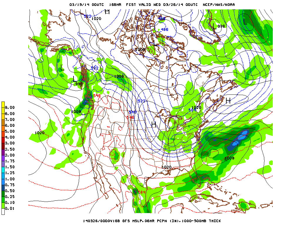
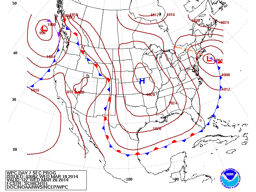
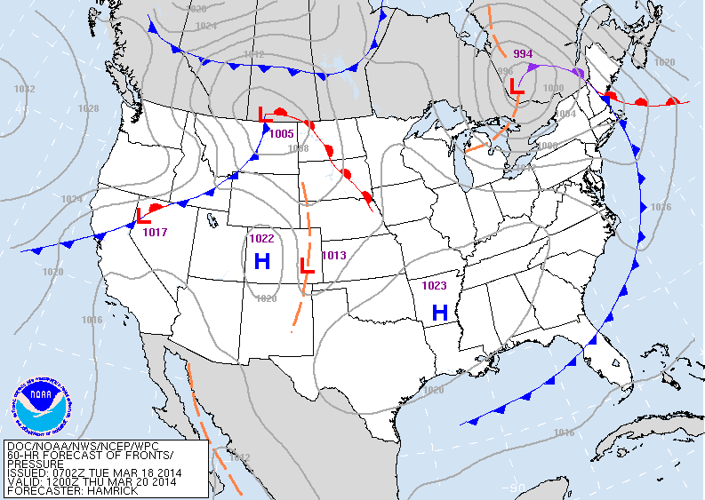
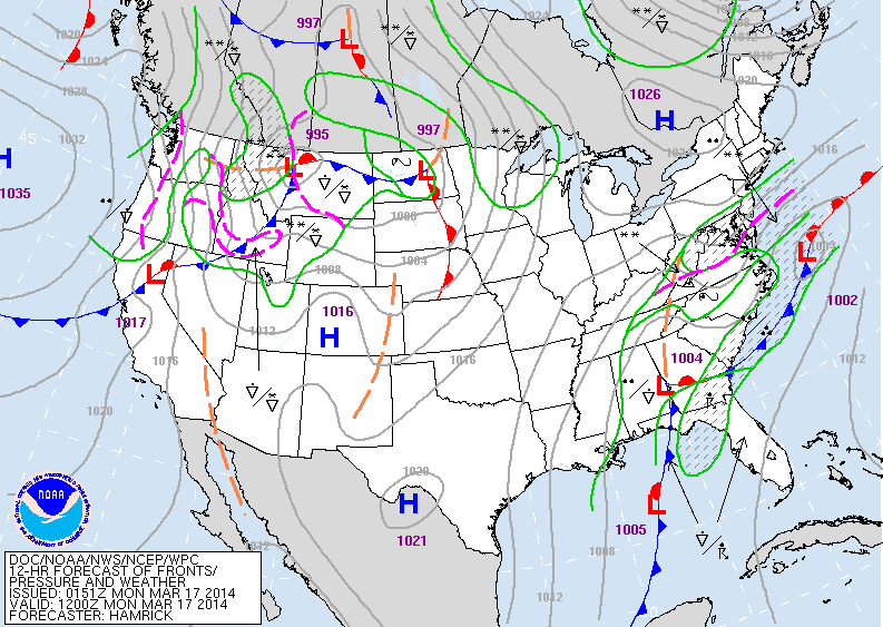
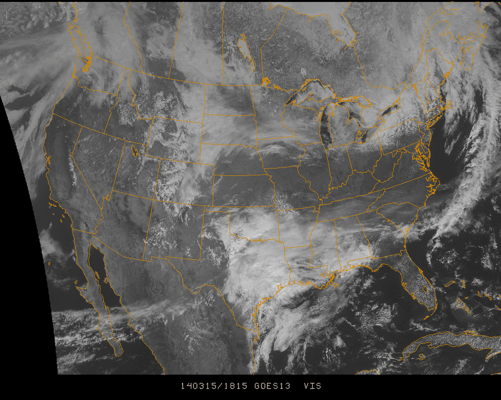
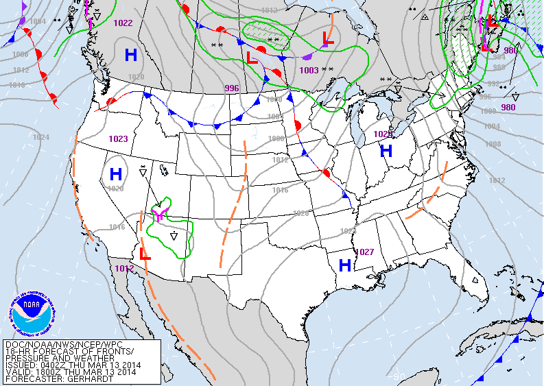
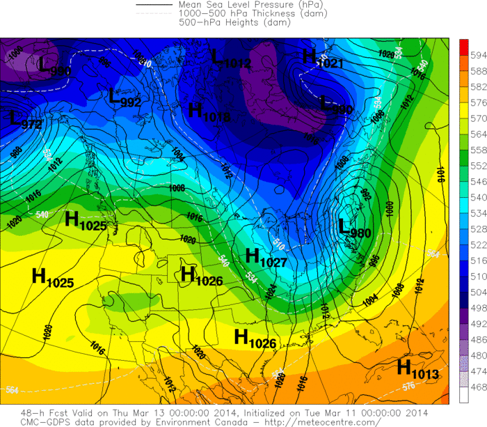
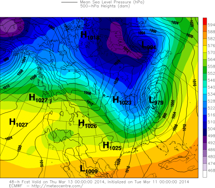
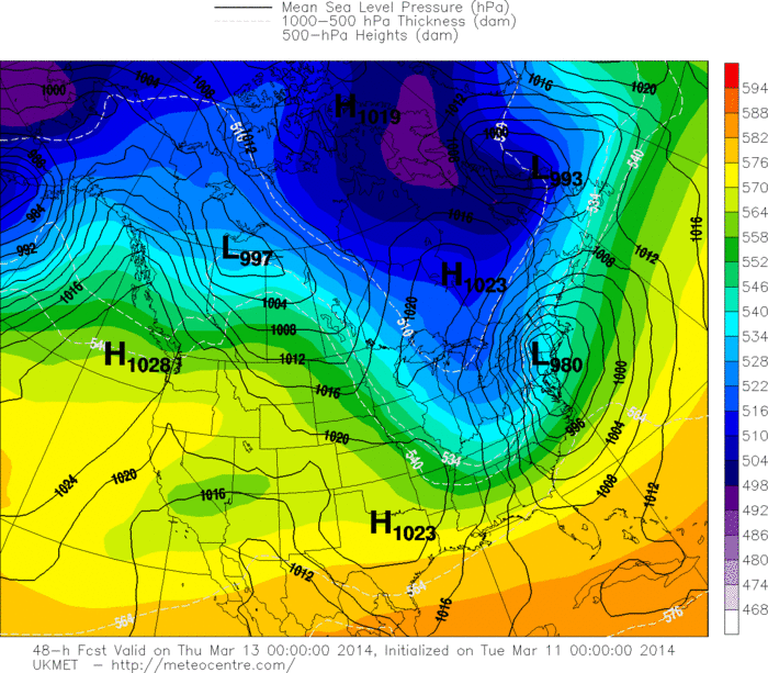
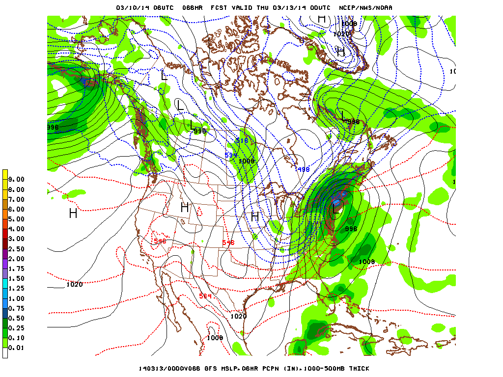
Above...today's map showing near blizzard for Northern Plains. System along the west coast should make it to East coast by Friday/Saturday. 
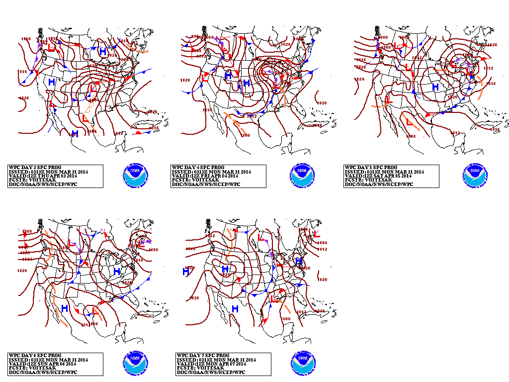
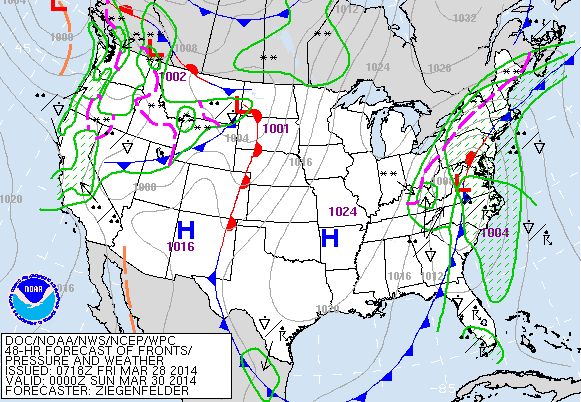
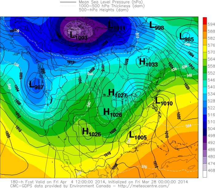
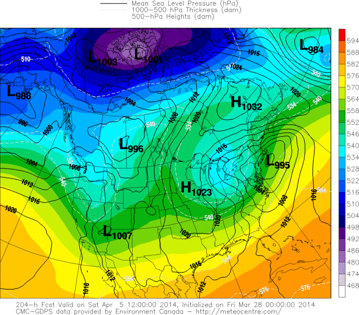
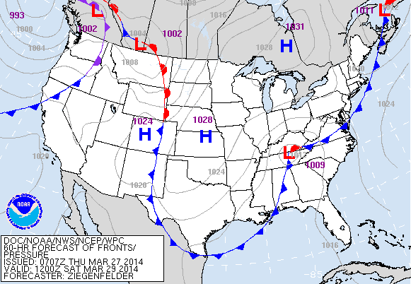
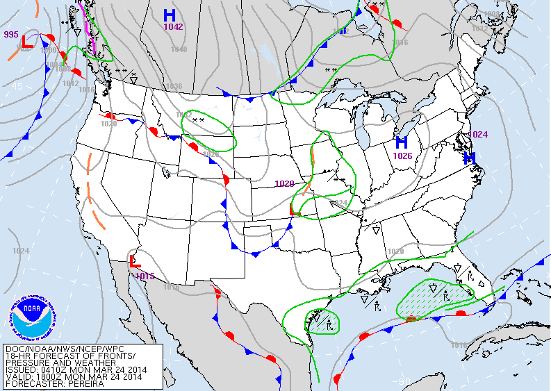
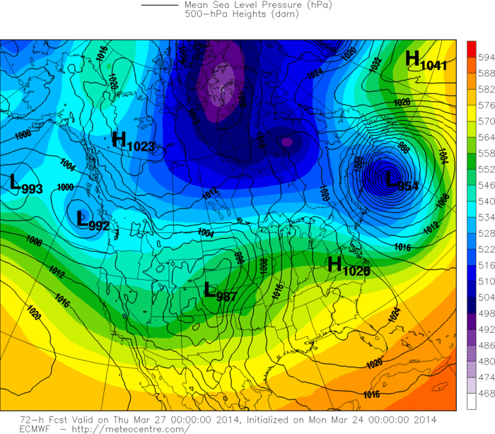
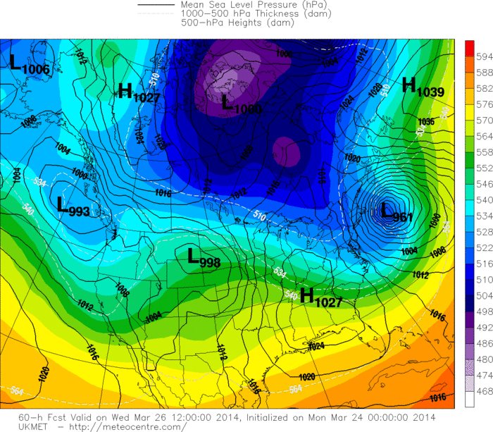
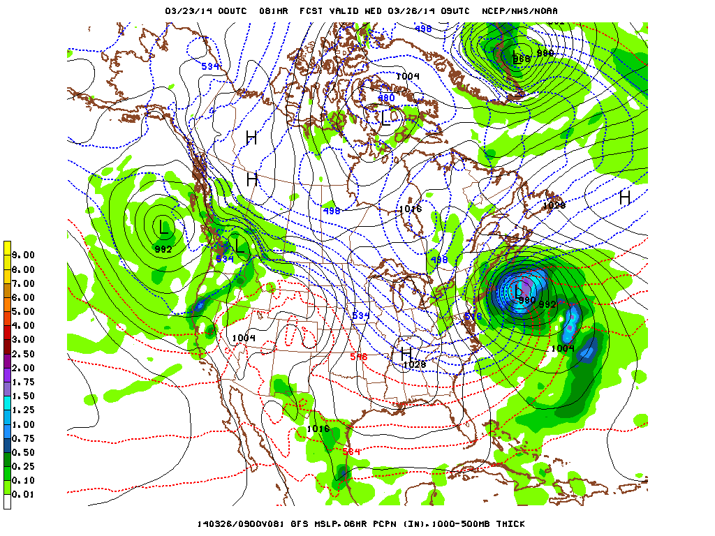
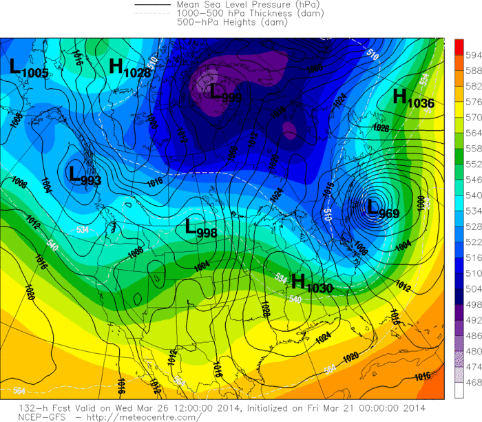
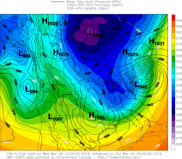
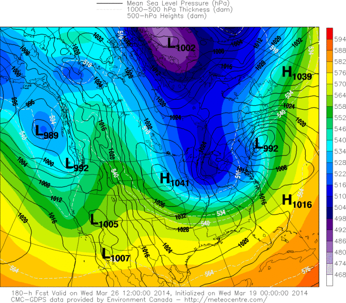
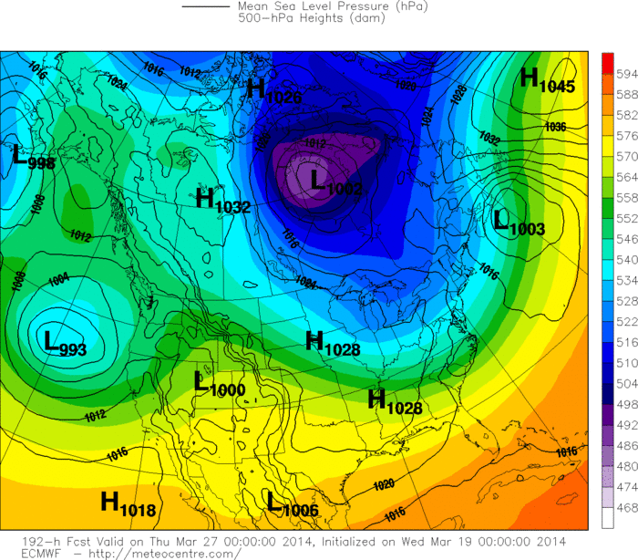
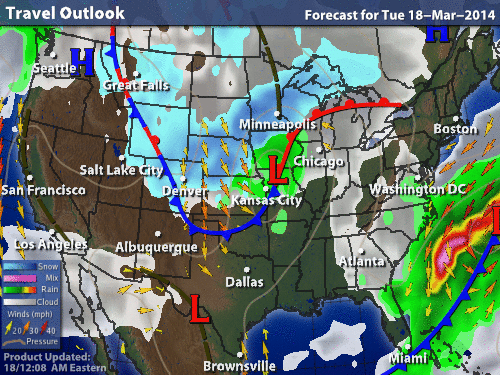
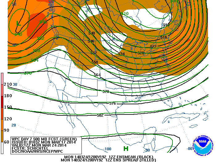
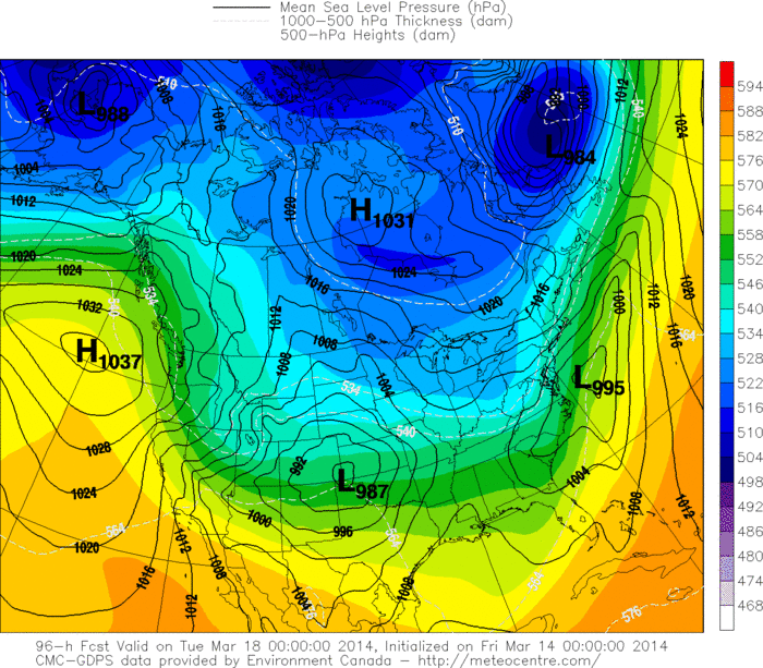
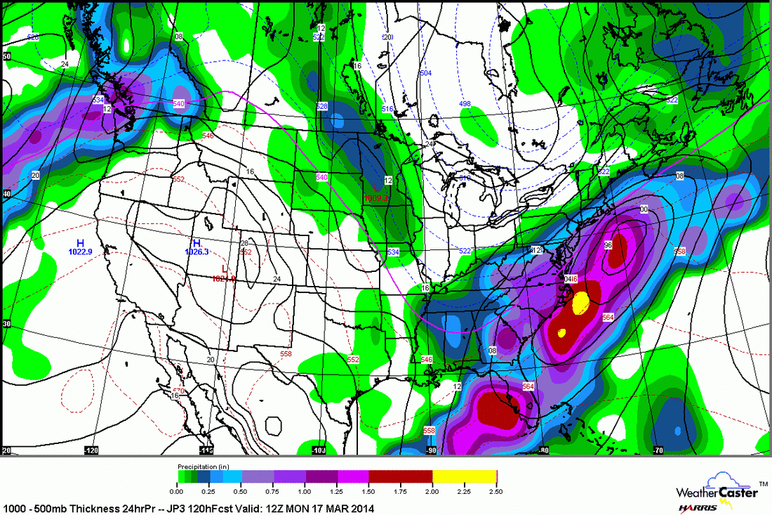
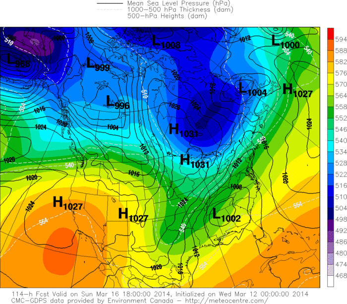
Maps for This Thursday thru next Monday. Storm in Plains on Thursday heads east Friday and Saturday. 
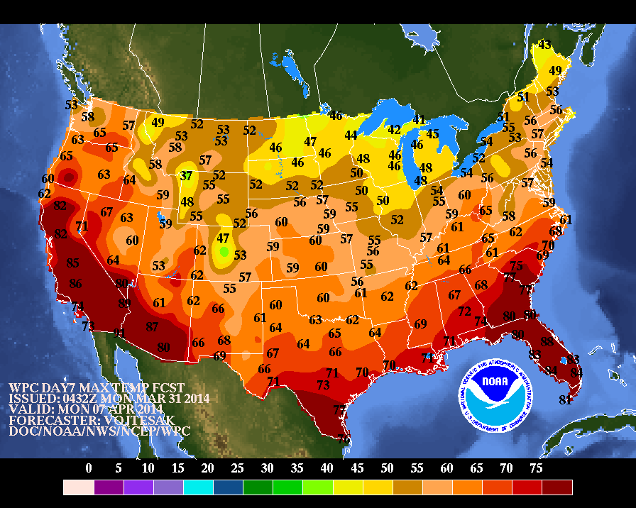
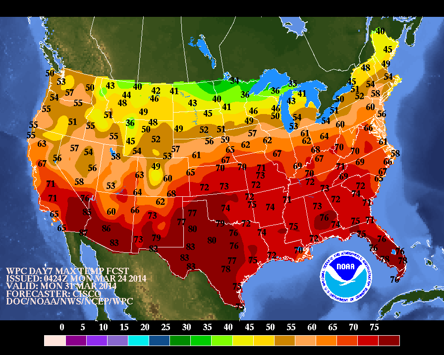
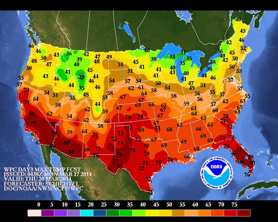
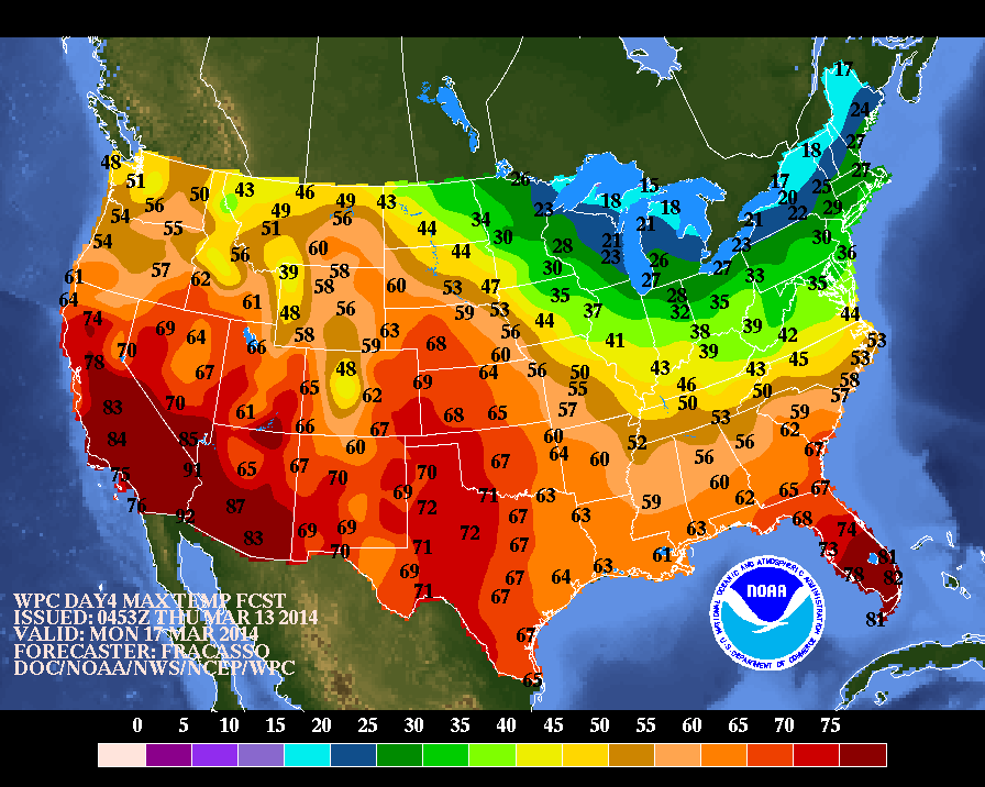
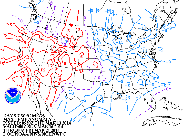
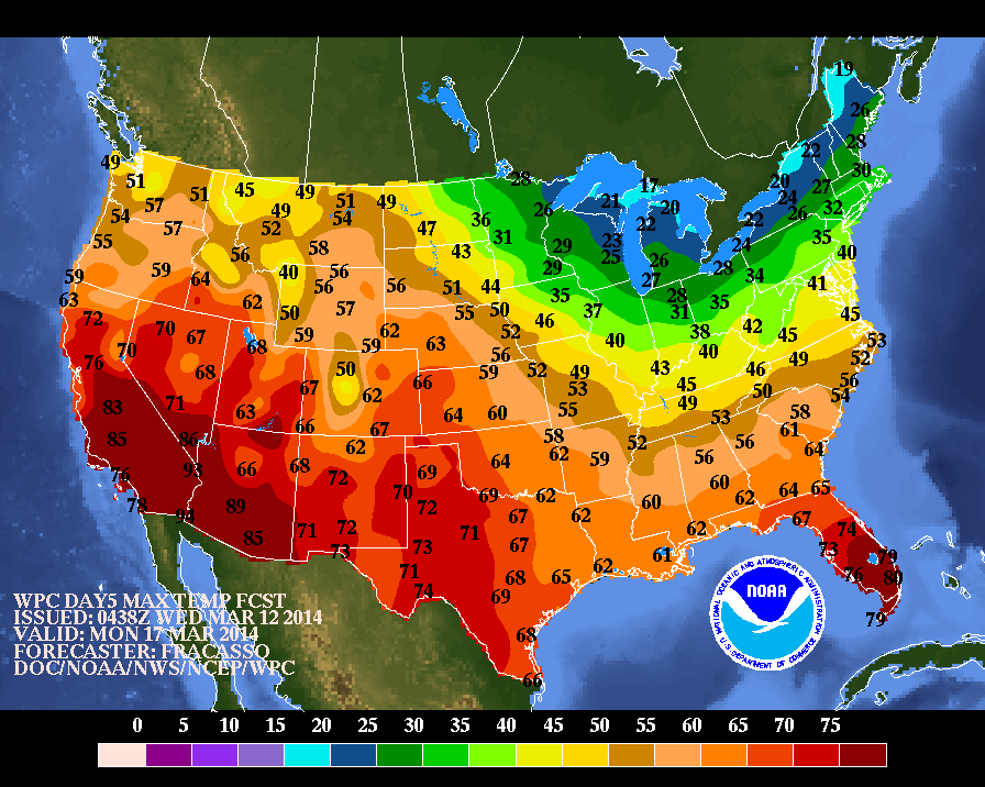
High temperatures forecast for next Monday....about the first time that spring time conditions will be felt over much of The Nation. A little late...but better late than never. Be safe.
0 Comments
15-20° warmer than last week in the Northeast? All we had to do is wade through the water, some places literally as many flood-prone areas felt the full force of the record-breaking rainfall yesterday in many areas, and another inch to go over the next 24 hours. As you can see, places like the eastern half of Long Island and into SE New England saw 4-5" 6" locally. Even places like central Florida got 4" but then again, they also had tornadoes touch down and also had to deal with hail in an even wider area.
Tomorrow afternoon the sunshine will start and will stick around until Thursday, then unfortunately the clouds and rain will return. Temps will stick around though so we won't have to worry about shoveling snow. Though the upper Central Plains will have to deal with that tonight into tomorrow. Central MN will see 5-8", Bismarck ND an astonishing 10-14". Again, thank those warmer temps for the rain. -Mike Merin The first Spring rain storm of this year is going be quite helpful. Precipitation totals have actually been quite below average for the month of March and this weekend could bring up to 2" of rain to many areas on the upper east coast. The center of the large and very moisture potent low can be seen in the eastern Tennessee/western North Carolina area based on this infrared satellite image. Strong upper level jet streaks will help feed more energy into this low causing it to deep as it churns its way slowly to the east. As the dry air flows into the circulation on Sunday, the Southeast coastline will dry out while the entire Northeast will be a washout. Colder air into Sunday night might even result in a bit of sleet & freezing rain into New England.
precipitation will linger into Monday but clouds will move out for all areas late that day with high pressure right behind bringing sunshine and 50's for much of the Northeast, reaching 60 into the Mid-Atlantic states. While certainly a nasty and wet weekend, it is a clear indication of the changing of the seasons and those boots should be stored away Satellite shows a good part of The Nation under clouds and wet weather...with snow being confined to the Northern most sections. This pattern will prevail all of next week. Map above for this Saturday night. Very wet storm in the East...many places getting at least 2" of rain. Very unsettled western third as well with rain changing to snow in higher elevations. Below...amounts of precip. for Saturday. Below.,...maps showing how storms will affect the Nation...especially The East all of next week....so keep the umbrellas handy. Have a safe weekend...stay dry. In order...this Sunday-Tuesday-Friday- next Saturday.
First ....a look at yesterday afternoon's visual satellite picture. Notice that the east coast storm actually has an eye. Winds were reports up to 78 mph on the Cape yesterday. This a.m's satellite pix....showing many systems just stacked up across the Nation. This will bring frequent rain..and snow in the north from this weekend right thru next week...although the arctic air will be minimal. Today's map showing one system in the Upper Midwest...next one in The Rockies...and you can just begin to see the next one off in The Pacific. This is what (above) map will look like Saturday. Low in Tennessee will bring heavy rain to the East...and into Sunday when even some sleet may mix in across The Northeast. Amounts of precip. (Above) for this weekend. Looks like NYC and Southern New England has the bulls eye of up to 2" of rain. Better than snow...but would be better to have sun and 60. Maybe Monday. Be Safe.
Big intense storm seen on Satellite off New England. Blizzard conditions for Eastern Maine thru Nova Scotia and New Foundland. Next weather system moving into Rockies...will head east to affect east coast in form of rain this weekend. The parade of fronts will continue from Pacific to Atlantic next week...with Pacific air as opposed to arctic...but wet from time to time. Map above for Friday. Front heads east but notice the lows along the front and yet another front approaching the Pacific Northwest. Keep umbrellas handy....as you will see in next map...amounts of rain expected this coming weekend. Above....over 1" of rain this weekend for Northeast and Mid Atlantic. Locally heavy rain for Florida. Very heavy rain from Central Califoria north and thru the Rockies...where higher elevations will see heavy wet snow. So this is Spring ? Be safe..and in the Northeast...watch out for that wind.
Patch of light blue over Central Appalachians will be the band of moisture that will affect Mid Atlantic into New England with a touch of light snow and snowshowers tonight....should not amount to more than 1" ...in spots....with possibly eastern L.I. and Ct. getting a couple of inches. Cape Cod will wind up with 4" or so. Nova Scotia will get a full fledged blizzard. Above...MM5 model depicting storm and its precipitation and showing the near miss for Northeast, Not much more to say. Above... Mean Canadian ensembles showing flow at 18,000 ft for the next 10 days. Indicates frequent changes and temps. still averaging below the norm. Unless anything changes big time...we'll chat again tomorrow....be safe.
Notice the blue streak in the Plains...very important energy that will either cause a blizzard in the Northeast or a near miss. Blue in Gulf is the southern Jet and when these 2 combine - a very big storm is likely to explode off the Mid Atlantic coast by Tuesday nite. All modeling suggests this is going to be a near miss....and let's hope so. Don't see any reason to go against the models now...with only a 2 in 5 chance that it misses the northern energy and shovels will be working by Wednesday morning. At this time 1"-3" snowfall from NJ to Conn. with 3-6" over Cape Cod. Todays map showing calm and cold in the East...a weak low in Plains and front in the Gulf. It's these 2 systems that will become a powerful Atlantic storm ...and stay far enough east to spare the big cities a March Blizzard.....or will it ? Above...liquid amounts predicted for this storm based on an offshore track. Red line is .25" which if it fell at night when cold enough would translate to 1"-3"......green line = .50".....translating to 4-6" Cape Cod. Below....a look at where the models put this storm by Wednesday early. You can clearly see they are in very good agreement. Above in order: Canadian, Euro, GFS, Ukmet. Below...high temperatures expected for this time next week....a sure signs of spring across much if not all of The Nation. We will be watching this closely.
It's sort of a broken record lately, but what happened to the last 3 snowstorms slated to hit the NY metro area? They just missed us, just grazed us, just passed by to the side. Guess what? The models are looking to make the next one #4 on that list. Now first off, we'll still see snow showers, but the 12+ inch counts seem to be a thing of the past. Both the GFS and UKMET (seen below, left and right respectively) have moved the Wednesday early AM low farther east meaning less snow for us. BUT (and this is the disclaimer we'll always mention in storms like this whose amounts can drastically change one way or the other depending on slight changes in positioning) once again the storm does not physically exist yet and won't until Monday morning when the clouds begin to clump together and then coalesce around a low, so the model uncertainty is still a big issue with it having to additionally guess how the precip itself will form. For now though it seems to be better for us with how much we have to deal with, well under the early scare for now. Below is a snapshot of Monday morning when we'll finally see the precip starting to fall over the Gulf (though with no visible center of low pressure yet). As of now (again, very subject to change) NY metro area may only see 1" during Tuesday afternoon and maybe another 2" during the night (NW Connecticut 1-2", eastern LI totals as well as eastern CT and up into NH may be 3-5", but we're once again on the edge of the storm, and the models still have another 24 hours before they can pinpoint where it can go in a more accurate fashion. Pat will see the better models tomorrow morning when he updates you all again.
-Mike Merin A beautiful Saturday for much of the country, albeit a bit frigid in the northern plains. The infrared imagery above shows clouds associated with a weak frontal system moving east away from the US this afternoon, into tonight (you can see the cold front's signature in the cloud line moving into the Mid-Atlantic states). The east coast is reaping the benefits of a warm front with temperatures reaching over 60 F as far north as New York City. The good news is that 60 degrees is not as farfetched a temperature anymore. Following the weak cold front shifting off the coast, high pressure takes control into the early week, bringing sunshine and colder air as we await the development of a coastal storm late Tuesday into Wednesday...
For right now, we can break down Wednesday's situation as follows for right now with much more details known by Monday... There WILL be a strong coastal storm but the path is still VERY UNCERTAIN. The air WILL be cold enough that any precipitation in the New York City area will be snow. Just one of the things that will affect the track are when the axis of the trough becomes negatively tilted, which in turn affects when/where the low pressure system will makes its backtrack as it turns north to bring snow. It's also good to remember that even though it is officially Spring by all definitions (Astronomical & Meteorological), mother nature doesn't always care. Snow in late-March is not uncommon. After this coastal low, the atmosphere does begin to take a greater Spring-like turn. Enjoy the weekend! - JL You can easily see the 2 jet streams on satellite....one zipping thru the Daktoas...the other thru Texas. These 2 will merge and there will be a big storm next week...but exactly how it tracks will be the question. Below..we will look at all the models and we think that a real MArch Lion will be affecting mid Atlantic & Northeast next Tues.nite & Wed. Above- HPC - our gov't long range/precip. center continue to buy The Canadian models and shows an intense storm near Cape Cod by Wed. a.m. Should this pan out..wind and heavy precip will batter the Northeast starting Tuesday nite. Heavy snows will fall and along the coast mixed precip is possible with thunder/lightning. This is The Euro...but Wed.night at which time the storm has already moved past. In any event..quite intense with hurricane force winds battering Nova Scotia. It's track is just a bit east of HPC. Above..GFS American Model - equally as intense and just a beam to the south of the benchmark...nevertheless...a biggie. Above...UKMET...but for Wed.nite...so likke the Euro ...the system has already move by and it is battering Nova Scotia. Above...The Canadian...saved the best for last. Look closely or click on map to enlarge. 2 centers...one off Cape Cod...the other off The N.J. coast....reflecting the upper low. Still feel this is the best representation of what map happen...and such an explosive pattern will easily mean and rough storm for The Northeast. Above...Canadian model depicting amounts of precipitation: Orange- red...expressed in millimeters which convert to 1" or better. If it verifies that is over 1 foot of snow for parts of The Northeast with near blizzard conditions. Keep in mind that the month of March can often produce storms like this that are very intense due to changing to seasons
and many other parameters. We will continue to monitor this event over the weekend. Have a nice one. You can see by our satellite that a front extends along the east coast thru the Gulf States into the Pacific. This southern jet can play an important role in east coast weather next week. System over Dakotas will bring some showers to East Saturday a.m. then it gets colder. (click on images to enlarge) Above...The Euro model for next Wednesday. East coast storm east of Cape Hateras N.C. Model takes storm just enough offshore so that it is not a major player. Notice the blue shading over Ohio Valley. The symbolizes the upper trof. Model is not deep enough and putting too much emphasis on one storm over baroclinic zone and feel that is in error as there will be 2 storms.. Above...Canadian. I know it was not correct last week...but this time I think it has a good handle on the situation. You can see 2 lows..... one off New Jersey...other east of that. This is more like the situation I am thinking of given the development of the trof aloft. HPC - our gov't long range group...still feels this storm could be a major player for mid Atlantic and Northeast.....with this storm not far from the benchmark of 70/40.....just around Cape Cod. UK Met model is quite similar to the Euro...again a bit too far east. A look at their upper air map below would tell me that the storm should be further west. Above...UK Met flow at 18,000 ft. Years ago when I started in weather...we did not have models printing out where storms would be..and we used this flow to determine such. Based upon above..surface storm should be right along the NC coast and as trof heads east...storm should be steered closer to the coast toward Cape Cod. A situation that we will watch carefully for next week. For now..enjoy the arrival of Spring.
Satellite shows system moving thru Great Lakes. It will bring showers to the east coast...with light snow accumulations across northern half of New England. Notice the dip in the jet stream south of California... and another dip across the Pacific Northwest. Two jets...will they merge or phase and produce a big storm mid part of next week. That's the million dollar question....as it has been all winter long. According to my long range winter forecast the answer is yes....but based upon today's models...that may not be the case. You'll see . Above - Canadian....the most vigorous with nor'easter near New Eng. Coast. It also was the same model that wanted to give NYC big snows this past Monday...and it was wrong. Above - Euro....saying No....but yesterday saying yes. Ummmmmm Above - GFS - showing 2 separate systems....which is not far from what I think will happen.....but as usual...GFS needs time to catch the action...so it's in the ball park. Lastly...the crew that does the extended forecast for The U.S. thinks that
there could be a winter storm next Wednesday....their map looking very much like the Canadian. Interesting ? I would love to see this storm miss us...and not have to deal with anything but fair - mild weather. We shall see. Be safe. Storm off the Carolinas will continue out to sea. Winter storm in Northern Plains will bring snow to The Dakotas - Upper Midwest...ranging from 6"-12" with wind gusting to 50 mph. Elsewhere , calm....with warm weather in The South. The Snowstorm will head into The Great Lakes and bring some showers to the East late Wed., into Thursday morning....with nicer weather taking over by the time Spring arrives Thursday...12:57pm Eastern time. This map is for Thursday...as spring arrives. Front in the East moves offshore and skies will clear...a bit breezy Northeast...but not bad. Nice weather over much of the south. Front in Rockies will bring some showers there...otherwise much of the Nation should be calm. Travel conditions today: white = clouds, blue = snow - green = rain. Latest map showing where the flu has been reported or not. Looks like Nebraska is flu-free- but then again...that's not one of our more populated states. In any event...be safe.
From Central New Jersey south to Delmarva - white St. Patty's Day. Rain and some t-storms in southeast. More rain and snow from west coast to Rockies. Satellite shows the snow in form of blue over the Mid Atlantic Coast. Today's map shows a pair of storm over The East....one bringing heavy snow to Washington DC/Baltimore and Del Marva. Second...bringing rain in the southeast. Another storm moving into The Rockies will bring heavy snow eastward to upper Midwest thru Tuesday. Above (click on image to enlarge)....expected high temperatures for this Thursday....when Spring arrives at 12:57 p.m. in The East. Above...mean flow at 18,000 ft. This indicated dry weather for the West as you can see a ridge there....with a broad trof for the remainder of the Nation keeping temperatures close to the norm. Whatever the weather...Irish eyes will be smiling...enjoy.
Just like two Sundays ago on the 2nd, as well as the 9th, this is the THIRD Sunday in a row that we'll have a snow system just barely out of range, which I as well as many others won't ever complain about. At the moment according to the models, the northern edge of the storm will be around the NY metro area and into Long Island, but even that's only scattered flurries or snow showers from 1AM tonight into possibly 1PM tomorrow, but again those are the chances of snow; we may not see them until later and/or we could see them end sooner, that's the scattered part of the forecast. Even better? Under 1/4" is set to fall across the area, so other than a light coating there won't be much to shovel. The ground temps will be well below freezing so whatever falls will have a chance of accumulating. Again, as you can see in the model below the north end of the storm will graze NYC and LI but that's also only in the lightest part of the storm (click to enlarge). So that means for Monday on St. Patrick's Day, parades will be able to go on relatively unscathed, and anyone looking to drink quite a lot will be able to do so without worrying too much about the slippery ground that would've come with more heavy snow.
After this system passes, the next system set to hit us will be on Wednesday but it'll be very minor. Once again I'll say it: even better? It'll be warm enough for rain. In fact the best part about it is that on Tuesday the NY metro area will be in the lower 40's, then Wednesday the mid 40's, and finally Thursday and Friday will both be in the lower 50's, well above average for this time of year. And i'll end with repeating myself once again: even better? Those temps will stick around during the weekend. I for one am looking forward to that. -Mike Merin The next big low pressure system will be tracking much further south to have any major impact on the Northeast. However, the St. Patrick's Day parade does not appear at the moment as if it will go by with no snow period... The main threat for precipitation is further south but even then, temperatures will not be cold for too long to bring a lot of snow... Today, Saturday March 15, 2014, is a mild day for much of the country. The clouds that can be seen in the south central US on the visible imagery above are associated with a low that will be building and deepening today and tomorrow as it moves eastward. I looks to just graze the NYC metro area Sunday night into Monday. The models are for the most part in agreement with the path... The panels below are from the 12Z GFS run. The timing of this slide is for Sunday night going into Monday just after midnight (2 AM Eastern Time). By this point, the secondary low has begun to form and move off the Carolina coast. Snow showers are likely to be seen in southern Pennsylvania, New Jersey, and further down into Maryland, Delaware, and Virginia. The areas further south more likely to see snow accumulations of up to 3"+.
Following this, conditions will gradually rebound to a much more Spring-like feel for the week with no storms causing big concerns into next weekend. Enjoy the day! - JL Clouds over The Gt. Lakes are associated with the next cold front that slips off the East Coast by Sunday and stalls over The Carolinas. Moisture is the SW....heads east as a new storm and follows out along that boundary. While this storm will split into a few smaller ones...it will be the plume of moisture that flows out of the Gulf and overruns the cold air on the ground that produces snow and wintry mix for Mid Atlantic to Southern New England for St. Patrick's Day. NYC/ PHL/ DCA/BWI may all be under this wintry precip. All models are on the same page with slight differences. The Canadian Model is still the most generous....which for the most part is always the case. Thunderstorms are possible from Texas into The Gulf States with this next low. Below......The Canadian Model for Monday. Below...The American GFS Model for Monday Now, The Euro Finally, The Japan Model, closest to the Canadian with more snow. My thinking as of now... from DCA to Southern New England... 4" +
of snow possible from late Sunday night into Monday. We'll be updating this thru the weekend. Have a nice one...be safe. The big late winter storm is moving off New England taking it's snow with it. In it's wake...icy cold winds - up to 45 mph in spots...and temps. averaging some 20 below the norm for The Northeast. Rest of the nation....quiet. Keep your eyes on that weak low in the southwest. Satellite picture shows deep low off Canadian Maritimes. Even though it does not look like much now...circulation in the southwest needs to be watched. This system could merge with another over the Northern Plains and produce stormy weather for The East Coast by Monday, St. Patrick's Day. Above...the persistent Canadian model for Monday. This model does not want to give up on an east coast storm that could bring snow from Mid Atlantic into Southern New England. The Euro is close...but other models are keeping it south. Below...a RARE look at the Japan Model who also wants to bring snow to Southern New England....and several inches at that. (Click image to enlarge). Finally, below...high temperatures for Monday...St. Patty's day. Below that...a map showing how temperatures will depart from the normal over the next 7 days. Notice that the blue ....below normal....is just where it was all winter long,
Storm in Southern Ill., bringing snow to Chicago and Gt.Lks...while rain spreads into the Carolinas. This system will bring rain to big cities...including thunder and lightning. Heavy snow will fall from western Pa., through the northern thirds of NYS and New England. Those places will get 1 to 2 feet. The 1-2 punch will be followed by record cold in Northeast and Mid Atlantic. Above map valid to early Wednesday evening. Intense storm will be near NYC with rain and t-storms from NYC south. The purple dotted line is the rain/snow line. As described above...those areas get the heavy snow. The temperature map above is for Monday, St. Patrick's Day. The green is not for St. Pat but for the coldest weather in the nation. Above, the Canadian model, the only model, that wants to form a storm in the south and bring it northeast to mess up parades on St. Patrick's Day along the East Coast. They have been insisting on this all week...but the infamous Euro keeps the storm supressed and further south. Who will win on this one ? Let's remember..."the luck of the Irish". Later.
The next storm seen here in the Plains...with moiosture being ejected from the Gulf. This will be an intense storm and will head into Appalachians.....across Penn., and then up off The New England Coast. Heavy rain and wind from Boston south.....heavy wet snow Northern NY - New England. Today's map: Storm in Missouri...mainly rain today...thunderstorms inb the Gulf States. See that high in Central Canada, it will bring unseasonably cold air to The Northeast and Mid Atlantic Thursday...where temps will average 20-25 degrees below the normal. (Click on image to enlarge). Above...three models...Canadian, Euro, UkMet.......almost all identical....now that's making the forecast easy and confident. Below you will see the map with the storm for Wednesday night. Notice the pick dotted line: anywhere from Western Pa., to near Albany NY...to White Mountains in N .H. and much of Maine....heavy wet snow..which could total more than 6". Finally below....amounts of precip. which will fall with this storm.
Get a checklist, because this upcoming week we'll have a jumble of everything. This morning above the CT line, much of the NE will have scattered light snow showers, more concentrated towards the eastern New England coastline. Closer to the NY metro area that will start off as drizzles first before tapering off to scattered flurries. Tuesday the sun will return with temperatures 5-10° higher. Wednesday's back to cloudy skies with rain, heaviest in the afternoon, then it will turn into snow at night. Thursday will be turning sunny once again, but there's winds and much cooler temperatures dropping by 15-20° and well below normal temps due to the front in the morning. Then Friday the temps rebound closer to seasonable temps rising once more by around 10° So you got that checklist filled out? Good luck. So the focus is Wednesday. For the NY metro area, much of the day will be rain, getting heavy in the afternoon, then lightening up and converting to snow anywhere between 11pm and 2am. For CT that conversion will happen an hour or two earlier (which increases their totals another 2-4"), and into NH they'll barely see ANY rain meaning they could be in the double digits.
The good thing is that there's no guessing game this time around as far as if we'll get hit or not; we know full well the low will move almost directly over us, so the only thing we're still looking to figure out is the timing of the changeover to snow. There's a good chance it will be late enough to have under 4" of snow, but if it's earlier by only 2 hours then that could be up to 6". Let's hope that the very warm temps on Wednesday can hold it off long enough. -Mike Merin The visible satellite image from today shows dry skies for much of the country. High pressure is in control from the Southwest, all the way to the Northeast.with temperatures still quite enjoyable for early March. The Pacific Northwest has been getting hounded with precipitation as of late and the next incoming Low will enter through said region. The water vapor imagery shows a huge circulation to the southwest of Alaska. This will carry on towards "The Last Frontier". The signature of the trough that will push into the Pacific Northwest can be seen in the dip of dry air just to the west of Washington & Oregon. This will sift its way through the US into the week and bring a windy and wet situation to the Midwest & eastern half of the country in both rain and snow late Tuesday . Since the trough has yet to reach land, that's about as in depth as we will go with this for the moment until more information is available tomorrow.
Enjoy the rest of your weekend! - JL The northeast is seeing its best Saturday in a while with temperatures reaching 50 degrees in NYC with beautiful sunshine! The visible satellite imagery of the eastern US shows plenty of dry patches through the skies ahead of a weak front moving eastward. Spotty rain or snow showers could be seen as this front continues trekking to the east from Illinois through to NYC tonight into tomorrow morning. Following this, the flow from the northwest will keep things pretty quiet with spotty cloud cover and another threat for light snow/rain overnight Sunday into Monday.
The eastern half of the US remains mostly dry with temperatures generally in the 40's until the next weather pattern of major concern approaches next mid-week and the late-winter cold air returns. For now, enjoy this beautiful weekend and don't forget to move your clocks forward 1 hour tonight. We'll lose an hour of sleep tonight but the sun sets much later! - JL The powerful storm shown below that brought severe thunderstorms, tornado warnings and waterspouts to Florida, heavy downpours to the deep south, and snowfall and freezing wintry mixes all the way through the Carolinas, will JUST be missing us. As I said yesterday, it's the difference only 40 miles makes. Tonight on the east end of Long Island and the southeast tip New England may see some passing drizzles or flurries, but other than that much of Long Island and especially the NY metro area should be in the clear. Here's what that storm currently looks like (click to enlarge) as it crawls up the eastern seaboard but still just out of reach of us. As far as for something else out of reach for now but may be affecting us in the future, yesterday NOAA issued a statement that there's a 50% chance of an El Niño event happening this year, mainly in the Summer and Fall. If you don't know what El Niño is, it's the major and widespread warming of the central and eastern pacific, not just the water temperature but the air around it as well. This creates a big shift in weather patterns across the pacific, but this is such a large scale that it can affect weather patterns across the globe. Not it's only half a degree C° (or around 1°F) above average for three consecutive months, but it means that there is more warming of the atmosphere which leads to instability and therefore thunderstorms. But another major change is in the jet stream. The lower jetstream ends up moving well north in the pacific, actually above Hawaii (giving them abnormally high temps), and extends all the way across the US mainly in the west and south. This would great for California, as the large amounts of precip would literally be shipped right to their front door and help combat their drought conditions.
There is another side-effect of this as well, and it's in the Atlantic. Because the thunderstorms lead out into the Western Atlantic, that means there's higher winds which means that they literally kill tropical storms before they have a chance to form. The term is called wind shear, which are cross winds that destabilize cyclones like hurricanes. Think of a pinwheel and it blowing in the wind, then go up to it and blow on it in another direction, it'll slow down or shake until it stops because the wind can't properly rotate it. That's what happens on a larger scale We'll have to see if this prediction comes through as right now it's a 50/50 chance of happening. If it does though we'll notice the difference well across the US. -Mike Merin |
We'll have daily weather discussions, talking about major systems on the horizon along with anything noteworthy that pops up on our radar.
Pat Pagano,
|