The next big low pressure system will be tracking much further south to have any major impact on the Northeast. However, the St. Patrick's Day parade does not appear at the moment as if it will go by with no snow period... The main threat for precipitation is further south but even then, temperatures will not be cold for too long to bring a lot of snow...
Today, Saturday March 15, 2014, is a mild day for much of the country.
Today, Saturday March 15, 2014, is a mild day for much of the country.
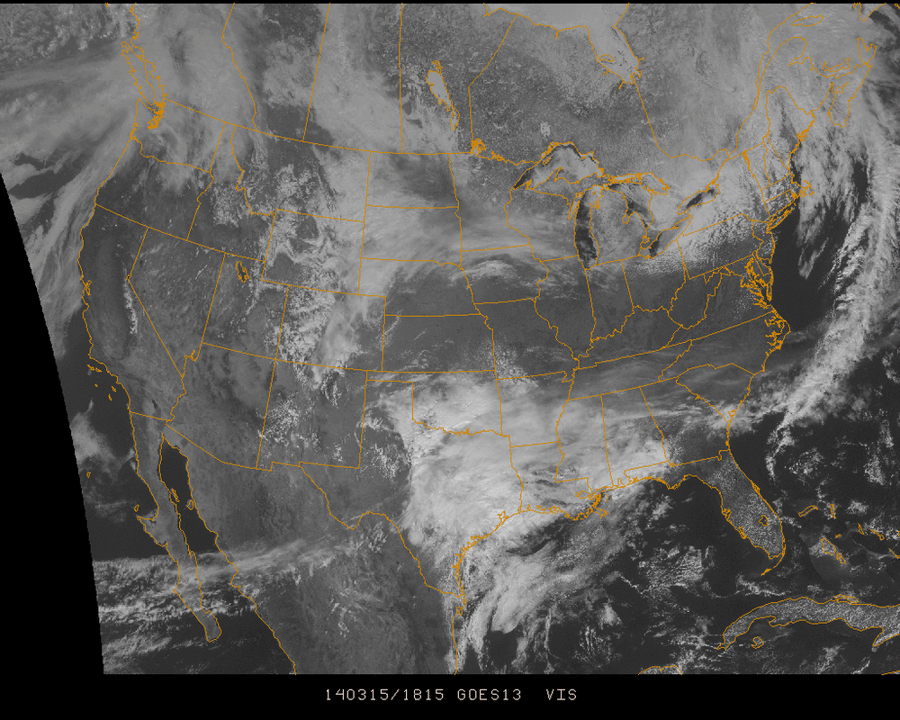
The clouds that can be seen in the south central US on the visible imagery above are associated with a low that will be building and deepening today and tomorrow as it moves eastward. I looks to just graze the NYC metro area Sunday night into Monday. The models are for the most part in agreement with the path... The panels below are from the 12Z GFS run.
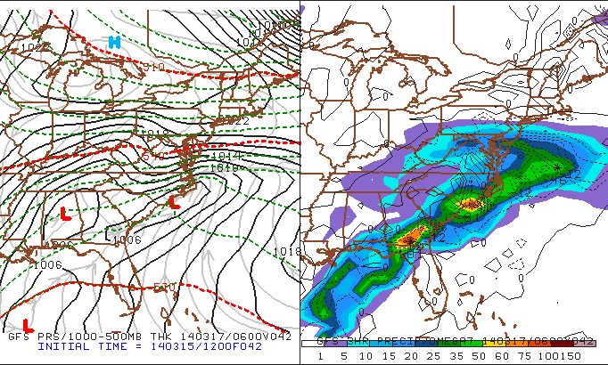
The timing of this slide is for Sunday night going into Monday just after midnight (2 AM Eastern Time). By this point, the secondary low has begun to form and move off the Carolina coast. Snow showers are likely to be seen in southern Pennsylvania, New Jersey, and further down into Maryland, Delaware, and Virginia. The areas further south more likely to see snow accumulations of up to 3"+.
Following this, conditions will gradually rebound to a much more Spring-like feel for the week with no storms causing big concerns into next weekend.
Enjoy the day!
- JL
Following this, conditions will gradually rebound to a much more Spring-like feel for the week with no storms causing big concerns into next weekend.
Enjoy the day!
- JL

 RSS Feed
