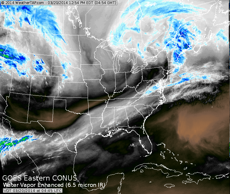
You can see by our satellite that a front extends along the east coast thru the Gulf States into the Pacific. This southern jet can play an important role in east coast weather next week. System over Dakotas will bring some showers to East Saturday a.m. then it gets colder.
(click on images to enlarge)
(click on images to enlarge)

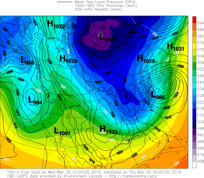
Above...The Euro model for next Wednesday. East coast storm east of Cape Hateras N.C. Model takes storm just enough offshore so that it is not a major player. Notice the blue shading over Ohio Valley. The symbolizes the upper trof. Model is not deep enough and putting too
much emphasis on one storm over baroclinic zone and feel that is in error as there will be 2 storms..
much emphasis on one storm over baroclinic zone and feel that is in error as there will be 2 storms..
Above...Canadian. I know it was not correct last week...but this time I think it has a good handle on the situation. You can see 2 lows.....
one off New Jersey...other east of that. This is more like the situation I am thinking of given the development of the trof aloft.
one off New Jersey...other east of that. This is more like the situation I am thinking of given the development of the trof aloft.
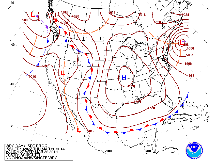
HPC - our gov't long range group...still feels this storm could be a major player for mid Atlantic and Northeast.....with this storm not far from the benchmark of 70/40.....just around Cape Cod.
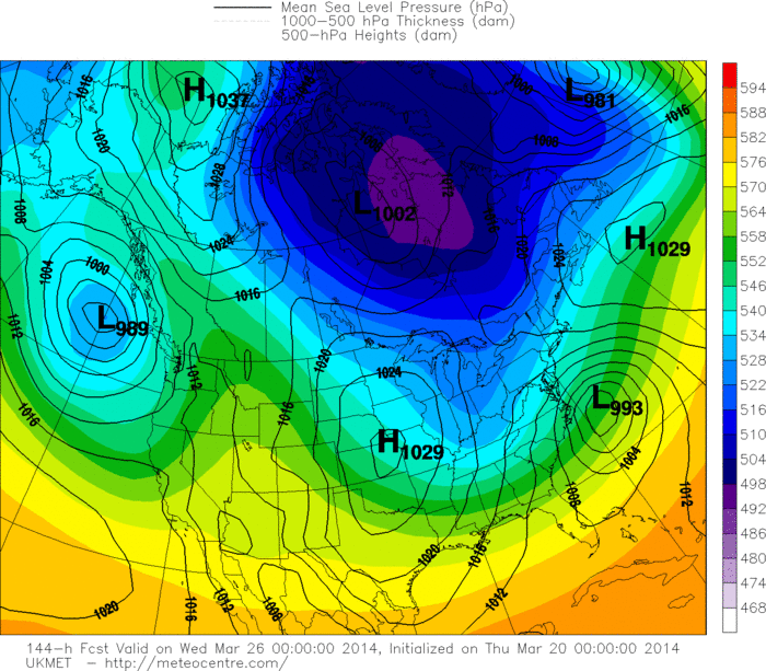
UK Met model is quite similar to the Euro...again a bit too far east. A look at their upper air map below would tell me that the storm should be further west.
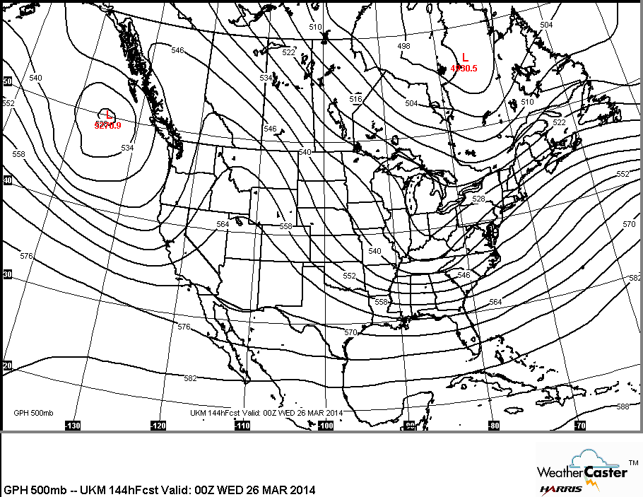
Above...UK Met flow at 18,000 ft. Years ago when I started in weather...we did not have models printing out where storms would be..and we used this flow to determine such. Based upon above..surface storm should be right along the NC coast and as trof heads east...storm should be steered closer to the coast toward Cape Cod. A situation that we will watch carefully for next week. For now..enjoy the arrival of Spring.

 RSS Feed
