Get a checklist, because this upcoming week we'll have a jumble of everything.
This morning above the CT line, much of the NE will have scattered light snow showers, more concentrated towards the eastern New England coastline. Closer to the NY metro area that will start off as drizzles first before tapering off to scattered flurries.
Tuesday the sun will return with temperatures 5-10° higher.
Wednesday's back to cloudy skies with rain, heaviest in the afternoon, then it will turn into snow at night.
Thursday will be turning sunny once again, but there's winds and much cooler temperatures dropping by 15-20° and well below normal temps due to the front in the morning.
Then Friday the temps rebound closer to seasonable temps rising once more by around 10°
So you got that checklist filled out? Good luck.
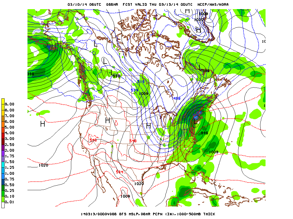
So the focus is Wednesday. For the NY metro area, much of the day will be rain, getting heavy in the afternoon, then lightening up and converting to snow anywhere between 11pm and 2am. For CT that conversion will happen an hour or two earlier (which increases their totals another 2-4"), and into NH they'll barely see ANY rain meaning they could be in the double digits.
The good thing is that there's no guessing game this time around as far as if we'll get hit or not; we know full well the low will move almost directly over us, so the only thing we're still looking to figure out is the timing of the changeover to snow. There's a good chance it will be late enough to have under 4" of snow, but if it's earlier by only 2 hours then that could be up to 6". Let's hope that the very warm temps on Wednesday can hold it off long enough.
-Mike Merin

 RSS Feed
