Notice the blue streak in the Plains...very important energy that will either cause a blizzard in the Northeast or a near miss. Blue in Gulf is the southern Jet and when these 2 combine - a very big storm is likely to explode off the Mid Atlantic coast by Tuesday nite. All modeling suggests this is going to be a near miss....and let's hope so. Don't see any reason to go against the models now...with only a 2 in 5 chance that it misses the northern energy and shovels will be working by Wednesday morning. At this time 1"-3" snowfall from NJ to Conn.
with 3-6" over Cape Cod.
with 3-6" over Cape Cod.
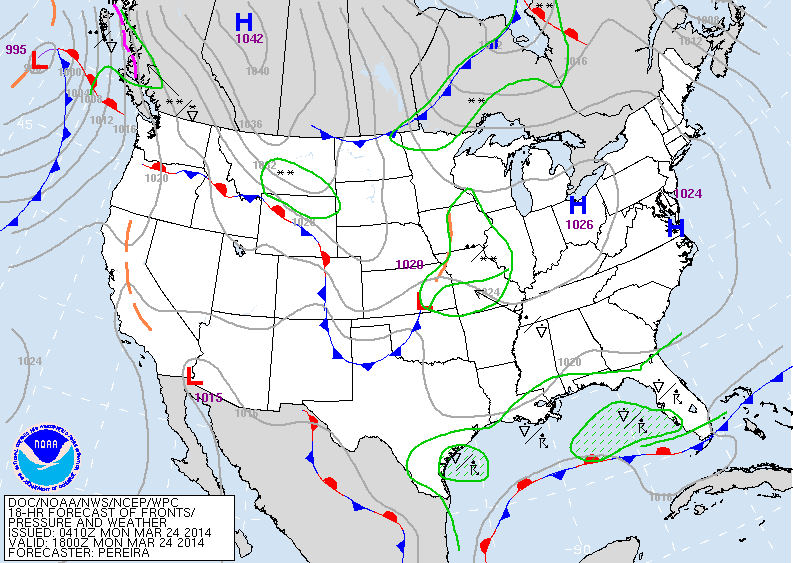
Todays map showing calm and cold in the East...a weak low in Plains and front in the Gulf. It's these 2 systems that will become a powerful Atlantic storm ...and stay far enough east to spare the big cities a March Blizzard.....or will it ?
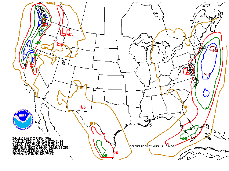
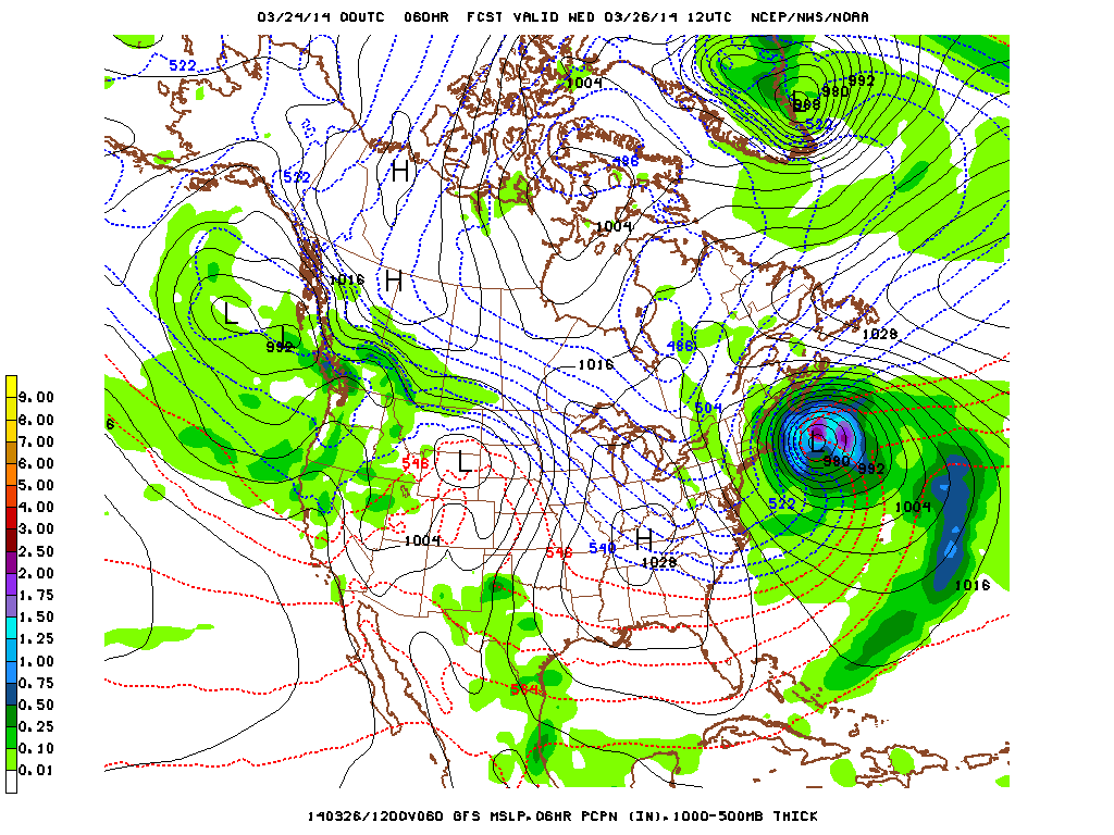
Above...liquid amounts predicted for this storm based on an offshore track. Red line is .25" which if it fell at night when cold enough would translate to 1"-3"......green line = .50".....translating to 4-6" Cape Cod.
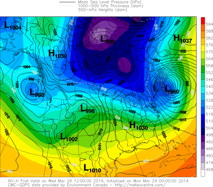
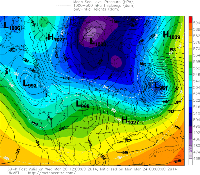
Below....a look at where the models put this storm by Wednesday early.
You can clearly see they are in very good agreement.
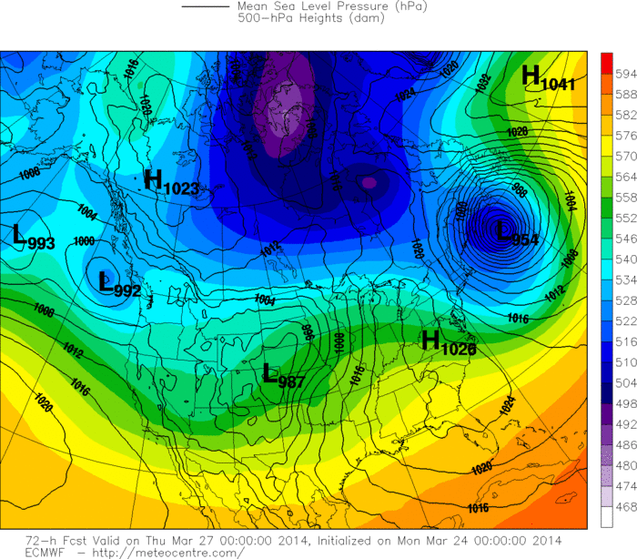
Below....a look at where the models put this storm by Wednesday early.
You can clearly see they are in very good agreement.
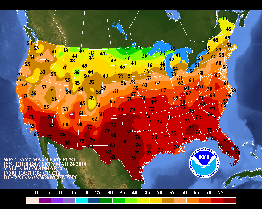
Above in order: Canadian, Euro, GFS, Ukmet. Below...high temperatures expected for this time next week....a sure signs of spring across much if not all of The Nation. We will be watching this closely.


 RSS Feed
