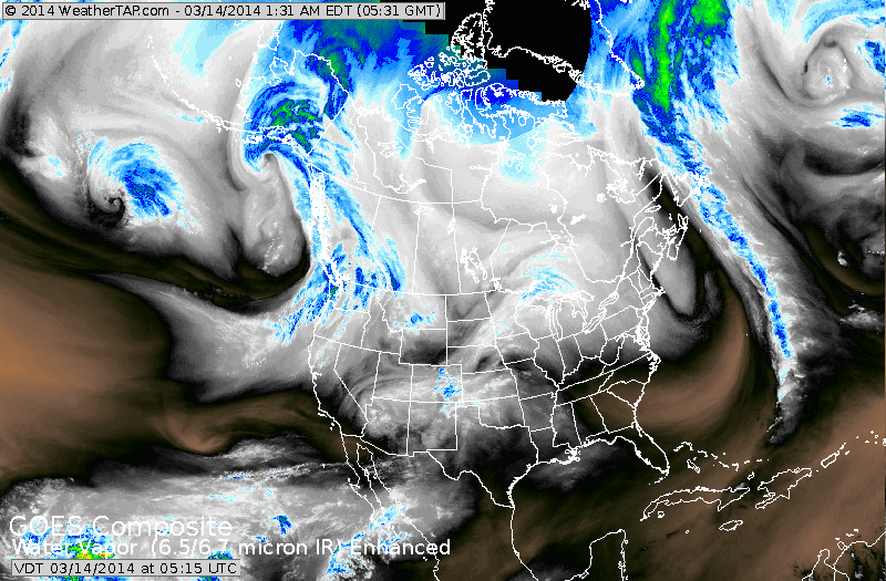
Clouds over The Gt. Lakes are associated with the next cold front that slips off the East Coast by Sunday and stalls over The Carolinas. Moisture is the SW....heads east as a new storm and follows out along that boundary. While this storm will split into a few smaller ones...it will be the plume of moisture that flows out of the Gulf and overruns the cold air on the ground that produces snow and wintry mix for Mid Atlantic to Southern New England for St. Patrick's Day. NYC/ PHL/ DCA/BWI may all be under this wintry precip. All models are on the same page with slight differences. The Canadian Model is still the most generous....which for the most part is always the case. Thunderstorms are possible from Texas into The Gulf States with this next low.
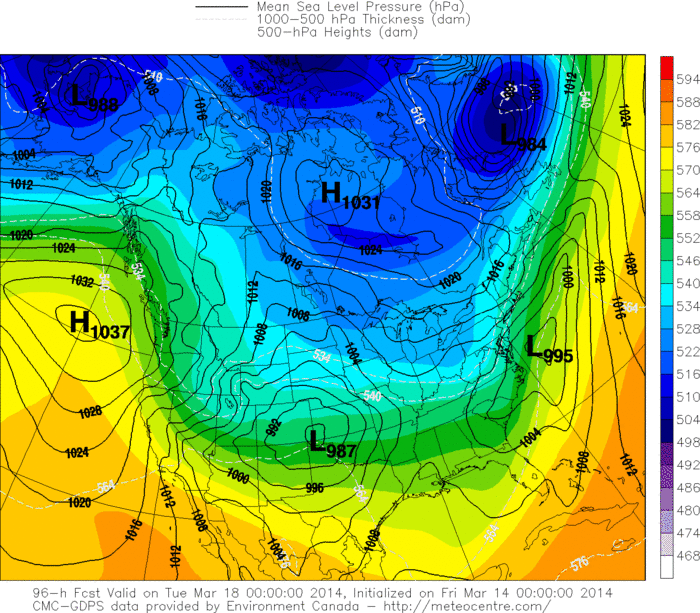
Below......The Canadian Model for Monday.
Below......The Canadian Model for Monday.
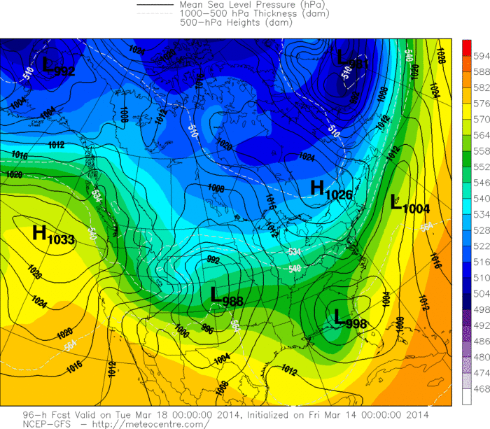
Below...The American GFS Model for Monday
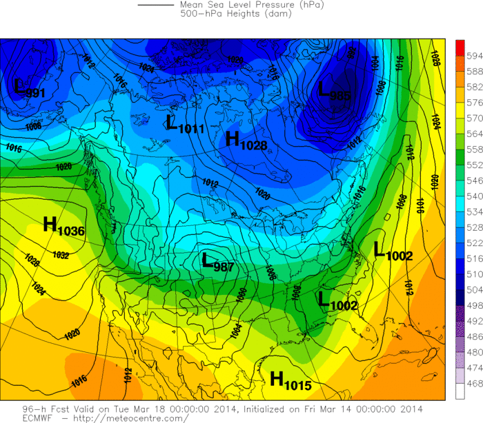
Now, The Euro
Finally, The Japan Model, closest to the Canadian with more snow.
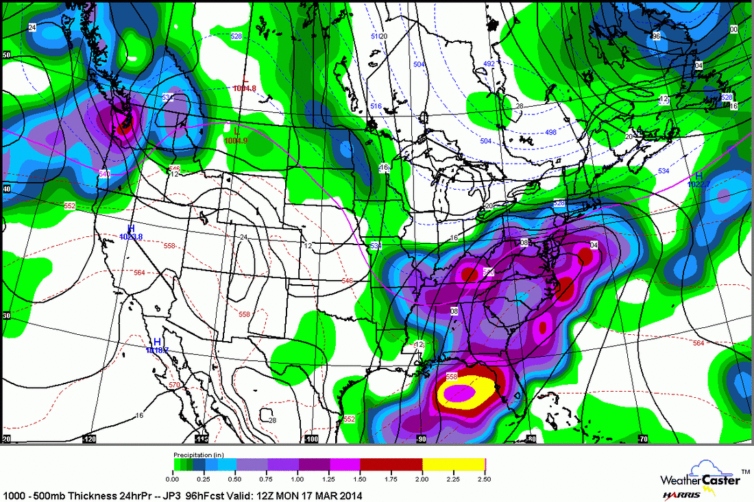
My thinking as of now... from DCA to Southern New England... 4" +
of snow possible from late Sunday night into Monday. We'll be updating this thru the weekend. Have a nice one...be safe.
of snow possible from late Sunday night into Monday. We'll be updating this thru the weekend. Have a nice one...be safe.

 RSS Feed
