First ....a look at yesterday afternoon's visual satellite picture. Notice that the east coast storm actually has an eye. Winds were reports up to 78 mph on the Cape yesterday.


This a.m's satellite pix....showing many systems just stacked up across the Nation. This will bring frequent rain..and snow in the north from this weekend right thru next week...although the arctic air will be minimal.
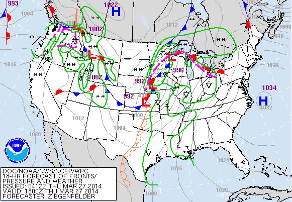
Today's map showing one system in the Upper Midwest...next one in The Rockies...and you can just begin to see the next one off in The Pacific.
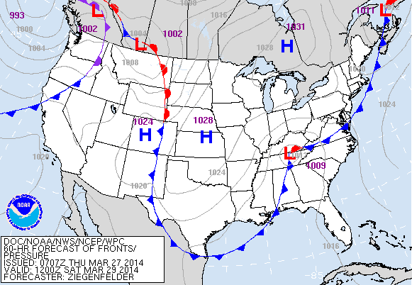
This is what (above) map will look like Saturday. Low in Tennessee will bring heavy rain to the East...and into Sunday when even some sleet
may mix in across The Northeast.
may mix in across The Northeast.
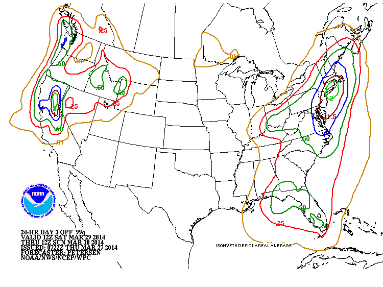
Amounts of precip. (Above) for this weekend. Looks like NYC and Southern New England has the bulls eye of up to 2" of rain. Better than snow...but would be better to have sun and 60. Maybe Monday. Be Safe.

 RSS Feed
