Just like two Sundays ago on the 2nd, as well as the 9th, this is the THIRD Sunday in a row that we'll have a snow system just barely out of range, which I as well as many others won't ever complain about.
At the moment according to the models, the northern edge of the storm will be around the NY metro area and into Long Island, but even that's only scattered flurries or snow showers from 1AM tonight into possibly 1PM tomorrow, but again those are the chances of snow; we may not see them until later and/or we could see them end sooner, that's the scattered part of the forecast. Even better? Under 1/4" is set to fall across the area, so other than a light coating there won't be much to shovel. The ground temps will be well below freezing so whatever falls will have a chance of accumulating.
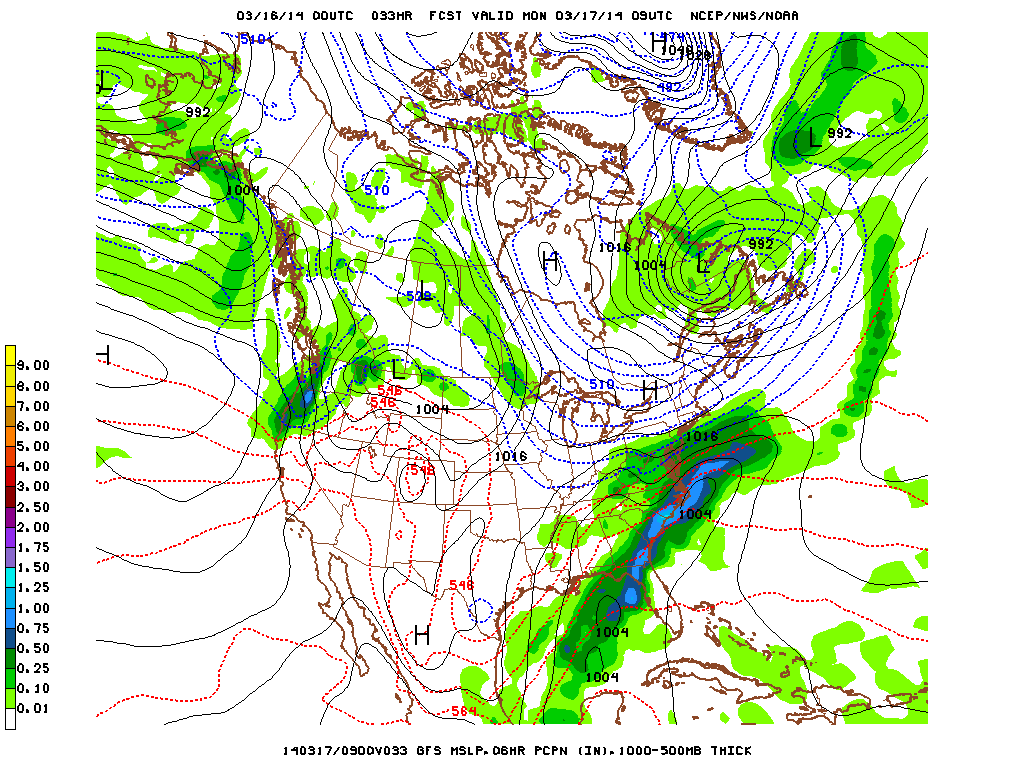
Again, as you can see in the model below the north end of the storm will graze NYC and LI but that's also only in the lightest part of the storm (click to enlarge).
At the moment according to the models, the northern edge of the storm will be around the NY metro area and into Long Island, but even that's only scattered flurries or snow showers from 1AM tonight into possibly 1PM tomorrow, but again those are the chances of snow; we may not see them until later and/or we could see them end sooner, that's the scattered part of the forecast. Even better? Under 1/4" is set to fall across the area, so other than a light coating there won't be much to shovel. The ground temps will be well below freezing so whatever falls will have a chance of accumulating.
Again, as you can see in the model below the north end of the storm will graze NYC and LI but that's also only in the lightest part of the storm (click to enlarge).
So that means for Monday on St. Patrick's Day, parades will be able to go on relatively unscathed, and anyone looking to drink quite a lot will be able to do so without worrying too much about the slippery ground that would've come with more heavy snow.
After this system passes, the next system set to hit us will be on Wednesday but it'll be very minor. Once again I'll say it: even better? It'll be warm enough for rain. In fact the best part about it is that on Tuesday the NY metro area will be in the lower 40's, then Wednesday the mid 40's, and finally Thursday and Friday will both be in the lower 50's, well above average for this time of year.
And i'll end with repeating myself once again: even better? Those temps will stick around during the weekend. I for one am looking forward to that.
-Mike Merin

 RSS Feed
