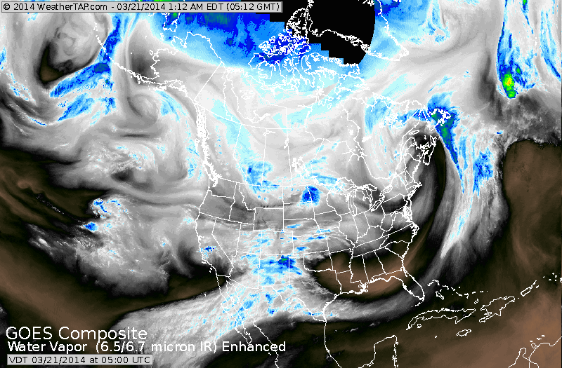
You can easily see the 2 jet streams on satellite....one zipping thru the Daktoas...the other thru Texas. These 2 will merge and there will be a big storm next week...but exactly how it tracks will be the question. Below..we will look at all the models and we think that a real MArch Lion will be affecting mid Atlantic & Northeast next Tues.nite & Wed.
Above- HPC - our gov't long range/precip. center continue to buy The Canadian models and shows an intense storm near Cape Cod by Wed. a.m. Should this pan out..wind and heavy precip will batter the Northeast starting Tuesday nite. Heavy snows will fall and along the coast mixed precip is possible with thunder/lightning.
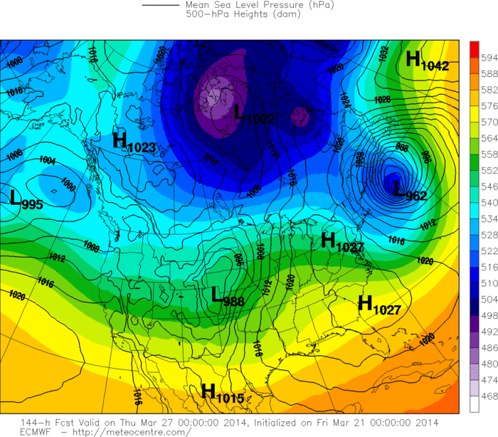
This is The Euro...but Wed.night at which time the storm has already moved past. In any event..quite intense with hurricane force winds battering Nova Scotia. It's track is just a bit east of HPC.
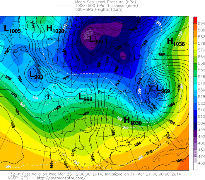
Above..GFS American Model - equally as intense and just a beam
to the south of the benchmark...nevertheless...a biggie.
to the south of the benchmark...nevertheless...a biggie.
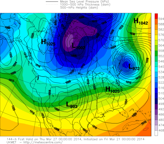
Above...UKMET...but for Wed.nite...so likke the Euro ...the system has already move by and it is battering Nova Scotia.
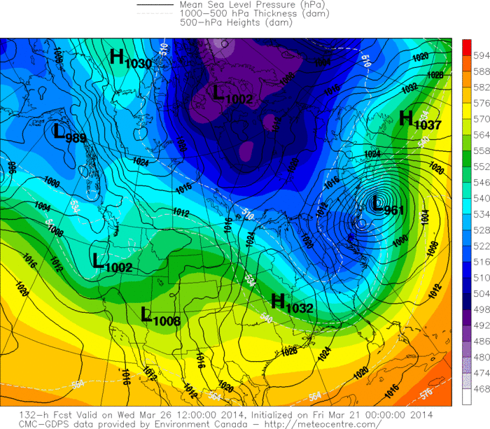
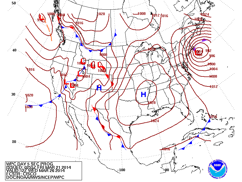
Above...The Canadian...saved the best for last. Look closely or click on map to enlarge. 2 centers...one off Cape Cod...the other off The N.J. coast....reflecting the upper low. Still feel this is the best representation of what map happen...and such an explosive pattern will easily mean and rough storm for The Northeast.
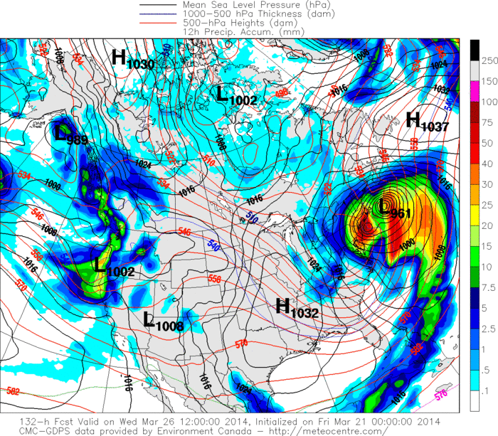
Above...Canadian model depicting amounts of precipitation: Orange- red...expressed in millimeters which convert to 1" or better. If it verifies that is over 1 foot of snow for parts of The Northeast with near blizzard conditions. Keep in mind that the month of March can often produce storms like this that are very intense due to changing to seasons
and many other parameters. We will continue to monitor this event over the weekend. Have a nice one.
and many other parameters. We will continue to monitor this event over the weekend. Have a nice one.

 RSS Feed
