Metro Weather Inc. Services
Like us, follow us, link to us, contact us!
  • Home
    • Daily Weather Discussion
  • Weather Prepared for You
    • Film and TV Production
    • Radio & Television
    • Government and Industry
    • Forensic Services >
      • Weather Record Request Form
    • Metro Morning Monitor
  • About Metro Weather
    • Senior Staff
  • Your Weather Images
  • Contact Us

Could Get Tricky For The Northeast

12/7/2022

0 Comments

 
Picture
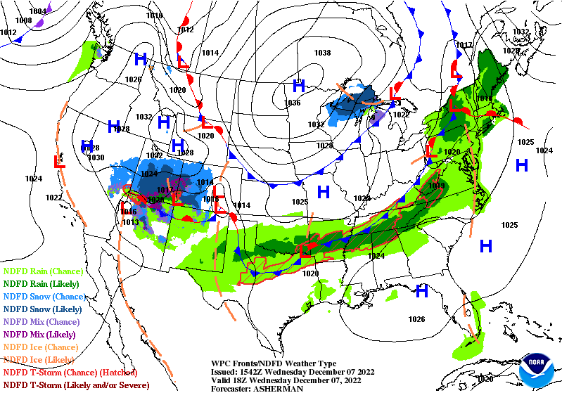
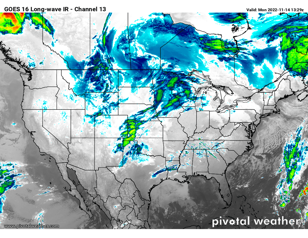
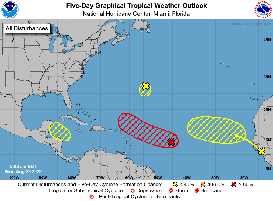
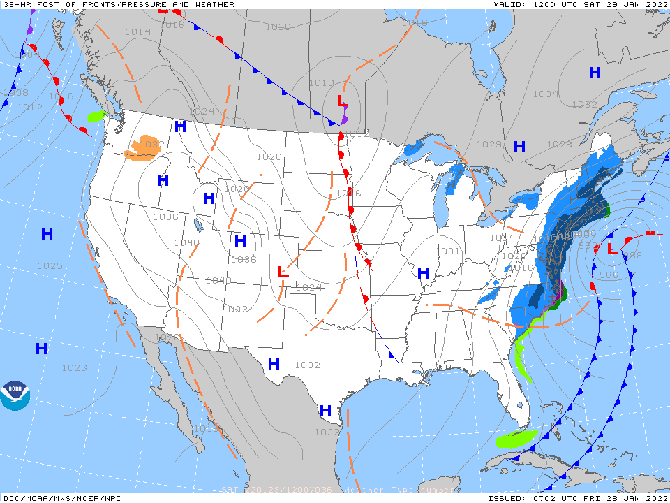
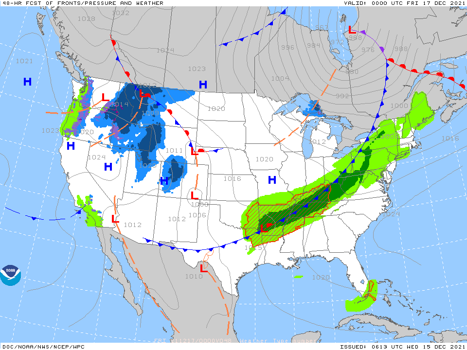
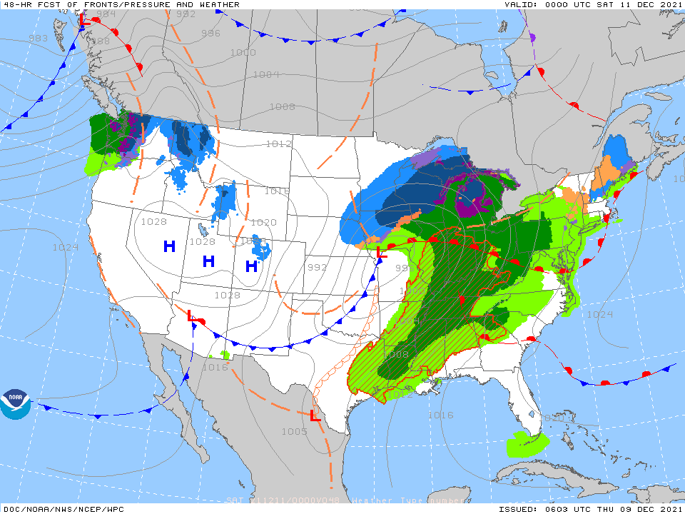
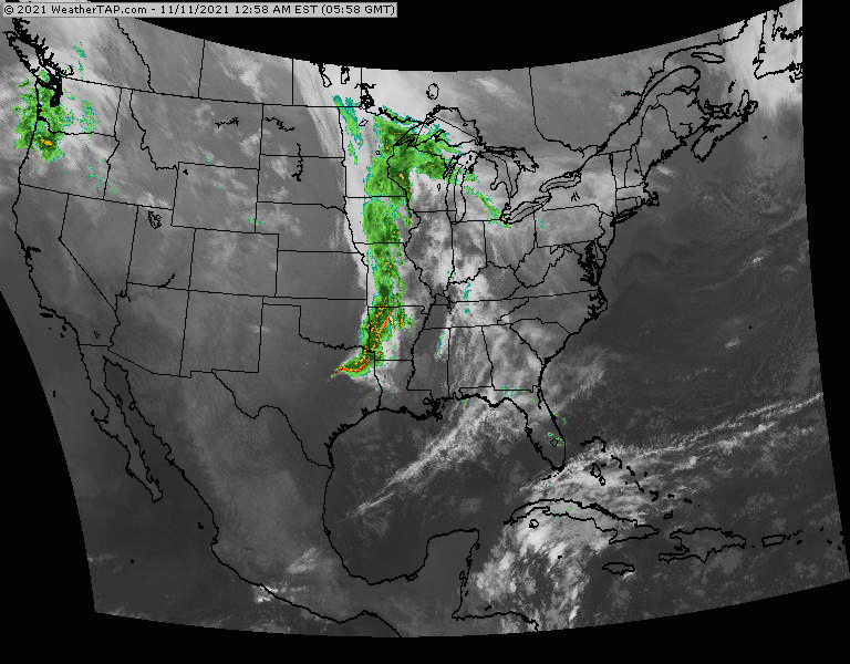
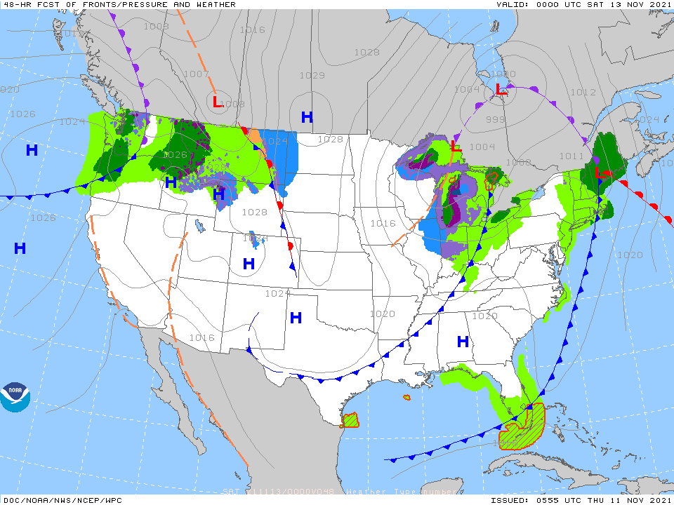
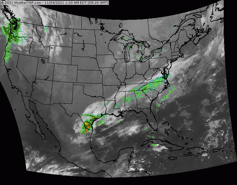
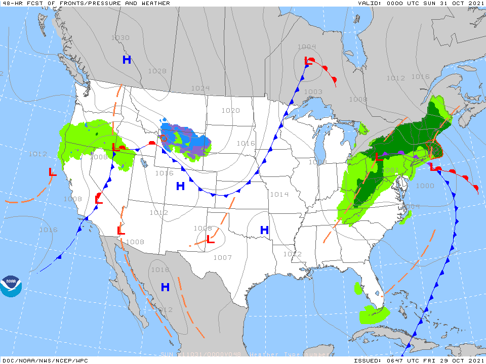
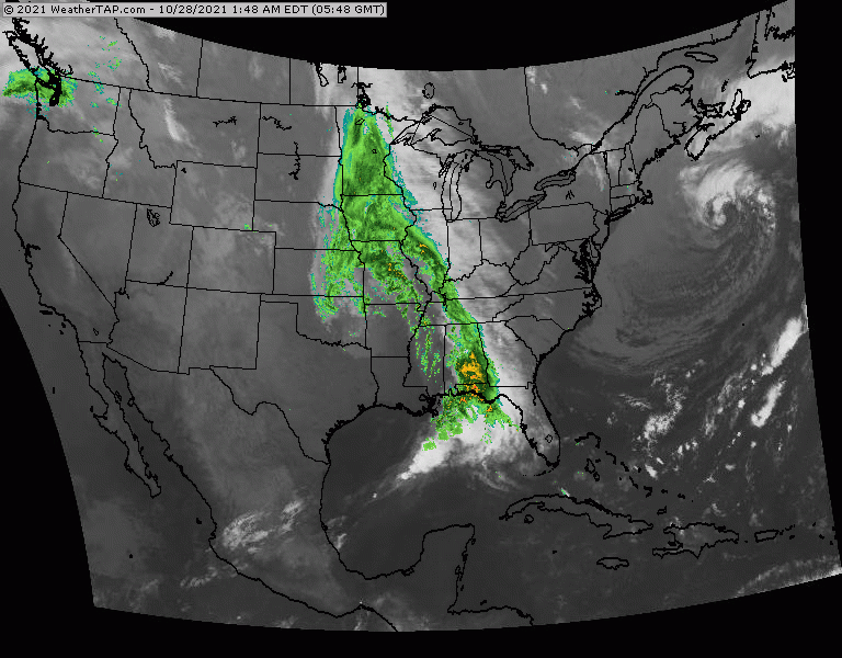
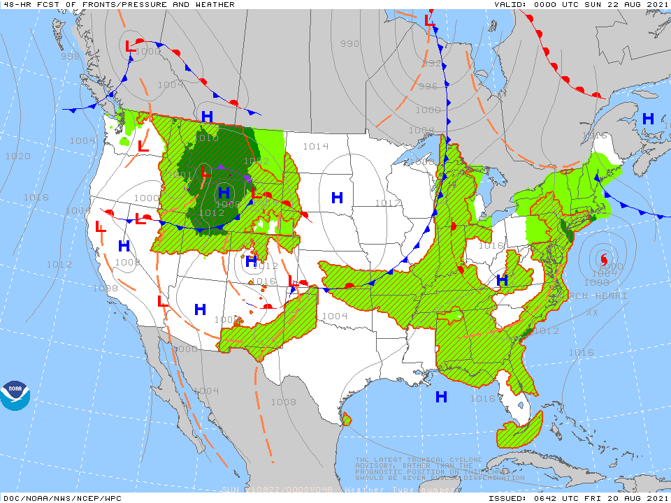
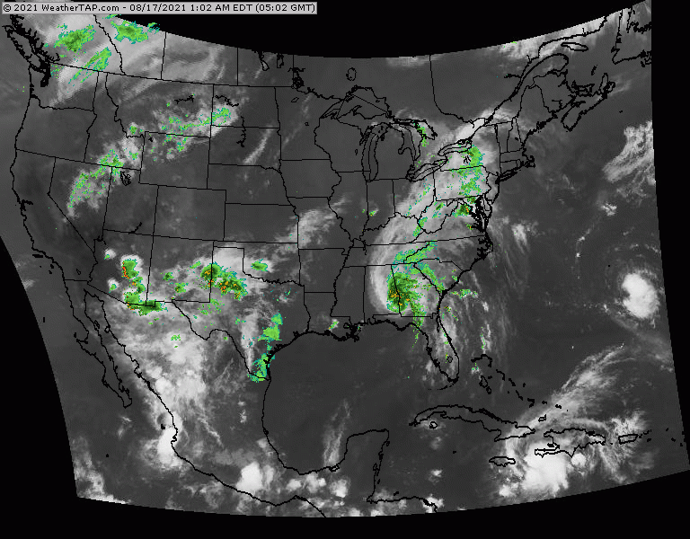
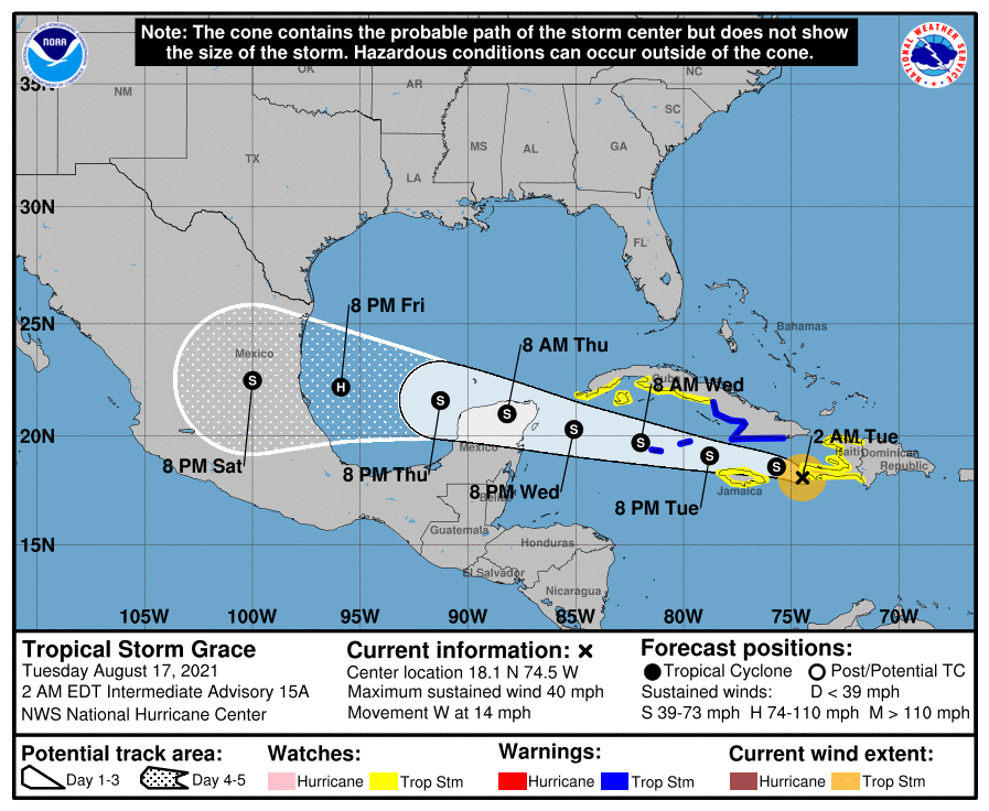
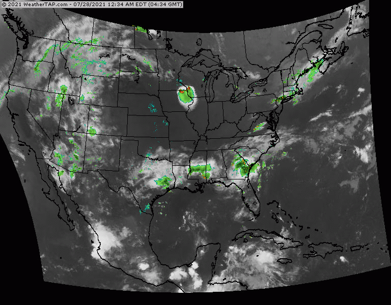
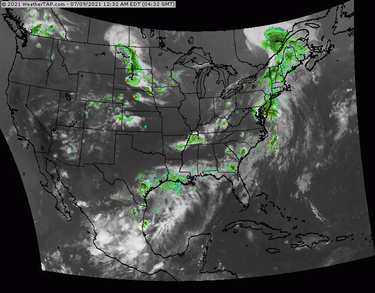
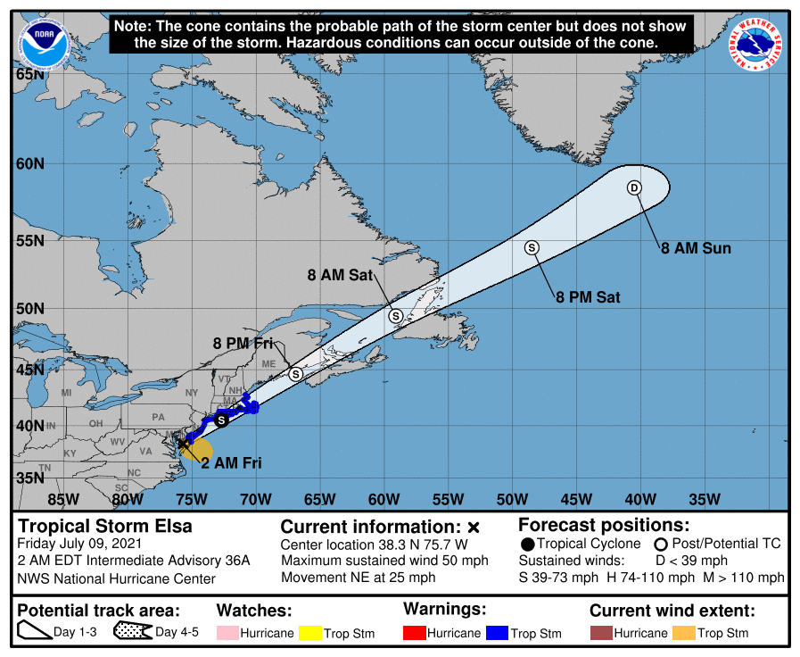
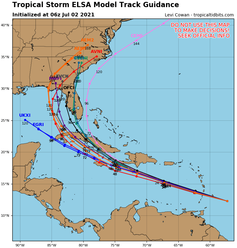
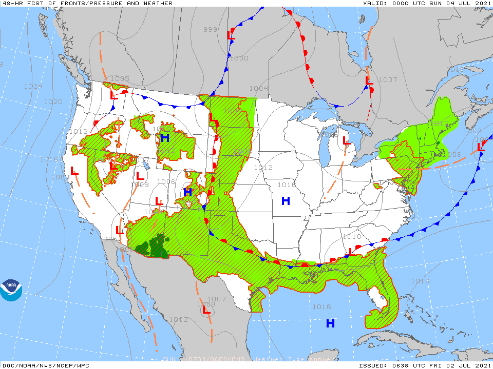
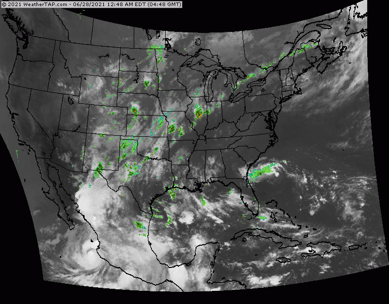
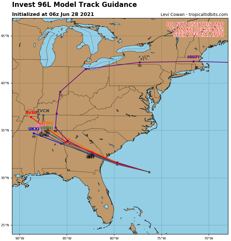
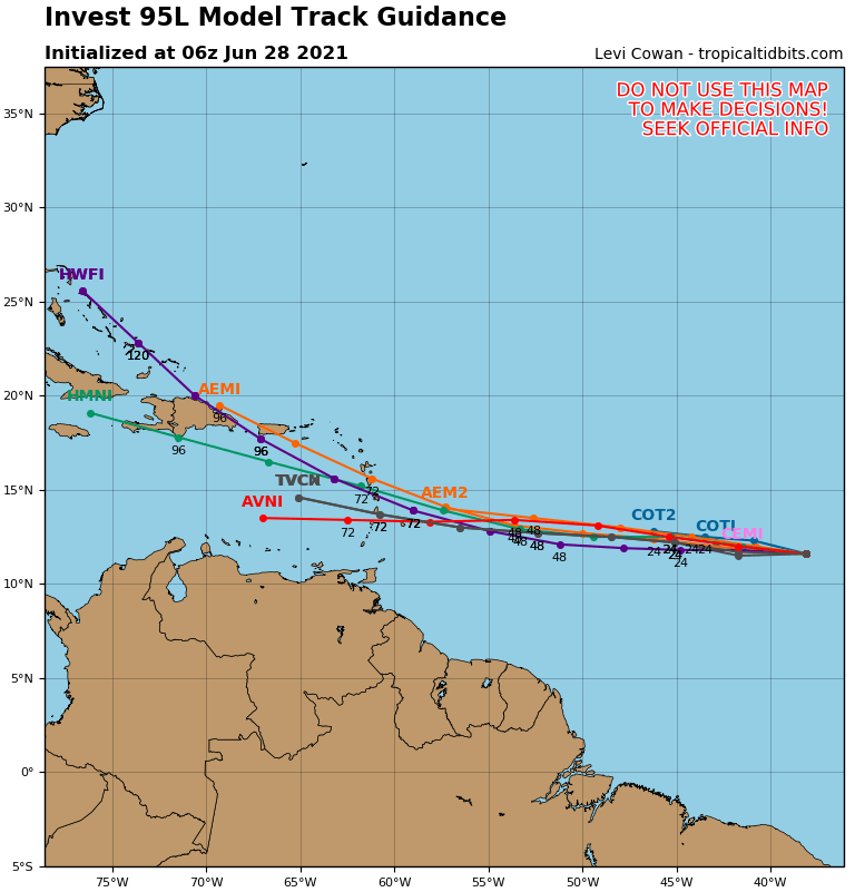
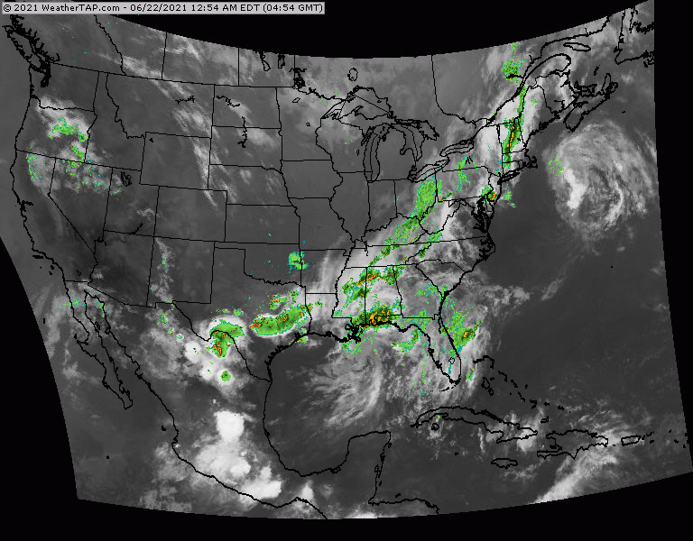
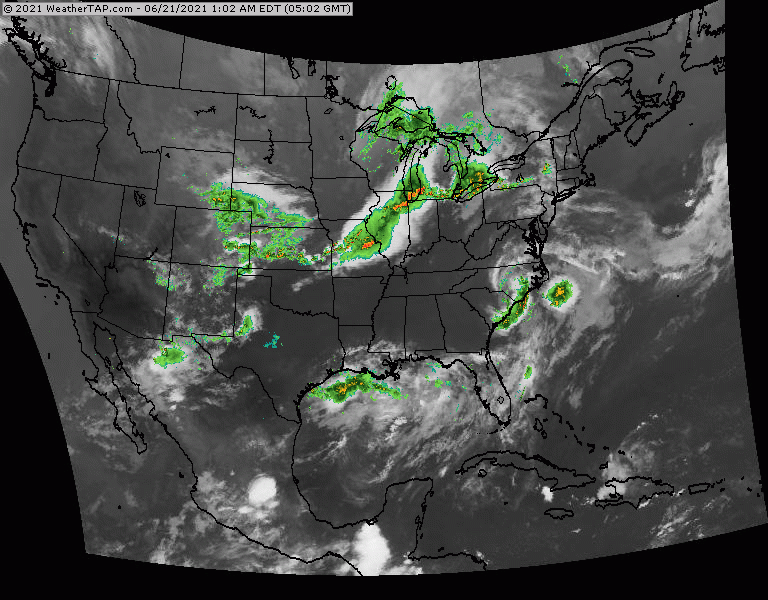
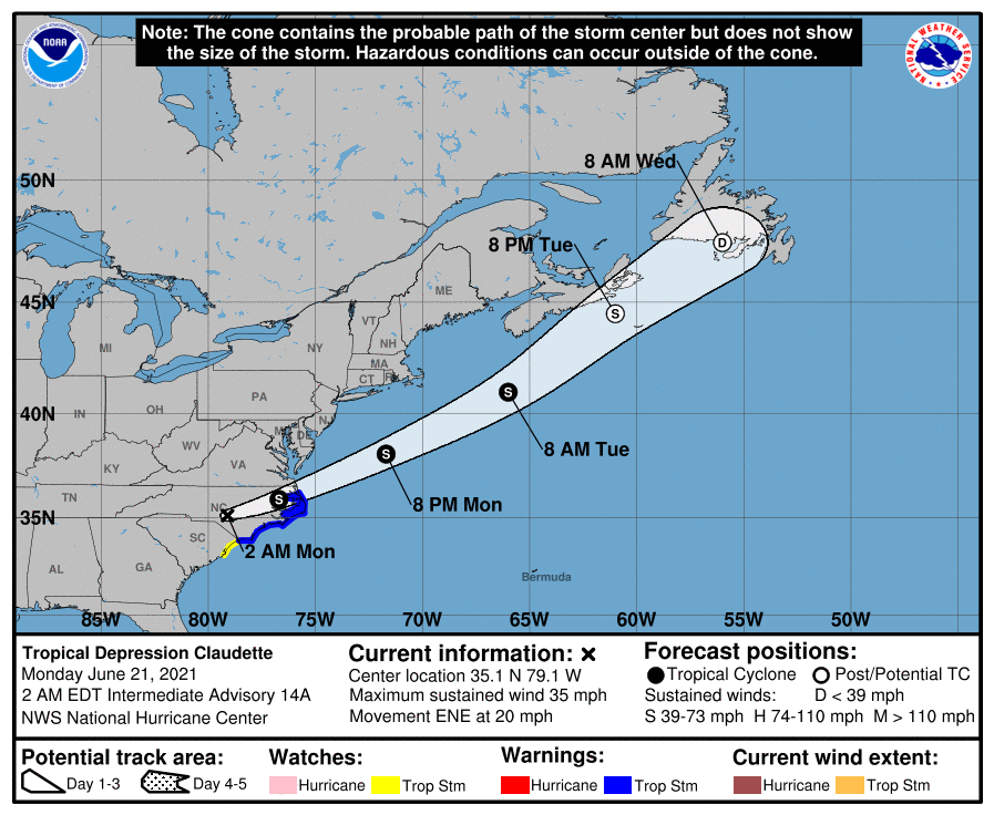
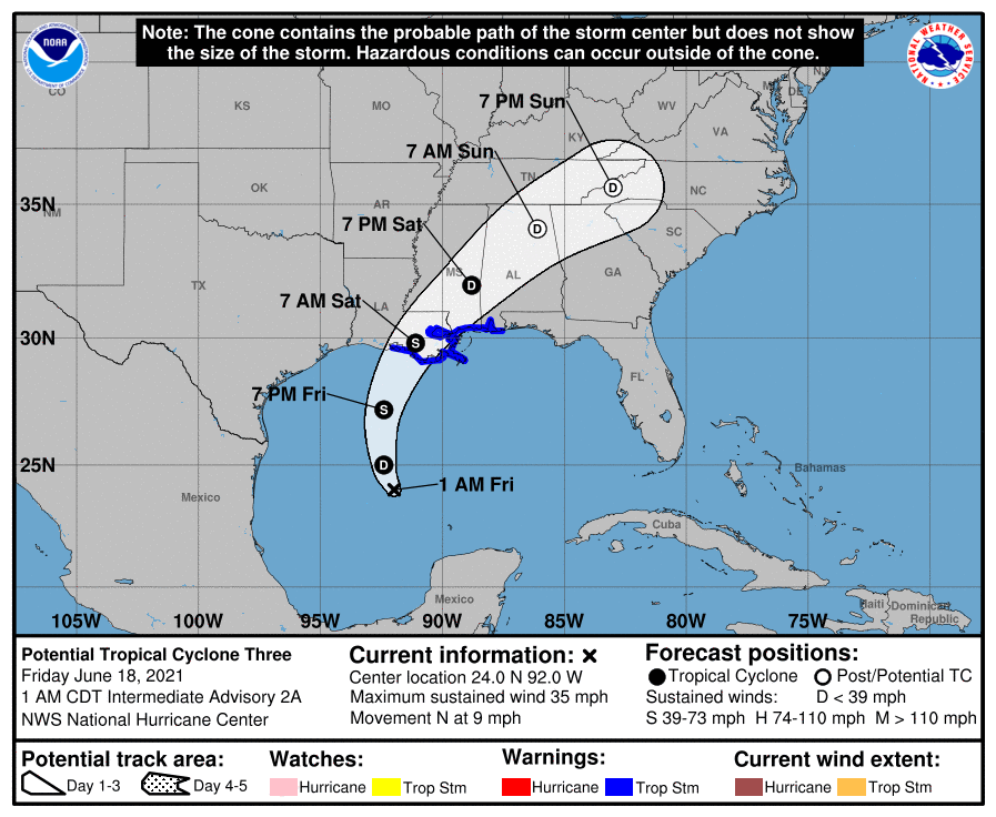
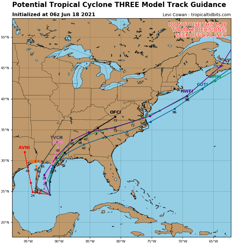
Satellite + radar above shows wave front in the South. Another system approaching the west coast will head east and could wind up off the coast of New Jersey Sunday/Monday.  That system may bring wet snow to mainly New England...but we will be watching it,  Meanwhile a tropical like disturbance se of Bermuda will head northeast...but could be a record breaker if it winds up getting the name Owen.
Picture
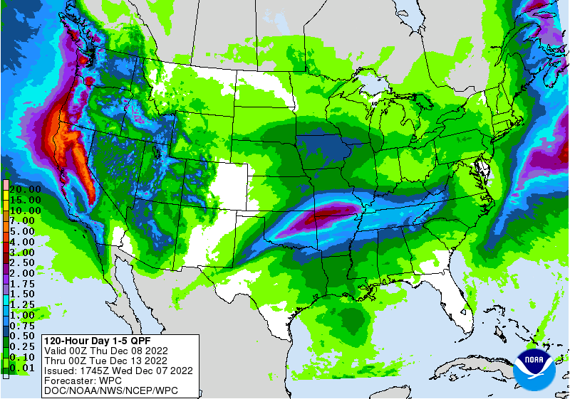
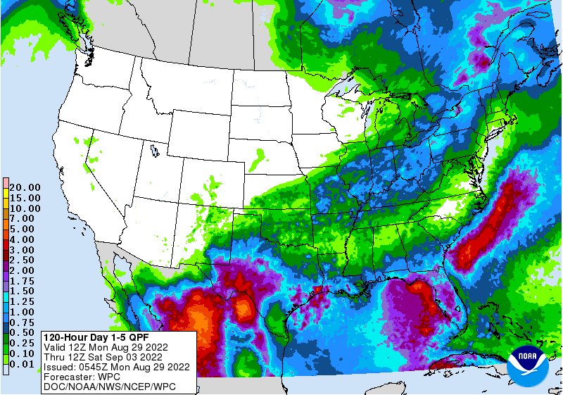
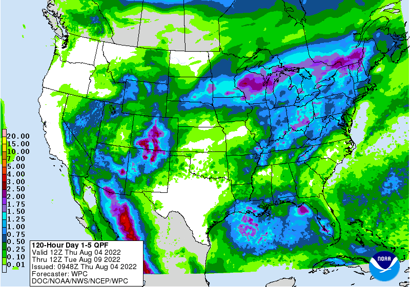
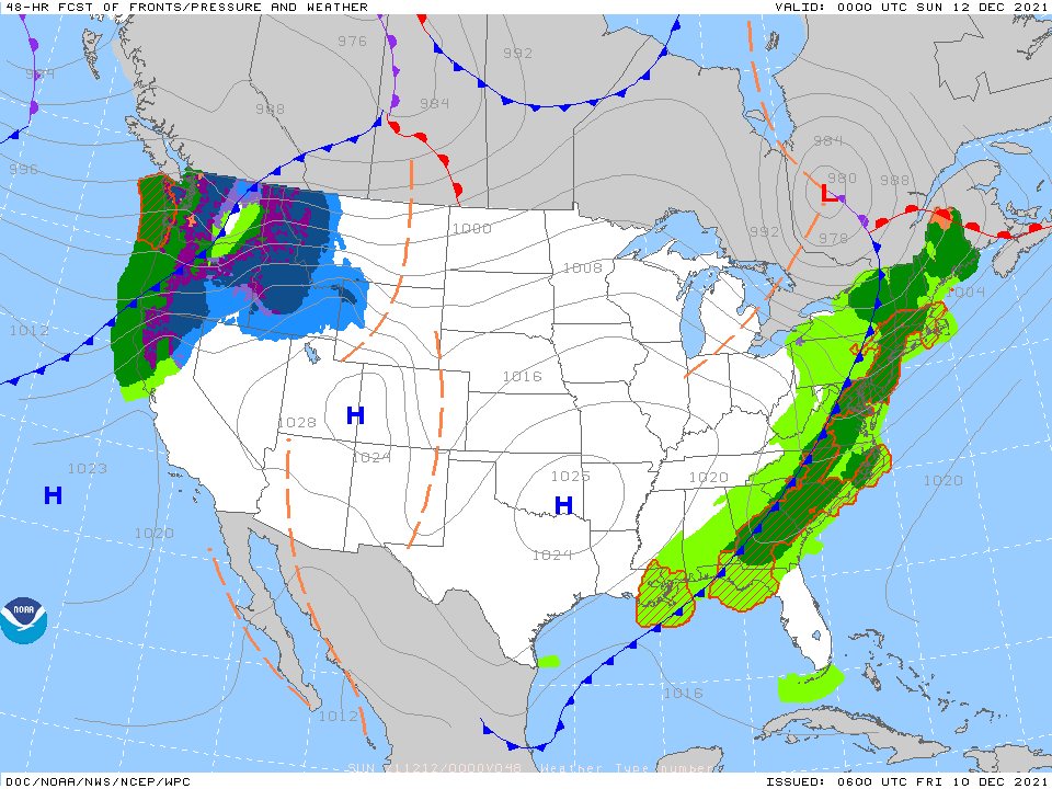
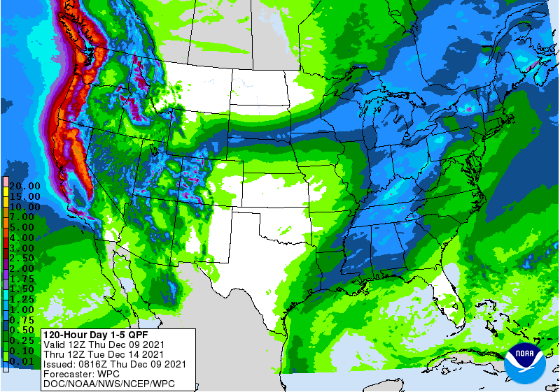
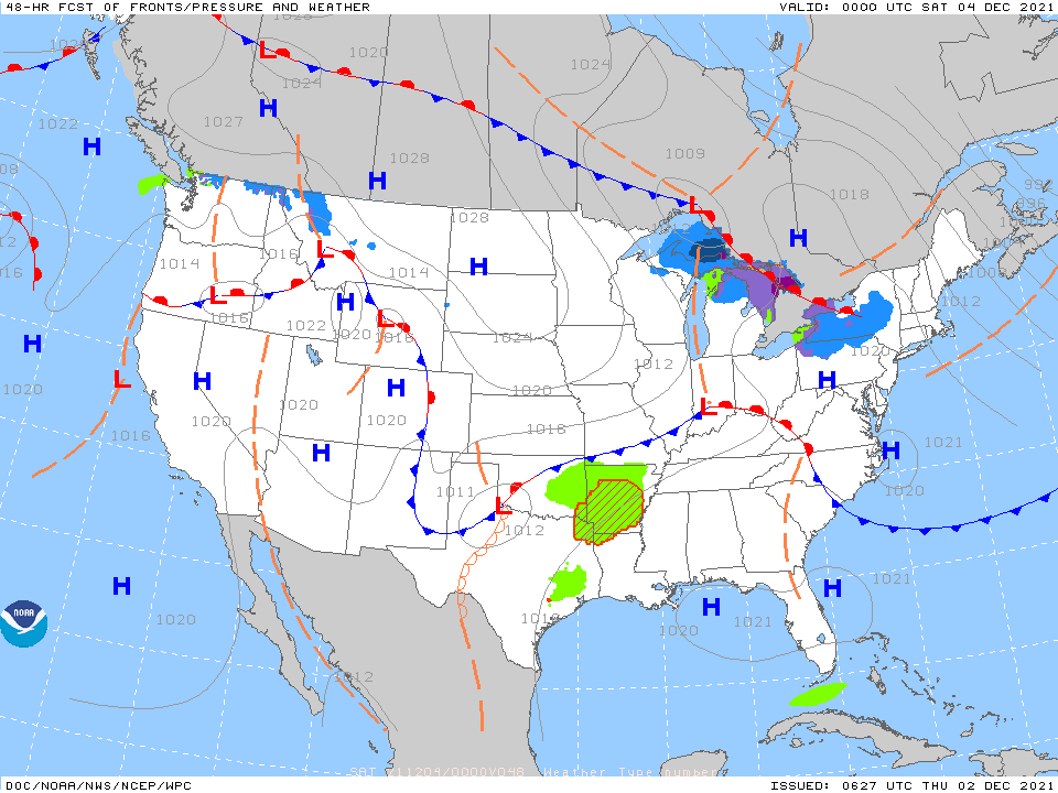
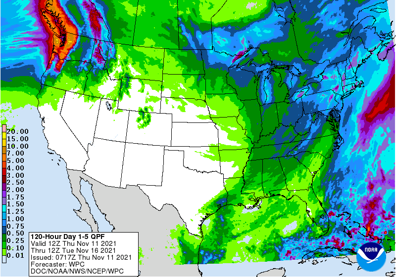
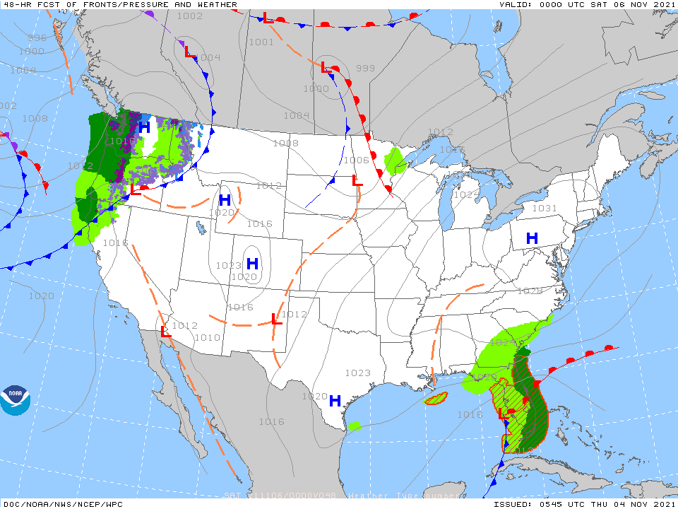
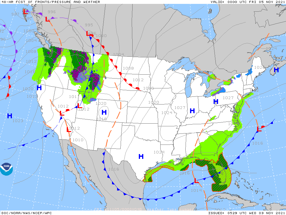
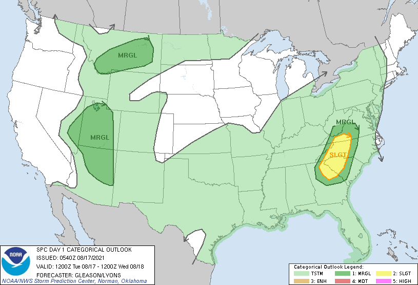
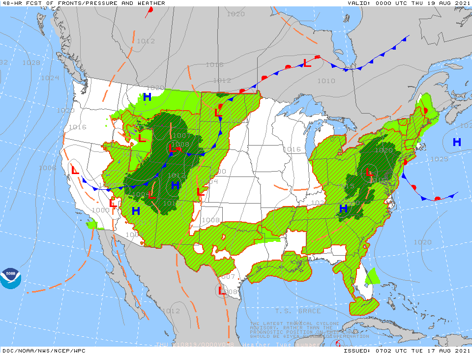
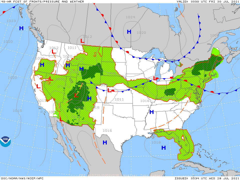
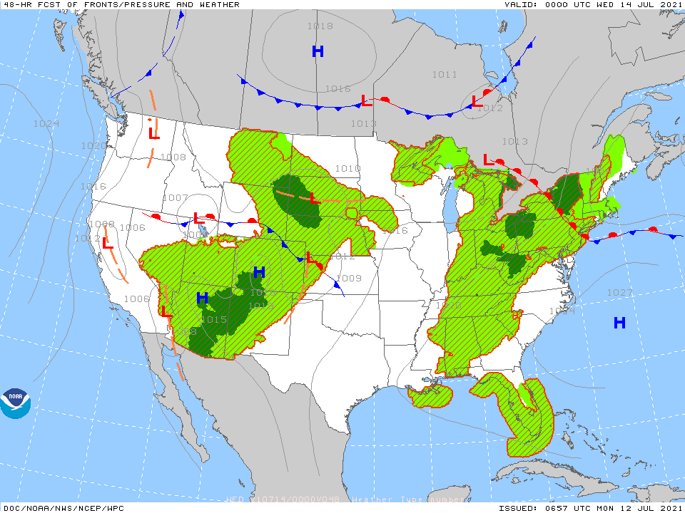
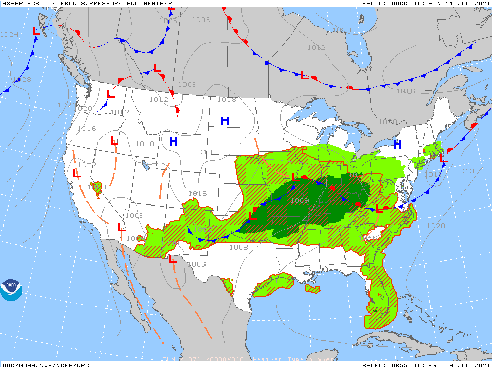
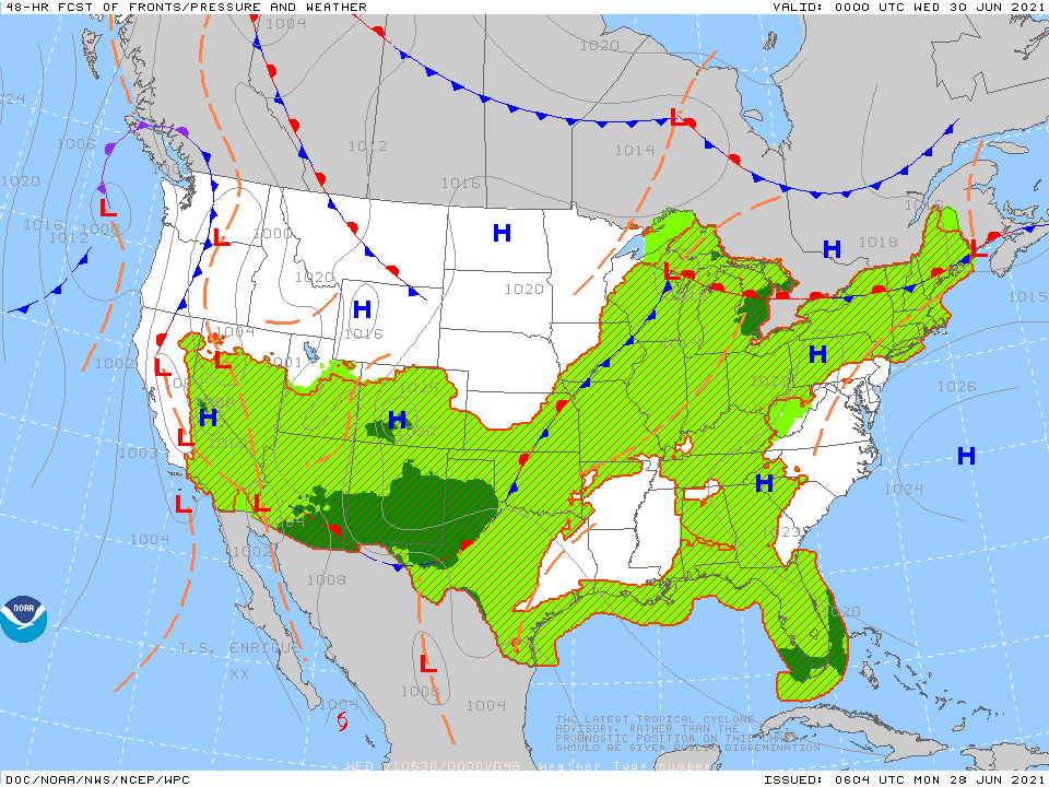
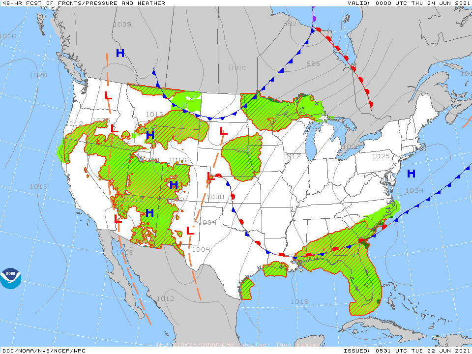
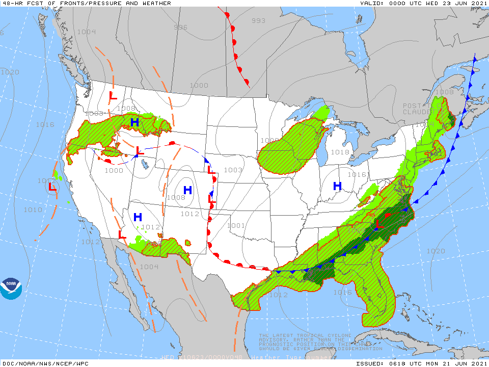
Below - animated maps for the next 2 days....rainfall into next Tuesday. 
​Be safe. 

Picture
Picture
0 Comments

Cold - Nationwide

11/14/2022

0 Comments

 
Picture
Satellite above shows winter storm from No. Rockies to Upper Midwest  with snow. That system moving to the East Coast by Tuesday night and Wednesday.  Most of the Nation..under colder air and will stay that way. 
​Below - rainfall expected through Saturday
Picture
0 Comments

Changes in the making......

8/29/2022

0 Comments

 
Picture
Above...today's threat of severe weather....greatest Northern Illinois.
Picture
​Rainfall expected from today through Saturday. 
Picture
Disturbance in south central Atlantic has 80% chance of forming into a tropical storm...as it moves toward No. Leeward Islands. It wouyld be given the name Danielle. 
0 Comments

We're Having Another Heatwave

8/4/2022

0 Comments

 
Picture
Picture
Picture
Picture
0 Comments

Big Winter Storm - Northeast

1/28/2022

0 Comments

 
Picture
Above - you can see the storm that will belt the East coast with wind..snow..coastal flooding - blizzard conditions for big cities from New York to Boston. Cape Cod could get 2 to 3 feet....not to mention drifts.
Below - satellite + radar picture - snowfall projections..current wind chills

​Below - liquid precip through Wednesday.....snapshot weather for Saturday.  Be safe.
0 Comments

Another Severe Outbreak !

12/15/2021

0 Comments

 
Picture
Above...map shows best areas for severe thunderstorms and tornadoes today into tonight. Red area has best possibility from Iowa into SE Minnesota.  Below - snowfall in next 48 hrs, animated maps....rainfall through Monday.
Below - snapshot weather for Thursday .   Be safe.
Picture
0 Comments

Record Highs - East , Tornadoes Central

12/10/2021

0 Comments

 
Picture
​Above - today's severe weather outlook includes a large area of Midwest and Ohio Valley under the gun for severe thunderstorms and tornadoes. The greatest risk is in the light brown area. Below - satellite and radar picture.
Picture
Above- showers move through New England....cold front gathering strength in Plains and that will be the reason for outbreak of severe weather today as described above. Some of that severe weather could
affect the East Coast Saturday.  Below....48 hour snowfall....animated maps and rainfall through Wednesday.

​Below- snapshot weather for Saturday.  Be safe.
Picture
0 Comments

Amazingly Quiet....

12/9/2021

1 Comment

 
Picture
Above- satellite picture shows next front over the Great Lakes and it will head east to bring showers to the East Coast Saturday along with record breaking warmth. Below - snowfall expected over the next 2 days....animated maps - rainfall through Tuesday.
​Below- snapshot weather for Friday.  Be safe.
Picture
1 Comment

Docile December, So Far......

12/2/2021

0 Comments

 
Picture
Above - Satellite + radar shows jet stream diving from The Northwest to Mid Atlantic. One disturbance in the stream moves through the Northeast this a.m. with showers. Another Saturday....another Monday. Next week does look more wintry. Below - animated maps for next 2 days + rainfall through Tuesday.
​Below- snapshot weather for Friday.  Be safe.
Picture
0 Comments

Cold Fronts Are On The Move ....

11/11/2021

0 Comments

 
Picture
Above - Satellite + radar shows cold front in Midwest which will arrive on East Coast Friday with rain. Next front in the Pacific Northwest will reach the East Coast late Saturday. Below....animated maps for the next 2 days along with rainfall through Tuesday.
Below - snapshot weather for Friday.   Be safe.
Picture
0 Comments

Staying Quiet Except Northwest & Southeast

11/4/2021

0 Comments

 
Picture
Satellite + radar above show showers from So. Texas to Carolinas and that zone of weather weather will be over the Southeast through Saturday. Rain in Pacific Northwest moves eastward.....elsewhere - fair - cool. Below - animated maps for next 2 days + rainfall through Tuesday.
​Below - snapshot weather for Friday.  Be safe !
Picture
0 Comments

Chilly But Quiet

11/3/2021

0 Comments

 
Picture
Above - satellite + radar - Some rain a/o wet snow showers in the lee of the Great Lakes. Rain over lower Mississippi Valley heads east and then offshore. Rain in Northwest.  Below - animated maps for the next 2 days and rainfall through Monday.
Below - snapshot weather for Thursday.  ​Be safe !
Picture
0 Comments

October Ends Quiet, Except Northeast !

10/29/2021

0 Comments

 
Picture
Satellite + radar above shows large storm in Ohio Valley with rain and wind for the Eastern Half of the Nation. This storm will move across the Northeast and Mid Atlantic tonight into Saturday then improving.  Things should quiet down next week. Below - animated maps for the next 2 days...severe weather threat for today - and rainfall thru Wednesday.
Lastly...snapshot weather for your Saturday. Be safe.
Picture
0 Comments

Another Storm Heads East

10/28/2021

0 Comments

 
Picture
Satellite + radar above shows next storm in the Plains with severe weather threat for Southeast today.  System will bring strong winds and heavy rain to the East Friday - Saturday.  Below animated maps for next 2 days....severe weather threat for today .....rainfall through Tuesday.
​Below - snapshot weather for Friday.  Stay safe.
Picture
0 Comments

Severe Storms - Upper Midwest - Henri To Hit New England !

8/20/2021

0 Comments

 
Picture
​Satellite & radar above show severe storms in Dakotas headed for the Upper Midwest today/  Grace is moving toward Mexico. Henri..still a tropical storm off the Carolinas...will become a hurricane and move north and likely make landfall over se New England Sunday.  That would be the first hurricane to make landfall in New England since Hurricane Bob - 30 years ago.  That area is a very large vacation spot right now and this storm should not be taken lightly. We expect The Hurricane Center to begin issuing watches and advisories shortly. It also comes at a time with astronomically high tides. Below - current Atlantic basic map - track of Henri - and track of Grace.
​Below - today's severe threat - anmated maps for the next 2 days....rainfall into next Wednesday.
Below - snapshot weather for Saturday.  Be safe...listen and watch for weather advisories .
Picture
0 Comments

Highly Unsettled....

8/17/2021

0 Comments

 
Picture
Satellite + radar above shows Fred in Alabama sending moisture north to New England. Showers and storms in the Southwest and Rockies. Grace can be seen moving away from Haiti.  Below - tropical satellite - track for Fred, and Grace
​Below - severe weather for today....animated maps....rainfall through Saturday
​Below - snapshot weather for Wednesday.  Be safe.
Picture
0 Comments

Cooling Off - No.Central, Severe Weather - Northeast

7/29/2021

0 Comments

 
Picture
Above - satellite-radar shows cluster of storms over Great Lakes - headed for Northeast and Mid Atlantic later today. Showers across the Rockies...cooling down for Northern Plains.  Below - severe risk for today - animated maps - rainfall into Tuesday.
Picture
​Below - snapshot weather for your Friday - be safe

0 Comments

Big Swings Nationwide

7/28/2021

0 Comments

 
Picture
Satellite + radar above showers storms exiting the Northeast,....new storms Midwest and South. Showers and storms West.  Cooler drier air moves into Upper Midwest and reaches the Northeast by week's end.
Below - severe risk for today....animated maps for next 2 days - rainfall into Monday.

Below - snapshot weather for Thursday......stay safe
Picture
0 Comments

Dangerous Heat - West, Flash Flooding - Northeast

7/12/2021

0 Comments

 
Picture
Satellite = radar above shows more wet weather in Northeast and down thru Ohio Valley to Texas. Flash flooding possible in Northeast. Death Valley Ca., hit 130 yesterday...hottest temp. in the world. Notice the spin in the Bahamas.....hurricane center not mentioning much...but that needs to be watched.  Below - animated maps for next 2 dasy - threat of severe weather today - and rainfall into Saturday.
​Below - snapshot weather for Tuesday.
Picture
0 Comments

Elsa Leaves Northeast

7/9/2021

0 Comments

 
Picture
Above - satellite + radar shows Elsa off Delaware moving toward Cape Cod with 50-55 mph winds. Showers and storms Northern Plains and across The Gulf Coast.  Below - track of Elsa......animated maps for next 2 days..... threat of severe weather today.....rainfall into Wednesday.
Snapshot weather for Saturday.  Have a nice and safe weekend.
Picture
0 Comments

Holiday Weekend...Choice Of Weather

7/2/2021

0 Comments

 
Picture
Above...satellite + radar shows wet weather along the East Coast...Texas Panhandle.....fair and hot west and spreading eastward. Below...animated maps for next 2 days...+ amount of rainfall into Tuesday.
​Below - track of Tropical Storm Else by hurricane center and by hurricane models.
Below - snapshot weather for Saturday.  Have a safe and enjoyable holiday weekend.
Picture
0 Comments

Heatwave, Flooding Storms. Tropical Depression !

6/28/2021

0 Comments

 
Picture
Satellite + radar above shows storms in the Plains and Great Lakes. Tropical disturbance will head into S.Carolina/Georgia coasts late today..heatwave - historically setting records west and northwest..and another for Northeast. Below - track of disturbance off SE coast.....animated maps....and rainfall into Saturday.
Below - latest tropical analysis....track of system in So. Atlantic
Snapshot weather for Tuesday......be safe !
0 Comments

East Cools Down, West Heats Up !

6/22/2021

0 Comments

 
Picture
Satellite + radar above shows front along east coast producing showers and thunderstorms today from New England to Texas. Cool Central..heat builds west  Below - animated maps...severe weather threat today...rainfall into Sunday.
​Below - latest tropical Atlantic map....disturbance in So. Central Atlantic continue moving toward Windward Island.
Picture
​Below- snapshot weather for Wednesday.....be safe !
Picture
0 Comments

Claudette Moves Offshore, Storms -Northeast

6/21/2021

0 Comments

 
Picture
Above - radar + satellite shows Claudette over N. Carolina moving offshore. A squall line over the Great Lakes will move into the Northeast later today and tonight.  Record breaking heat will again take over the far West. Below - track of Claudette ...and Atlantic analysis which shows another system in S. Central Atlantic that could intensify in the coming week. 
​Below - threat of severe weather today.......animated maps.....rainfall into Saturday.
Below- snapshot weather for Tuesday.  Be safe !
Picture
0 Comments

Summertime Weather, Claudette To Be Born

6/18/2021

0 Comments

 
Picture
Satellite + radar above shows a cluster of storms over the Great Lakes...may bring severe weather to Ohio Valley today and Northeast on Saturday. Tropical depression in Gulf likely to become Claudette and head for Louisiana Coast this weekend.  Below... tropical maps.
​Below - animated maps for next 2 days....severe threat for today ....rainfall through Wednesday.
Snap shot weather for Saturday - have a safe weekend.
Picture
0 Comments
<<Previous
    Genesis of a Tornado
    We'll have daily weather discussions, talking about major systems on the horizon along with anything noteworthy that pops up on our radar.

    Pat Pagano,
    Mike Merin

    Follow us on Twitter and like us on Facebook to get updates whenever we post a new entry!

    RSS Feed

Powered by Create your own unique website with customizable templates.