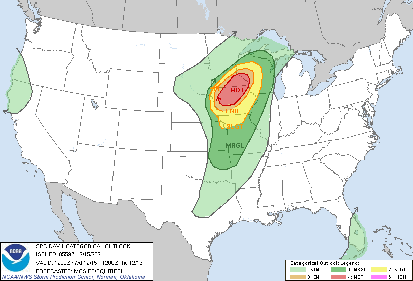
Above - today's severe weather outlook includes a large area of Midwest and Ohio Valley under the gun for severe thunderstorms and tornadoes. The greatest risk is in the light brown area. Below - satellite and radar picture.

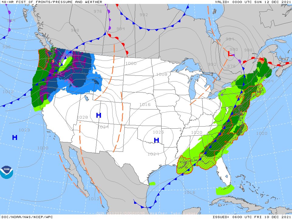
Above- showers move through New England....cold front gathering strength in Plains and that will be the reason for outbreak of severe weather today as described above. Some of that severe weather could
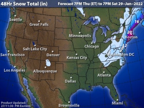
affect the East Coast Saturday. Below....48 hour snowfall....animated maps and rainfall through Wednesday.
affect the East Coast Saturday. Below....48 hour snowfall....animated maps and rainfall through Wednesday.


Below- snapshot weather for Saturday. Be safe.

 RSS Feed
