Not many people usually get off for Columbus day, but with the shutdown there will be more who will be able to go outside, so what will they be looking forward to?
Here's the GFS model for Monday morning at 8am EST:
Here's the GFS model for Monday morning at 8am EST:
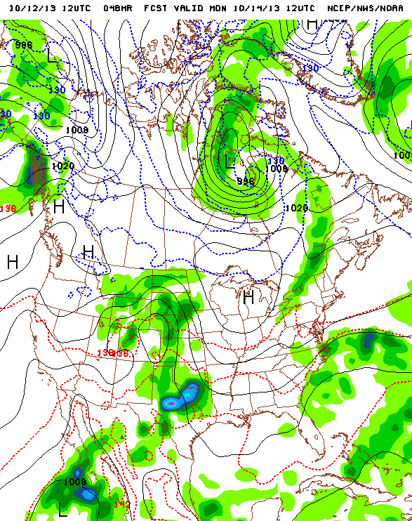
For the northeast there's a trailing cold front that should dissipate by the time it gets to central NY state with the Adirondacks. There's still a stalled low pressure system off the edge of NC, the snow that's plaguing the southern Rockies will remain, and plenty of instability will bring heavy rain to central TX and parts of OK. You can actually see on the bottom left of the picture the next Pacific tropical system which has a 50% chance of becoming Tropical Storm Octave. Speaking of the tropics though:
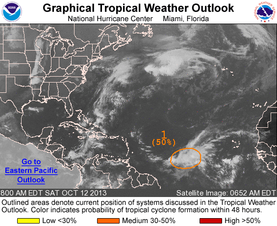
Here's the latest snapshot of the tropics, with the area highlighted being the greatest chance of becoming Tropical Storm Lorenzo. More info will come out once it becomes more organized.
Finally why we're not seeing the large amount of rain that's currently over DC and its surrounding area: the system knows who deserves to get rained on. No just kidding, here's the reason:
Finally why we're not seeing the large amount of rain that's currently over DC and its surrounding area: the system knows who deserves to get rained on. No just kidding, here's the reason:
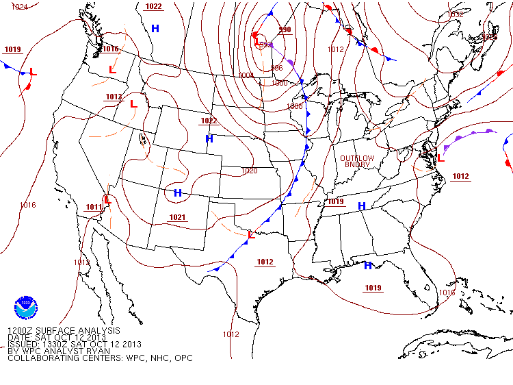
High pressure shears away any precip that tries to get north of NJ so we're in the clear. We'll keep an eye on the possibility of Lorenzo forming, but other than that the NY metro area will have a long string of sunny days with similar temps each day. Enjoy it.
-Mike Merin
-Mike Merin

 RSS Feed
