Metro Weather Inc. Services
Like us, follow us, link to us, contact us!
  • Home
    • Daily Weather Discussion
  • Weather Prepared for You
    • Film and TV Production
    • Radio & Television
    • Government and Industry
    • Forensic Services >
      • Weather Record Request Form
    • Metro Morning Monitor
  • About Metro Weather
    • Senior Staff
  • Your Weather Images
  • Contact Us

Wintry West moving east.......slowly

12/4/2013

0 Comments

 
Picture
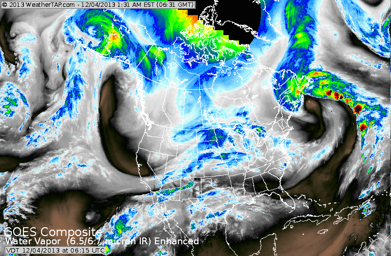
Water vapor satellite shows stormy weather in Plains (dark blue). That's leading edge of arctic air. Notice the big "u" shaped pattern in Pacific...that system heads southeast to Gulf of Mexico and turns up East Coast Sunday and Monday. Away from coast...cold air trapped with result in ice...further north...interior New England gets it's first general snowfall....coastal areas should see rain...starting as snow/sleet.
Picture
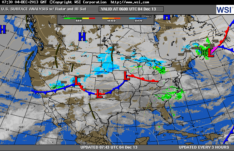
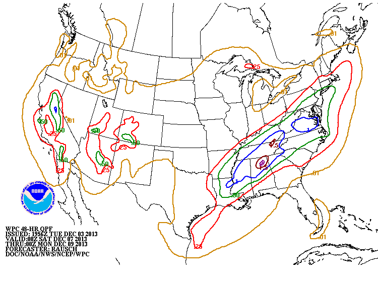
Above...you see the storm mid section...which heads northeast and allows cold air to move to the East Coast this weekend. Below...amounts of precipitation expected this weekend.
Picture
Picture
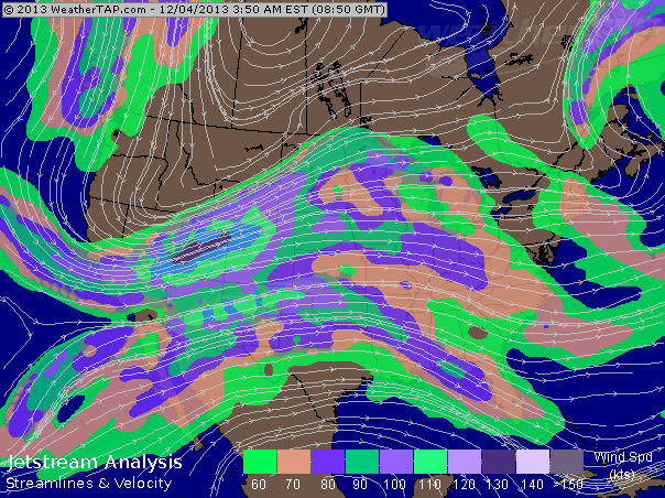
Jet stream map...look in the far upper left. The jet streak coming south will be the instigator for the storm in the East Sunday and Monday.
Later.
0 Comments


Leave a Reply.

    Genesis of a Tornado
    We'll have daily weather discussions, talking about major systems on the horizon along with anything noteworthy that pops up on our radar.

    Pat Pagano,
    Mike Merin

    Follow us on Twitter and like us on Facebook to get updates whenever we post a new entry!

    RSS Feed

Powered by Create your own unique website with customizable templates.