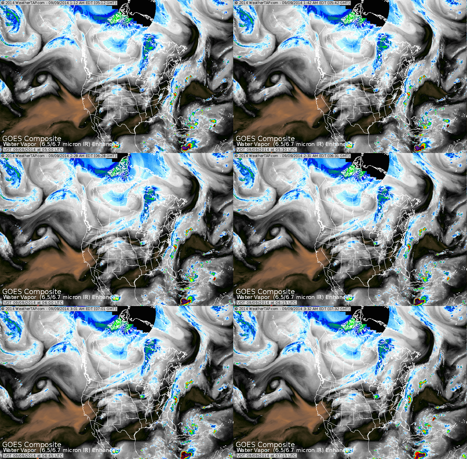
Satellite shows arctic cold front from Montana to Central Canada. Front will drop south and east and bring snow to Northern Rockies...while severe storms break out in Midwest today and head for Ohio Valley Wednesday. Front along east coast will tease Northeast with some rain or drizzle.
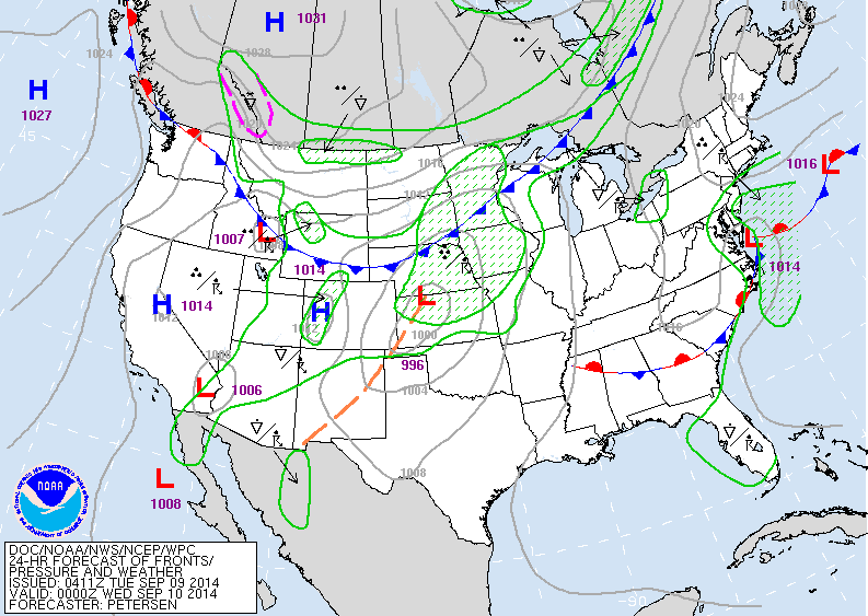
Map above for late today. Weak low along mid Atlantic coast bringing damp weather there. Cold front in Plains bringing snow to Northern Rockies and storms in Midwest and Plains.
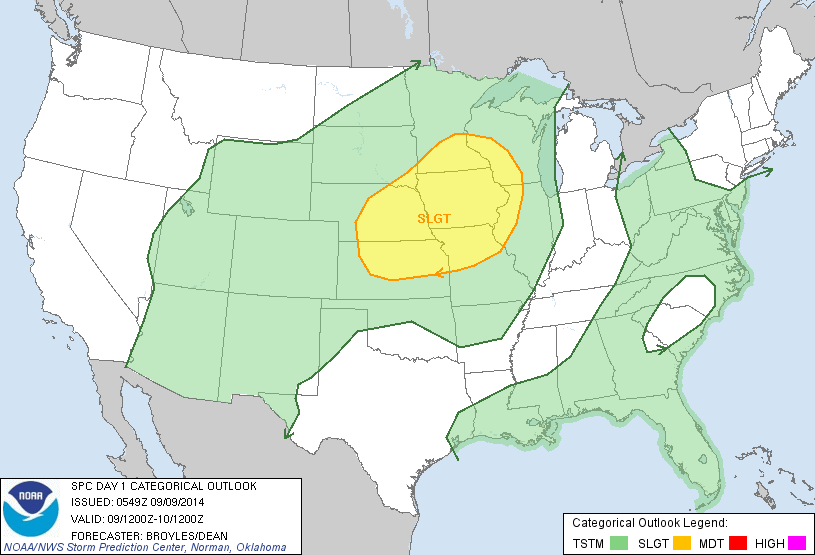
Map above - shows risk of severe weather in yellow for today and tonight.
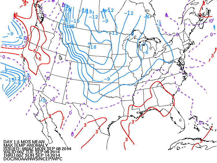
This map shows how daytime temperatures will average thru this weekend. Notice...15 to 20 below normal in Plains and Rockies.
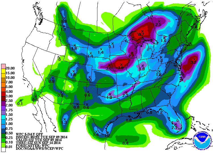
Amounts of rain expected from today thru Sunday.
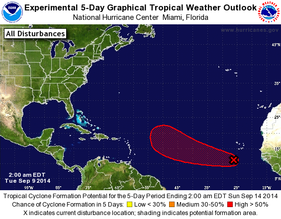
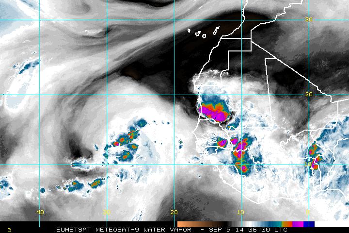
Above - hurricane center watching this disturbance off Africa. Below..satellite picture of it...but notice the "black" that is dry air....do atmosphere not the greatest. Be safe.

 RSS Feed
