
You can see our California low over The 4 Corners Area....shoving moisture ahead of it. The Northern Jet is also evident across The Rockies. The 2 will phase but I don't think it will be as quickly as models suggest...therefore...precip. may not be as heavy...nor will things get as warm. There is still concern that the banked up cold air will lead one to a path of error....so that normal parameters that would suggest snow to rain...may not verify. There are lots of things about this situation that just don't sit right with me this a.m. Hopefully things will become clearer late today.
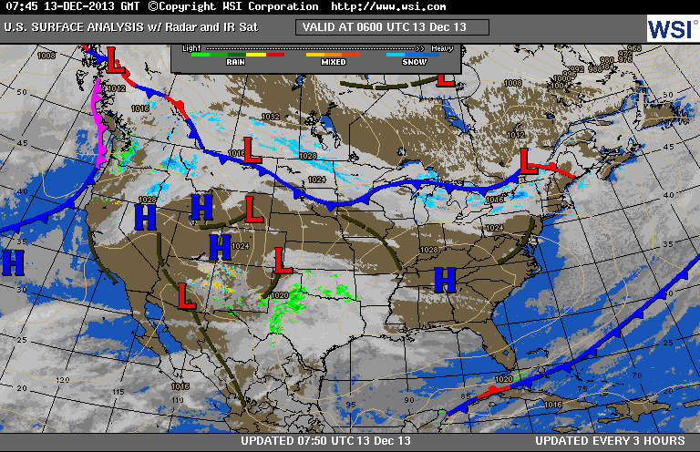
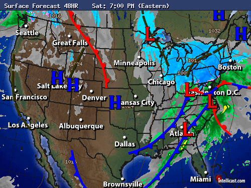
Two maps above: first - current surface map...showing our storm moving thru Southern Plains. Second...what map will look like by
early Saturday evening.....a mess ! 2"-4" of snow from NY Metro
changing to sleet then rain..... 4"-8" interior NJ - Pa - NYS - New England...with a foot or more for NH & Maine. 4"-8" also possible across Ohio Valley.
early Saturday evening.....a mess ! 2"-4" of snow from NY Metro
changing to sleet then rain..... 4"-8" interior NJ - Pa - NYS - New England...with a foot or more for NH & Maine. 4"-8" also possible across Ohio Valley.
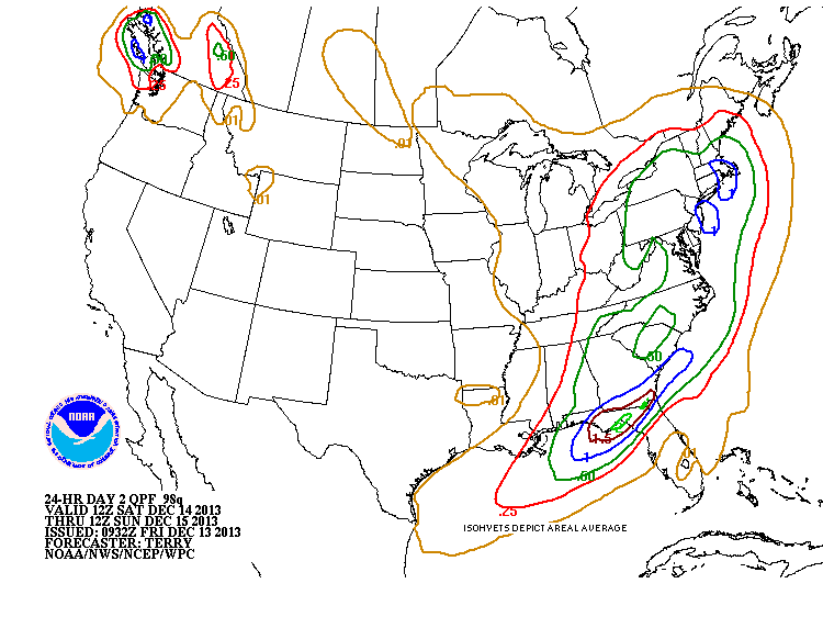
Above map shows amount of liquid to fall with this system. The 1" AMOUNTS (BLUE) mainly due to rain. As with all storms..things will change and so will our postings...so keep with us and be safe.

 RSS Feed
