SATELLITE SHOWS 2 JET STREAMS ON THE MOVE FROM WEST TO EAST, YOU CAN SEE THE POLAR VORTEX IN EASTERN CANADA..AND IN IT'S PRESENT POSITION...ANY STORMS ALONG THE JET WILL HEAD THRU CAROLINAS AND OUT TO ATLANTIC. SYSTEM ON WEDNESDAY COULD BRING SOME SNOW TO NORTHEAST...BEST CHANCE EASTER L.I. AND CAPE COD. (CLICK ON IMAGE TO ENLARGE)

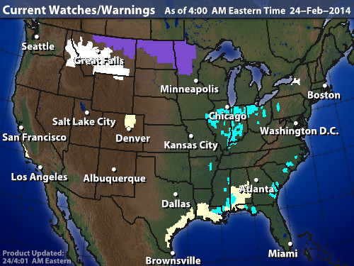
MAP BELOW...SHOWS CURRENT WATCHES AND WARNINGS: NOTICE THE WINTER ADVISORIES DOWN SOUTH.
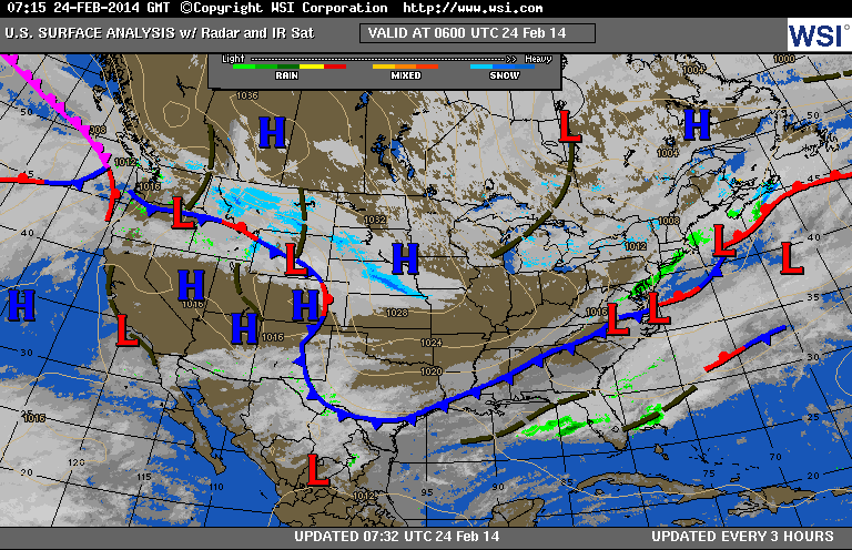
CURRENT SURFACE MAP BELOW SHOWS COLDER AIR SPREADING OVER MUCH OF THE NATION - EAST OF ROCKIES., IN THE NORTH...THE COLD WILL BE MORE LIKE JANUARY THAN LATE FEB.
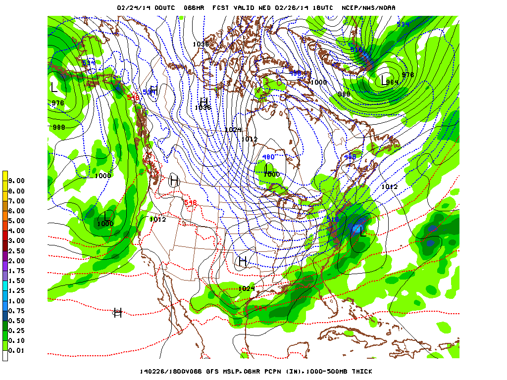
MAP ABOVE IS FOR MID DAY WEDNESDAY FROM GFS MODEL. SHOWING LOW OFF MID ATLANTIC WITH THE HEAVIEST PRECIP JUST OFFSHORE. ON THIS TREND...1-3" COULD FALL OVER EASTERN L.I AND CAPE COD. COULD THIS LOW TURN MORE NORTH AND BRING SNOW TO CITIES LIKE PHILY - NYC ? YES....BUT AT THIS TIME...MODELS INDICATE THAT WILL NOT HAPPEN AND NO REASON TO DOUBT THEM AT THIS TIME....SO LET'S GO ALONG WITH THE FLOW. NEXT SYSTEM
TO WATCH WILL BE THIS WEEKEND. MORE ON THAT LATER. BE SAFE.
TO WATCH WILL BE THIS WEEKEND. MORE ON THAT LATER. BE SAFE.

 RSS Feed
