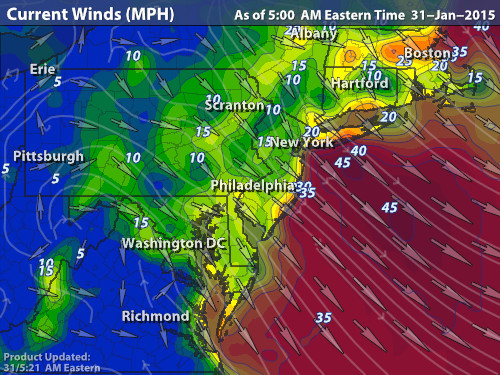
Winds of 20-30 MPH from the NW with up to 40MPH gusts are still plaguing the tri-state area. These should lessen by 5-10 MPH throughout the day and much more at night. Be careful outside as wind chills will be below zero.
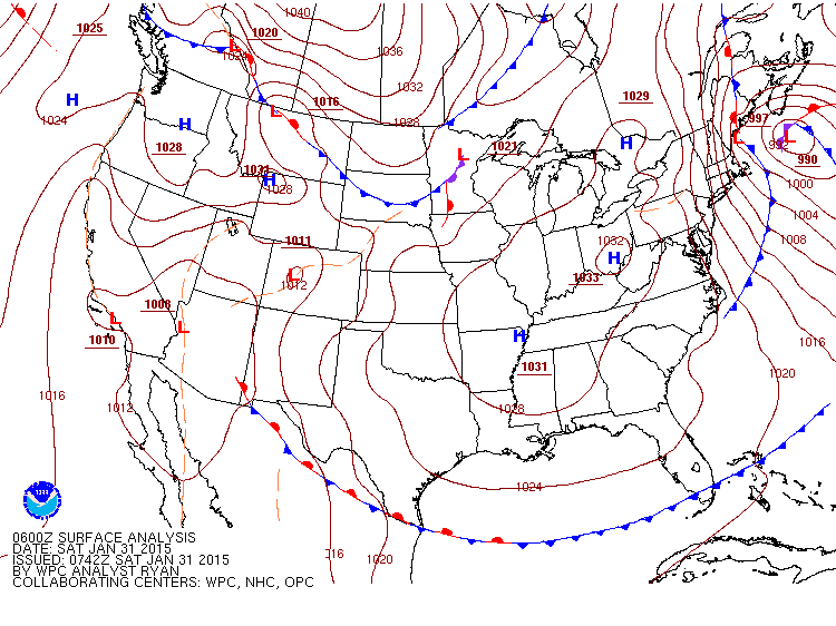
You can see the culprit in the picture below, a strong area of low pressure that's to the east of New England. That tight pressure gradient (and temperature) is causing our current problems.
As for the Superbowl snow storm, current models have the storm tracking with the low 10-20 miles south of NYC as it passes through. GFS is edging towards partial wintry mixed precip early on Monday while the rest are all snow. Temperatures indicate that it will be an all-snow event.
6PM-10PM: 30% chance of passing flurries ahead of the storm <.50"
10PM-1AM: 60% chance of light snow showers 1-2"
1AM-7AM: 100% heavier snow showers 4-6"
7AM-2PM: 100% heavier snow showers with higher winds 3-5"
2PM-6PM: 80% snow showers with higher winds 1-2"
6PM-9PM: 10% leftover flurries
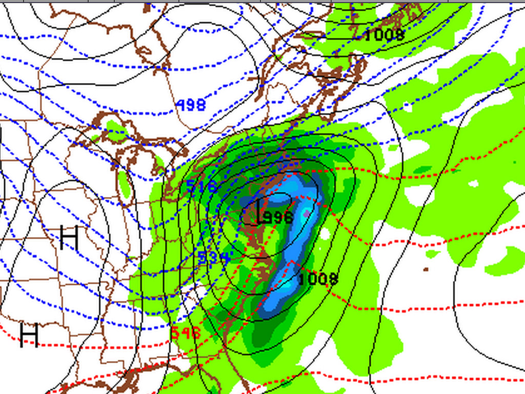
The picture below is Monday at 10AM when the storm is right over us. Those tight gradients will once again cause us problems with winds. More to come tomorrow as the models come together more.
-Mike Merin


 RSS Feed
