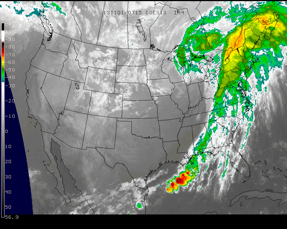
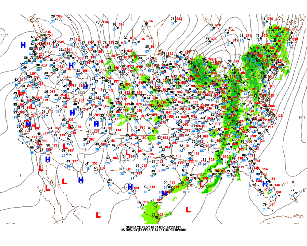
Top: Satellite picture showing the strong cold front moving into The East. Some places getting strong winds there...up to 50-55 mph. A severe thunderstorm watch could go up for parts of Northeast and Mid Atlantic today. Just above....surface map also showing this front. Notice the closeness of the isobars ? That's why there will be so much wind in many places today.
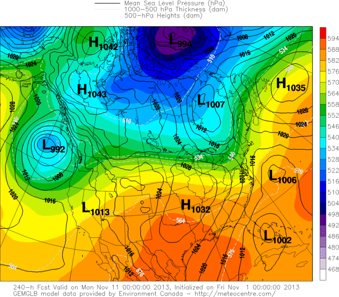
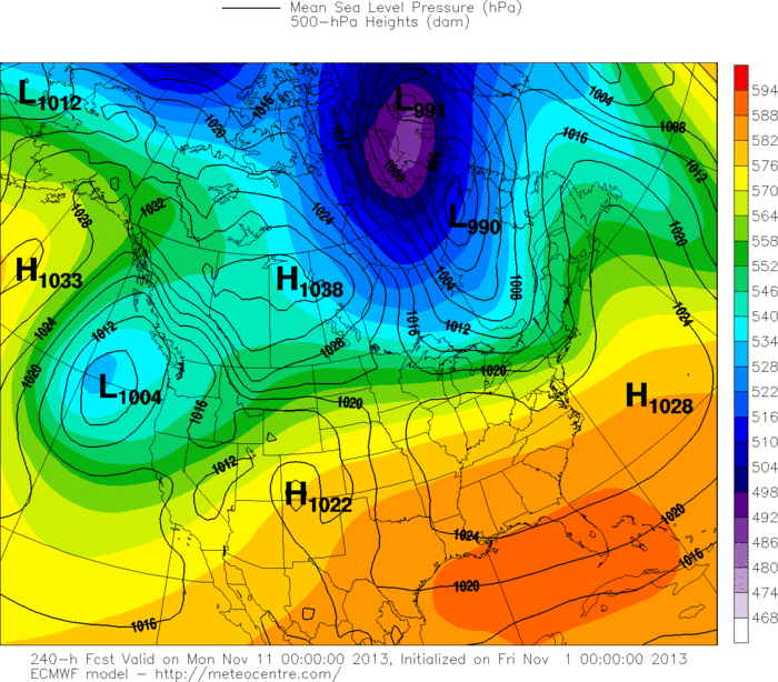
Below...we take you to the question as to whether or not the Canadian Model is on to something concerning the tropics and Florida. All week insisting on something there this time next week. Below...I have posted today Canadian and then The Euro Model for the same period. For that part of the Nation...(Southeast) completely different. We see next week. Be safe..nice weekend. Later.
Below...we take you to the question as to whether or not the Canadian Model is on to something concerning the tropics and Florida. All week insisting on something there this time next week. Below...I have posted today Canadian and then The Euro Model for the same period. For that part of the Nation...(Southeast) completely different. We see next week. Be safe..nice weekend. Later.

 RSS Feed
