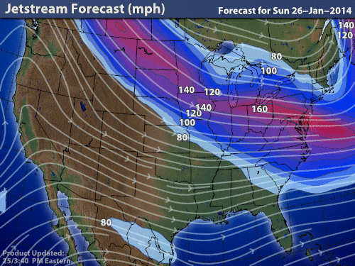
The Jet Stream will be making an appearance this week, driving from Alberta, Canada all the way through the US into the mid-Atlantic seaboard.
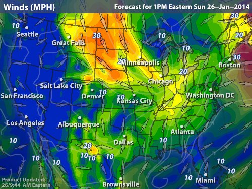
The areas hardest hit will be the Dakotas with 40MPH sustained winds and 60MPH gusts, then gradually getting weaker as it dives south. By gradual I mean that we'll still see 40MPH gusts in OK and St. Louis, even seeing up to 40MPH in New England.
Now for the wintry weather. Tomorrow for the NY metro area we'll only see a chance of a few scattered snow showers pass through. It will be much like yesterday only shorter lived. The difference though is that we'll also be just above the freezing mark so the snow will be denser. Once that all passes, it'll be back to very cold temperatures well below the averages of 39/27 for this time of the year.
Tuesday and Wednesday will be approaching 20° for the highs and into the lower teens and upper single digits respectively for the lows. We'll have to wait until Thursday before seeing milder weather and Friday before we get back near seasonal temps.
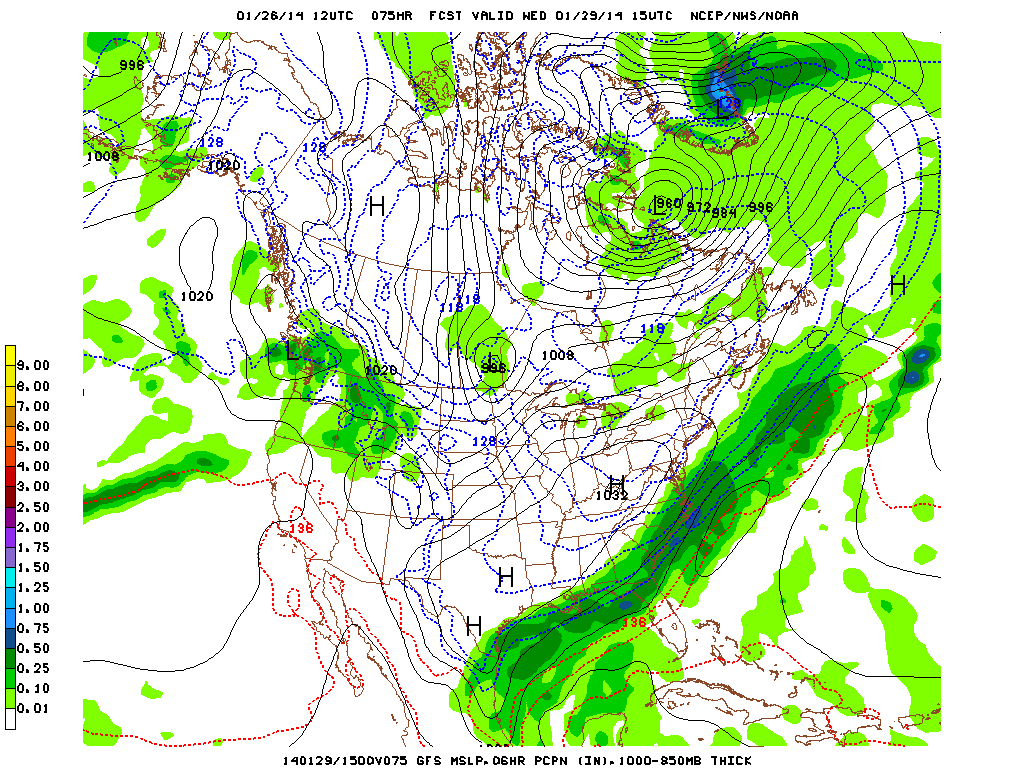
Finally the wild weather. This is what we'll see on Wednesday: a HUGE band of precip that will just be missing us to the south bringing ice, yes ICE into the south and a good amount of snow all the way down into Florida. This large band will form over the next few days from the Deep South and will continue to miss us throughout the week but nevertheless will create some very turbulent and windy weather for those in its path. I'm just amazed at how far it will stretch across the nation, and how there's a possibility of widespread possible thunderstorms in the southern half of it for this time of year.
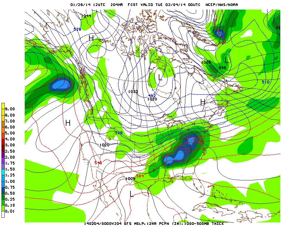
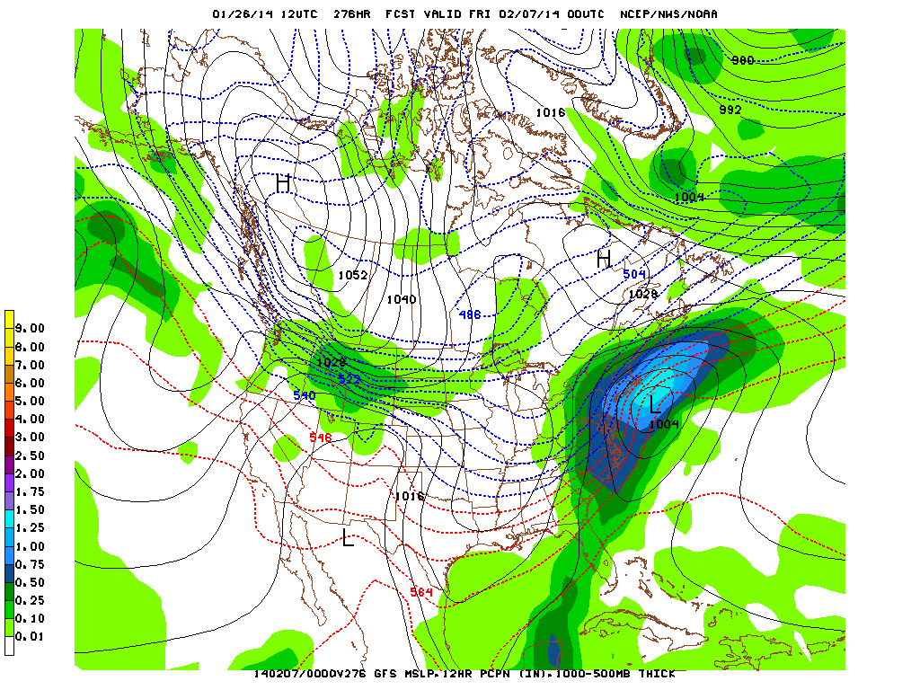
The real wild weather though is something coming up next week, two possible snowstorms arriving next Monday/Tuesday as well as another huge one on Friday. Take a look for yourself below
The real wild weather though is something coming up next week, two possible snowstorms arriving next Monday/Tuesday as well as another huge one on Friday. Take a look for yourself below
We'll keep an eye on these as the week goes on. Hopefully the models are just trying to give us something exciting to look at after this quiet week.
-Mike Merin
-Mike Merin

 RSS Feed
