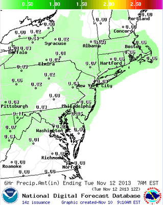
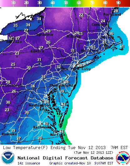
With the cold front moving through the Northeast after the sun goes down on Veteran's Day, many areas will see snow towards the morning. But as you can see from the lows above, the coastline will have a much lower chance of seeing the changeover to snow, including the NY metro area.
Remember though that even if lows are 35° (CT, RI, Boston, etc.) there is a good chance of snow in the upper levels of the atmosphere that can fall down to the surface. Granted the snow will melt upon contact with the surface, many people will still get to see some of the first snowflakes of the season. It was in the 60's a few days ago right? Things can change so quickly.
Remember though that even if lows are 35° (CT, RI, Boston, etc.) there is a good chance of snow in the upper levels of the atmosphere that can fall down to the surface. Granted the snow will melt upon contact with the surface, many people will still get to see some of the first snowflakes of the season. It was in the 60's a few days ago right? Things can change so quickly.

We also won't be seeing much in precip amounts overnight, so even if people see snow showers, at most half of an inch of it will fall down a fraction of that having a chance of sticking. Remember that in the amounts to the left, much of that will be rain before possibly changing over to snow.
Much of the nation for the rest of the week will be covered in high pressure, but we're keeping an eye on a system that will start to form next Saturday in the center of the nation a possibly bring a large amount of precip to the Northeast next Sunday night. As of now it looks like it will be warm enough to only cause snow in the upper elevations, but we'll have to wait a few days to see how the air movement will effect the temperatures.
Salute a vet tomorrow, and enjoy the holiday.
-Mike Merin
Salute a vet tomorrow, and enjoy the holiday.
-Mike Merin


 RSS Feed
