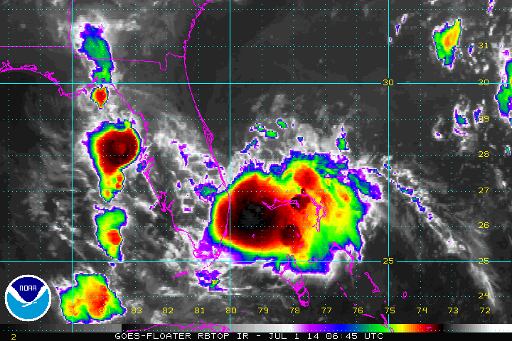
Above...IR satellite of tropical depression #1...soon to become Tropical Storm Arthur. He will move north..then
northeast affecting real estate thru Carolinas. After that he should turn northeast missing the Northeast. A front stalled along the coast could complicate the picture.
northeast affecting real estate thru Carolinas. After that he should turn northeast missing the Northeast. A front stalled along the coast could complicate the picture.
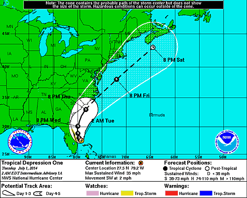
Above...early track from hurricane center which will likely be updated today as it becomes a tropical storm.
Above...NWS position for "Arthur" on Friday the 4th. We think that's a bit too slow. Also think that front will steer it more northeast....so things should clear up across the Northeast during Friday.
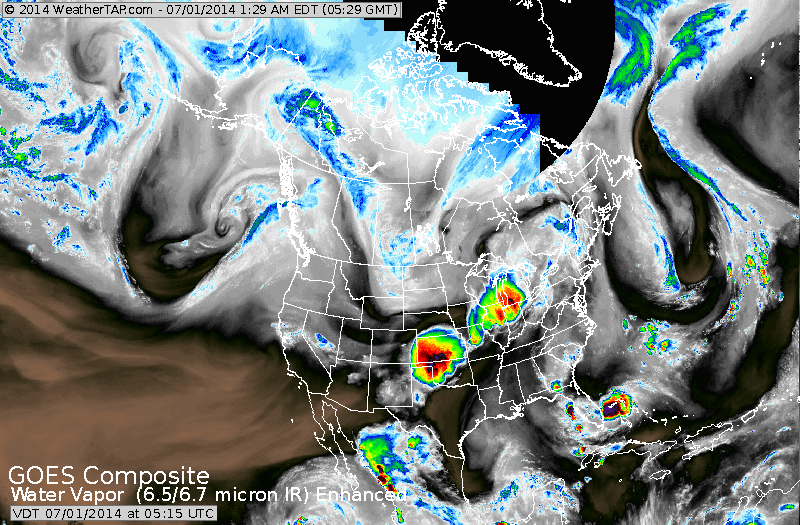
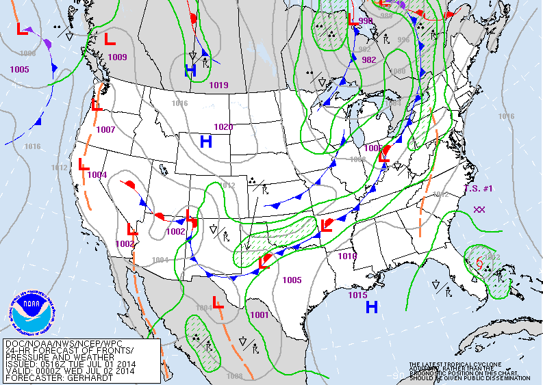
Satellite above shows depression off Fla. Cold front in Great Lakes continues to be a big thunderstorm producer...it will make it's way into Northeast Wednesday and Thursday. Cooler drier air can be seen in Rockies and Plains.
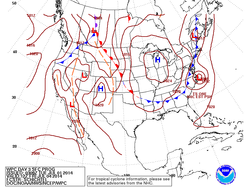
Above...today's map showing Arthur along the Central East coast of Fla. Cold fronts moving thru Great Lakes could complicate pix along the East coast with Arthur...but if anything may help to steer it out to sea off the Carolinas.
More on this thru the day. Later.
More on this thru the day. Later.

 RSS Feed
