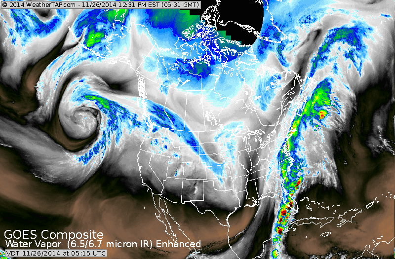
Storm moving up the East coast....6-10" from Appalachians thru Eastern Pa...into interior New England. Big cities will get rain...some sleet then some snow...but should escape the big snows. The line between heavy snow and rain will be very close...and should storm shift 30-40 miles east... then more snow from Washington DC to Boston. Good news is that the storm moves out late tonight and little if any precip. should fall on Thanksgiving Day. Flurries will continue over Great Lakes as you can see that energy diving down the Plains.
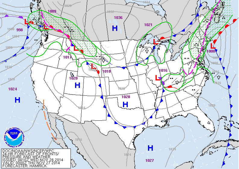
Map is valid for early this evening. Coastal storm is
south of Cape Cod...and that all important rain - snow line runs from Boston to NYC to Washington DC. Again..if that
storm jogs 25 miles to the east...then the snow line also
moves east. Time will tell.
south of Cape Cod...and that all important rain - snow line runs from Boston to NYC to Washington DC. Again..if that
storm jogs 25 miles to the east...then the snow line also
moves east. Time will tell.
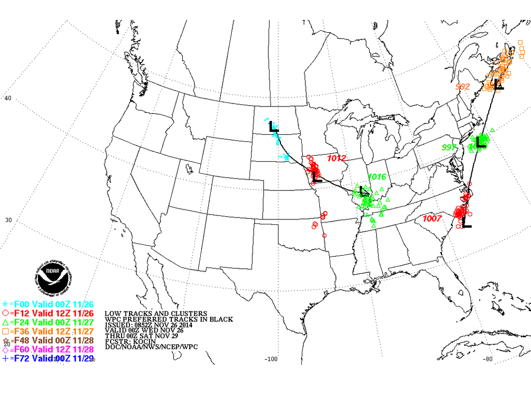
Above - storm track. The green..red...yellow colors show the positioning of other models...all of which are clustered in same area....agreement !
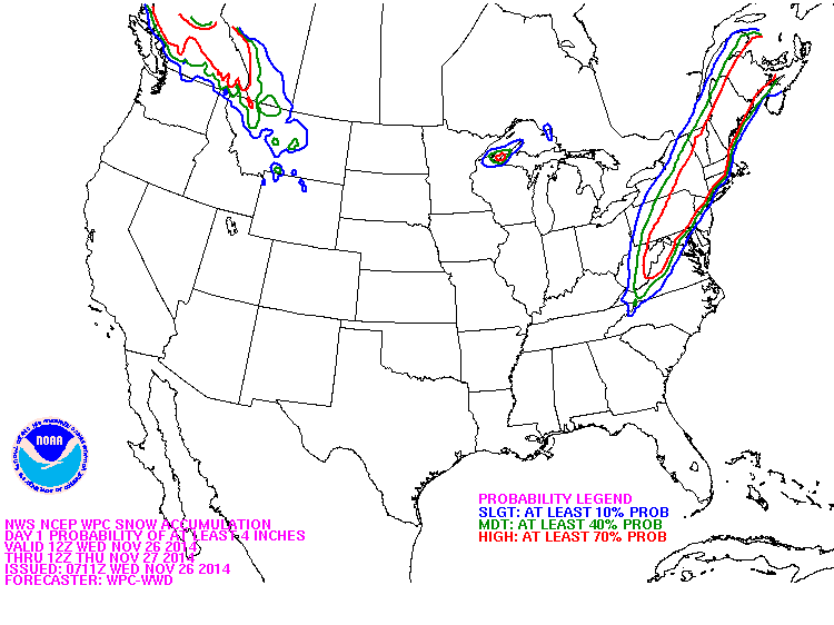
Above...probability of 4" or more of snow. Notice the distance in the big cities between 10% (blue) and red (70%),
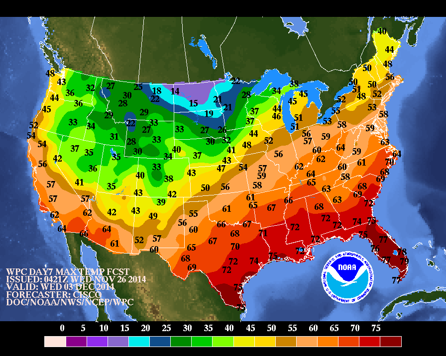
Above....daytime temperatures expected next Wednesday.
Eastern half warms up..west cools down while California
get much needed rain....but with that will come mud slides and floods. Have a happy and safe Thanksgiving .
Eastern half warms up..west cools down while California
get much needed rain....but with that will come mud slides and floods. Have a happy and safe Thanksgiving .

 RSS Feed
