
Above....Wet for the East Coast...with snow on the western edge.
Next surge of moisture in Pacific Northwest...but you can see how there are more surges just coming in off the North Pacific. An upper low near
Hawaii....will spin moisture east in the southern jet.
Next surge of moisture in Pacific Northwest...but you can see how there are more surges just coming in off the North Pacific. An upper low near
Hawaii....will spin moisture east in the southern jet.
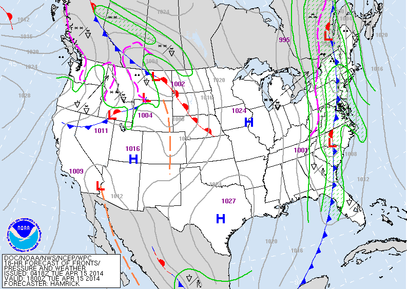
Above...today's weather map showing the front and wet weather up and down the east coast along with winds of 40 mph or higher. Fair mid section..then unsettled from Northern Rockies to Pacific Northwest.
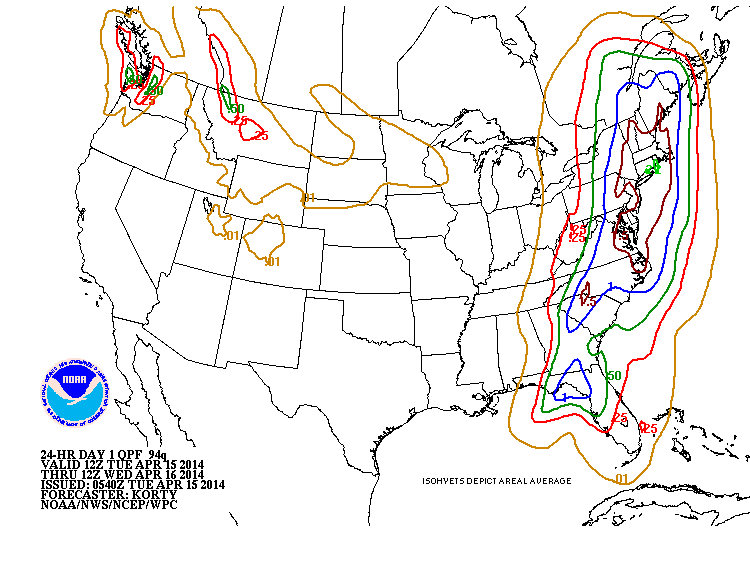
Below...amounts of rain that will fall over the next 24 hours...with the
Northeast getting the brunt of it.
Below...amounts of rain that will fall over the next 24 hours...with the
Northeast getting the brunt of it.
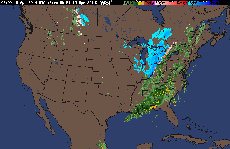
Above...early morning radar....blue indicates snow....pink...sleet..green -plain old rain. Yellow could indicate heavy rain and/or thunderstorms.
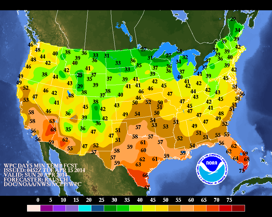
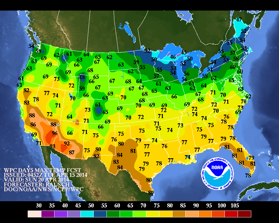
Above 2 maps....first showing temperatures for Easter Sunday morning...for all those egg hunts and religious services. Bottom...
high temperatures for Easter Sunday afternoon. A closer look tomorrow
at where the sun will be and rain will fall on Easter Sunday. Later.
high temperatures for Easter Sunday afternoon. A closer look tomorrow
at where the sun will be and rain will fall on Easter Sunday. Later.

 RSS Feed
