
This satellite shows a cold front along East Coast...arctic air - center nation....and wet weather in the west. This pattern will not change much into next week.
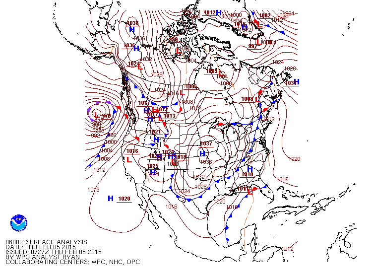
Map above shows a string of highs...test your geography.
One near Nebraska...Another over Alaska. This is arctic air..and they come down from Alaska to center nation and then southeast. This keeps the eastern 2/3 of the nation- cold. Lows in the Pacific head to Rockies and they move southeast cutting thru Ohio Valley. This pattern will produce a long duration of snow from Gt Lks to Northeast this weekend into next week...when some spots will easily get over a foot again.
One near Nebraska...Another over Alaska. This is arctic air..and they come down from Alaska to center nation and then southeast. This keeps the eastern 2/3 of the nation- cold. Lows in the Pacific head to Rockies and they move southeast cutting thru Ohio Valley. This pattern will produce a long duration of snow from Gt Lks to Northeast this weekend into next week...when some spots will easily get over a foot again.
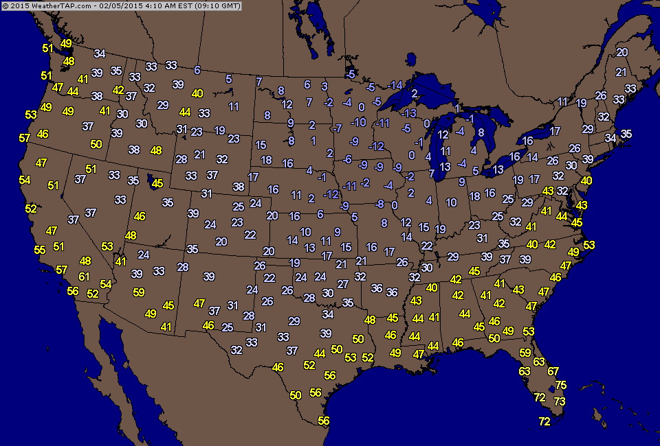
You need not be a meteorologist to find the cold front above. Draw a line from New England to Louisiana. Above..temperatures as of 4am this a.m.
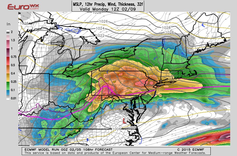
This is the Euro Model for 7am Monday. The low is over
se Virginia with heavy snow across Pennsylvania..No. NJ
NYC..and New England. These areas could see over a foot
by Monday night.
se Virginia with heavy snow across Pennsylvania..No. NJ
NYC..and New England. These areas could see over a foot
by Monday night.
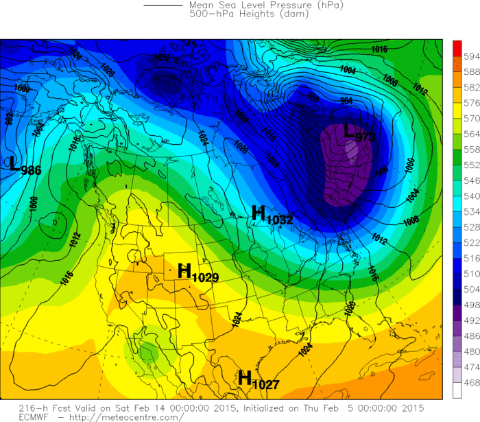
This is The Euro Model for next Thursday. The darker the colors...the colder the air. West is balmy...East is stingy cold. Be safe.

 RSS Feed
