
Sharp cold front in Midwest will head east and bring some rain
to the East by Tuesday. Upper air storm in Minnesota will
head south and stall and it could bring days of wet -much needed - weather to the East. Below...weather map for this evening showing cold front moving east.
to the East by Tuesday. Upper air storm in Minnesota will
head south and stall and it could bring days of wet -much needed - weather to the East. Below...weather map for this evening showing cold front moving east.

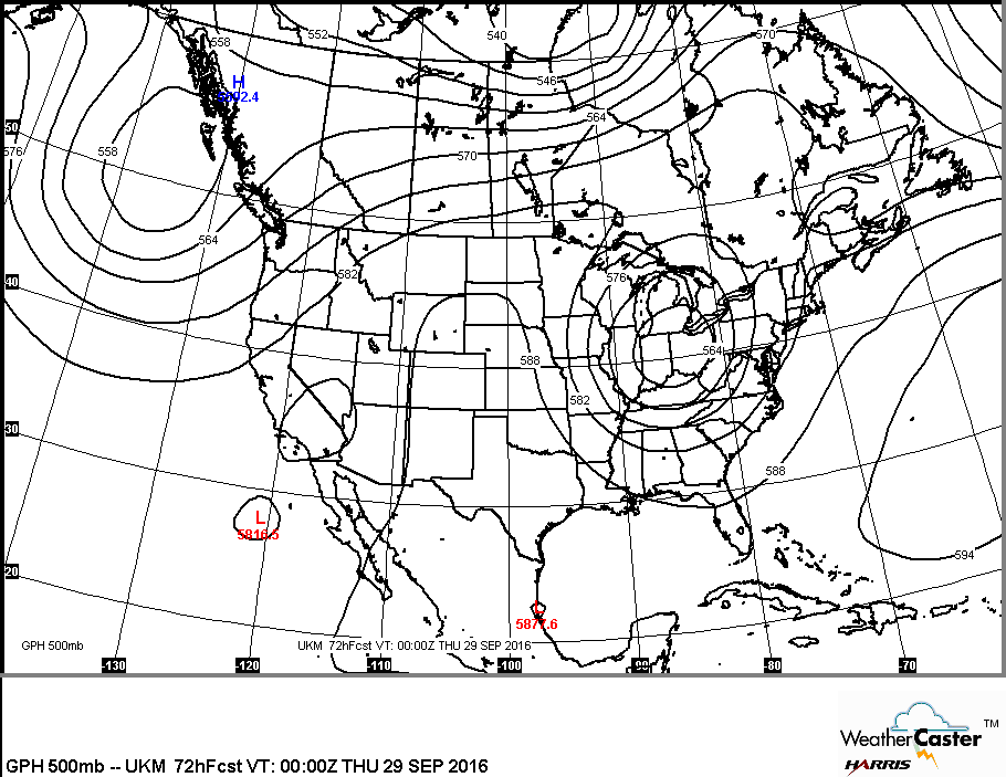
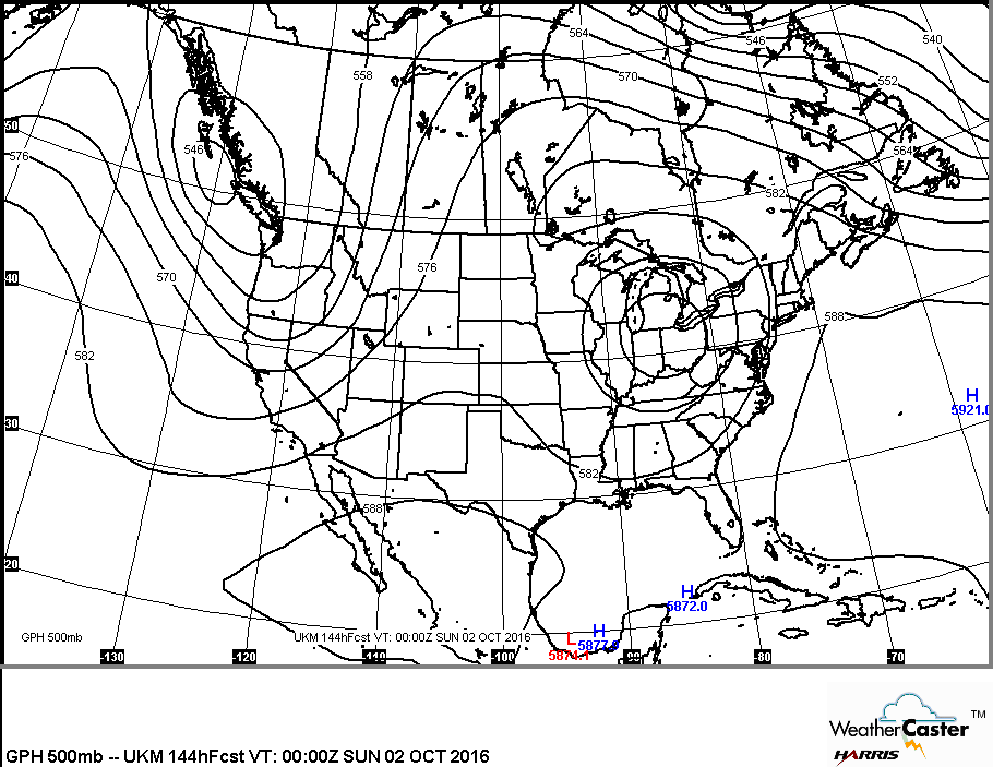
Below...a look at upper air for this Wednesday...showing upper low over Ohio Valley. Following picture is the upper air for this Saturday. Don't see much change ? Exactly...so weather will not change.
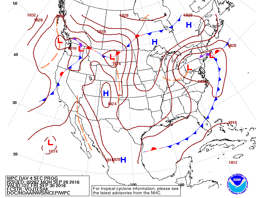
Below...how will the above yupper air transcribe to the surface. Map for this Friday.
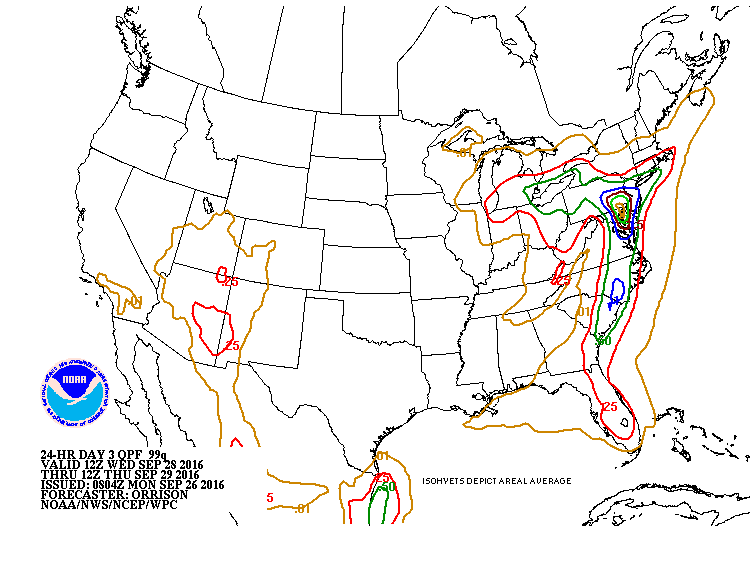
Following picture - amount of rainfall into midweek.
Lastly, a look at the tropics. Wave in south central Atlantic is forecast to become a major hurricane by several models and threaten the Eastern Seaboard. Much too early to speculate but needs to be watched. If it does form...it would be given the name....Matthew ! Be safe.


 RSS Feed
