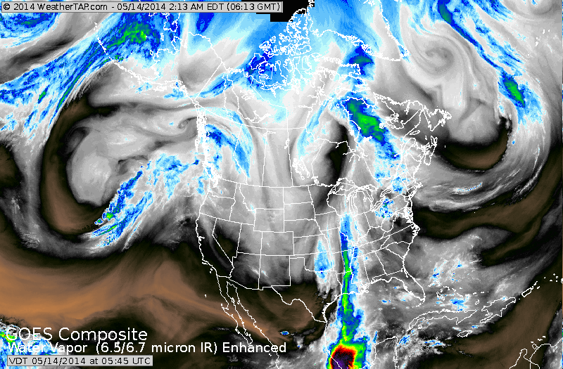
Above....follow the flow...moving down The Rockies...curving up across Texas to The Great Lakes. That's the powerhouse jet stream or trof. The heaviest rains moving north from Texas....with some heavy rain now in The Northeast. As that jet moves east....heavy rains of 1"-3" are likely all across The East by end of the week.
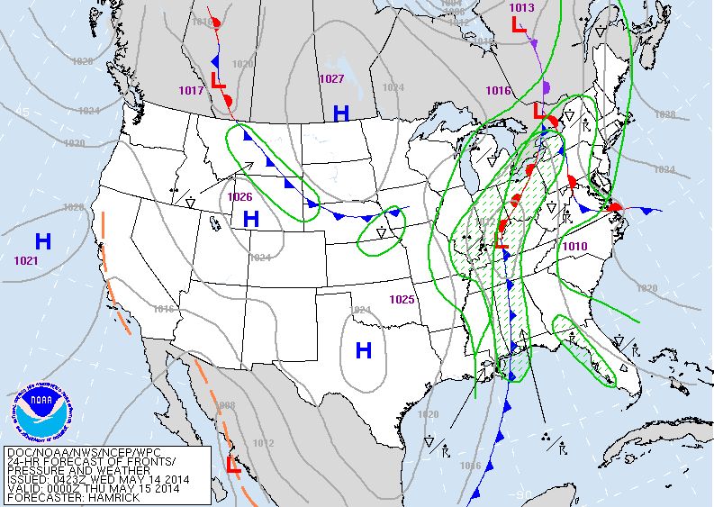
Above: today's map...showing the front heading east with all of it's rain. Cool high pressure in Plains...Hot out West.
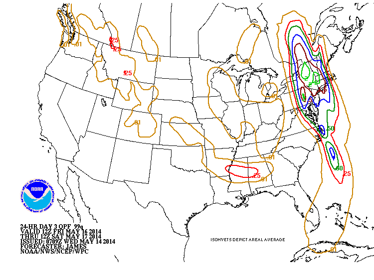
Above - map showing amounts of rain Friday into Saturday....clearing will need an ark in Northeast and Mid Atlantic....especially late Friday & Friday nite.
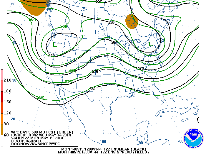
Above...upper air flow at 18,000 ft. This is where we find the jet stream. According to this mean flow chart....cool - unsettled weather for the west and east....best weather...mid nation.
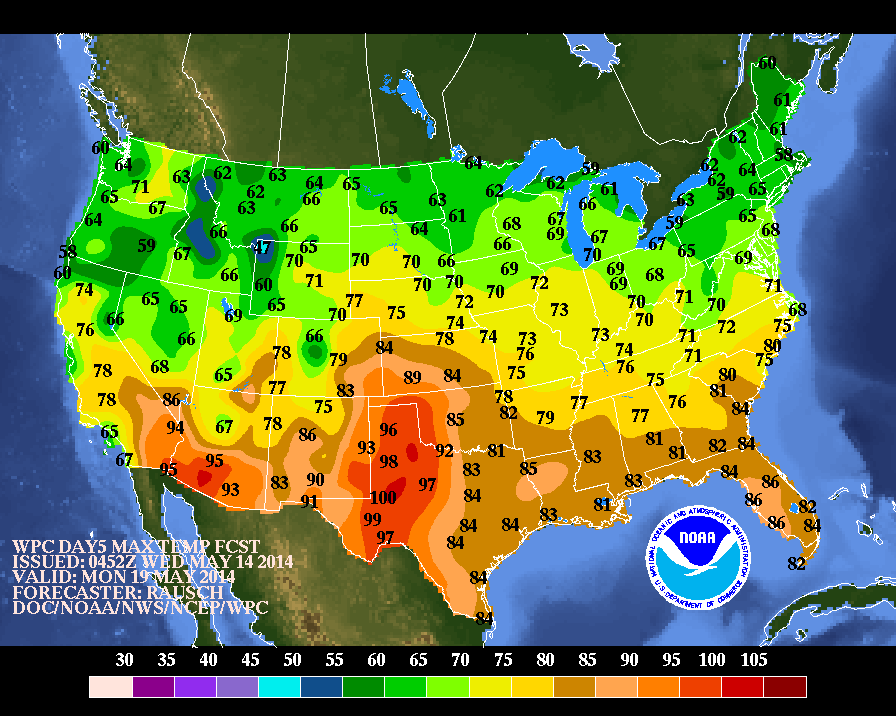
Above - map depicting high temperatures for this coming Monday. Notice how the green...cool air...has seeped south. The warm weather confined to the southern third of The Nation. I have a feeling that this could prevail thru Memorial Day Weekend...especially since it comes early this year. We'll see. For now...be safe.

 RSS Feed
