
Satellite shows conveyor belt of moisture moving from Fla., to Mid Atlantic....this rain should reach southern New England Thursday. Powerhouse storm east of Vancouver, B.C. will bring wind and wet weather to The Northwest,
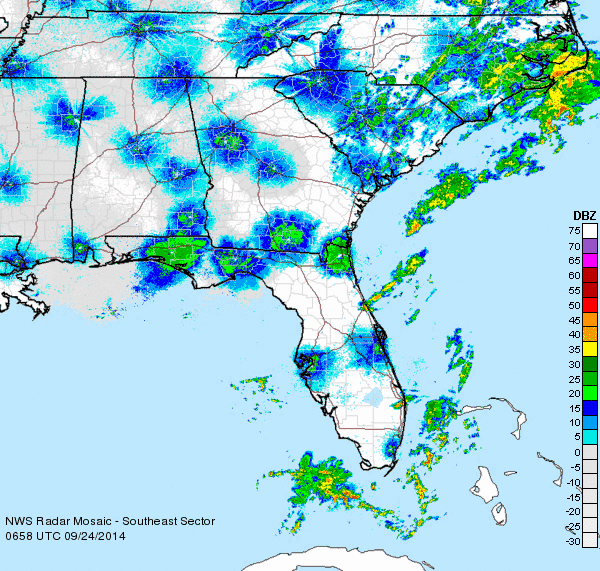
Early morning Wednesday radar shows rain over Carolinas marching north. This will give the Mid Atlantic heavy rain...and they can use it.
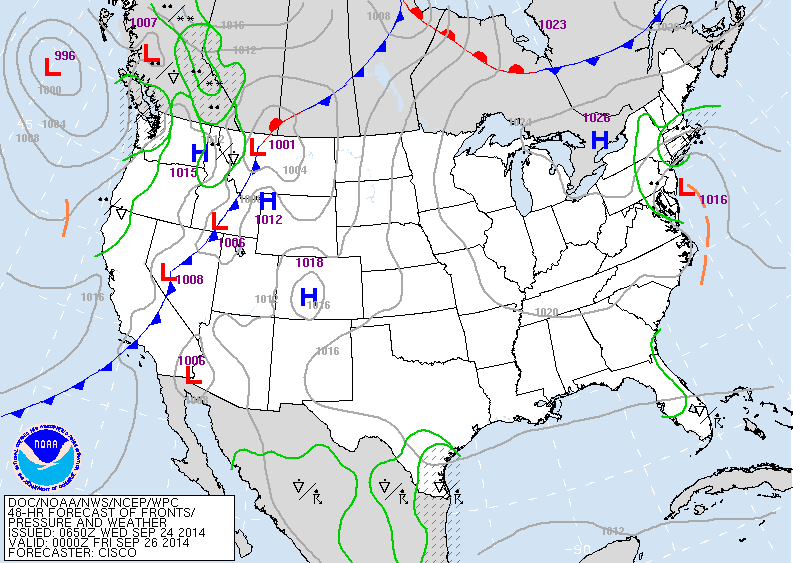
The map above for late Thursday....shows the low along Mid Atlantic coast with rain. Unsettled in Northwest and southern Texas.....rest of The Nation...no problem.
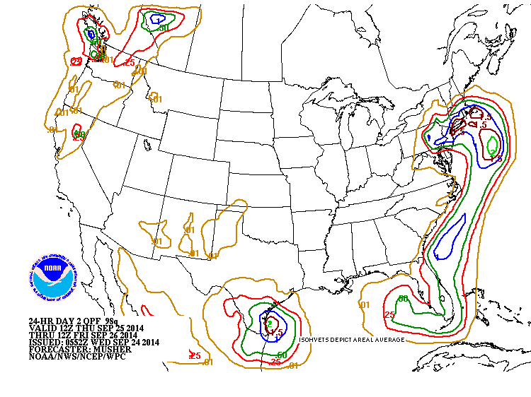
Above...amounts of rain which will fall thru Thursday. The brown indicates 1.50"....which I think is a bit much and this could be overdone for those areas...nevertheless...first significant rain in some time for those places.
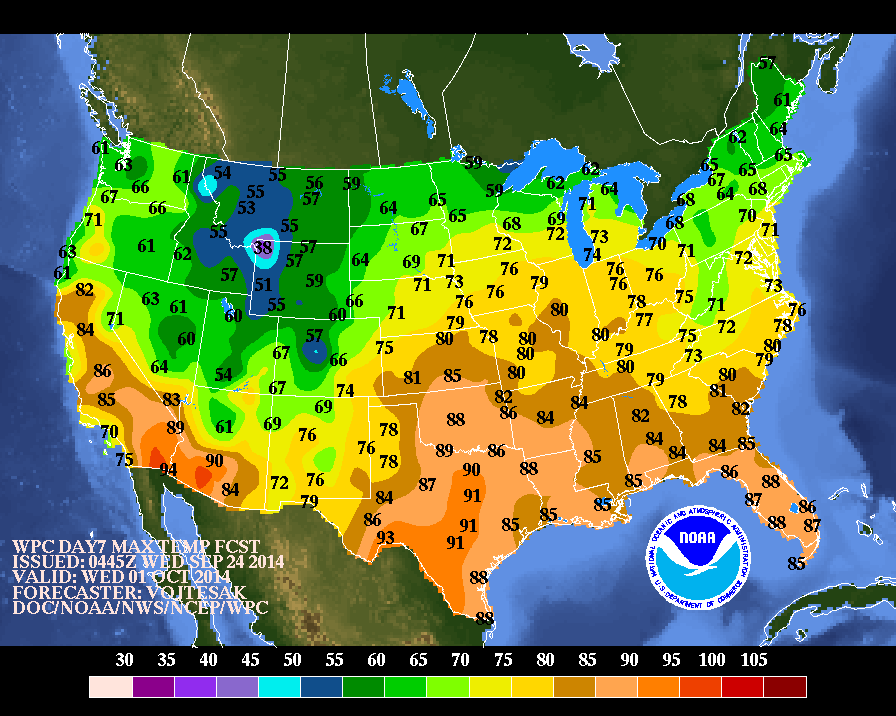
Above...high temperatures expected for next Wed., Oct. 1st. Notice how cold it is in the Rockies....a sign of things to come ? Be safe. Later.

 RSS Feed
