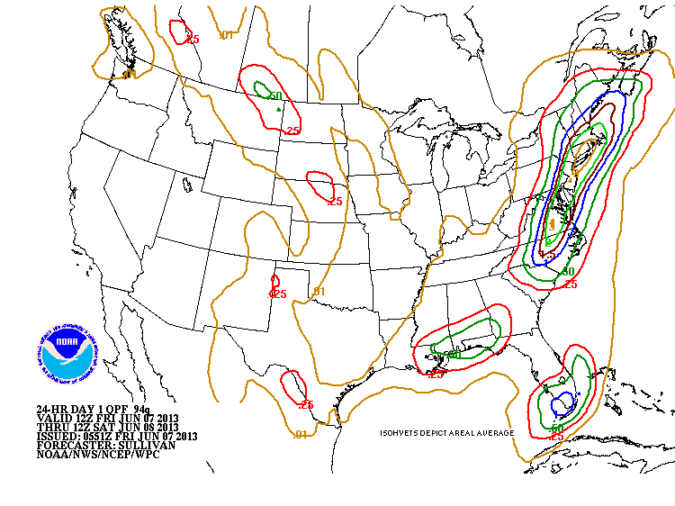
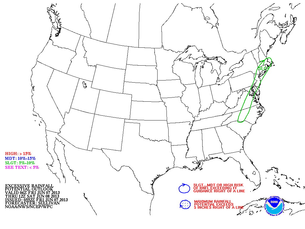
By now...we all know that heavy rains hit the 95 corridor today into tnte. Below - see the predicted amounts of rain....as the area expected to see excessive rainfall as depicted by The National Weather Service.
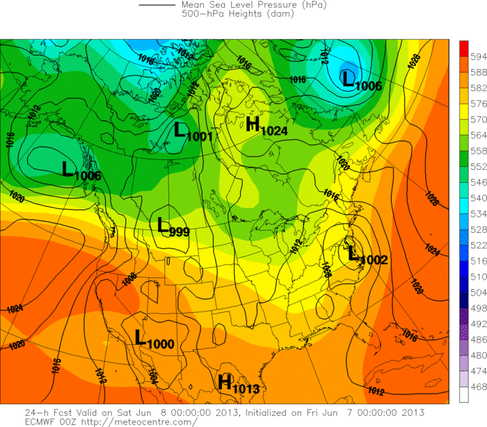
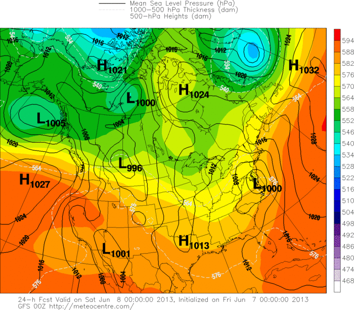
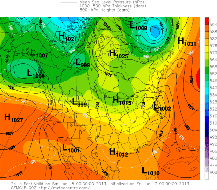
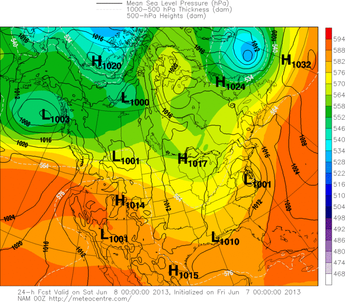
Below....here are all of the various models valid for 8 p.m tonight. Amazing how they all come together just before the event. Keep in mind that The Canadian gets the award on this one...first to call it...and almost exactly on track.
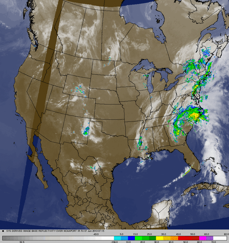
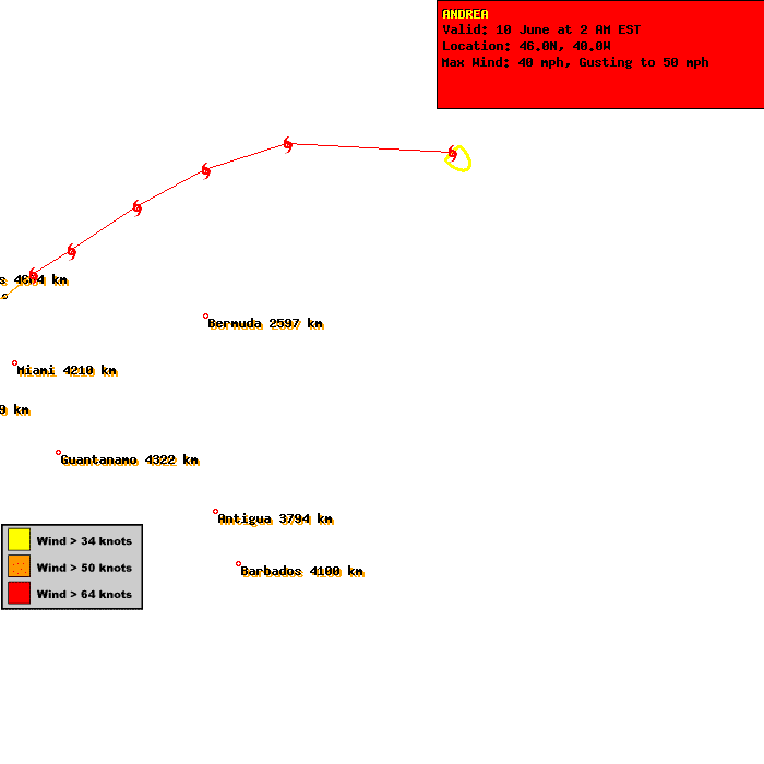
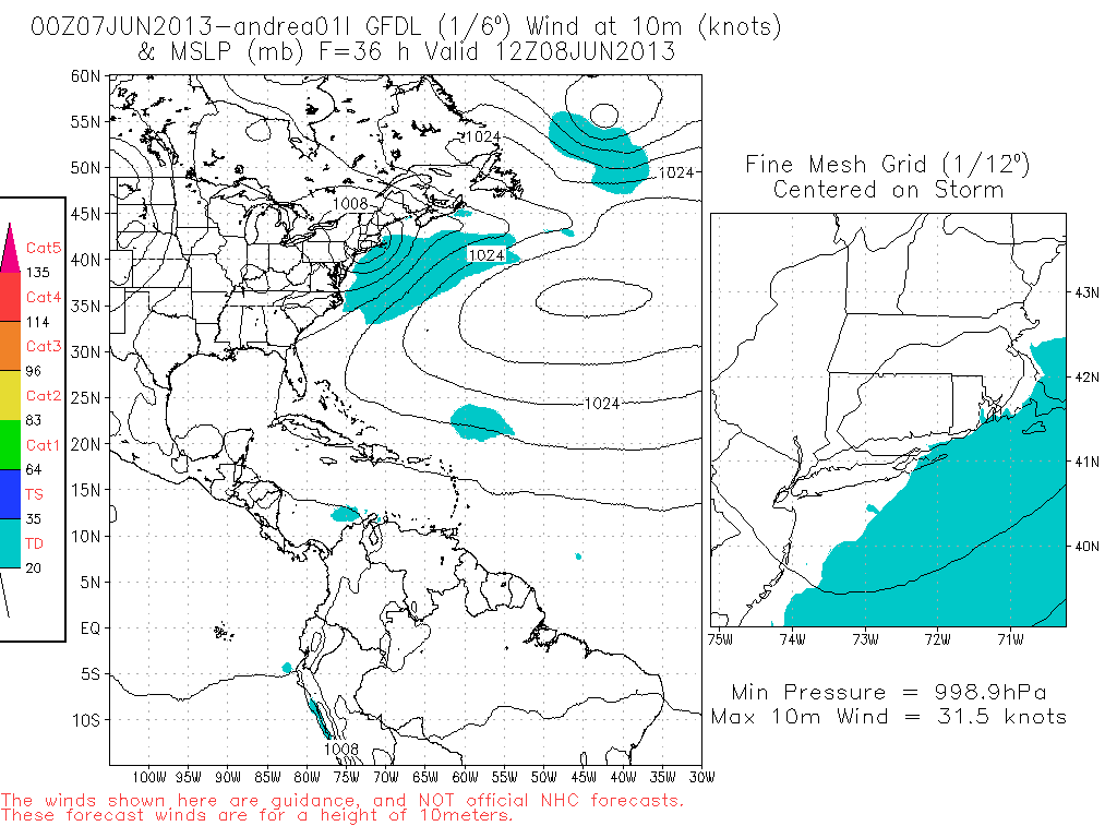
Below in order...you will see a combo Satellite/ radar picture....clearing showing Andrea working north. The is followed by her track.....and then The GFDL predicition of Andrea...a model long regarded as one of the best when it comes to tropical forecasting abilities.
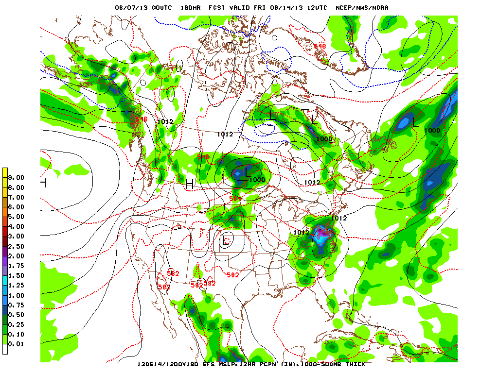
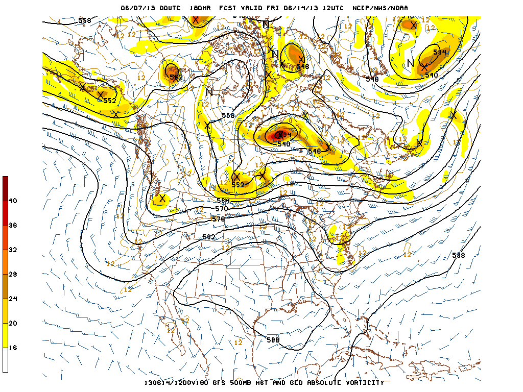
finally..... alook at what the Gfs is trying to do for one week down the road. It wants to take a short wave trof to the coast and create an unusual storm for this time of year. My long range forecast does not show anything even close....but that doesn't mean that the GFS could be wrong. If GFS pulls this off...I will be quite impressed. I do not feel that it's out of the question...but thinking that this entire pattern could actually be further south. So...below you will see the GFS surface and 500 MB flow for next Friday. We will watch and compare as we move thru next week. Be safe...and have an enjoyable weekend. Later.

 RSS Feed
