Metro Weather Inc. Services
Like us, follow us, link to us, contact us!
  • Home
    • Daily Weather Discussion
  • Weather Prepared for You
    • Film and TV Production
    • Radio & Television
    • Government and Industry
    • Forensic Services >
      • Weather Record Request Form
    • Metro Morning Monitor
  • About Metro Weather
    • Senior Staff
  • Your Weather Images
  • Contact Us

Wet & Mild Then Re-Freeze

1/11/2018

0 Comments

 
Picture
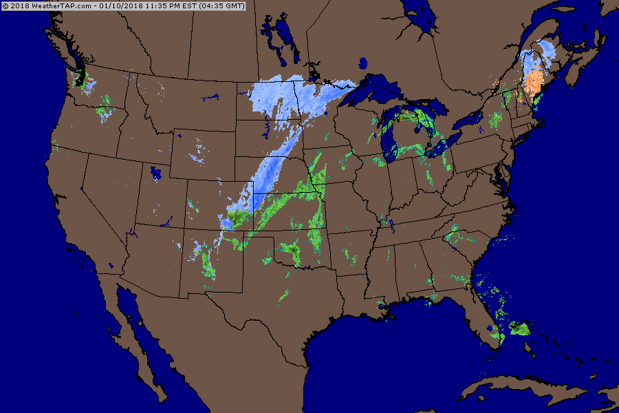
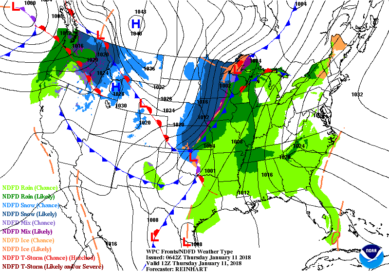
Above - radar shows rain changing to snow across the Plains.  Rain over the SOutheast and Ohio Valley into Northeast. Below - green areas indicate chance of thunderstorms today.
Picture
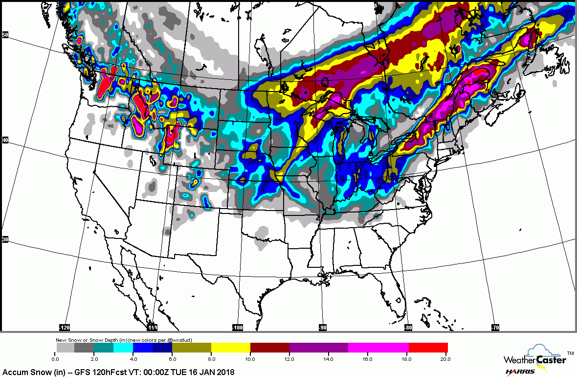
Below - snowfall predictions for next 5 days.....followed by animated maps for the next 2 days.
Picture
Picture
Picture
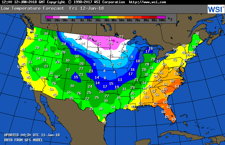
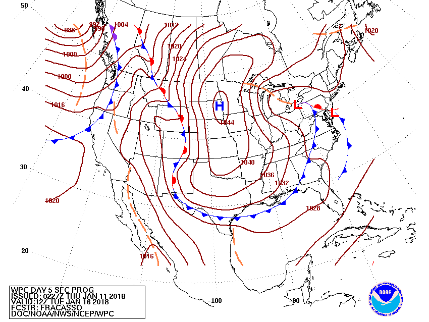
Above - temperatures expected by Saturday morning. Below - next Tuesday - clipper low reforming along mid Atlantic coast ...likely to bring snow to that area. More on that tomorrow.  Be safe.
Picture
0 Comments


Leave a Reply.

    Genesis of a Tornado
    We'll have daily weather discussions, talking about major systems on the horizon along with anything noteworthy that pops up on our radar.

    Pat Pagano,
    Mike Merin

    Follow us on Twitter and like us on Facebook to get updates whenever we post a new entry!

    RSS Feed

Powered by Create your own unique website with customizable templates.