
Satellite pix shows jet stream coming off Pacific and climbs thru
Western Canada and then dives down into The Rockies. From there it scoops down to Texas and heads up The East Coast. Notice the bright colors in the East....call it Spring rains...and plenty of it...with thunderstorms that could even be severe in the south.
Western Canada and then dives down into The Rockies. From there it scoops down to Texas and heads up The East Coast. Notice the bright colors in the East....call it Spring rains...and plenty of it...with thunderstorms that could even be severe in the south.
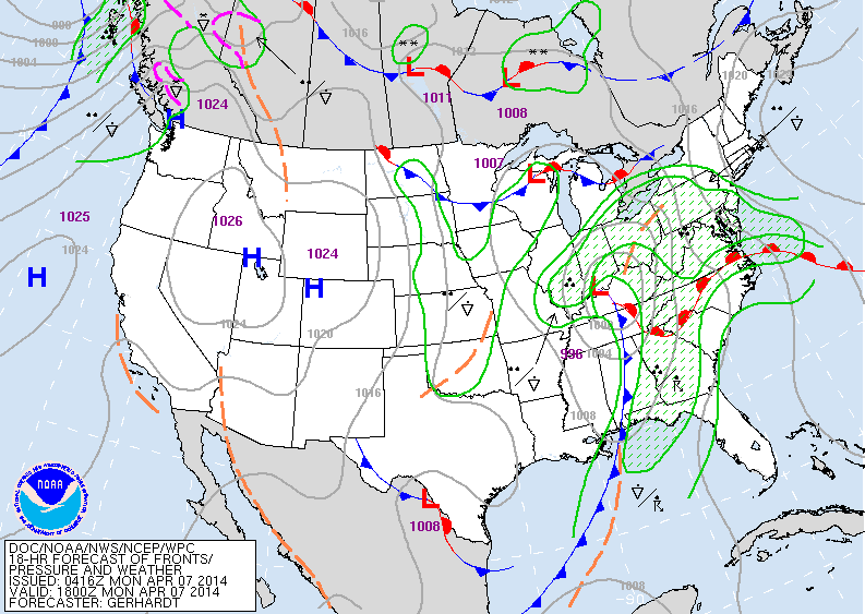
Map for mid day today - Monday. Storm in Ohio Valley with rain over
much of the East. High pressure over the Rockies with sun and warm temps. Southern Ca., 90's next few days.
much of the East. High pressure over the Rockies with sun and warm temps. Southern Ca., 90's next few days.
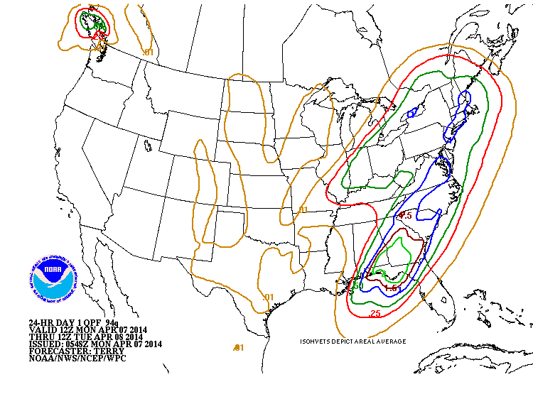
Above...amounts of rain over the next 24 hours.....blue = 1" - heaviest over the Gulf States. Bone dry - west.
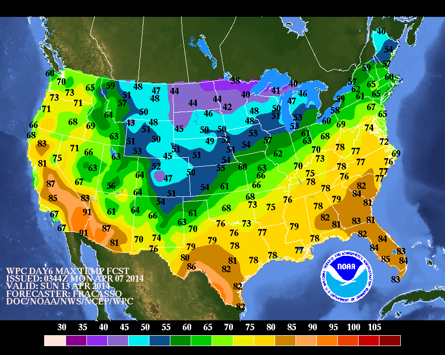
Above...expected high temperatures for this coming Sunday, Palm Sunday. Notice the warm up in the East ! Chilly air confined to Dakotas and Great Lakes. Stay dry - east - stay cool - west. Later.

 RSS Feed
