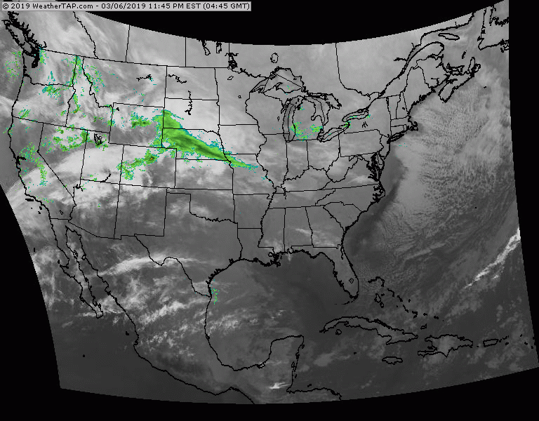
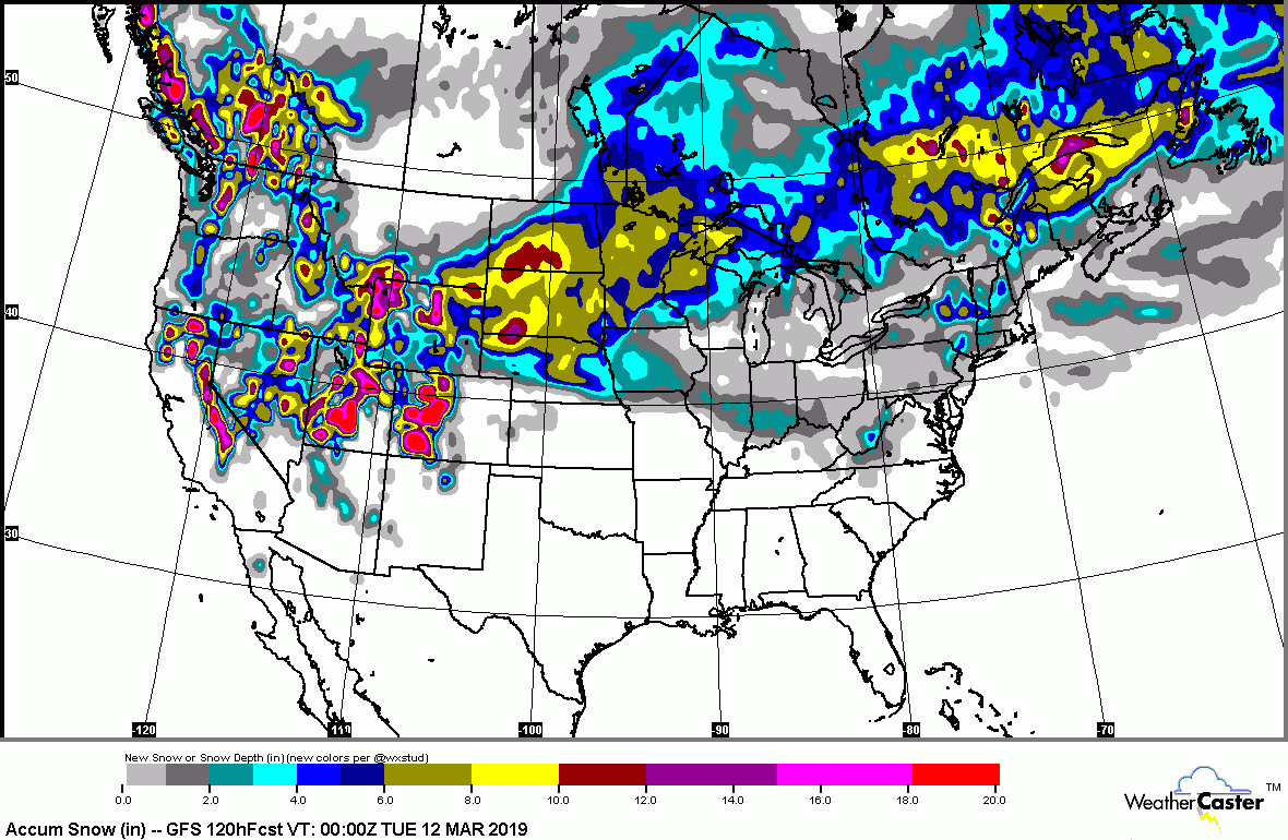
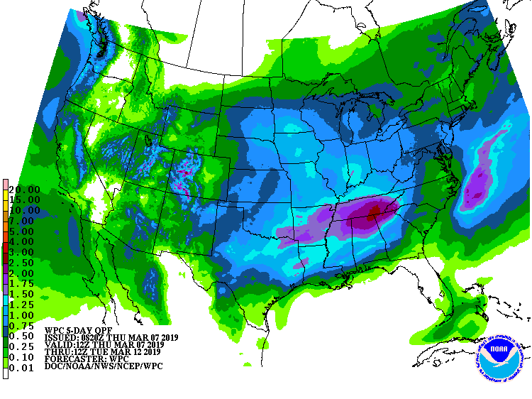
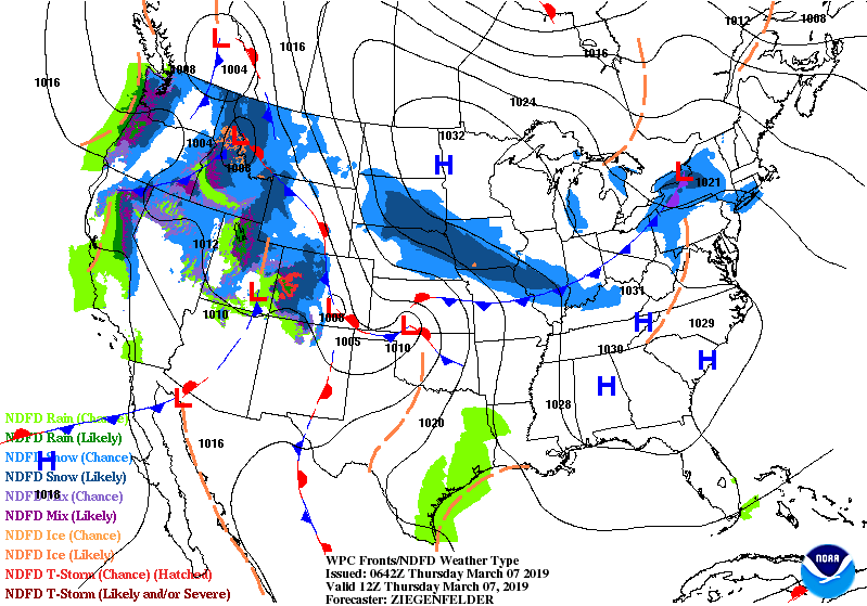
Satellite/radar above - first piece of weather coming across Plains in form of snow...will weaken out by time it reaches the Mid Atlantic Friday night and just some light snow or flurries. Second storm off west Coast will head for Great Lakes as a major March storm....this weekend. Below - snow and rain forecasts through Tuesday.
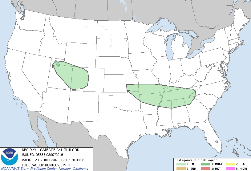
Following - today's chances of thunderstorms in green...followed by animated maps for the next 2 days.
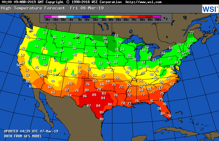
Finally...high temperatures for Friday. Be safe.

 RSS Feed
