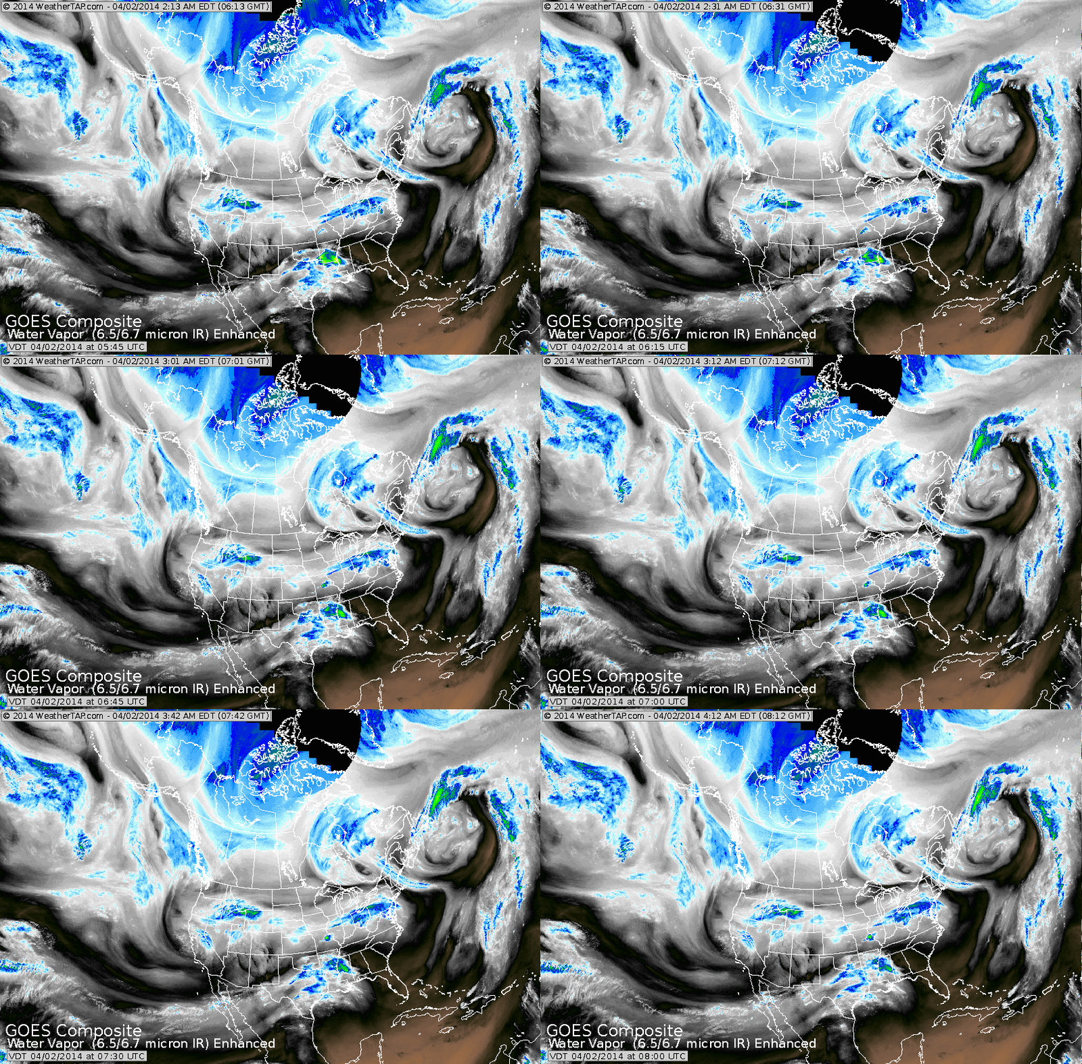
A band of wet weather is sliding from Ohio Valley east. Notice the blue showing up over The Gulf Coast. That will turn northeast up the coast
by end of week. Notice the swirl over California...that will be the next big weather maker for early next week.
by end of week. Notice the swirl over California...that will be the next big weather maker for early next week.
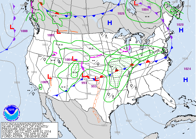
Today's map shows extensive area of rain from Ohio Valley back to The Rockies. All is moving west to east.....so umbrellas will get a work out.
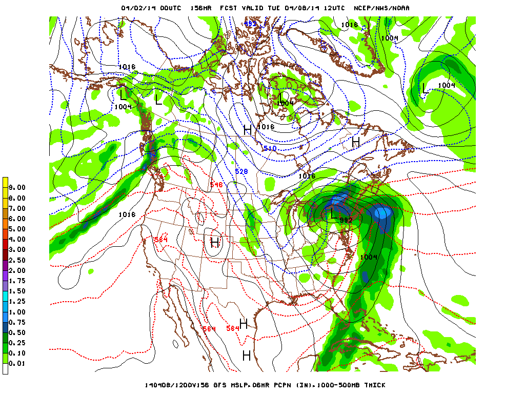
Above....GFS Model for next Tuesday. Storm heads into East with more
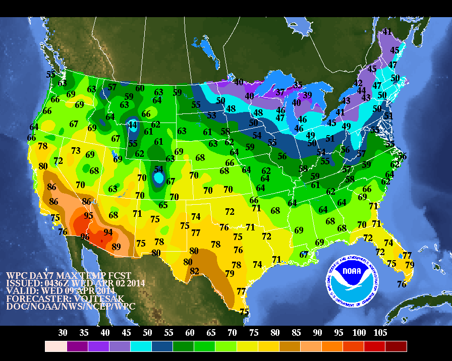
wind and rain. Below....high temperatures expected for next Wednesday....following that storm. As you can see...the chilly air returns to Gt. Lks and Northeast. Later.
wind and rain. Below....high temperatures expected for next Wednesday....following that storm. As you can see...the chilly air returns to Gt. Lks and Northeast. Later.


 RSS Feed
