
Satellite - radar overlay shows showers and storms working up
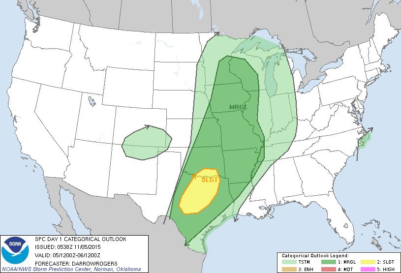
across the Plains and some of these could be on the severe side today into tonight. A band of light showers noted along the mid Atlantic. A strong cold front is diving down through the Pacific Northwest.....so weather is on the move. Below...risk of severe weather today in dark green and yellow.
across the Plains and some of these could be on the severe side today into tonight. A band of light showers noted along the mid Atlantic. A strong cold front is diving down through the Pacific Northwest.....so weather is on the move. Below...risk of severe weather today in dark green and yellow.
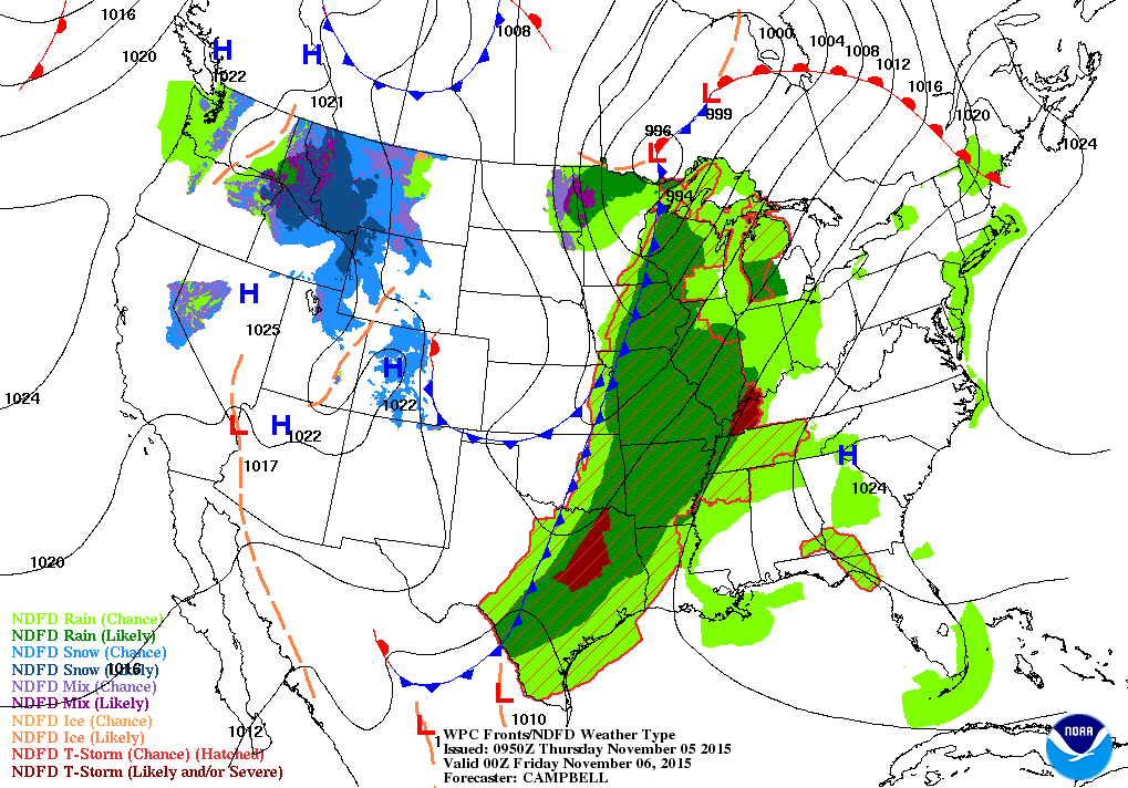
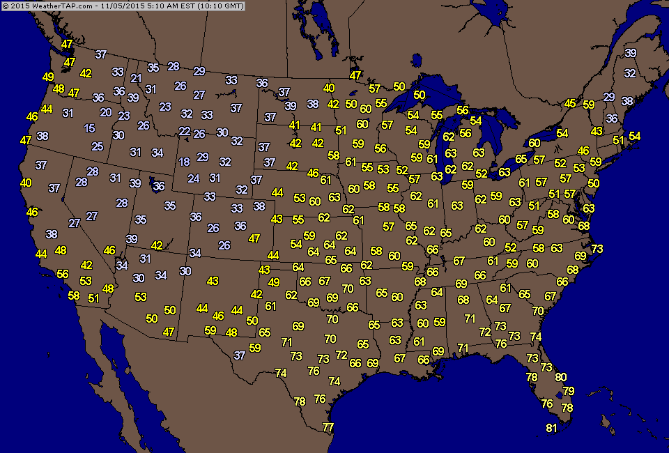
Map above for this evening showing cold front in center nation bringing the wet stormy weather. The cold air behind it generating more snow in the Northern Rockies. Below...temperatures as of early this morning....easily showing the cold front.
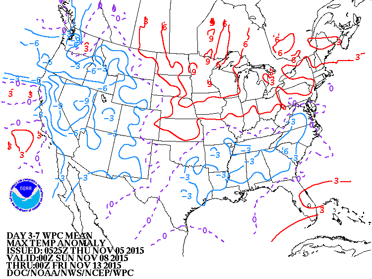
Below...a look how daytime temperatures will average through Nov. 14th. Blue is below..or colder.....red is above...or warmer.
Be safe.
Be safe.

 RSS Feed
