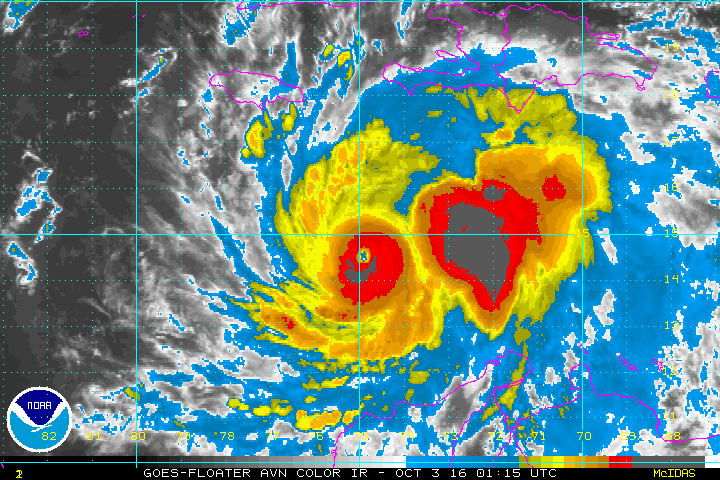
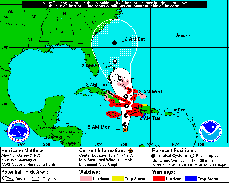
Satellite shows the eye of Matthew moving north slowly...affecting Jamaica...Haiti...Cuba....some places over 15" of rain....not to mention wind. As for The U.S.- the storm will hit the Bahamas mid week and then we need to watch a cold front now in Rockies to see it's speed. The slower it is..the better the chance of Matthew affecting the entire east coast. Faster it is..better chance of veering out into The Atlantic. Below...Hurricane center track.
Currently..latest satellite/radar - shows an old low spinning around in the Northeast....cold front in Rockies.

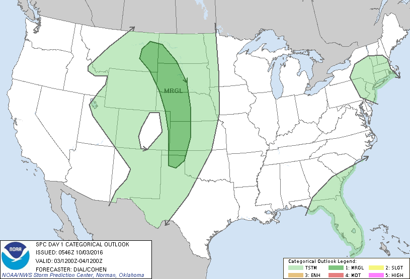
Risk of severe weather today in dark green.
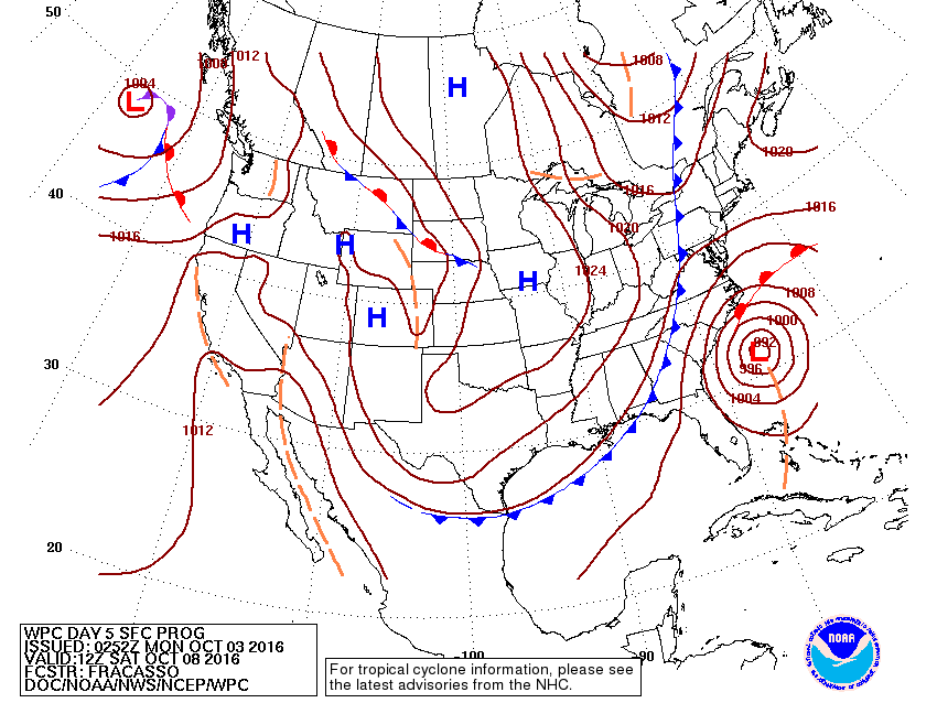
What the weather map could look like Saturday. Front stays in that position...then hurricane could move north along coast.
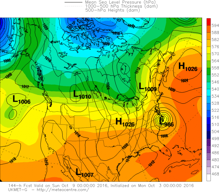
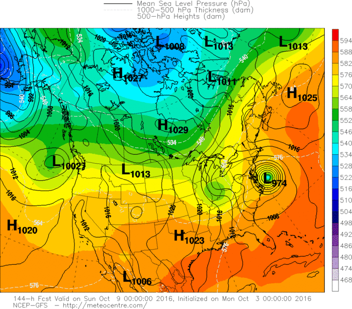
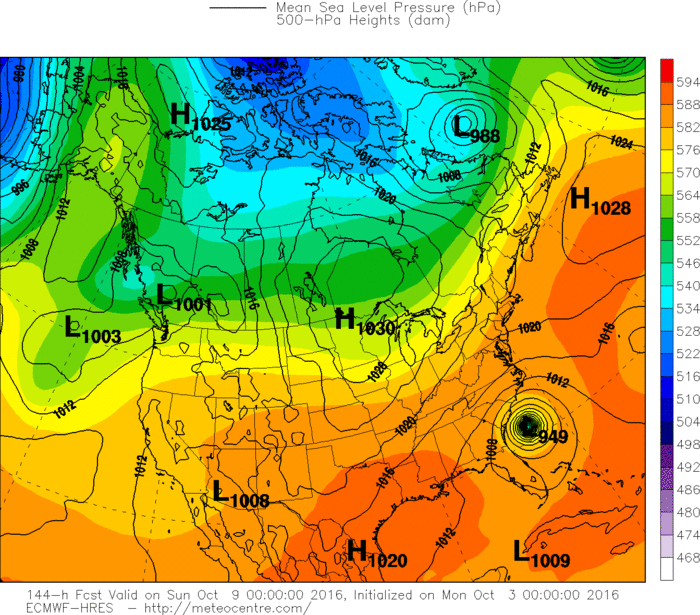
Below...the various models and their take on where Matthew may be by the weekend. Good luck...stay safe.
Below...the various models and their take on where Matthew may be by the weekend. Good luck...stay safe.

 RSS Feed
