Erika is a tropical storm now with 50 mph winds and will move across the Leeward Islands on Thursday. After that...track is a bit questionable but hurricane center brings it to Bahamas on Sunday as a hurricane. Below..satellite picture of Erika.
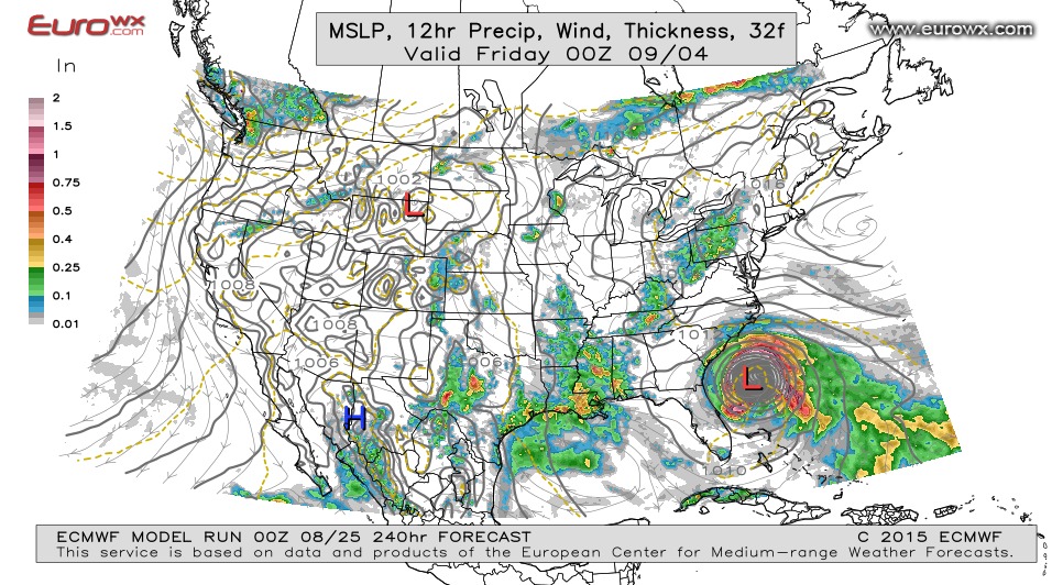
Below..Canadian Model brings Erika into Gulf to affect west coast of Florida....while below that...European model wants to pose a threat to the SE Coast.
Below...the track projected by many models.

Early satellite/ radar showing a front moving into Northeast
with some showers. Storms near Louisiana Coast and in Arizona. Clouds dominate Great Lakes.
with some showers. Storms near Louisiana Coast and in Arizona. Clouds dominate Great Lakes.
Front along east coast will cause showers and thunderstorms..otherwise typical August weather elsewhere. Below...dark green indicates chance of some severe weather...mainly across New England. Be safe.

 RSS Feed
